
What if you could inspect your entire property—all thousand-plus hectares—in just an hour? What if you could see the early signs of crop stress days before they’re visible to the naked eye and apply exactly what’s needed, right where it’s needed? This isn’t a future concept; it’s the reality on Australian farms right now. Farmers are using a bird’s-eye view to boost yields while reining in their costs on water, fertiliser, and chemicals.
Core Applications from Mapping to Spraying
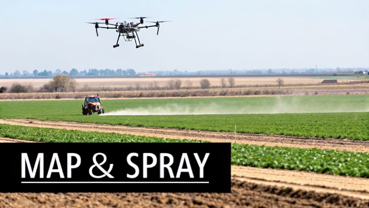
It’s easy to get caught up in the idea of just having an “eye in the sky,” but the true worth of an agriculture drone in Australia is how it solves real, expensive problems on the ground. These aren’t just fancy cameras; they’re specialised tools built to collect data and perform jobs with a precision that’s simply out of reach for traditional farming methods.
From spotting crop stress weeks before you could see it from the ute to applying chemicals with centimetre-perfect accuracy, drones tackle the everyday challenges that chip away at a farm’s bottom line. The two most powerful uses right now are crop health mapping and precision spraying, each offering a direct solution to some of farming’s most persistent headaches.
Spotting Problems Before They Start with Crop Health Mapping
Every farmer knows that sinking feeling of finding a problem in the paddock when it’s already too late. This industrial pain point—the hidden yield loss from issues like nutrient deficiencies, pests, or irrigation faults that you can’t see until the damage is done—means you are always reacting, not preventing. By the time a crop shows visible signs of stress, you’re already behind.
This is exactly where aerial mapping changes the game. It’s like giving your entire property a regular health check-up, but one that can see things the human eye can’t. A drone with a multispectral sensor is like a doctor’s scanner for your crops, capturing light from specific bands beyond what we can see. This reveals subtle changes in plant health that signal stress long before the leaves turn yellow.
To turn this data into a reliable map, you must eliminate distortions caused by unstable flight. The Evolution Flight Peregrine addresses this directly with its advanced flight controller and gimbal stabilization. This technical specification ensures the multispectral sensor remains perfectly steady, even in light wind, generating crisp, accurate imagery. This directly translates to a business outcome: reliable NDVI maps you can trust to make precise, cost-saving decisions.
These maps use a simple colour code to tell you what’s going on:
- Deep Green: Healthy, thriving plants working at full capacity.
- Yellow and Orange: Areas under moderate stress. This could be an early warning for a lack of water or nutrients.
- Red: Pinpoints zones with severely stressed plants or even bare soil, flagging them for immediate investigation.
The result is you get to be proactive, not reactive. Instead of discovering a full-blown infestation, you can spot a small problem corner, treat just that spot, and move on. This early intelligence empowers you to make small, precise interventions that protect your yield and stop minor issues from turning into costly, farm-wide disasters.
Precision Spraying for Maximum Impact and Minimum Waste
The other game-changing application takes aim at a major industrial pain point: the immense cost and environmental headache of broad-acre chemical spraying. Anyone who has run a boom sprayer knows how much product is wasted—over-spraying healthy patches and letting expensive chemicals drift onto neighbouring land or into waterways. It’s a hit to your input costs and a major compliance risk.
Precision drone spraying solves this. The market numbers tell the story: in 2023, the Australian agriculture drone market was valued at USD 33.9 million, and it’s forecast to explode to USD 691.4 million by 2033. Precision spraying is a key reason why, with drones shown to reduce pesticide use by up to 30%. You can dig into more data on these market trends and their drivers.
A heavy-lift platform designed for this work must maximize time in the air. The Evolution Flight Condor is a single-rotor UAS built specifically for this purpose. Its 40L spray tank capacity is a technical specification that directly generates a business outcome: fewer return-to-fill trips. This means more hectares sprayed per hour, increasing operational efficiency and making the most of tight weather windows.
The real magic is in the accuracy. By feeding the health maps from a surveillance flight directly into the spraying drone, it can perform a variable-rate application on its own. It’ll hit weed patches with the full rate of herbicide, apply a lighter touch of fungicide to stressed areas, and skip the healthy sections entirely. This isn’t just about saving money on chemicals; it’s about operating sustainably and staying well within environmental guidelines. It’s a win for your budget and a win for your land.
Choosing the Right Drone and Sensor Technology
Getting the right results from a drone all comes down to the hardware you choose. It’s easy to get lost in all the options out there, but a smart investment starts with understanding the basic differences between the drones themselves and the sensors they carry.
Think of it like choosing between a ute and a road train. Both are incredibly useful, but you wouldn’t use a ute to haul grain across the state. It’s about matching the tool to the scale of the job.
The first big decision is between a multi-rotor and a single-rotor drone. A multi-rotor, with its four, six, or even eight propellers, is like a small helicopter—it’s nimble, stable, and can hover perfectly in one spot. This makes them brilliant for detailed inspections or mapping smaller, more complicated paddocks. But that design has a major drawback: short flight times.
Single-Rotor Drones for Endurance and Efficiency
For anyone running a broadacre farm in Australia, short flight times create a serious industrial pain point. Using a standard multi-rotor to cover a large property means you’re constantly landing to swap batteries, turning a simple mapping job into an all-day ordeal and undermining the drone’s efficiency promise.
This is exactly where single-rotor platforms change the game. The Evolution Flight Galaxy solves this problem with its single-rotor design. This technical specification provides superior aerodynamic efficiency, resulting in a flight time of over one hour. The business outcome is clear: you can map hundreds of hectares in a single flight, eliminating the constant downtime. This efficiency turns drone mapping from a time-consuming chore into a powerful, scalable tool for managing large properties.
This means you can survey entire paddocks, fence lines, or irrigation channels without having to land once. You get a complete, consistent set of data over a huge area, allowing you to make quick decisions that protect your bottom line.
Turning Sensor Specs Into Real-World Value
Just as important as the drone is the sensor it’s carrying. It’s easy to get bogged down in technical jargon, but it’s much more helpful to think about what problem each sensor actually solves. Two of the most important sensors in agriculture are multispectral and LiDAR.
- Multispectral Sensors: Think of these as your crop health specialists. They see light that the human eye can’t, producing detailed health maps (like NDVI) that show plant stress from pests, disease, or nutrient issues weeks before you could ever spot them from the ground.
- LiDAR Sensors: LiDAR stands for Light Detection and Ranging. All you really need to know is that it builds incredibly precise 3D maps of the ground.
This is a game-changer for a critical industrial pain point in Australia’s drought-prone climate: inefficient water flow. Getting water across uneven land often leads to runoff, waterlogging, and waste. An Evolution Flight Galaxy carrying a high-precision LiDAR payload completely solves this. It fires millions of laser pulses at the ground, creating a high-density point cloud.
This technical specification—the ability to generate a dense and accurate point cloud—provides a very real business advantage. The resulting 3D digital elevation model gives you the exact data needed to design smarter irrigation layouts, plan effective drainage, and see precisely how water will flow during heavy rain. You’re no longer guessing; you’re making data-driven decisions that directly improve your farm’s resilience and profitability.
Navigating Australian Drone Regulations
Let’s be honest, the moment you start looking into agricultural drones in Australia, the rulebook can seem like a mountain. For many farmers, this industrial pain point—the fear of getting tangled up in complex aviation law—is enough to shelve the whole project, making a genuinely useful tool feel completely out of reach.
But here’s the good news: it’s not as complicated as it first appears. The rules are set by the Civil Aviation Safety Authority (CASA), and their goal is simple—to keep everyone safe. Once you understand the basic framework, you can fly with total confidence.
The Two Main Paths for Flying on Your Farm
When it comes to agricultural drone work, you’ll generally head down one of two paths. The first is flying with a small drone under the basic rules, often called standard operating conditions. This is fine for some simple observation, but for serious farm work like spraying or using larger, more capable drones, you’ll outgrow these limitations very quickly.
That brings us to the second, more professional path: becoming a certified operator. Think of it in two parts:
- Remote Pilot Licence (RePL): This is your personal ticket to fly. It’s just like a driver’s licence, proving you have the skills and knowledge to operate a drone safely.
- RPA Operator’s Certificate (ReOC): This certification is for your business. It shows CASA that you have formal procedures in place for everything from maintenance and flight logs to overall safety management.
The perceived bureaucratic nightmare of obtaining these certifications is a common roadblock. This is exactly why finding the right partner is so critical. A dedicated provider like Evolution Flight doesn’t just hand you a drone and walk away. Their team guides you through the compliance maze, turning a confusing process into a clear, step-by-step plan. The result? You’re in the air sooner, without the legal headaches.
Unlocking True Efficiency with BVLOS Approval
For anyone managing a large-scale Australian property, there’s one more set of rules you need to know: Beyond Visual Line of Sight (BVLOS). The industrial pain point here is that standard regulations require you to keep the drone in sight at all times. On a farm that sprawls over thousands of hectares, that’s just not practical and makes surveying your entire property in one go impossible.
Gaining BVLOS approval is the key to unleashing the full power of an agricultural drone on broadacre farms. It means the drone can fly missions far beyond what you can see, covering massive areas in a single automated flight. This requires a robust safety case and reliable technology. An Evolution Flight Patriot, for example, is equipped with redundant flight control and communication systems. This technical specification provides built-in failsafes, which is a critical part of the safety case for CASA. The business outcome is the ability to operate legally and efficiently over vast areas, transforming the drone from a line-of-sight tool into a strategic, property-wide asset.
Working with an experienced Australian team makes this achievable. They can help you prepare the safety case and documentation, taking the guesswork out of the process.
Turning Aerial Data Into Profitable Actions
Flying a drone and collecting terabytes of high-resolution imagery is the easy part. The industrial pain point? Making sense of it all. Countless farmers end up with data that just sits on a hard drive, useless. It’s a huge frustration, being buried in complex files without a clear way to turn them into decisions that actually make you money.
The real value of an agricultural drone in Australia isn’t the drone itself. It’s the entire workflow that turns raw aerial data into practical, on-the-ground actions.
Think of it like this: the drone flight is just gathering your ingredients. You need a recipe (processing software) and an oven (an analytics platform) to turn those raw materials into something valuable. Without that complete process, you’re just left with a mess on the kitchen counter.
This is why you need a complete solution that goes beyond the hardware to cover data processing, security, and integration.
From Raw Data to Actionable Intelligence
Once the drone lands, the first job is data processing. This is where specialized software takes the hundreds or even thousands of individual photos and “stitches” them together into one seamless, high-resolution map of your property. This process, called photogrammetry, builds the foundation for everything else.
After the map is built, the real work starts: turning that map into intelligence. It’s about spotting patterns and creating clear instructions for your machinery. For example, a processed multispectral map might highlight a section of underperforming crop. The right software can then automatically generate a prescription map—a digital file that tells your variable-rate spreader exactly how much fertiliser to apply and where. No more guesswork, no more waste.
But this whole process creates a massive amount of sensitive information, leading to another critical pain point: data vulnerability. In a competitive industry, you must protect this business intelligence. A secure data pipeline isn’t just a “nice-to-have”; it’s essential. The Evolution Flight ecosystem addresses this risk through its NDAA-compliant hardware and encrypted data links. These technical specifications ensure your farm’s valuable operational data stays confidential from capture to analysis, giving you the business outcome of complete peace of mind and protecting your competitive advantage.
Integrating Insights Into Your Farm Management System
The final, and arguably most important, step is getting these new insights into your existing farm management software (FMS). The pain point here is data incompatibility—having powerful drone data stuck in one program while your spray logs and financials are in another.
You only achieve true efficiency when data flows smoothly. For example, the incredibly detailed point cloud data from a LiDAR sensor is only useful if it can be opened in your farm planning software. An experienced partner like Evolution Flight provides the technical know-how to ensure data from their platforms, such as the Evolution Flight Patriot fitted with a LiDAR payload, integrates perfectly with your FMS. They handle the technical headaches, turning a complex dataset into a practical tool you can use right away.
This integrated approach is quickly becoming the new standard. Projections show that by 2025, over 30% of large farms will be using drones, combining AI and advanced imaging to boost yields by 15-20%. In Australia, where the agriculture sector employs around 300,000 people but faces an annual labour shortage of 40,000 workers, drones are filling critical gaps in the Australian workforce.
The graphic below breaks down the simple legal steps to get your drone operations started.
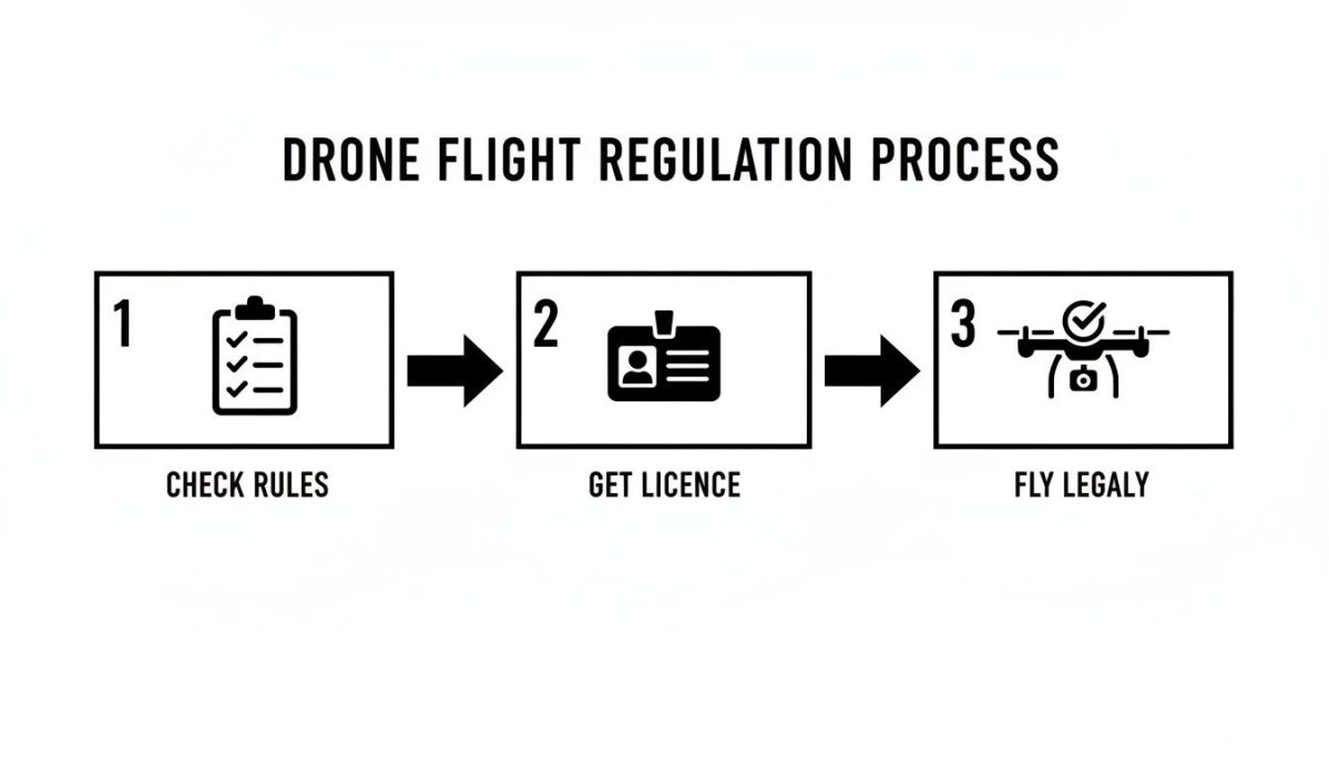
As you can see, once you have a clear plan—checking the rules, getting licensed, and flying legally—the regulatory side becomes just another manageable part of your operational workflow.
How to Choose the Right Drone Partner in Australia
Picking the right drone is only half the job. The partner you choose is just as crucial. It’s easy to find a cheap drone online, but out in the paddock, this isn’t a toy—it’s a vital piece of farm equipment. The industrial pain point is when that equipment fails, and you’re left with no one to call. A grounded drone during a critical window means lost time and lost money. Without reliable local support, you’re just left with an expensive headache.
Local Support That Understands Your Challenges
There’s nothing more frustrating than having a problem and dealing with a support team in a different time zone. When you have a tight window to spray, waiting days for an email won’t cut it. The real pain isn’t just a slow reply; it’s a missed opportunity that directly impacts your yield. This is why accessible, Australian-based support is something you can’t afford to compromise on.
You need to find a provider with technicians right here in Australia. A local team gets the unique challenges you’re up against, from our harsh weather to confusing local regulations. That means you get practical, timely advice that keeps your drone in the air and your operation running without a hitch.
Hardware Security and Compliance
An often-overlooked pain point is the security of the drone hardware itself. Using non-compliant gear can expose your farm to data breaches and could even get you blacklisted from certain supply chains. The data your drone gathers is sensitive business information that must be protected.
This is where specific security certifications really matter. Evolution Flight platforms like the Galaxy and Patriot are NDAA (National Defense Authorization Act) compliant. This technical specification means their entire supply chain has been vetted to strict security standards, eliminating the risk of unsecure, foreign-made components. The business outcome is confidence—knowing your operational data is protected and that your equipment meets the highest security benchmarks. This level of proven security makes a provider like Evolution Flight a name you can trust.
A Partnership for Long-Term Success
At the end of the day, choosing a drone supplier is about starting a long-term partnership. Your success hinges on more than just the day you buy the drone. It’s about the whole package: training, maintenance, and knowing your investment will still be relevant in a few years.
When you’re making your decision, think about these key factors:
- Platform Durability: Is this drone built to handle the heat, dust, and wind of the Australian outback? A tough, well-built machine will last much longer and cause fewer headaches.
- Payload Versatility: Can you swap out the equipment it carries? A system that can carry a LiDAR sensor one day and a spray tank the next offers a much better return on your investment.
- Comprehensive Training: A great partner won’t just hand you the keys. They’ll make sure your team is fully trained, confident, and ready to operate the system safely and effectively right from the start.
Choosing the right agriculture drone in Australia means looking past the spec sheet. You need to weigh up the quality of the support, the security of the hardware, and the durability of the platform. That’s how you ensure your investment pays off for many seasons to come.
Your Top Questions About Ag Drones, Answered
Thinking about bringing drones onto your farm? You’re not alone. It’s a big step, and it’s natural to have questions. Here are the answers to some of the most common ones we hear from farmers just like you.
How Much Does an Agriculture Drone Cost in Australia?
That’s the big question, isn’t it? The truth is, the price tag can swing wildly. You could be looking at a few thousand dollars for a simple mapping drone or upwards of $100,000 for a serious, heavy-lift spraying system loaded with advanced sensors.
But the sticker price is only part of the story. You’ve also got to factor in the software subscriptions, proper training, and ongoing maintenance to keep it in the air. The right setup really comes down to the size of your operation and what you need the drone to do.
Do I Need a Licence to Fly a Drone on My Farm?
Most of the time, yes. If you’re using a drone for anything beyond a quick personal look—especially for commercial tasks like spraying or detailed mapping—you’ll almost certainly need to get licensed with CASA.
This typically means you’ll need a Remote Pilot Licence (RePL) for the operator and an RPA Operator’s Certificate (ReOC) for your farm business. The regulations can be a bit of a maze, so it’s always best to check the latest rules or have a chat with your supplier before your first flight.
Can Agriculture Drones Fly in Bad Weather?
Not really, and this is a major frustration for farmers. Losing precious operational days to weather is a real problem. While professional-grade drones are built tough, they have their limits—high winds, heavy rain, or extreme heat will keep them on the ground.
Wind is usually the biggest showstopper. This is where the right equipment makes a difference. An Evolution Flight Galaxy single-rotor UAS, for instance, is built with superior aerodynamics. This technical specification gives it a higher wind tolerance than most multi-rotors. The business outcome is a wider operational window, allowing you to get the job done on more days and boosting your farm’s overall efficiency.
Ready to see how a professional drone platform can transform your farm’s productivity and profitability? Evolution Flight offers secure, NDAA-compliant systems and expert Australian support to ensure your success.
Explore our drone solutions and get a personalized quote by visiting us at https://evolutionflight.com.