
Drones are quickly becoming one of the most indispensable tools on the modern Australian farm. They're solving real-world problems, from crop monitoring and health analysis to highly targeted precision spraying.
For farmers, this technology offers a powerful new way to gather critical data, boost efficiency, and finally get on top of the challenges that come with managing massive properties. What was once a niche gadget is now a core piece of farm equipment.
How Drones Are Redefining Australian Farming
Think about the sheer scale of Australian agriculture for a moment. Imagine trying to get an accurate, up-to-the-minute picture of what’s happening across a 10,000-hectare wheat farm. For generations, the only options were driving the fencelines or relying on satellite images, which are often out of date, low-resolution, or blocked by cloud cover.
Making fast, well-informed decisions has always been a massive challenge. This is exactly where agriculture drones in Australia are changing the game. These aren't just toys; they are sophisticated flying platforms built to capture data, giving producers an incredibly detailed "eye in the sky" right when they need it.

This isn't just a passing trend. The market growth tells the story. In 2023, the Australian agriculture drone market was valued at USD 33.9 million. By 2033, it's projected to explode to USD 691.4 million.
That’s a compound annual growth rate (CAGR) of 35.19%, which highlights just how quickly this technology is being adopted on the ground. You can find more detail on this rapid market expansion and its key drivers online.
Solving Key Farming Challenges
Drones are designed to tackle some of the most persistent and costly problems in Australian farming, delivering practical solutions that directly impact the bottom line.
- Beating Labour Shortages: Drones automate time-consuming jobs like crop scouting, weed spotting, and spraying. This frees up your team to focus on more critical, high-value tasks.
- Smarter Water Management: In a dry country, every drop counts. Drones equipped with thermal or multispectral sensors can pinpoint irrigation leaks or dry patches with incredible accuracy, helping you optimise water use.
- Precision Over Guesswork: Why spray an entire paddock when only a small section has a problem? Drones enable spot-spraying of fertilisers, pesticides, and herbicides, dramatically cutting input costs and reducing environmental runoff.
This shift from broadacre management to targeted intervention is where the real value lies. It allows growers to move from reactive fixes to proactive management, catching small problems before they become big ones.
Key Drone Applications in Australian Agriculture
To see how this works in practice, this table summarises the main ways drones are being used on farms today to solve specific problems and drive better business outcomes.
| Application | Primary Pain Point Solved | Business Outcome |
|---|---|---|
| Crop Spraying | Inefficient broadacre application of chemicals; difficult-to-access terrain. | Reduced chemical costs, lower environmental impact, improved operator safety. |
| Farm Mapping | Lack of accurate, up-to-date topographical and asset data for planning. | Better farm planning, optimised irrigation design, accurate boundary identification. |
| Crop Health Monitoring | Inability to quickly identify crop stress, disease, or nutrient deficiencies at scale. | Early intervention, maximised yields, reduced crop loss, targeted fertiliser use. |
| Weed Detection | Time-consuming and labour-intensive manual weed scouting. | Faster and more accurate weed identification, enabling precise spot-spraying. |
| Livestock Monitoring | Difficulty in tracking stock, checking water points, or finding animals in vast paddocks. | Saved time and fuel, reduced animal stress, faster response to issues. |
These applications show how drones transform data into decisions, making the entire farming operation more efficient and profitable.
Think about the immense industrial pain point of mapping thousands of hectares to get a single, unified view of crop variability. A purpose-built, heavy-lift platform like the Evolution Flight Jupiter-H2 was engineered to solve this exact problem.
Its 3-hour flight endurance isn't just a technical specification; it’s a direct business solution. This endurance means you can survey thousands of hectares in one go, creating a complete, current map of crop health that was previously impossible to achieve efficiently, dramatically reducing operational time and cost.
Ultimately, using agriculture drones is about moving from guesswork to data-driven certainty. It empowers you to see more of your property, act faster, and manage your land with a level of precision that was simply out of reach until now. That ability to make better, faster decisions is the true power these systems bring to the modern farm.
Choosing the Right Drone for Your Farm
Just like any piece of farm equipment, you need the right drone for the right job. Picking the correct platform is the first real step to seeing a return on your investment, because the drone you’d use for mapping a thousand-hectare station is a completely different beast from one used for spot-spraying an awkward gully.
The best place to start is to think about the main job you need it to do. A drone is a tool, not a magic wand. You wouldn't use a little ute to do a prime mover's work, and the same logic applies here. Getting a handle on the main types—multi-rotor, single-rotor, and heavy-lift—is key to matching the tech to what you actually need to get done on the ground.
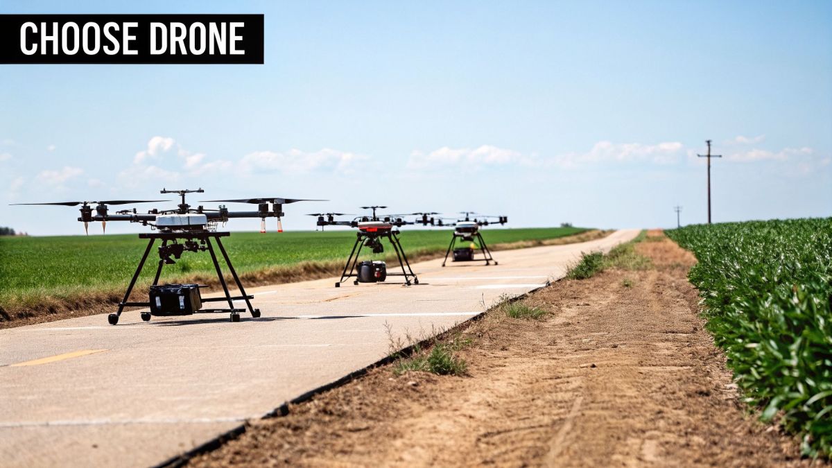
Multi-Rotor Drones
Multi-rotor drones, with their four, six, or even eight propellers, are what most people picture when they think of a drone. They're popular for a reason: they are incredibly stable and easy to fly, which makes them perfect for any job that requires hovering or getting a close-up look. Think of them as the versatile farm ute of the drone world.
They're brilliant for:
- Mapping smaller paddocks and building detailed 3D models.
- Checking on infrastructure like fences, gates, and water troughs.
- Monitoring crop health in manageable areas where endurance isn't the top priority.
The trade-off? Flight time and carrying capacity. Most will stay in the air for 20-40 minutes at a time and can't lift heavy spray tanks, so they aren't the solution for broadacre spraying.
Single-Rotor Drones
These drones look and fly more like a traditional helicopter, with one large main rotor and a small tail rotor. That design gives them a serious advantage in power, flight time, and the ability to handle windy conditions. They're the specialists, built for the tough jobs.
Let's take a classic industrial pain point for many Australian farmers: spraying invasive weeds down a steep, hard-to-reach gully. Sending a crew in on foot is slow, expensive, and frankly, dangerous. A standard multi-rotor drone would get tossed around by the wind and wouldn't have the grunt to carry enough chemical to make a difference.
This is exactly where a specialised platform like the Evolution Eagle single-rotor drone shines. Its technical specification of a 30kg spray payload and incredible stability in rough air directly addresses this challenge. The business outcome is simple: you can apply herbicide precisely in the worst terrain, which cuts chemical waste, saves a fortune on labour, and completely eliminates safety risks for ground teams.
Their power is ideal for spraying, but their complexity and cost mean they are a more focused investment for a specific, high-value task.
Heavy-Lift Platforms
These are the true workhorses of the drone world. Heavy-lift platforms can be either very large multi-rotor or single-rotor designs, but they are all engineered for one purpose: to carry the heaviest payloads for the longest time. They are absolutely essential for serious, large-scale survey work that demands sophisticated (and heavy) sensors like high-end LiDAR scanners.
While a smaller drone is great for a quick look around, you need a heavy-lift system to gather data across an entire property. Their ability to carry advanced sensors for long flights means you can cover huge areas in one go, collecting the kind of high-quality data needed for precise topographical maps or detailed vegetation analysis across the whole station.
Ultimately, choosing the right ag drone is a balancing act. It comes down to weighing up your specific needs against what the machine can do. By being crystal clear on the main problem you're trying to solve—whether it’s mapping, spot-spraying, or broadacre surveying— you can find a system that will deliver real, measurable results for your operation.
Seeing Your Farm in a Whole New Light
A drone on its own is just a clever flying machine. Its real value on the farm comes from the specialised sensors and payloads you attach to it. These tools turn a simple camera in the sky into a powerful instrument for understanding your property in ways the naked eye can't, revealing hidden patterns in crop health, soil conditions, and overall productivity.
Think of it like putting on a pair of special glasses. Without them, a paddock might look like a uniform sea of green. But with the right sensor, you can suddenly see subtle variations—areas of stress, nutrient deficiency, or the beginnings of disease—long before they become visible problems. This is the edge that specialised payloads give to agriculture drones in Australia: turning invisible data into intelligence you can act on.
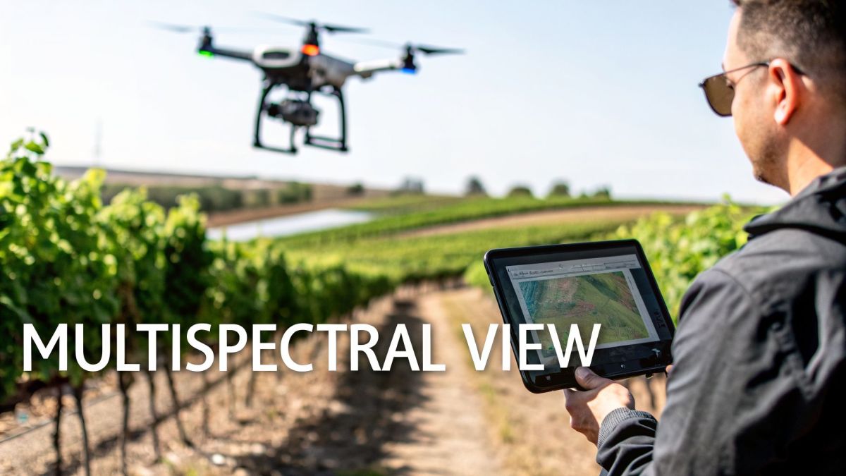
Beyond the Visible Spectrum
Most agricultural sensors are designed to see light we can't. They capture information directly linked to plant biology and the physical environment, with each sensor type adding another layer to your understanding of the farm.
Multispectral Sensors: These are the workhorses for monitoring crop health. They capture light in specific bands, including the standard red, green, and blue, but more importantly, bands we can’t see like near-infrared (NIR) and the Red Edge. Healthy plants reflect a huge amount of NIR light, so by measuring these reflections, you can generate detailed maps that show plant vigour and stress.
Thermal Cameras: Instead of light, these sensors measure heat. On a farm, this is brilliant for checking on irrigation systems. A thermal camera can quickly find a blocked sprinkler, a leaky pipe, or patches of a paddock that are too wet or too dry, all by picking up tiny differences in soil and canopy temperature.
LiDAR (Light Detection and Ranging): LiDAR works by shooting rapid laser pulses at the ground and measuring how long they take to bounce back. The result is an incredibly detailed 3D map of the terrain. It can even "see" through foliage to map the ground beneath, making it perfect for planning drainage, analysing water flow, or calculating earthworks volumes with centimetre-level accuracy.
Gathering these different data types gives you a much clearer picture of what’s really happening on your property, allowing you to manage resources with far greater precision.
Solving Problems Before They Cost You Money
The true value of these sensors is in their ability to catch expensive problems early. Consider the critical industrial pain point for an agronomist or vineyard manager: spotting a fungal outbreak before it devastates a crop. By the time you can see it with your own eyes, the damage is already done and a big chunk of your yield is likely gone.
This is exactly where a specific technical capability delivers a powerful financial outcome. The Evolution Flight Agri-Mapper 5000 is built to handle this exact scenario.
Its multispectral sensor captures five distinct spectral bands, including the crucial Red Edge band. This specific technical feature allows it to detect minute changes in a plant's chlorophyll content—a key sign of stress from disease. The business outcome is simple: you can spot an outbreak days or even weeks before it's visible, enabling early, targeted treatment to stop widespread crop loss and protect your profits.
This approach stops widespread crop loss in its tracks, protects the quality of your produce, and ultimately secures your bottom line. Instead of reacting to a disaster, you’re proactively managing a threat with precise data. It’s this direct link between advanced tech and a clear commercial benefit that makes modern agriculture drones such a vital tool for Australian farmers.
Flying by the Rules: Australian Drone Regulations and Biosecurity
Putting a drone to work on your farm is a brilliant way to gather intelligence, but it’s important to remember you're operating an aircraft. And just like a tractor or a spray rig, there are rules of the road. Getting your head around the regulations from the Civil Aviation Safety Authority (CASA) is the first step to making sure your drone operations are safe, legal, and effective.
These rules aren't there to make life difficult; they exist to keep everyone safe, both in the air and on the ground. For most farmers, which regulations apply will come down to the weight of your drone and what you’re doing with it.
Getting to Grips with CASA's Flight Rules
For many on-farm jobs, the rules are surprisingly straightforward, especially if you’re only flying over your own property. CASA has structured the regulations based on the size of your drone and the type of work you're doing.
Excluded Category Operations: This is the simplest pathway for many farmers. If your drone weighs less than 25kg and you’re flying it over your own land (and not getting paid by someone else to do it), you can likely operate under the 'Excluded Category'. You'll still need to stick to the standard operating conditions, which means flying during the day and always keeping the drone in your direct line of sight.
Licensing and Certification: Things change when your operations get bigger. If you want to fly a heavier drone (over 25kg) or start a business doing drone work for other properties, you'll need to get properly certified. This usually involves the pilot earning a Remote Pilot Licence (RePL) and the business securing a Remotely Piloted Aircraft Operator's Certificate (ReOC).
No matter how you're flying, you always have to be mindful of no-fly zones. These are common around airports and pop up during emergencies, but can also exist in other areas. While most farms are clear of these zones, a quick check of local airspace restrictions before you fly is always a smart move.
More Than Just Flight Rules: Biosecurity and Data Security
For Australian agriculture, staying compliant goes well beyond flight regulations. One of the biggest industrial pain points on any farm is managing on-farm biosecurity. The risk of an unsecure data link spreading sensitive information about weed locations or disease outbreaks is a major operational threat.
Think about it: you've just mapped a nasty patch of serrated tussock. That data is incredibly sensitive. If your drone sends that data over an insecure link, it could be intercepted. This isn't just a privacy issue; it's a major biosecurity and commercial risk.
This is a scenario where specific technical hardware provides a clear business outcome. The Evolution Defender, which is NDAA compliant, was engineered to address this exact threat. Its technical specification is a fully encrypted, closed-loop data system, meaning all communications between the drone and the controller are completely secure. The business outcome is peace of mind: your critical farm data—whether it's spray plans, yield maps, or biosecurity intelligence—stays completely private, ensuring your drone is a secure asset, not a liability.
What does that mean for you? Peace of mind. It guarantees that your critical farm data—whether it's spray plans, yield maps, or biosecurity intelligence—stays completely private. You can be confident that your drone is a secure tool for managing your property, not a potential liability.
Turning Drone Data Into Profitable Decisions
Getting high-resolution images with your ag drone is really just the start. The real magic happens when you turn that raw data into clear, practical information that helps you make better, more profitable decisions on the farm. This isn't just about snapping pictures; it's a whole workflow, from planning the flight to processing the data, all designed to create maps that are more than just pretty—they're precise tools for managing your property.
At the core of this whole process is accuracy. If your maps aren't geographically accurate, they might look impressive, but they’re useless for precision tasks. It's crucial to get your head around a few key concepts if you're serious about getting real value from your drone.
The Foundations of Accuracy: RTK, PPK, and GCPs
For a drone map to be worth anything, every single pixel needs to correspond to a precise spot on the ground. Think of it this way: if your map is off by even a few metres, you could end up spraying the wrong area or miscalculating a stockpile. The standard GPS in a typical drone just doesn't cut it, as it can be out by several metres.
That's where more advanced positioning technologies come in.
- Real-Time Kinematic (RTK): This system uses a live data connection between the drone and a ground-based station (or a networked service) to correct positioning errors on the fly. It gives you centimetre-level accuracy right then and there, but you need a constant, stable data link, which can be a real headache in remote Aussie paddocks.
- Post-Processed Kinematic (PPK): With PPK, both the drone and a base station record raw satellite data during the flight. After the drone lands, you process this data together on a computer to correct any errors. This approach is often more reliable because it doesn't depend on a shaky live connection.
- Ground Control Points (GCPs): These are physical markers you place on the ground at locations with known coordinates. Later, you use software to match the drone's images to these points, essentially pinning the map to the real world. It works, but laying out and surveying a bunch of GCPs is slow, hard work.
Each of these methods is a path to creating a survey-grade asset from a simple drone map.
To make sense of these options, it's helpful to see them side-by-side. Each has its place, depending on your needs for accuracy and your operational constraints.
Drone Accuracy Technologies Compared
| Technology | Typical Accuracy | Best For | Operational Requirement |
|---|---|---|---|
| Standard GPS | 2-5 metres | Basic scouting, video, and non-precision mapping. | None beyond the drone itself. |
| RTK | 1-3 centimetres | Real-time precision tasks like spot spraying; situations where you need instant results. | Continuous, stable data link between the drone and a base station. |
| PPK | 1-3 centimetres | Large-area, survey-grade mapping; mining; long-term monitoring where repeatability is key. | A base station to log data during the flight; post-flight data processing. |
| GCPs | 1-5 centimetres | Achieving high accuracy without an RTK/PPK drone. | Physically placing and surveying markers on the ground, which is time-intensive. |
Ultimately, PPK and RTK deliver the professional-grade accuracy needed for most serious agricultural applications, saving immense amounts of time compared to the manual GCP method.
Solving the Repeatability Problem in Large-Scale Operations
For large farms or mining operations, a major industrial pain point is achieving repeatable, survey-grade data. You need to be absolutely sure that a map you fly today lines up perfectly with one you fly next month. This is essential for tracking crop growth or landform changes, but standard GPS makes this impossible.
This inconsistency makes long-term analysis impossible and undermines the whole point of using data to manage your operation. This is exactly the problem the Evolution Surveyor Pro was built to solve. Its technical specification of integrated Post-Processed Kinematic (PPK) capabilities directly addresses this. The business outcome is a massive reduction in fieldwork time and cost. You get centimetre-level accuracy across huge areas without the back-breaking work of setting up ground control points, delivering reliable, repeatable data you can trust for critical decisions, season after season.
This isn’t some small add-on; it’s a fundamental part of the platform's design. The result is a massive reduction in time and money spent in the field. You get centimetre-level accuracy across huge areas without the back-breaking work of setting up ground control points for every single flight. It gives you reliable, repeatable data you can trust for critical decisions, season after season.
From Flight Plan to Final Map
The whole data workflow is a logical process, designed to ensure you get a quality result at the end. Here’s how it generally works:
- Mission Planning: Before you even think about taking off, you plan the flight path in your software. The key here is ensuring enough image overlap (usually 70-80%) and flying at a consistent height.
- Data Capture: The drone flies the mission automatically, capturing thousands of images along with the all-important satellite positioning data for PPK or RTK.
- Data Processing: Back in the office, the images and positioning data are loaded into photogrammetry software. If you're using PPK, this is where the drone's data is corrected using the base station's file.
- Model Generation: The software then gets to work, stitching all the images together. It creates a high-resolution orthomosaic (a single, corrected map), a 3D point cloud, or a digital surface model.
- Analysis and Action: Finally, you can use this accurate map to do the real work—creating prescription maps for variable-rate spraying, pinpointing problem areas in your crop, or building out your farm management plans.
Is a Drone Worth the Investment? Calculating Your ROI and Best Practices
When you’re looking at bringing an agricultural drone onto your farm, the first question is always the same: will it pay for itself? The technology is impressive, no doubt, but what really matters is the impact on your bottom line. Calculating your return on investment (ROI) isn't about guesswork; it's about looking at real cost savings and potential yield gains.
The biggest win comes from the shift to precision. Instead of treating an entire paddock as a single unit, a drone lets you manage it with almost surgical accuracy. This means you’re putting fertiliser, water, and chemicals only where they’re actually needed, which can slash your input costs.
Take managing nitrogen in a large canola crop, for instance. We all know that over-applying is a waste of money and bad for the environment, while under-applying costs you yield. A drone carrying a multispectral sensor can fly the paddock and generate a detailed vigour map, showing you exactly which spots need a top-up. That data then guides your variable-rate spreader, ensuring every dollar you spend on fertiliser is put to good use.
Getting the Most Out of Your Drone
Cutting costs is a great start, but a solid operational plan is what ensures you get value from your drone day in and day out. Think of it this way: buying the drone is just the first step. How you use and maintain it is what really counts.
- Routine Maintenance: Treat your drone like any other critical piece of farm machinery. Set up a schedule to check propellers, batteries, and sensors for wear and tear. A pre-flight checklist is absolutely non-negotiable.
- Integrate Your Data: Raw data from a drone flight is just a collection of images. The real value is unlocked when you feed those insights into your farm management software to guide your daily and seasonal planning.
- Keep Your Skills Sharp: Technology and regulations are always evolving. Ongoing training makes sure your team can operate safely, efficiently, and within the law, which ultimately extends the life and usefulness of your investment.
This kind of strategic thinking is becoming the norm. The growth projections for drone use in Australian agriculture are staggering—from just under 275,000 flights in 2023 to an expected 1.9 million by 2043. That’s a compound annual growth rate of 10.3%. You can dig into the full government numbers in this insightful Airservices Australia forecast.
The process of turning raw data into real intelligence is actually pretty straightforward.
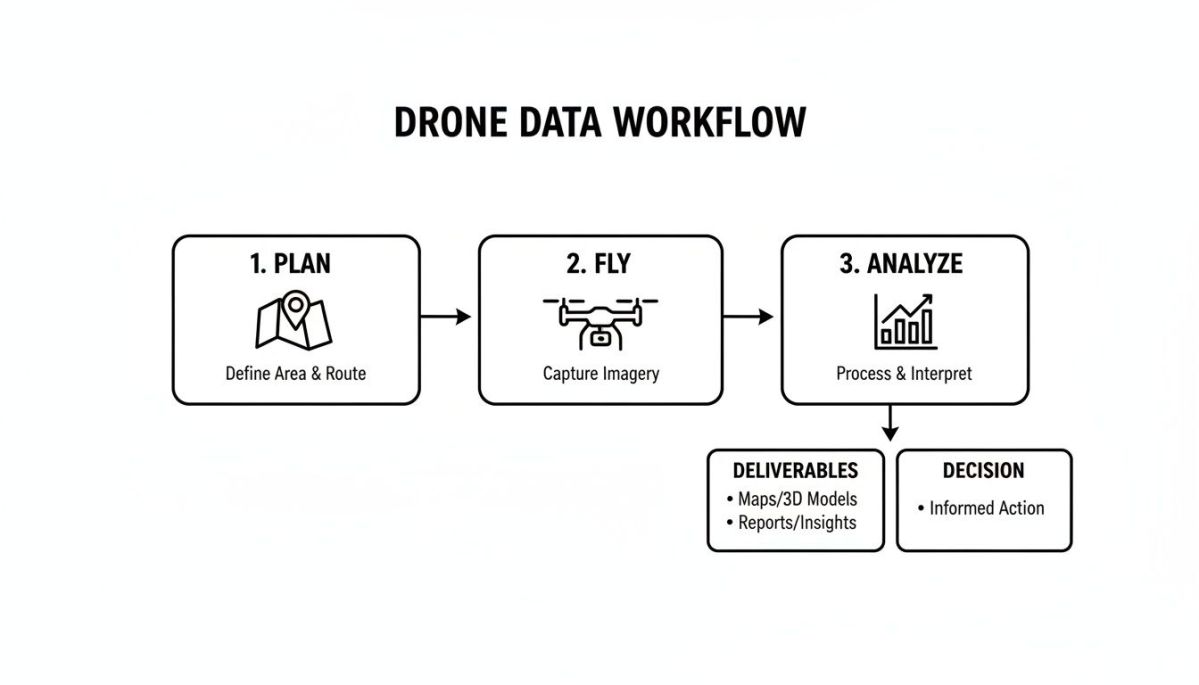
As you can see, the flight itself is just one part of the puzzle. The real magic happens when you process and analyse the data to make smarter, more profitable decisions on the ground.
Operational Best Practices for Australian Conditions
To get consistent and reliable results, you need to stick to some best practices, especially given our unique conditions. Think about the industrial pain point of spraying in variable Aussie weather. Without proper planning, you risk spray drift, wasted chemicals, and poor results, costing you thousands.
A purpose-built spraying drone like the Evolution Eagle is designed for these tough situations. The operator can use its robust flight characteristics to plan missions effectively—flying at the right time of day and using specific nozzles to minimise drift. The business outcome is effective, on-target spraying that maximises chemical efficacy and minimises waste, directly protecting the operator's investment and the environment.
The real business outcome—effective, on-target spraying—comes from combining a capable machine with disciplined, best-practice operation.
When you focus on the direct cost savings, the potential for yield improvement, and solid day-to-day work habits, a drone stops being just another purchase and becomes a genuine profit-generating asset for your farm.
Common Questions About Agriculture Drones in Australia
Thinking about getting a drone for your farm? You're not alone. But with any new piece of equipment, there are always plenty of practical questions that need answering. Making the right investment means getting straight answers, so here are a few of the most common things we get asked by farmers across Australia.
How Much Does an Agriculture Drone Cost?
This is usually the first question we get, and the honest answer is: it depends entirely on what you need it to do. The price for agriculture drones in Australia can be anywhere from a few thousand dollars for a simple mapping drone right up to $50,000 or more for a top-of-the-line spraying unit.
The best way to think about it is like any other piece of farm machinery. You wouldn't buy a combine just to mow your lawn, and the same logic applies here. The key is to match the drone's capability—and its price—to the specific job you have in mind and the return you expect, whether that's from saving on chemicals or boosting your yields.
Do I Need a Special Licence to Fly on My Farm?
Good news for most farmers – probably not. Thanks to CASA's 'Excluded Category' rules, you can fly a drone that weighs less than 25kg on your own property without needing a formal Remote Pilot Licence (RePL).
But, and this is important, you still have to follow the standard operating conditions, like always keeping the drone within your line of sight. You will need a licence if the drone is over 25kg, if you plan to fly it for hire, or if you want to get into more complex types of flying.
How Far and How Long Can an Ag Drone Fly?
Flight time and range really come down to the drone's design and what it's carrying. Your average multi-rotor mapping drone will probably give you 25-40 minutes in the air, which is enough to cover a few hundred hectares. For bigger properties, single-rotor or specialised fixed-wing drones can stay up for much longer.
One of the biggest industrial pain points for operators on large properties is the stop-start nature of surveying massive areas with standard drones. This is where the technical specifications of a machine like the Evolution Flight Jupiter-H2 make a real difference.
Its 3-hour flight endurance is the direct solution to this problem. The business outcome is the ability to map thousands of hectares in a single flight. This creates a complete, consistent dataset for your entire property, massively cutting down time in the field and the overall cost of the operation, which is a game-changer for large-scale farm management.
How Secure Is My Farm Data?
This is a big one, and it's something that often gets overlooked. The information your drone collects—data on crop health, weed maps, water sources, and infrastructure—is incredibly valuable and sensitive. Using a drone that sends this data over unencrypted links is a serious biosecurity and commercial risk.
It's absolutely crucial to make sure your drone platform is built with data security as a priority. You need to know that your farm's operational intelligence is kept private and stays in your hands.
At Evolution Flight, we build secure, high-performance drone platforms designed for the demands of Australian agriculture. To find the right system for your operation and solve your biggest on-farm challenges, explore our advanced drone solutions at https://evolutionflight.com.