
Picking the best drone mapping software really comes down to what you need to achieve on a project. If survey-grade accuracy is non-negotiable, Pix4Dmapper is a standout. For projects that value simplicity and teamwork, DroneDeploy is brilliant. And for those in Australia focused on heavy civil and earthworks, Propeller Aero is purpose-built for the job.
How to Choose Your Ideal Drone Mapping Software
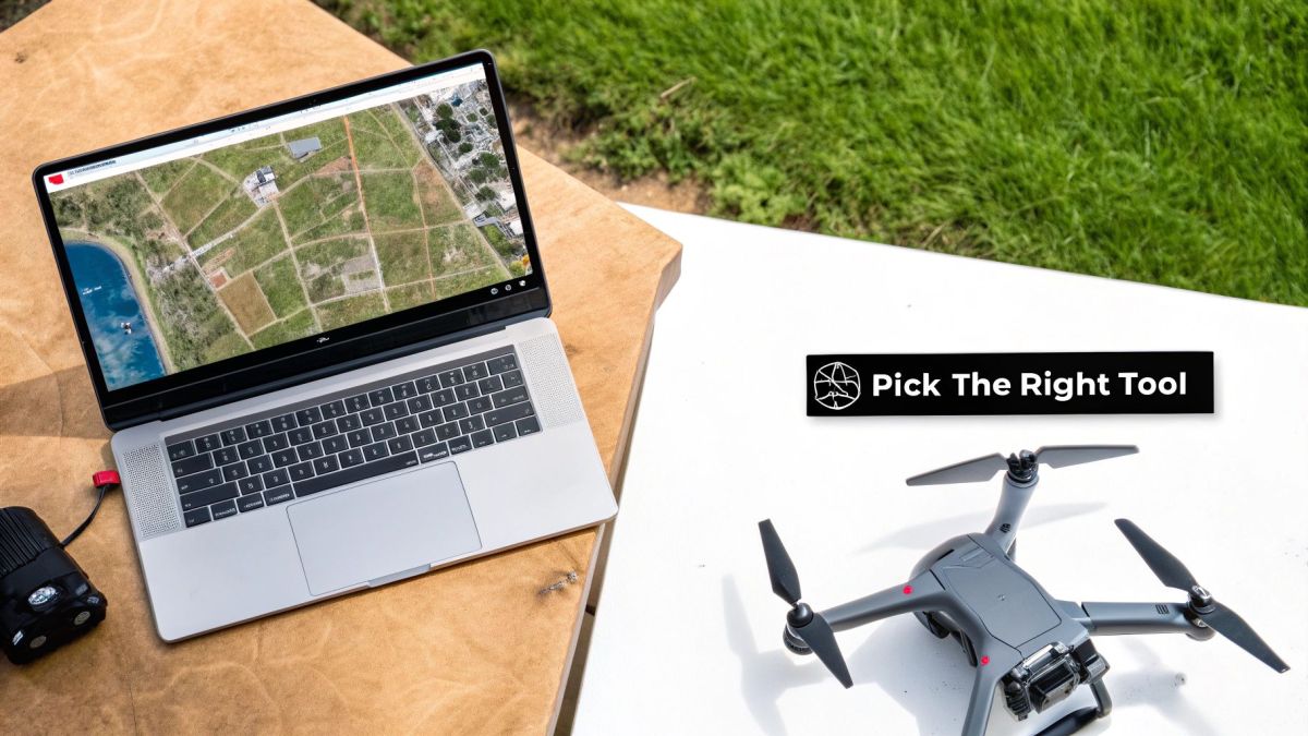
Choosing the right platform can feel overwhelming, but it gets a whole lot easier when you zero in on what your operation truly needs. The best software isn't about having the longest feature list; it's about solving real problems on the ground, whether you're in construction, agriculture, or mining. This guide is designed to cut through the jargon and help you choose with confidence.
Let's break down the top contenders against a clear set of criteria, so you can see what actually matters for your workflow.
Key Comparison Criteria
To give you a practical, balanced view, I've evaluated each software against three core pillars. These aren't just technical specs; they reflect the day-to-day realities for professionals who depend on drone data to get their jobs done right.
- Processing Accuracy and Control: How well does it deliver survey-grade results? I'm looking at its support for RTK/PPK data, how it handles Ground Control Points (GCPs), and the granular control it gives you to tweak processing settings for the best possible outputs.
- Workflow Efficiency and Usability: A powerful tool you can't figure out is useless. This is all about the user interface, automated features, and how fast you can go from uploading images to getting a final map. It’s about which platforms make complicated tasks feel simple.
- Integration and Analytical Capabilities: Your drone data needs to play nice with other software. Here, I'm checking how easily each platform fits into existing CAD and GIS systems and what kind of built-in analysis tools it offers for things like stockpile measurements or crop health assessments.
One of the first big decisions you'll face is choosing between on-premises vs cloud computing. This choice has a huge impact on how you store data, your processing power, and who can access the information.
The most valuable software is one that not only processes your data accurately but also fits neatly into your existing project management and analytical workflows, turning raw images into actionable business intelligence.
A Quick Guide to Top Drone Mapping Software
If you just need a quick pointer for a specific job, here's my take on the best tools for common use cases here in Australia.
| Use Case | Top Recommendation | Why It Wins |
|---|---|---|
| Survey-Grade Accuracy | Pix4Dmapper | You get unmatched control over every processing parameter for seriously high-precision results. |
| Ease of Use & Collaboration | DroneDeploy | Its intuitive cloud platform is perfect for teams and getting maps processed quickly. |
| Heavy Civil & Earthworks | Propeller Aero | It’s built from the ground up for worksite management with powerful 3D analytics. |
| GIS Integration | Esri Suite | It plugs seamlessly into the entire ArcGIS ecosystem, which is a massive plus for GIS pros. |
Getting to Grips with Drone Mapping Tech
Before you can pick the right drone mapping software, it’s worth understanding what’s happening under the bonnet. These clever systems are the magic that turns thousands of simple drone photos into incredibly precise and useful 3D models and maps. Knowing the basics helps you see why one piece of software might be perfect for a certain job, but not another.
The two main technologies you’ll come across in drone mapping are photogrammetry and LiDAR. They both create detailed 3D data, but they go about it in completely different ways. This difference is key, as it has a direct impact on your project's cost, accuracy, and what you can ultimately achieve.
Photogrammetry is essentially the science of measuring things from photos. Drone mapping software takes hundreds or even thousands of overlapping, geotagged images and stitches them together to recreate a 3D scene. It's a fantastic and budget-friendly way to produce visually stunning outputs like orthomosaics and detailed 3D models.
Photogrammetry: The Go-To for Visual Mapping
At its core, photogrammetry works by finding common points in multiple images and using a process called triangulation to work out their exact 3D position. It's a bit like how our own eyes create depth perception from two slightly different viewpoints. The whole process generates a dense point cloud—a huge collection of data points that acts as the digital skeleton of your site.
From this point cloud, the software can produce a few critical outputs:
- Orthomosaic Maps: Think of this as a single, massive aerial photo that’s been corrected so it’s perfectly to scale, just like a real map.
- Digital Surface Models (DSMs): These models show the elevation of everything on the ground, including buildings, trees, and stockpiles.
- 3D Textured Meshes: These are the realistic, full-colour 3D models that are brilliant for inspections, site walk-throughs, and showing clients what’s happening.
This is the technology driving the boom in drone use across Australia. The local industry was valued at USD 614.0 million in 2024 and is expected to rocket to USD 1,500.7 million by 2033. A huge part of that growth comes from industries like agriculture and mining that depend on these visual maps. You can discover more insights about the Australian drone market growth and see what it means for your own work.
LiDAR: When You Need Pinpoint Accuracy
LiDAR, which is short for Light Detection and Ranging, works more directly. A LiDAR sensor on a drone fires out thousands of laser pulses per second and times how long they take to bounce off a surface and return. Each one of these measurements creates a hyper-accurate point in 3D space.
The real superpower of LiDAR is its ability to see through vegetation. The laser can slip through gaps in a tree canopy to map the true ground level underneath, making it an absolute must-have for forestry work or creating ultra-precise Digital Elevation Models (DEMs).
Unlike photogrammetry, which needs good light and clear views, LiDAR is an active sensor, so it doesn't mind working in lower light. This makes it a tough, reliable choice for jobs that demand the highest accuracy, like mapping powerline corridors or conducting detailed land surveys where the ground elevation is everything. It’s a bigger investment, for sure, but LiDAR delivers a level of precision that photogrammetry just can’t touch in dense or tricky environments.
Comparing The Leading Drone Mapping Platforms
Choosing the right drone mapping software isn't about picking the one with the longest feature list. It’s about understanding how each platform actually performs in the real world, on a real job site. This comparison gets straight to the point, looking at four of the biggest names in the game: Pix4Dmapper, DroneDeploy, Esri's ArcGIS Drone2Map, and Propeller Aero. We'll break them down against practical criteria to help you figure out which one actually fits your workflow.
The first big decision you’ll face is often between a powerful desktop-based program that gives you total control, and a cloud-based platform that’s all about speed and collaboration. Getting your head around this fundamental difference is the first step to making the right choice.
At their core, all these platforms turn a collection of drone images into data you can actually use. The diagram below shows the typical journey from capturing images to creating a final 3D model.

It’s within this process—from photogrammetry or LiDAR capture to a final, usable model—that each software shows its true colours with its own unique algorithms and toolsets.
Pix4Dmapper: The Surveyor’s Choice For Precision
For years, Pix4Dmapper has been the go-to for professionals who absolutely cannot compromise on accuracy. As a desktop application, it puts you in the driver's seat for the entire photogrammetry process, from tweaking initial image calibrations right through to the final export.
This level of granular control is precisely its biggest selling point. You can meticulously define processing parameters, manage Ground Control Points (GCPs) with surgical precision, and generate exhaustive quality reports. For surveyors and engineers, this isn't just a nice-to-have feature; it’s fundamental to validating the integrity of their data.
Of course, all that power comes with a price. There's a steeper learning curve, and you’ll need a seriously high-performance computer to run it well. Processing big datasets can tie up your machine for hours, sometimes even days. It's the classic trade-off: you get outputs you can bet your license on, but you have to invest the time and resources.
DroneDeploy: Simplicity And Speed In The Cloud
DroneDeploy flips the script completely. It's a fully cloud-based platform built from the ground up for simplicity, speed, and teamwork. The workflow is incredibly straightforward: plan a flight in the app, fly the mission, upload the images, and let DroneDeploy’s servers do all the heavy lifting.
This approach makes it fantastic for teams that don't have a dedicated photogrammetry expert on staff. A project manager can be looking at a site map on their tablet just hours after the drone has landed, sharing notes and measurements with colleagues across the country. Its App Market is also a huge plus, letting you add industry-specific tools for things like construction progress tracking or agricultural health analysis.
The main thing to keep in mind with DroneDeploy is that you're swapping that fine-tuned processing control for sheer convenience. While the results are more than accurate enough for most commercial jobs, it might not meet the stringent demands of a licensed surveyor who needs to justify every variable in their process.
Key Differentiator: At its heart, the choice between Pix4Dmapper and DroneDeploy is about control versus convenience. If your work demands auditable, centimetre-perfect accuracy with full manual oversight, Pix4Dmapper is still king. If getting results quickly and sharing them effortlessly with your team is the priority, DroneDeploy is hard to beat.
Esri ArcGIS Drone2Map: Seamless GIS Integration
If your organisation already lives and breathes the Esri ecosystem, then ArcGIS Drone2Map is a no-brainer. Its killer feature is its native, seamless integration with ArcGIS Pro, ArcGIS Online, and the rest of the Esri toolkit.
This means your drone data flows directly into your existing GIS workflows without any clunky import/export headaches. You can create orthomosaics, 3D point clouds, and digital surface models (DSMs), and then immediately start running advanced spatial analysis in the familiar ArcGIS environment. It effectively makes your drone just another sensor in your wider geospatial data strategy.
Think of it less as a standalone mapping tool and more as a specialised cog in a much larger machine. Its strength isn't necessarily in being the most powerful photogrammetry engine on the market, but in being the best-integrated one for the millions of GIS professionals who depend on Esri products every day.
Propeller Aero: Purpose-Built For Earthworks
Propeller Aero is a different beast altogether. It’s a highly focused platform designed from the ground up for the heavy civil construction, mining, and waste management industries. It marries a clean, user-friendly cloud platform with incredibly powerful tools for tracking earthworks, measuring stockpile volumes, and keeping an eye on site progress.
Its secret sauce is the AeroPoints system—smart, portable GCPs that take the pain out of achieving survey-grade accuracy. This tight integration of hardware and software makes it incredibly easy for site crews to capture reliable data, time and time again. The 3D site models are interactive and built specifically for comparing site conditions against design plans, calculating cut/fill volumes, and generating progress reports that actually make sense to site managers.
Because it's so specialised, it’s not a general-purpose mapping tool. If you’re not moving dirt for a living, its toolkit is probably overkill. But for the people it’s built for, Propeller offers a polished, incredibly effective solution that speaks their language.
Drone Mapping Software Feature Comparison
To help you see how these platforms stack up at a glance, we've put together a simple comparison table. This breaks down the key attributes of each one, giving you a clear idea of where they shine.
| Feature | Pix4Dmapper | DroneDeploy | Esri Suite (Drone2Map) | Propeller Aero |
|---|---|---|---|---|
| Processing Type | Desktop | Cloud-Based | Desktop & Cloud | Cloud-Based |
| Primary Strength | Granular Control & Accuracy | Ease of Use & Collaboration | Native GIS Integration | Earthworks & Site Management |
| Ideal User | Surveyors, Engineers | Construction PMs, Agri-Techs | GIS Analysts, Planners | Site Managers, Miners |
| Learning Curve | High | Low | Medium (if new to Esri) | Low |
| Hardware Needs | High-Performance PC | Standard Web Browser | Mid-to-High Tier PC | Standard Web Browser |
This table really highlights the different philosophies at play in the market. It's a dynamic space, with the global drone mapping software market projected to grow at a CAGR of 20.1% from 2025 to 2031, and Australian industries are a huge part of that story. The Australian drone market itself pulled in $1,051.3 million in 2024 and is forecast to reach $2,708.5 million by 2030, driven by the strong local adoption of platforms just like these. You can learn more about the drone mapping software market growth and what it means for the industry.
Ultimately, the 'best' drone mapping software is the one that best fits your job. A surveying firm that needs maximum precision will naturally gravitate towards Pix4Dmapper. A large construction company juggling multiple sites will see huge value in DroneDeploy's collaborative tools. A government agency will benefit from Esri's deep GIS integration, and a mine operator will get an immediate return on investment from Propeller's purpose-built earthworks features. Match the software's strengths to your operational goals, and you'll make a choice you can be confident in.
How Australian Industries Are Using Drone Mapping
Knowing the features of a drone mapping platform is one thing, but seeing how it solves real-world problems is what really matters. Across Australia, industries are well past the theory stage and are putting this technology to work, turning old-school processes into efficient, data-rich operations. From the huge mine sites of Western Australia to the agricultural heartlands of New South Wales, drone mapping is making a genuine difference to the bottom line.
This isn't just about creating pretty maps. It's about getting answers to critical business questions. How much dirt did we move this week? Are the crops healthy? Is our worksite actually being built to spec? Let's dig into how different Australian industries are using this tech to find out.
Construction Progress and Earthworks Management
In construction, keeping track of progress and staying precise is everything. Drone mapping software gives you a bird's-eye view of your worksite, taking a chaotic, moving environment and turning it into a digital model you can actually make sense of.
Firms are using platforms like Propeller Aero and DroneDeploy to fly a site weekly, sometimes even daily, to generate fresh orthomosaics and 3D models. This lets project managers see exactly how work is progressing against the schedule, spot potential delays before they become major problems, and make sure everything lines up with the original designs. What used to take days with manual surveyors can now be done in just a few hours.
The biggest win is in earthworks. Calculating cut-and-fill volumes—how much material you need to dig out or bring in—is fundamental to any civil job. Drone mapping automates this, delivering volume measurements with up to 99% accuracy. This stops costly mistakes and puts an end to arguments over quantities.
This level of detail makes a difference across the entire project.
- Safety and Compliance: Drones can get a look at hard-to-reach spots, check on slope stability, and document safety standards without sending a person into a potentially risky situation.
- As-Built Verification: Teams can lay 3D models over their BIM or CAD designs to instantly see where reality doesn't match the plan.
- Stakeholder Reporting: Handing over an interactive 3D map is a much more powerful way to show clients and stakeholders what's happening than just talking about it.
Precision Agriculture and Crop Health Analysis
Australian agriculture is a huge operation, and managing thousands of hectares efficiently is a constant battle. Drone mapping, especially when paired with multispectral sensors, has become a vital tool for modern farmers and agronomists. It's the core of what we call precision agriculture.
By analysing how crops reflect different spectrums of light, this technology creates detailed health maps. These maps use indices like NDVI (Normalised Difference Vegetation Index) to flag areas of plant stress long before you could ever spot them with your own eyes. This means farmers can get on top of problems before they take hold.
For example, a wine grower in the Barossa Valley might use drone data to find a small patch of vines that are struggling with water stress. Instead of turning on the sprinklers for the whole vineyard, they can give that specific area the water it needs, saving a valuable resource and boosting their yield. It’s this kind of targeted action that completely changes the game for managing inputs like fertiliser and pesticides.
Mining Operations and Stockpile Management
The Aussie mining industry lives and dies by accurate, regular measurements of stockpiles, pits, and tailings dams. The old way of doing it with ground-based surveys is slow, can be dangerous for the crew, and often gets in the way of operations. Drones offer a much faster, safer, and generally more accurate solution.
Mine operators use data from a drone flight to create precise Digital Surface Models (DSMs) of their stockpiles. The software then crunches the numbers to calculate the volume of those piles with incredible accuracy. This is crucial data for managing inventory, forecasting production, and balancing the books. A single flight that takes maybe 20 minutes can capture all the data needed to measure dozens of stockpiles.
This rapid data capture is quickly becoming the norm right across the country. In Australia, the use of semi-autonomous survey drones has shot up, with platforms like Propeller Aero becoming popular for their powerful geo-referencing and cut-and-fill tools. The growth is hard to ignore; the Western Australia drone market is projected to grow at a CAGR of 16.3% from 2024 to 2032. The Australian Capital Territory and Victoria are expected to grow even faster, at 27.7% and 24.0%, respectively. You can dive deeper into this by exploring the latest research on drone mapping trends in Australia. This rapid adoption really shows just how valuable these tools are for industries that manage massive physical assets.
Integrating Drone Data into Your Existing Workflows

Getting great data from a drone flight is one thing, but the real magic happens when that information slots perfectly into the tools your team relies on every day. The best drone mapping software understands this, making sure your aerial insights don't just sit in a folder somewhere. It’s all about turning raw data into actionable intelligence within your existing project management or design platforms.
Without a smooth pipeline from the field to the office, you risk creating more problems than you solve. Even the most precise data can become a bottleneck if your team has to manually shuffle files or wrestle with incompatible formats.
Understanding Key Data Formats
To get your drone data playing nicely with other systems, you need to get comfortable with a few common file types. Each format has a specific job and is designed for particular software, like the advanced systems used with Innoflight drones.
- GeoTIFF (.tif): This is your bread and butter for orthomosaic maps. Think of it as a high-res image that knows exactly where it is in the world, making it perfect for GIS and CAD programs.
- LAS/LAZ (.las, .laz): When you're working with 3D data, these are the formats you'll be using. They contain the millions of tiny points that make up a point cloud, which is the foundation for detailed 3D modelling and analysis.
- Shapefile (.shp): A classic in the GIS world. Shapefiles are ideal for exporting vector features you’ve identified on your map—things like property lines, stockpile perimeters, or road centrelines.
Knowing which file to export for which task is the first and most crucial step towards a hassle-free workflow.
Connecting Software with APIs
For a truly connected system, many of the top platforms provide an Application Programming Interface (API). An API is basically a bridge that lets your different software programs talk to each other and exchange data automatically. This is a massive step up for efficiency.
An API lets you push data from your drone mapping software straight into platforms like Autodesk Construction Cloud or ArcGIS without any manual downloading or uploading. This automation saves an incredible amount of time and cuts down on human error.
Imagine a workflow where a freshly processed orthomosaic from today’s flight automatically appears on your project management dashboard. This simple connection ensures the entire team is looking at the most current site conditions, all the time. This is what separates a decent workflow from a truly effective one.
Answering Your Drone Mapping Software Questions
As you narrow down your options, a few practical questions always seem to pop up. It’s the nitty-gritty stuff that matters: What kind of computer do I need? How can I be sure the maps are accurate? Will my current drone even work? Getting solid answers here is crucial before you invest your time and money.
Let's walk through the most common questions we hear from professionals, giving you the clarity to move forward with confidence.
Do I Need a Powerful Computer for Drone Mapping?
That really depends on whether you go for a desktop or a cloud-based program. They work in fundamentally different ways, which completely changes the hardware you'll need.
If you opt for a desktop solution like Pix4Dmapper, then yes, you absolutely need a powerful machine. All the heavy processing happens right on your computer, which means you’ll need a robust CPU, a dedicated graphics card (GPU), and plenty of RAM. Without it, you’ll find your workflow grinds to a halt when you’re dealing with big datasets.
On the other hand, cloud platforms like DroneDeploy and Propeller Aero do all the hard work on their own powerful servers. This is a game-changer. It means you can manage massive, complex projects from a standard office laptop or even a tablet out in the field. The processing load is their problem, not yours.
The choice between desktop and cloud isn't just about features. It's a strategic decision: do you invest in powerful local hardware for total control, or do you prioritise easy access and team collaboration with a cloud-based system?
How Do I Achieve Survey-Grade Accuracy?
Getting your maps accurate enough to hand off to an engineer isn't just about the software. It’s a combination of having the right gear on your drone and sticking to a solid process on the ground. For survey-grade results, a few things are non-negotiable.
First, your drone needs to have either Real-Time Kinematic (RTK) or Post-Processed Kinematic (PPK) capabilities. This tech refines the drone's GPS data down to centimetre-level precision, either as it flies or just after it lands. It’s the foundation of an accurate map.
Second, you have to use Ground Control Points (GCPs). These are simply targets you place on the site, with their exact coordinates measured by a survey-grade GPS rover. Your mapping software then uses these known points to pin your entire model to the real world, correcting any tiny errors. The combination of an RTK/PPK drone and properly placed GCPs is the gold standard for reliable, survey-grade accuracy.
Can I Use Any Drone with This Software?
It would be nice if everything just worked together, but unfortunately, that’s not the case. You absolutely have to check for compatibility before committing to a software platform.
Most of the major players, like DroneDeploy and Pix4D, keep updated lists of the drones they officially support. Unsurprisingly, these lists are usually dominated by popular models from brands like DJI. Full support means the software can handle the whole mission for you—from flight planning to camera control.
What if your drone isn't on the list? You're not necessarily out of luck. Many platforms let you manually upload images from pretty much any camera drone. The catch is you'll lose all the automated flight planning and control, which means more manual work. Before you buy, always double-check that your specific drone and camera are fully supported to avoid any headaches down the line.
Ready to elevate your aerial operations with industry-leading hardware? Innoflight International designs and manufactures advanced UAS solutions built for precision, reliability, and performance. Explore our range of heavy-lift, LiDAR, and agricultural drones to find the perfect platform for your needs.