
Choosing the right drone camera in Australia isn't about hobbyist aerial photography anymore. For serious enterprise operators, it's a major investment. The decision has shifted from simply capturing a nice picture to acquiring precise, actionable data that solves real-world business problems and delivers a clear return.
The Growing Demand For Enterprise Drone Cameras In Australia
Across Australia, the use of enterprise drones is booming. This isn't just a fleeting trend; it’s a fundamental change in how industries manage their assets, keep an eye on the environment, and keep their people safe. Key sectors like mining, utilities, and infrastructure now depend on advanced drone camera technology to collect information that was once dangerous, prohibitively expensive, or flat-out impossible to get.
The market numbers back this up. The Australian drone camera market was valued at USD 106.69 million in 2024 and is expected to climb to an impressive USD 387.33 million by 2033. This massive growth is primarily driven by the need for high-resolution optical cameras—the workhorses of detailed inspections and environmental monitoring. You can dig deeper into these numbers with the Australia drone camera market report on Deep Market Insights.
Solving Industrial Problems From The Air
For most Australian businesses, the real challenge is picking a specialised camera payload that actually solves a pressing industrial headache. A generic, off-the-shelf drone camera just doesn't cut it when the stakes are high. The true value is found when you match the right sensor to the right problem.
Think about a utility company tasked with inspecting hundreds of kilometres of power lines in the middle of nowhere. Their biggest pain point is spotting tiny, early-stage defects—things like cracked insulators or a few frayed wires—before they cause a catastrophic failure and a widespread blackout.
A standard consumer drone camera probably won't have the resolution or zoom needed to see those subtle flaws from a safe distance. This can lead to missed issues and a dangerous false sense of security. It's a classic case of hardware limitations creating direct business risk.
The Evolution Flight Advantage
This is exactly why specialised, high-performance systems are no longer a luxury but a necessity. The quality of the data you collect from the get-go determines the value of your entire operation. Your first step towards a successful drone program is choosing a system that delivers detail you can trust.
That's where platforms like those from Evolution Flight come in. They build secure, high-performance drone solutions designed for Australia's tough conditions. These drones are built to carry advanced, high-resolution payloads that can spot minuscule defects from a standoff distance, turning a routine flight into a powerful, proactive maintenance tool.
The business outcome is crystal clear: better safety, less downtime, and preventing expensive equipment failures before they happen. This guide will walk you through the critical factors to consider, so you can choose the right drone camera system for your mission.
Matching Drone Camera Payloads To Your Mission
Choosing the right drone camera is a lot like picking the right tool for a job on-site. You wouldn't use a sledgehammer to drive a nail. In the same way, each camera payload is built for a specific purpose, designed to capture a particular kind of data that solves a distinct operational problem. Getting this right is the first step toward a drone program that actually delivers results.
The most familiar and versatile tool in the kit is the RGB (Red, Green, Blue) camera. It sees the world just like we do and is the absolute workhorse for visual inspections, high-resolution photography, and building 3D models of assets. Its main job is simple: give you a crystal-clear visual record.
But what about the problems you can't see? That’s where specialised sensors come in, capturing light and energy far beyond the visible spectrum to uncover a whole new layer of information.
This flowchart gives you a simple decision-making framework. It all starts with your mission goal and whether you need to see what's physically there or what's happening beneath the surface.
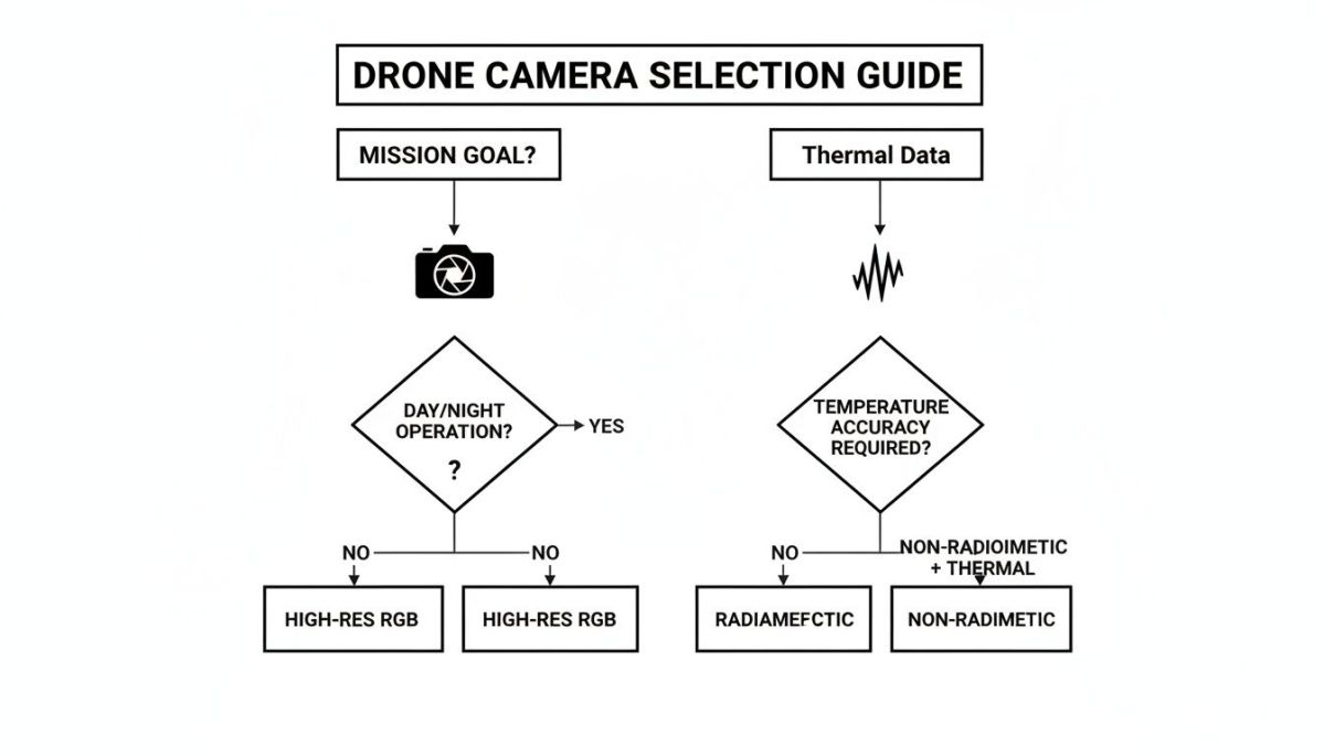
As the chart shows, defining your mission is the critical first question. The answer immediately points you toward the right kind of data you need to capture, and by extension, the right camera for the job.
Seeing Beyond The Visible Spectrum
Thermal and multispectral cameras are perfect examples of sensors that detect what our eyes miss. A thermal camera doesn't see light; it sees heat. It builds an image by detecting tiny differences in temperature and displays that information as a visual heat map.
Think about an energy company trying to find faulty panels across a huge solar farm. A defective panel often gets dangerously hot long before it stops working.
An Innoflight drone with a high-resolution thermal camera can scan thousands of panels in a single flight. The camera's radiometric sensor doesn't just show a vague "hot spot"—it provides an exact temperature reading. This delivers the real business outcome of predictive maintenance. The crew can replace failing cells before they drag down the farm's output, preventing costly downtime.
A multispectral camera, on the other hand, is built to see plant health. It captures light in very specific, narrow bands—including near-infrared, which healthy vegetation reflects strongly. By analysing these reflections, an agronomist can spot crop stress, disease, or nutrient issues well before any damage is visible to the naked eye.
Specialized Tools For Specific Jobs
Beyond these, other specialised payloads are vital for Australian industries.
LiDAR (Light Detection and Ranging) scanners are indispensable for creating hyper-accurate topographical maps and 3D models. They work by firing rapid laser pulses at the ground and measuring the time it takes for the light to return, calculating distance with incredible precision. This is the go-to tool for mining and transport agencies that need centimetre-accurate elevation data for planning new infrastructure or tracking stockpile volumes.
Hyperspectral cameras take this even further. Where multispectral cameras look at a handful of light bands, hyperspectral sensors capture hundreds. This allows for incredibly detailed material identification, making them invaluable for complex environmental monitoring or mineral exploration.
Drone Camera Payloads And Their Industrial Applications
Matching the payload to the job is non-negotiable if you want to see a return on your investment. To make it clearer, this table breaks down which camera types are best suited for key applications across Australia.
| Camera Type | Core Function | Primary Data Output | Key Australian Applications |
|---|---|---|---|
| RGB | Captures high-resolution visual imagery. | Geotagged photos, videos, 3D models. | Infrastructure asset inspection, construction progress monitoring, real estate marketing. |
| Thermal | Detects and measures heat signatures. | Radiometric thermal maps, temperature data. | Solar farm inspections, electrical fault detection, search and rescue, wildlife monitoring. |
| Multispectral | Measures plant health by analyzing light reflectance. | Vegetation health indices (e.g., NDVI). | Precision agriculture, crop stress analysis, forestry management, environmental compliance. |
| LiDAR | Creates precise 3D elevation models using lasers. | Point clouds, digital elevation models (DEM). | Mining surveys, corridor mapping for roads/rail, flood modelling, vegetation encroachment analysis. |
By understanding these core functions, you can align your procurement strategy with your specific operational needs. This ensures your drone camera becomes a valuable data-gathering asset—not just an expensive gadget sitting on a shelf.
How Camera Specs Directly Affect Your Bottom Line
When you're looking at drone cameras in Australia, it's easy to get bogged down in a sea of tech specs like megapixels and shutter speeds. But these aren't just numbers on a datasheet. Each one directly translates into a real-world capability that can either solve a critical business problem or create an expensive new one.
Think of a camera's sensor size as a bucket catching rain. A small sensor is like a small bucket—it only catches a little bit of light at a time. A larger sensor is a much bigger bucket, gathering far more light in the same amount of time. This isn't just a technical detail; it has huge operational consequences.
Imagine you're with a utility company inspecting transmission lines at dawn or dusk. Low light is a constant battle. A drone camera with a small sensor will struggle, giving you grainy, unclear images. You could easily miss subtle but critical defects, like a hairline crack on an insulator. A larger sensor, on the other hand, captures enough light to produce sharp, detailed visuals even when the sun is low, ensuring you see every crucial detail.
From Sensor Size to Data You Can Trust
The bigger the sensor, the better its ability to capture high-quality data—and that data is the entire reason you're flying the drone in the first place. A larger sensor typically means larger individual pixels, which boosts two key metrics that are non-negotiable for industrial inspections.
Dynamic Range: This is the camera's knack for seeing details in both the brightest highlights and the darkest shadows of a single scene. A high dynamic range stops sunlit areas from blowing out into pure white and deep shadows from becoming solid black blobs. It reveals the crucial details hiding in the extremes of light.
Low-Light Performance: As we touched on, bigger pixels capture more photons. This creates a stronger signal with less "noise" or graininess in the final image. It’s absolutely essential for any operation that needs to start early or finish late to hit a tight project deadline.
These specs aren't about making pretty pictures. For an asset inspector, they deliver the business outcome of higher data fidelity. This reduces the risk of misinterpreting what you see and leads to far more confident—and correct—maintenance decisions.
Solving the Expensive Problem of Motion Blur
One of the costliest issues in aerial mapping is motion blur. It's a direct result of how a camera's shutter works. Many standard cameras use a rolling shutter, which scans the image from top to bottom, one row of pixels at a time. When the drone is flying, especially when mapping linear assets like pipelines or rail corridors, this creates a distorted, wobbly "jello" effect.
This isn't just a visual glitch; it completely corrupts the geometric accuracy of your data. For a surveying firm, that's a dealbreaker. It means your 3D models and orthomosaics are unreliable, forcing you to do expensive and time-consuming re-flights. It’s a huge industrial pain point that eats into project timelines and profitability.
The solution is a global shutter, which captures the entire image sensor instantly, freezing motion and eliminating distortion. The Evolution Flight IG-120 Heavy-Lift UAS is specifically designed to integrate with advanced camera payloads that feature this technology. By capturing crisp, geometrically stable images while moving at speed, it directly addresses the motion blur problem. This generates the business outcome of eliminating costly re-flights, delivering more accurate digital twins to clients, and making the entire surveying operation more efficient and profitable.
Heavy Lift Drones and Getting the Most From Your Camera
No matter how incredible your camera sensor is, it’s useless without the right drone to carry it. For serious enterprise work across Australia, this means looking beyond off-the-shelf models. You need a platform built for endurance, stability, and—most importantly—the ability to carry heavy, specialised camera systems. These heavy-lift drones are the bedrock of reliable data collection.

This move towards more capable drones isn't just a niche trend; it’s a massive market shift. Commercial drone use in Australia is exploding, valued at USD 784 million in 2023 and forecast to reach a staggering USD 3,487 million by 2033. You can dig into the numbers in this full Australian commercial drone market analysis. This growth is driven by missions where long-endurance platforms fly premium scanners over huge areas, achieving mapping accuracy down to the millimetre.
The Unseen Hero: Gimbals and Stabilisation
At the core of any professional drone camera setup is the gimbal. Think of it as the drone’s ‘steady hand’—a smart, motorised mount that keeps the camera completely isolated from the drone's vibrations, tilts, and turns. It’s what ensures your camera stays locked on target, even when the aircraft is fighting gusty winds.
This technology is absolutely non-negotiable for capturing clean, usable data. Without it, every tiny shudder from the drone translates into blurred photos and shaky video, making your expensive high-resolution sensor worthless. In the windy conditions common across the Australian outback or along the coast, a rock-solid stabilisation system is simply a must-have.
Solving the Geospatial Data Bottleneck
Let’s look at a real-world headache for geospatial and surveying firms. Their job is to map huge areas, like new transport corridors or sprawling mine sites, with pinpoint accuracy. To do this, they rely on heavy, top-of-the-line LiDAR scanners—payloads that are far too bulky for your average drone.
This creates two major problems:
- Payload Capacity: Most drones can’t even lift these advanced sensors off the ground.
- Flight Endurance: Even if a drone could lift the scanner, its short battery life would force the team to constantly land, swap batteries, and relaunch. A single large survey quickly becomes a logistical nightmare of fragmented flights.
This inefficiency blows out project costs, stretches out time in the field, and delays getting the final data to the client. It’s a huge bottleneck that directly hits a firm's productivity and bottom line.
A heavy-lift drone isn’t just about carrying more weight; it’s about unlocking a completely new, more efficient way of working that delivers a real business outcome.
The Evolution Flight IG-120 Advantage
This is exactly the kind of industrial problem that a purpose-built system like the Evolution Flight IG-120 Heavy-Lift UAS was designed to solve. Its 12 kg payload capacity is not just a number; it’s the technical spec that directly overcomes the limitation of smaller drones, allowing it to carry high-end LiDAR scanners and other large sensor packages.
Paired with its extended flight endurance, this capability generates a clear business outcome for survey teams: the ability to map vast corridors in a single, continuous flight. This means a massive reduction in fieldwork time, lower operational costs, and a much faster project turnaround for clients in mining, transport, and utilities.
For any Australian enterprise investing in a high-end drone camera, the drone itself must be seen as part of the total system. Choosing a heavy-lift platform isn’t just an upgrade; it’s a strategic move that unleashes the full potential of your sensor and maximises your return on investment.
Navigating Data Security and Compliance in Australia
Using a high-end drone camera in Australia is about more than just getting the perfect shot. The moment that drone captures data—especially over critical infrastructure or sensitive locations—you step into a complex world of data security and regulatory compliance. Getting this wrong isn't a small slip-up; it's a massive business risk.
You have to understand that Australia’s drone market is really two different worlds. On one side, the consumer market is booming, thanks to fairly relaxed rules for hobbyists. It's a huge industry, generating USD 261 million in 2023 and forecast to reach USD 714 million by 2030. You can dig into the numbers on Australia's consumer drone market growth on Grand View Research.
But that casual, anything-goes vibe stops dead when you cross into professional use. For commercial operators, the rules set by the Civil Aviation Safety Authority (CASA) are just the starting line.
The Critical Weak Spot: Insecure Supply Chains
For any organisation working in defence, government, or critical infrastructure, the biggest headache is the risk of a compromised supply chain. When a drone or its camera payload is built with parts from untracked or unvetted sources, it can have hidden backdoors or vulnerabilities baked right in.
This creates an unacceptable risk that your sensitive data—like a detailed LiDAR scan of the power grid or thermal imagery of a port—could be siphoned off without you ever knowing.
This isn't just theory. It's a very real governance problem that can get a drone platform blacklisted from any serious government or enterprise project. The consequences of using a non-compliant system are severe: cancelled projects, legal trouble, and a total loss of trust in your operations.
How Vetted Technology Delivers Peace of Mind
This is exactly why having a verified, secure supply chain isn't a "nice-to-have"; it's a non-negotiable technical requirement. It’s the only real solution to the threat of data leaks and foreign surveillance.
Evolution Flight was built to solve this exact industrial pain point. Our platforms, including the Evolution Flight IG-120 Heavy-Lift UAS, are designed for Green UAS Certification and are fully compliant with the stringent supply-chain rules of the US National Defense Authorization Act (NDAA). This technical specification is not just a label; it is a guarantee that every component is vetted and secure. For our clients in public safety, defence, and utilities, this provides the critical business outcome of risk mitigation and operational assurance. They can deploy our platforms over sensitive assets, confident that their data is locked down and their technology is a secure tool, not a hidden liability.
The Drone Buyer's Checklist: Getting It Right From The Start
Choosing the right drone and camera system is a big decision. It’s not just about the tech specs on a brochure; it’s about making a smart investment that pays off in the field. A wrong move early on can lead to headaches and wasted money down the track.
This checklist pulls together everything we've discussed, giving you a practical framework to ask the right questions and make sure the gear you buy actually solves your problems.

Think of this as your guide to shifting the conversation from generic features to tangible results. It’s about finding the right drone cameras Australia solution that fits your specific job.
Key Questions To Ask Your Vendor
Before you even think about signing a purchase order, your team needs clear, direct answers to these questions. Don't accept vague promises—they’re a huge red flag.
- Real-World Performance: "Forget the marketing specs. What is the actual flight time with our X kg payload? We need the real number, not the best-case-scenario."
- Local Support: "What does your support look like? Do you have a team on the ground here in Australia that can provide hands-on training and technical help when we need it?"
- Security & Compliance: "Can you show us the paperwork? We need to see proof of a secure supply chain and that your hardware is fully NDAA compliant."
- Integration & Future-Proofing: "How well does this system play with our current software, like Pix4D or ArcGIS? What's the plan for upgrading to new sensors in the future?"
Solving The #1 Problem: Wasted Time On-Site
One of the biggest money pits in any industrial drone operation is inefficiency in the field. It’s the hidden cost that blows out budgets and delays projects.
Imagine a survey crew spending half their day just swapping batteries because their drone can't cover the entire site in one go. That's hours of lost productivity.
This is exactly the problem platforms like the Evolution Flight IG-120 Heavy-Lift UAS are built to solve. Its extended flight endurance is a core technical spec that delivers a powerful business outcome: the ability for your team to map a massive area in a single flight. This directly slashes field hours, reduces logistical complexity, and keeps the project on time and on budget.
The "best" drone camera isn't the one with the highest specs. It's the one that perfectly matches your mission needs and solves a real-world business problem. It’s all about the result, not just the gear.
Tips for Smooth Operations
Once you've got the right equipment, you need to use it effectively to get the best return on your investment.
- Create Your Playbook: Develop clear Standard Operating Procedures (SOPs) for every type of job. From pre-flight checks to downloading the data, make it a repeatable, reliable process.
- Plan Your Mission Before You Go: Use your flight planning software to map out your flight paths, altitudes, and camera settings before you even leave the office. It saves a ton of time on-site.
- Stick to a Maintenance Schedule: Don't wait for things to break. Regular checks on props, batteries, and sensors prevent failures in the field and keep your data quality high.
- Keep Your Pilots' Skills Sharp: Technology changes fast. Investing in ongoing training ensures your team stays on top of new features, software updates, and emergency procedures.
By using this checklist, you can move forward with confidence, knowing you're choosing and running a drone system that will become a powerful, reliable asset for your business.
Ready to find a platform that fits your mission? Get in touch with the experts at Innoflight for a tailored consultation.
Your Questions, Answered
Let's dig into some of the most common questions we get about choosing and using commercial drone cameras here in Australia. These are the things that often come up in conversation, and getting them right can make all the difference.
For Accurate Aerial Mapping, What's the One Camera Spec I Can't Ignore?
If you’re doing any kind of mapping or photogrammetry, the single most important feature to look for is a global shutter. This isn't just a nice-to-have; it's fundamental to getting data you can actually trust.
Think of it this way: a camera with a rolling shutter captures an image line by line, a bit like a desktop scanner. When your drone is moving, this creates a subtle (or not-so-subtle) 'jello' effect. For mapping linear assets like pipelines or rail lines, this distortion is a project-killer. It messes with the geometric accuracy of your 3D models and almost guarantees you’ll be heading back out for expensive re-flights.
A global shutter, on the other hand, acts like a classic camera flash. It captures the entire image sensor in one single instant. This freezes the motion completely, eliminating distortion and ensuring every single photo is a geometrically perfect snapshot. A payload with a global shutter, like the ones we integrate with our Innoflight platforms, means better data, more reliable digital twins, and no wasted time on rework.
Should I Go with a Multi-Rotor or a Fixed-Wing Drone?
The honest answer? It completely depends on the job you need to do.
Fixed-wing drones are fantastic for covering huge areas quickly. If you're surveying a massive farm or a long transport corridor, their efficiency is hard to beat. The trade-off is that they can't hover, and they need a fair bit of room to get into the air and land.
For most inspection work and detailed mapping, a multi-rotor drone is far more flexible. The ability to hover, fly slowly, and get up close to vertical structures like bridges, telco towers, or building facades is invaluable.
And when the job calls for heavy, specialised gear like a high-end LiDAR scanner, you'll need a heavy-lift multi-rotor platform. This is where systems from Innoflight shine, giving you the power, stability, and payload capacity to get that high-resolution data safely and effectively.
Are There Special Rules for Flying Thermal or LiDAR Cameras?
When it comes to the Civil Aviation Safety Authority (CASA), their main focus is on your drone's weight and your certification level, not what kind of sensor you have bolted on. The core rules of the sky are the same whether you're flying a standard camera, a thermal imager, or a LiDAR unit.
However, it's how you use that technology that can bring other legal requirements into play.
- Privacy Laws: Pointing a thermal camera at a residential area, for instance, could easily put you in the territory of state and federal privacy legislation. You have to be aware of what you're capturing.
- Operational Approvals: CASA might not have specific rules for LiDAR lasers, but if your mission takes you into restricted airspace near an airport or a military base, you'll absolutely need special permissions to be there.
Your mission plan needs to cover more than just the flight itself. It has to account for CASA's rules and any other laws that apply to data collection and privacy for that specific job.
If you need practical advice on matching the right drone and camera to your specific operational challenges, we're here to help. Explore our secure, high-performance drone solutions, built for Australia's toughest conditions, at the official Innoflight website.