
For decades, keeping Australia's vast power grid in check was a tough, boots-on-the-ground (or in-the-air) job. It meant linemen scaling massive towers or helicopters flying precariously low over rugged terrain. It was slow, risky, and incredibly expensive. Think of it like trying to find a single loose stitch on a kilometre-long blanket by examining it inch by inch.
This old-school approach wasn't just dangerous; it was also inefficient. It often meant that by the time a problem was found, it had already caused a failure. This reactive cycle of "break-then-fix" is a massive headache for utility providers and their customers.
The Staggering Cost of Outages
When the power goes out, the costs add up fast. In fact, Australian businesses lose a staggering $7 billion every year because of power disruptions. Many of these outages could have been avoided with a more forward-thinking inspection strategy, a point often highlighted in reports from Australian power line inspection companies.
The limitations were clear. Utilities needed a better way to get a complete picture of their network's health without putting crews in harm's way or spending a fortune on helicopters. This challenge set the stage for a major shift in how we look after our most critical infrastructure.

A Smarter Way Forward
This is where drone power line inspection comes in. By sending up a drone, inspection teams can get a high-definition view of every component from a safe distance. It turns a high-risk, labour-intensive task into a precise, data-driven operation.
Drones give us a faster, safer, and more detailed look at the grid than we've ever had before.
"The old way was about fixing what's broken. The new way is about using data to predict and prevent breaks before they ever occur, ensuring a more reliable and resilient power supply for everyone."
This isn't just a minor upgrade; it's a fundamental shift from reacting to problems to actively preventing them. It’s about building a smarter, more reliable grid that keeps the lights on for communities and businesses all across the country.
Traditional vs Drone Power Line Inspection
To really understand the difference, it helps to see a direct comparison. The old methods simply can't compete with the safety, speed, and data quality that drones bring to the table.
| Metric | Traditional Methods (Ground Crews/Helicopters) | Drone-Based Inspection |
|---|---|---|
| Safety | High risk of falls, electrocution, and aircraft accidents. | Minimal risk. Operators work safely from the ground. |
| Speed | Slow and methodical. A few kilometres covered per day. | Extremely fast. Covers vast areas quickly and efficiently. |
| Data Quality | Relies on visual checks, notes, and handheld cameras. | High-resolution imagery, thermal data, and precise LiDAR models. |
| Cost | Very high due to labour, insurance, and helicopter fees. | Significantly lower operational costs. Fewer staff needed. |
| Accessibility | Limited in rugged terrain, dense bush, or restricted areas. | Can access almost any location, regardless of terrain. |
| Disruptions | Often requires power shutdowns for close-up inspections. | Most inspections can be done while lines are live, reducing downtime. |
Ultimately, the move to drone inspections is a clear win. It empowers utility companies to manage their networks with greater precision and foresight, ensuring a more stable and efficient power supply for everyone.
How Drone Inspection Technology Works
A drone used for power line inspection is far more than just a flying camera. Think of it as a sophisticated data-gathering platform—a high-tech toolkit designed to give us a complete health check of our energy grid from a safe distance. The drone itself is the skilled technician, and the sensors it carries are its specialised senses, each one revealing a different, crucial layer of information.
To really get why drone inspections are such a game-changer, we need to look at the three primary technologies that do the heavy lifting. Each sensor payload serves a unique purpose, and when they work together, they create a detailed and actionable picture of the grid's condition. This combination of "eyes" allows us to see what the human eye can't, from hidden heat signatures to minuscule structural faults.

High-Resolution RGB Cameras: The Digital Eye
The most fundamental tool in the drone's arsenal is the high-resolution RGB (Red, Green, Blue) camera. This is basically the equivalent of having a ridiculously powerful zoom lens that can get right up close to the action without any of the risk. These cameras capture crystal-clear visual data, letting inspectors spot tiny physical defects that would be impossible to see from the ground.
With this tech, operators can easily identify issues like:
- Corroded bolts or connectors on a transmission tower.
- Cracked or chipped insulators that could lead to electrical faults.
- Frayed conductor strands that compromise the line's integrity.
- Damage to poles from weather, pests, or simple wear and tear.
The level of detail is extraordinary. An operator can zoom in on a single cotter pin from hundreds of metres away, making sure every component is secure and doing its job. This visual evidence is the first line of defence in proactive maintenance.
Thermal Sensors: Seeing The Unseen Heat
While an RGB camera shows what a power line looks like, a thermal sensor shows what it feels like in terms of heat. These radiometric sensors detect infrared energy, creating a heat map of all the electrical components. It’s like having a pair of night-vision goggles that see temperature instead of light, instantly revealing problems that are completely invisible to the naked eye.
Overheating is a classic sign that something is about to fail. A loose connection, a faulty component, or increased electrical resistance all generate excess heat. A thermal camera can pinpoint these hotspots with remarkable accuracy long before they escalate into a catastrophic failure or, even worse, a fire.
By identifying these thermal anomalies early, utility companies can schedule targeted repairs, preventing costly outages and significantly improving grid safety and reliability. It’s the ultimate tool for preventative maintenance.
LiDAR: Creating The Digital Twin
Perhaps the most impressive technology of the lot is LiDAR (Light Detection and Ranging). If RGB cameras give you a 2D photo and thermal sensors a heat map, LiDAR builds a complete, centimetre-accurate 3D model of the entire environment. It works a bit like a bat's sonar, sending out thousands of laser pulses every second and measuring how long they take to bounce back.
This process creates a dense "point cloud" of data, which is then turned into a precise digital replica of the power lines, towers, and everything surrounding them. This 3D model is invaluable for several critical tasks.
Utilities use LiDAR data to:
- Measure vegetation encroachment with extreme precision, identifying any trees or branches that are getting too close to the lines and pose a fire or outage risk.
- Analyse conductor sag under different weather conditions to ensure lines maintain safe clearance from the ground and other objects.
- Create a "digital twin" of their assets, giving them an exact baseline for tracking changes and degradation over time.
This 3D view is essential for modern asset management. To understand more about this technology, you can find a deeper dive into how LiDAR works on UAV drones in this guide. Together, these three technologies provide a complete, multi-layered view of grid health, empowering utilities to make smarter, data-driven decisions that keep the power flowing safely and reliably.
The Benefits of Using Drones for Grid Maintenance
Switching to drone power line inspections is more than just a tech upgrade; it’s a fundamental shift in how we manage our energy grid. We move from being reactive—fixing things after they break—to a proactive, data-rich strategy. This change brings real, measurable benefits not just to Australian utility companies, but to every household and business that depends on reliable power. It’s a win across the board, improving safety, speed, costs, and the quality of the information we can gather.
Ultimately, it all adds up to a safer, more dependable, and more affordable energy network for everyone.
Enhancing Worker Safety
Let's start with the most important thing: people. Traditionally, power line inspections are high-risk jobs. We’re talking about sending linemen up massive transmission towers or flying them in helicopters, often in less-than-ideal weather. The dangers of falls and electrocution are very real.
Drones flip this script entirely. An operator can now stand safely on the ground, sometimes hundreds of metres away, guiding the drone through complex and dangerous spots. This one change dramatically reduces the potential for workplace accidents, creating a far safer environment for the skilled technicians we rely on.
Boosting Operational Efficiency
The sheer speed of drone inspections is a game-changer. A ground crew might take all day to cover just a few kilometres of lines. Helicopters are faster, sure, but they come with huge costs and logistical headaches.
In contrast, a single drone team can survey huge stretches of the grid in a fraction of the time. This rapid data gathering allows utilities to check more of their network, more often. It gives them a much clearer, more up-to-date picture of the health of their assets.
We're already seeing this in action with major Australian utilities. SA Power Networks, for example, uses its drone program to find faults faster and simplify maintenance jobs, which means less downtime for customers.
Driving Significant Cost Savings
The business case for using drones is incredibly strong. When you add up the costs of traditional methods—helicopter contracts, specialised climbing crews, hefty insurance premiums, and lost revenue from outages—the numbers get big, fast.
Drones bring those operational expenses way down. They need smaller crews, use minimal energy, and can often get the job done while the power lines are still live, which means fewer service interruptions.
By spotting problems early, drones help prevent the kind of catastrophic failures that lead to multi-million dollar repairs and major blackouts. You stop thinking of it as a cost and start seeing it as a smart investment in grid stability.
Delivering Superior Data Quality
Perhaps the biggest long-term win is the quality of the data. Human inspections, as good as they are, can be subjective. What one technician flags, another might not. Drone data, however, is objective, consistent, and incredibly detailed.
High-resolution visual, thermal, and LiDAR data builds a digital history of every asset. This opens the door to powerful predictive maintenance. Instead of just waiting for something to fail, utilities can analyse trends over time to see when a part is likely to fail and replace it before it becomes a problem. This ability to run continuous, automated checks is also transforming how we inspect large infrastructure like solar power plants, making them safer and more efficient.
The Drone Inspection Workflow: From Planning to Action
A successful drone inspection isn't as simple as just launching a drone and flying it around. It's a highly structured process, almost like a carefully choreographed dance between technology and human expertise. Each step is designed to build on the last, ensuring every flight is safe, efficient, and delivers the exact data needed to keep the lights on.
Think of it like building a house. You start with a detailed blueprint, bring in the skilled construction crew, have experts handle the finishing touches, and finally, deliver a comprehensive report. This methodical approach turns a complex aerial survey into a straightforward series of manageable tasks, transforming raw data into real-world maintenance actions.
Let's walk through the key phases of a typical project.
Phase 1: Mission Planning and Preparation
Believe it or not, the most important work happens long before the drone's propellers start spinning. The mission planning phase is the strategic bedrock of the entire operation. This is where we define exactly what we're looking for. Are we hunting for vegetation getting too close to the lines? Pinpointing thermal hotspots on transformers? Or assessing storm damage across a specific part of the grid?
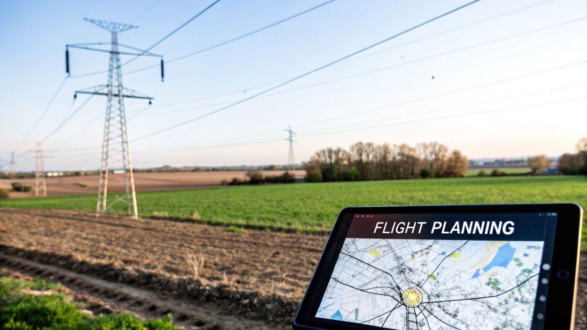
Using specialised software, pilots meticulously map out automated flight paths. This isn't just about drawing a line on a map; it's about programming the drone to maintain precise, safe distances from live wires and navigate tricky terrain on its own. A solid flight plan is the foundation for a safe and successful mission. For a deeper look at the technology involved, you can learn more about the sophisticated UAV flight planning software that makes this possible.
Phase 2: On-Site Deployment and Data Capture
With the plan locked in, the team heads out to the field. This is the on-site deployment phase, and it’s all about precision and execution. Once on location, pilots run through a strict pre-flight checklist, confirming everything from battery levels and sensor calibrations to communication links. Safety is paramount, and absolutely nothing is left to chance.
When cleared for take-off, the drone follows its pre-programmed flight path with incredible accuracy. As it flies along the power lines, its high-tech sensors—high-resolution cameras, thermal imagers, and LiDAR scanners—are busy capturing thousands of data points. This automated flight ensures the data is gathered consistently and efficiently, creating a complete digital picture of the infrastructure's health from every possible angle.

This process shows how a structured, checklist-driven approach is essential for a smooth operation, from ground prep to data collection and secure handling after the flight.
Phase 3: Data Processing and Analysis
Once the drone is safely back on the ground, the real digital heavy lifting starts. The raw data—a massive collection of images, thermal readings, and LiDAR point clouds—is uploaded for processing and analysis. This is where powerful software takes all that information and stitches it together into a coherent, interactive model of the power line corridor.
Specialised software uses techniques like photogrammetry to build a detailed 3D "digital twin" of the assets. Then, smart AI algorithms get to work, automatically scanning the model to flag potential defects like cracked insulators, corroded hardware, or dangerously close tree branches. A task that would take a human inspector weeks of painstaking work can now be completed in just a few hours.
Phase 4: Reporting and Actionable Insights
The final, and perhaps most crucial, step is turning all that processed data into clear instructions for the maintenance crews. In the reporting and action phase, a detailed report is generated. This document highlights every single identified defect, complete with high-resolution imagery and precise GPS coordinates.
But this is much more than a simple list of problems. The report prioritises each fault by its severity, helping utility managers decide where to send their resources first. A minor issue might get scheduled for routine maintenance, whereas a critical thermal hotspot would trigger an immediate, urgent response. This targeted approach means repair teams know exactly where to go, what they’ll find, and what tools they need before they even leave the depot. It makes maintenance safer, faster, and far more cost-effective.
To see how these stages connect, here's a simple breakdown of a drone inspection project from start to finish.
Phases of a Drone Inspection Project
| Phase | Key Activities | Primary Objective |
|---|---|---|
| 1. Planning | Define scope, map flight paths, risk assessment, select sensors | Create a safe, efficient, and compliant flight plan to meet inspection goals. |
| 2. Deployment | Conduct pre-flight checks, execute automated flight, monitor real-time data | Safely capture high-quality, comprehensive data of the target assets. |
| 3. Processing | Upload raw data, create 3D models, run AI defect detection | Transform raw data into a structured, analysable digital twin of the infrastructure. |
| 4. Action | Generate reports, prioritise defects, issue work orders | Deliver clear, actionable insights to maintenance teams for targeted repairs. |
Ultimately, this entire workflow is designed to bridge the gap between seeing a problem from the air and fixing it on the ground.
Navigating Australian Drone Regulations
Getting a drone power line inspection program off the ground isn't just about having the right tech. It’s about making sure every single flight is safe, legal, and completely above board. In Australia, our skies are governed by a solid set of rules from the Civil Aviation Safety Authority (CASA), all designed to keep people and property out of harm's way.
For any utility manager, getting your head around these rules is non-negotiable. It's the difference between a smooth, efficient inspection program and one that hits a wall of legal and financial headaches. Honestly, the simplest way to tick all the boxes is to partner with a drone service provider who is already certified and has runs on the board.
Understanding Key CASA Certifications
When it comes to commercial drone operations like power line inspections, a couple of core certifications are absolutely essential. Think of them as two sides of the same coin: one for the business, and one for the person flying the drone.
-
Remote Operator’s Certificate (ReOC): This is the main licence for the business itself. Holding a ReOC proves the company has its act together with documented safety procedures, risk management plans, and proper staff training – all meeting CASA’s high standards.
-
Remote Pilot Licence (RePL): This one is for the individual pilot. To get a RePL, pilots have to show they can handle the aircraft, know the airspace rules inside and out, and can manage a flight safely from start to finish.
Hiring a drone provider without a valid ReOC is a massive risk. It could mean the company lacks the proper safety systems, insurance, or operational approvals needed for complex jobs like inspecting live high-voltage infrastructure.
The Importance of BVLOS Operations
For those long stretches of power lines that cross regional and remote Australia, one specific approval changes everything: Beyond Visual Line of Sight (BVLOS). The standard rules say a pilot must always be able to see their drone with their own eyes.
But a BVLOS approval from CASA lets a certified operator fly the drone over much greater distances, relying on advanced telemetry and GPS. This is a huge deal for large-scale grid inspections. It means a drone can survey tens, or even hundreds, of kilometres of power lines in a single flight. Getting that BVLOS certification is no small feat; an operator has to prove an exceptional level of safety and technical skill.
Of course, choosing the right gear is a big part of meeting these standards. For anyone exploring their options, you can find a helpful guide to selecting professional UAV drones to get a better feel for the technology's capabilities.
At the end of the day, making sure your drone partner holds all the necessary CASA certifications—especially specific approvals like BVLOS—is the best way to guarantee every inspection is done safely, legally, and professionally. That diligence protects your assets, your people, and the public.
What's Next for Drones in Grid Management?
Drone power line inspection isn't just a new fad; it's quickly becoming the bedrock of modern energy infrastructure management. The technology is moving at a breakneck speed, evolving from simple data gathering to enabling an intelligent, responsive, and truly resilient power grid for Australia. The future is all about making inspections faster, smarter, and more predictive.
The biggest game-changer right now is Artificial Intelligence (AI). Not long ago, someone had to manually sift through thousands of images from an inspection flight—a painfully slow process. Now, AI-powered software can chew through that data, automatically flagging defects like cracked insulators or corroded bolts in minutes, not days.
This intelligent automation turns a mountain of raw data into real, actionable insights almost instantly. It frees up maintenance crews to focus on fixing problems instead of just finding them, bringing us one step closer to a grid that can essentially diagnose itself.
Better Drones, Smarter Sensors
The drones themselves are also getting a major upgrade. We're seeing huge leaps in flight time, thanks to new hybrid power systems. By combining battery power with small, efficient petrol engines, these drones can stay in the air for hours on end. This makes them perfect for covering massive stretches of remote power lines in a single go.
At the same time, the sensors they carry are becoming incredibly sophisticated. New payloads can now pick up on subtle issues that were once invisible, like corona discharge—a faint electrical glow that signals insulation is starting to fail. Catching this early can prevent a major fault down the line, giving us a much deeper diagnostic toolkit.
This boom is driven by a massive need for better grid monitoring, both here and overseas. The global drone inspection market is forecast to explode, growing from USD 15.2 billion in 2025 to a staggering USD 61.5 billion by 2035. With our vast networks and rugged terrain, Australia is a huge piece of this puzzle, as local utilities turn to these tools to keep the lights on and costs down. You can read the full research about these market trends to get a sense of just how quickly the industry is changing.
Building the Smart Grid of Tomorrow
All these advancements are essential building blocks for the 'smart grid'—a decentralised energy network that uses digital tech to instantly react to changes in electricity use. In this future, drones will be the grid’s eyes in the sky, feeding a constant stream of real-time data back into the system.
This will create a grid that can:
- Automatically reroute power around a fault to stop a blackout before it happens.
- Seamlessly manage the flow from renewable sources like solar and wind farms.
- Predict when a component is about to fail and schedule its own maintenance.
Getting there will take ongoing innovation and investment in high-impact energy tech. For those on the front line developing these systems, looking into programs like the ARPA-E Funding for High Risk, High Impact Energy Tech can be a crucial step. By embracing these changes, Australia is paving the way for a smarter, more reliable, and sustainable energy future for everyone.
Got Questions About Drone Power Line Inspections?
As drones become a go-to tool for keeping the grid in good shape, a lot of utility managers have practical questions. It makes sense. Before you adopt a new way of doing things, you want to know exactly how it works and what to expect.
Let's tackle some of the most common queries we hear.
How Accurate Is This Drone Data, Really?
In a word: incredibly. Drone data isn't just a slight improvement; it's a massive leap beyond what the human eye can catch from the ground or a helicopter. We’re talking about high-resolution cameras that can spot millimetre-sized cracks in an insulator or a few frayed strands on a conductor, all from a safe distance.
It gets even better when you look at the other tools we can put on a drone:
- Thermal Sensors: These can pick up on temperature shifts as small as one or two degrees Celsius. That's how you find a component that's starting to overheat long before it has a chance to fail.
- LiDAR Scanners: This technology creates a 3D digital twin of your power line corridor that’s accurate down to the centimetre. It’s perfect for checking vegetation growth is a safe distance away from lines or measuring conductor sag with pinpoint precision.
What you end up with is objective, measurable data. It's not just a hunch or a "looks okay from here." You get a reliable digital record of every asset's health that you can track over time.
Can Drones Actually Fly in Bad Weather?
This is a great question. While a drone isn't going to fly in a cyclone, modern industrial drones are tough. They're built for the field, not for a sunny day in the park.
Most professional drones built for a drone power line inspection can handle moderate winds, light rain, and a pretty broad range of temperatures without any trouble.
Of course, there are limits. Heavy rain, high winds (usually over 50 km/h), and any sign of lightning will ground a flight. Safety always comes first. Any professional drone operator will have a strict pre-flight check that includes a thorough weather assessment to make sure conditions are right for both a safe flight and good data collection.
The bottom line? While extreme weather will stop a drone mission, these machines are robust enough for most typical field conditions. You’ll find weather-related delays are often fewer than with traditional ground crews who face their own set of weather constraints.
How Do We Get Started With a Drone Program?
Rolling out a drone inspection program is a step-by-step process, and you’ve got a couple of solid options.
One way is to build your own in-house team. This means buying the drones and sensors, getting your staff trained and certified under CASA regulations, and setting up your own systems for managing all the data you’ll be collecting. It’s a big commitment, but it gives you total control.
The other, more common path is to partner with an experienced drone service provider. This is often the smarter way to start, and here’s why:
- Immediate Expertise: You get access to seasoned, certified pilots and top-tier equipment right away. There's no steep learning curve.
- Lower Upfront Costs: You avoid the huge capital outlay for specialised drones, expensive sensors, and powerful processing software.
- Guaranteed Compliance: A good provider handles all the complex CASA certifications and approvals (like BVLOS), so you know every flight is above board.
For most utilities, starting with a trusted partner is the quickest and most effective way to see what drones can do for your operations. It lets you prove the concept and see the benefits firsthand before deciding whether to bring it all in-house down the track.
Ready to see how safer, smarter inspections can transform your grid maintenance? Innoflight International designs and manufactures advanced drone platforms built for the demands of infrastructure inspection, LiDAR mapping, and more. Explore our enterprise-grade UAS solutions today.