
When you hear drones and surveillance, it’s easy to picture a simple camera in the sky. But for professionals in industries like utilities, mining, and emergency services, that’s not the whole story. These are sophisticated aerial intelligence platforms built to solve dangerous, expensive, and incredibly complex operational problems.
This is all about gathering specific, actionable data—the kind that truly moves the needle on safety and efficiency.
From Flying Cameras to Aerial Intelligence Platforms

The role of drones in business has grown up. What started as a way to get a bird's-eye view has evolved into a fundamental tool for gathering hard data and managing operations. Modern drone systems are less about just "seeing" something and far more about "understanding" it with pinpoint accuracy.
Think about a utility company responsible for a vast, remote power grid. The real headache isn't just the cost of fixing things when they break; it's the danger and expense of sending out line workers or helicopters for routine inspections. It's slow, risky work that often yields very little useful information.
Solving Problems with Precise Data
This is where an aerial intelligence platform completely changes the game. Instead of just a basic photo, a drone armed with specialized sensors delivers quantitative data, shifting the entire operation from reactive to proactive.
The value becomes obvious when you look at what this makes possible:
- Predictive Maintenance: You can spot a failing insulator on a transmission tower from the air, long before it triggers a blackout.
- Enhanced Safety: A drone can assess the stability of a mine wall or inspect a bridge without putting a single person in harm's way.
- Rapid Response: In a wildfire, a drone can map the fire's perimeter in minutes, giving first responders the intel they need to deploy resources effectively.
This is about turning a raw aerial view into something you can measure. The right drone and sensor combination doesn't just give you a picture; it provides actionable intelligence that directly impacts safety, efficiency, and the bottom line.
The Business Outcome of Advanced Surveillance
This shift is critical for any organization managing large-scale physical assets. Take a transportation agency that needs to monitor hundreds of kilometers of railway. The core industrial pain point is that manual track inspections are slow, labor-intensive, and can miss critical faults that lead to service disruptions or derailments.
A platform like the Evolution Flight Patriot is a direct solution. Its technical specification of exceptional endurance allows it to fly an entire rail corridor and capture high-resolution imagery in a single mission. This specific capability drives a clear business outcome: a drastic reduction in inspection costs and a faster, more complete picture of track conditions. Ultimately, that means better safety and more reliable service for everyone.
Understanding Core Surveillance Drone Capabilities
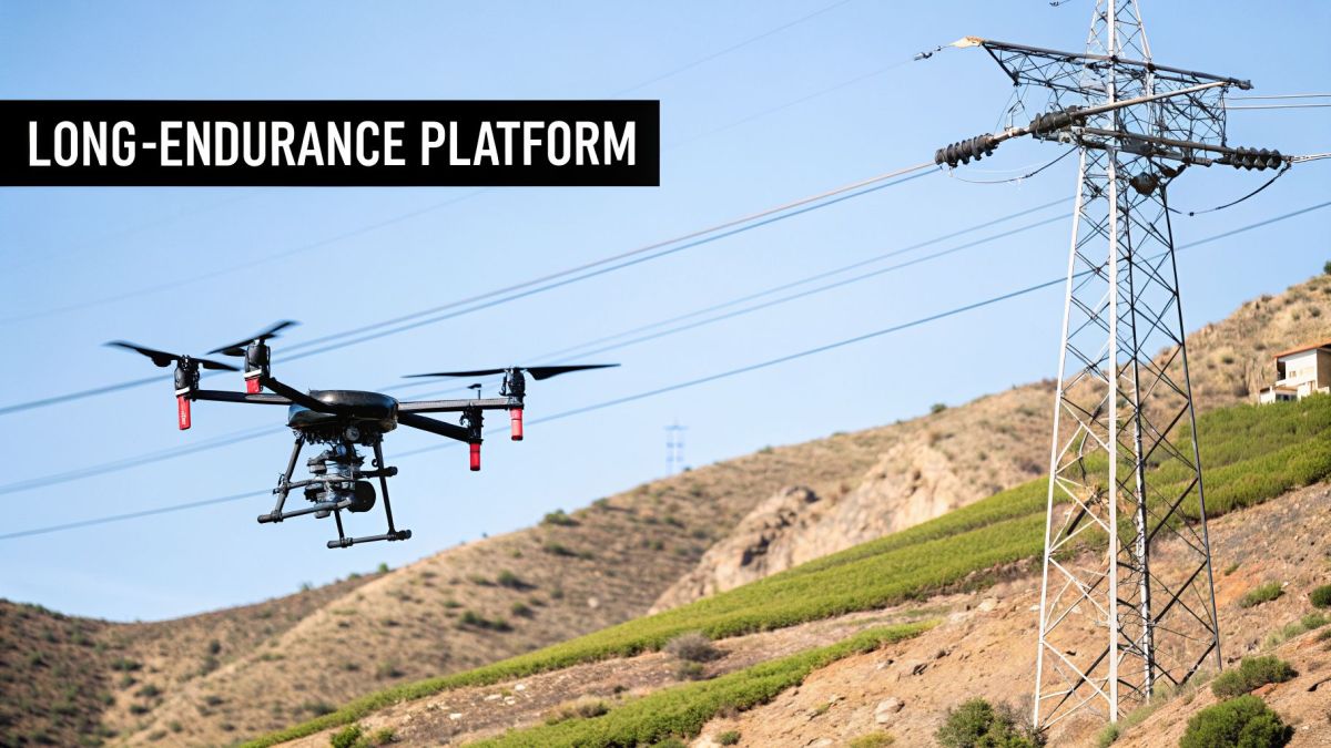
When you’re looking at using drones and surveillance for a specific job, it all starts with the airframe. The physical body of the drone dictates what it can and can't do—you wouldn't try to haul lumber in a sports car, and the same logic applies here. Most professional platforms fall into one of two camps: multi-rotors (like quadcopters) and fixed-wing or hybrid models.
Think of a multi-rotor drone as a specialist in precision and stability. With its ability to take off vertically and just hang in the air, it’s perfect for getting up close. This is what you'd use to inspect a single blade on a wind turbine or get a detailed look at a specific piece of equipment in a busy substation.
Fixed-wing and hybrid designs, on the other hand, are the marathon runners of the drone world. They’re built for endurance, capable of flying for hours and covering huge distances with incredible efficiency. This makes them the go-to choice for jobs that involve long, linear inspections, like patrolling a border or mapping massive tracts of land for environmental surveys.
Matching the Platform to the Problem
The first step in choosing a drone is to pinpoint the exact operational problem you're trying to solve. If you need a stable eye-in-the-sky for a confined area, a multi-rotor is almost always the right answer. But if you’re tasked with monitoring hundreds of kilometers of remote assets, endurance becomes the only thing that matters.
For utility companies, this is a huge and expensive headache. Imagine trying to inspect hundreds of kilometers of power lines stretched across rugged terrain. Sending out ground crews is slow, dangerous, and costly. Flying a helicopter is even more expensive and often yields limited data. The sheer scale makes a thorough inspection by traditional means almost impossible.
This is a challenge that demands a platform capable of flying for long stretches while carrying a heavy, sophisticated sensor package. A short-range drone just won't cut it.
The core business outcome isn’t just about seeing the power lines from the air; it’s about transforming a week-long, high-risk manual task into a safe, single-day automated operation that delivers superior data.
Solving Large-Scale Inspections with Endurance
This is exactly where a purpose-built system proves its worth. A platform like the Evolution Flight Patriot is designed from the ground up to solve this large-scale inspection problem. Its impressive endurance and heavy-lift capacity aren't just specs on a data sheet; they are the keys to unlocking massive operational improvements.
Here’s a practical look at how its design features solve real-world problems:
- Exceptional Endurance: With its long flight time, the Patriot can inspect vast sections of a power grid in a single mission. This technical capability directly translates to the business outcome of shrinking a multi-week manual job down to a single day of automated work, dramatically cutting operational costs.
- Heavy-Lift Capacity: The ability to carry advanced sensors like LiDAR and high-resolution thermal cameras is non-negotiable for this kind of work. This spec allows the drone to capture precise 3D models and spot thermal anomalies—delivering the business outcome of far more actionable intelligence than a simple visual check ever could.
By combining endurance with a powerful payload, a utility company can build a "digital twin" of its entire network. It can map vegetation encroachment, identify insulators that are about to fail, and assess the structural integrity of its towers with a level of detail and accuracy that ground crews could never match. The payoff is a sharp drop in operational costs, a more reliable grid, and a huge boost in safety for your people.
A Drone Is Only as Good as Its Mission Plan
An advanced surveillance drone is an incredible piece of technology, but its true value isn't just in its hardware. The real magic happens when you pair that tech with a well-defined mission profile—basically, the playbook that tells the drone exactly what to do, where to go, and what to look for.
Think of it this way: a master carpenter doesn't just own a powerful saw; they know the right technique for every cut, whether it’s for rough framing or delicate trim work. It's the same with drones. A mission profile is the specific technique for the job, dictating the flight path, sensor activity, and data collection to get the precise results you need.
From "Eyes in the Sky" to Rapid Response
Different jobs call for completely different strategies. You wouldn't use the same approach to monitor a pipeline as you would to assess hurricane damage. The mission profile is tailored to the unique demands of the task, ensuring you get the right data as efficiently as possible.
Here are a few common profiles you'll see in the field:
- Intelligence, Surveillance, and Reconnaissance (ISR): This is the classic "eyes in the sky" mission. It involves methodical, wide-area patrols to spot, track, and understand activity on the ground. For security and public safety, this kind of situational awareness is invaluable.
- Persistent Asset Monitoring: If you're responsible for a power grid or a pipeline, you need to watch for slow, creeping changes. This profile uses automated, repeatable flights over the same assets to build a history, helping you catch corrosion or ground erosion before they cause a critical failure.
- Rapid Damage Assessment: When a disaster hits, time is everything. This mission profile is built for speed. The drone flies a pre-planned route over the impacted zone, giving first responders a quick, big-picture view of the damage so they can direct resources where they're needed most.
Solving the Problem of Securing Large Areas
Imagine trying to secure a national border or a massive industrial complex. The industrial pain point is that sending out ground patrols is slow, expensive, and inevitably leaves security gaps. This is a classic operational headache—how do you maintain a constant watch over a huge perimeter? It's a perfect use case for a long-endurance ISR mission.
This is where a drone's specs stop being just numbers on a sheet and start delivering real-world value. A platform like the Evolution Flight EF-700, for example, has a secure, NDAA-compliant design. This technical feature directly addresses the risk of data compromise in sensitive government and enterprise work, providing the business outcome of operational confidence and eligibility for high-value contracts.
The challenge isn’t just about watching; it’s about maintaining a constant, trustworthy presence. For critical security missions, knowing your data is secure and the platform can't be hijacked is just as important as its flight time.
By equipping it with a high-end Electro-Optical/Infrared (EO/IR) sensor, you get crystal-clear surveillance, day or night. Security teams get live, actionable intelligence, letting them spot and respond to threats in real time. The outcome is simple: better security and smarter use of your personnel, covering far more ground with a smaller team.
This shift toward drone-based solutions is happening across defense, security, and emergency management. The global drone market is expected to jump from USD 69 billion in 2026 to USD 147.8 billion by 2036, largely because of these kinds of autonomous capabilities. North America, which accounts for 42.19% of the market, sees major investment from U.S. military programs. Meanwhile, regulators in places like Australia have paved the way for wind-tolerant drones that are cutting disaster response times by up to 60%. You can explore more data on drone market opportunities and see how these applications are expanding.
Drone Surveillance in Action Across Key Sectors
It's one thing to talk about what surveillance drones can do. It's another to see how they're solving real, expensive problems on the ground. Across industries, organizations are finally moving away from slow, high-risk methods and using aerial data to see a clear return on their investment in cost, time, and safety.
The industrial pain point for electric utilities has always been vegetation management. When trees get too close to power lines, they cause outages and wildfires. For decades, the only solution was slow, dangerous ground crews or costly helicopter patrols.
The missions that solve these problems are built on a few core functions that turn a drone into a powerful tool for data collection and decision-making.
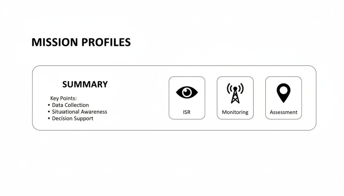
These core mission types—ISR, Monitoring, and Assessment—are the building blocks for using drones effectively in just about any field.
A Modern Fix for Utility Corridor Management
This is where a drone designed for the job completely changes the game. A platform like the Evolution Flight EF-2000, built for large-scale asset management, offers an immediate and practical solution. When you pair it with a high-precision LiDAR scanner, its long-endurance technical spec allows it to fly the entire transmission corridor and capture a dense point cloud of data.
This builds a perfect 3D digital model of the entire right-of-way. The real business outcome is the ability to pinpoint—with millimeter accuracy—every single branch that’s a threat today or will be in the near future. This lets crews take a surgical approach to trimming, focusing their efforts only where it's absolutely needed.
This shift from expensive, reactive work to a smart, proactive strategy is a game-changer. By finding these risks early, utilities can lower outage risks by up to 40% and cut vegetation management costs by a staggering 70-80% compared to old-school methods.
The market numbers back this up. Drones in the utility sector are a huge reason the global commercial drone market is expected to jump from USD 83.97 billion in 2025 to USD 116.81 billion in 2026. As you can see in the full research about these market projections, these kinds of LiDAR applications are helping U.S. utilities prevent more than USD 1 billion in potential damages every year.
Old Methods vs. New Drone Solutions
The improvements we’re talking about aren't small tweaks; they represent a fundamental shift in how work gets done. The table below puts this into perspective, showing the clear contrast between traditional pain points and the outcomes from a modern drone program.
Operational Transformation with Drone Surveillance
| Industrial Pain Point | Traditional Method (Cost/Time/Risk) | Evolution Flight Drone Solution (Outcome) |
|---|---|---|
| Power Line Vegetation Management | High-cost helicopter patrols or slow, hazardous ground crews walking the line. | The Evolution Flight EF-2000 with its LiDAR payload and long endurance provides precise 3D maps for targeted trimming. This technical capability results in a business outcome of cutting operational costs by 70-80% and reducing outage risks. |
| Large-Scale Infrastructure Inspection | Manual inspections by personnel, often working at height or in dangerous, confined spaces. High risk of accidents and slow data collection. | Drone surveys using high-resolution cameras capture detailed data from a safe distance, completing inspections up to 90% faster while keeping people out of harm's way. |
| Post-Disaster Damage Assessment | Ground teams trying to navigate hazardous and inaccessible terrain. This gives a slow, incomplete view that delays response and recovery. | Rapid aerial mapping creates a complete overview of the affected area in hours, not days, giving first responders immediate and actionable situational awareness. |
This clear difference makes a powerful business case for adopting drone surveillance. These platforms don't just deliver data—they provide a safer, more efficient, and more reliable way of operating. The investment quickly pays for itself through lower operational costs, better asset performance, and a huge boost in personnel safety.
Choosing the Right Surveillance Drone Platform
Picking the right drone for your surveillance program is a lot like choosing the right tool for any other job. You wouldn't use a hammer to drive a screw, and you shouldn't use a short-range quadcopter for a long-distance pipeline inspection. For any serious enterprise operation, this decision goes way beyond just looking at a spec sheet. It's about matching the drone's real-world performance to the specific problem you need to solve.
When you start comparing models, three things should be at the top of your list: endurance, payload capacity, and weather tolerance. A drone that can only fly for 20 minutes is practically useless for mapping a 100-kilometer pipeline. In the same way, a platform that can’t handle a little wind or rain is going to spend more time sitting on a shelf than it does in the air, bringing you zero return.
Overcoming Large-Scale Survey Challenges
The industrial pain point for industries like geospatial services or mining is that traditional ground-based surveys are painstakingly slow, and hiring a helicopter is incredibly expensive. This creates a huge bottleneck, making it tough to get the timely, repeatable data you need for critical tasks like calculating pit volumes or modeling potential flood zones.
Every delay in surveying an area drives up your cost per kilometer and pushes back project deadlines. It's a classic example of where the right technical capabilities can directly solve a major business headache.
The real challenge isn't just about collecting the data. It's about doing it quickly and cost-effectively over huge, often rugged, areas. The whole business case depends on covering as much ground as possible in every single flight.
How Technical Specs Deliver Business Value
This is where a purpose-built system like the Evolution Flight EF-LiDAR 240 really comes into its own. It was engineered from the ground up to solve the exact cost and logistical problems that plague large-scale surveying. Its technical features aren't just numbers on a page; they're directly tied to improving your bottom line.
Here’s a simple breakdown of how its specs create a clear return on investment:
- Long Endurance: This technical spec allows the platform to stay airborne for long stretches, enabling it to cover massive areas with fewer flights. This is the single biggest factor in achieving the business outcome of slashing the cost-per-kilometer for data collection.
- Optimized Payload Integration: The EF-LiDAR 240 is designed to carry high-end LiDAR scanners without sacrificing performance. This capability ensures the data you capture is incredibly accurate, which produces the business outcome of reliable, precise work for tasks like stockpile measurement and terrain analysis.
By combining long flight times with top-tier sensor integration, companies can see a productivity bump of an estimated 25-35%. It changes a costly, slow process into a streamlined operation, leading to faster project turnarounds and more reliable data.
You can see the effects of this shift across the industry. In the geospatial and mining sectors, LiDAR-equipped drones have become the go-to tool for terrain mapping. This movement is a huge part of why the drone market is projected to exceed USD 90 billion by 2036, with inspection and mapping accounting for over 30% of all commercial use. Today, mining operators rely on these long-endurance drones for repeatable surveys of pits and haul roads, getting sub-centimeter accuracy that leads to these major productivity gains. You can read the full research about these drone market findings to see just how these applications are reshaping entire industries.
Data Security and Following the Rules
When you're running drones and surveillance missions in sensitive environments, the conversation about data security isn't an afterthought—it's the first thing on the table. For anyone in defense, public safety, or managing critical infrastructure, a compromised drone isn't just a technical glitch; it's a massive operational and business liability.
We're not just talking about keeping your videos private. We're talking about protecting the entire data stream, from the moment the sensor captures an image to the second it hits your screen. That requires end-to-end encryption for data both in transit and at rest. If that link is broken or hijacked, you don't just lose data. You lose control, situational awareness, and trust.
Meeting Tough Government Standards
If you're aiming for government or critical infrastructure contracts, you have to play by their rules. The industrial pain point here is that non-compliant hardware can automatically disqualify you from high-value contracts. In the US, for example, the National Defense Authorization Act (NDAA) has strict guidelines that dictate where your drone's parts can come from to prevent spying and cyber threats.
Imagine investing hundreds of thousands into a new drone fleet, only to discover you're automatically disqualified because your platforms aren't compliant. It's a costly, and entirely avoidable, mistake. This is where choosing the right platform becomes a strategic business decision.
For operators in these fields, a secure supply chain isn't a premium feature; it's the price of entry. One weak link can expose an entire operation, leak critical intelligence, and create a security risk you simply can't afford.
This is precisely why we're so transparent about our supply chain at Evolution Flight and are actively pursuing Green UAS Certification. The technical aspect here is a deep, independent audit that examines every part of a drone's security. This provides the business outcome of verified compliance, building customer confidence and ensuring eligibility for sensitive contracts.
Building Confidence and Trust in Your Operations
Passing this rigorous certification gives our customers something they can count on: proof that their platform is secure. The result for your business is clear. Whether you're in defense, emergency services, or utilities, you can fly an Evolution Flight platform knowing your data is locked down and your operations are safe from foreign interference.
By building our systems to meet tough standards like the NDAA and undergoing these exhaustive security checks, we tackle the problem of operational risk head-on. When you deploy our platforms for critical drones and surveillance missions, you aren't adding a new security headache. You're using a trusted, proven tool that protects your mission, your data, and your organization's good name.
Your Top Questions About Drone Surveillance, Answered
Getting a drone program off the ground always comes with a few big questions. People want to know about the cost, the rules, and how all this new tech will fit into their current setup. Let's tackle these common concerns head-on so you can build a solid plan for your organization.
How Much Does a Drone Program Cost?
It's tempting to focus on the sticker price of the drone, but that's just the beginning of the story. Think of it like buying a new work truck; you still need to budget for the tools in the back, the fuel, and the skilled driver.
A realistic budget includes specialized sensors like LiDAR or thermal cameras, the software to process all that data, proper pilot training, and ongoing maintenance.
But here's the crucial part: don't just see these as expenses. The real conversation is about the return on investment (ROI). For most operations, the initial outlay is quickly balanced out by huge savings in labor, major improvements in worker safety, and the ability to prevent catastrophic, multi-million-dollar failures before they happen.
What Are the Main Legal Restrictions?
Next up is the legal side of things. The rules for flying surveillance drones change depending on where you are, but they almost always touch on a few key areas.
You’ll encounter regulations covering:
- Flying with Visual Line of Sight (VLOS) versus Beyond Visual Line of Sight (BVLOS).
- Operating in different classes of airspace.
- Respecting local and national privacy laws.
Your first stop should always be your local aviation authority for the final word on compliance. However, you can make this much simpler by starting with the right hardware. Choosing a platform from a manufacturer that designs for security and compliance, like those from Evolution Flight, gives you a much stronger foundation for a responsible and legal operation.
How Difficult Is Data Integration?
Finally, the practical question: will this new drone data play nicely with the systems you already use? The good news is, modern drone platforms are built for exactly this.
The data you collect comes in standard, easy-to-use formats. For instance, a LiDAR scan will typically produce .LAS files, which you can drop directly into most GIS, CAD, or asset management software without any fuss.
Many platforms also come with robust Application Programming Interfaces (APIs). These APIs act as a bridge, allowing your own enterprise software to communicate directly with the drone’s data platform. This means the high-quality intelligence you gather doesn't get stuck in a silo; it becomes instantly usable for your entire team.
Ready to see how a purpose-built drone platform can solve your organization's biggest operational challenges? Contact Evolution Flight today to discuss your unique surveillance needs and discover the right solution for your mission. Learn more at https://evolutionflight.com.