
Think of a farmhand who never gets tired, can scout every single hectare, and spots problems the human eye would miss. That's essentially what a drone is for modern agriculture. These unmanned aerial vehicles (UAVs) are kitted out with advanced sensors, turning traditional farming into a high-tech, data-led operation.
They are, at their core, flying data collectors and applicators. Drones give Australian farmers a bird's-eye view of their land like never before, helping them boost yields, cut costs, and operate more sustainably.
Why Drones Are the Future of Australian Farming
The classic picture of Aussie farming—the ute, the kelpie, the endless paddocks—is getting a major update. A new piece of kit is fast becoming just as vital: the agricultural drone. This isn't just some gimmick; it's about solving real-world problems with smart, practical technology.
With global food demand on the rise and finite farmland to work with, the pressure is on to get more from less. This is where precision agriculture enters the picture, and drones are one of its most powerful tools. They deliver the granular detail needed to stop guessing and start making targeted, informed decisions.
The Shift to Smarter Farming
For generations, farmers have walked their fields, relying on experience and a keen eye to manage crops and livestock. These methods have served us well, but they have their limits, especially across vast properties. A small patch of stressed crop or a slow irrigation leak can easily go unnoticed until it’s a costly headache.
Drones completely change the game. A quick flight over the property can gather enormous amounts of data far more quickly and accurately than anyone could on foot or in a ute. This allows farmers to get on the front foot, spotting issues early and making sure resources like water, fertiliser, and pesticides are used exactly where they need to be.
By providing a detailed, real-time overview of the entire farm, drones empower growers to make better decisions. It's like having an agronomist who can survey hundreds of hectares in a single morning.
This technology helps farmers answer critical questions with solid data:
- Which specific parts of the paddock are low on nitrogen?
- Is that a hidden water leak in the back corner of the property?
- Are pests starting to take hold in a particular crop row?
Answering these questions precisely means you only apply inputs where they are truly needed. This approach directly reduces operational costs and is much kinder to the environment. Drones in agriculture aren't just about flying; they’re about farming smarter, not harder, for a more profitable and sustainable future.
Choosing the Right Drone for Your Farm
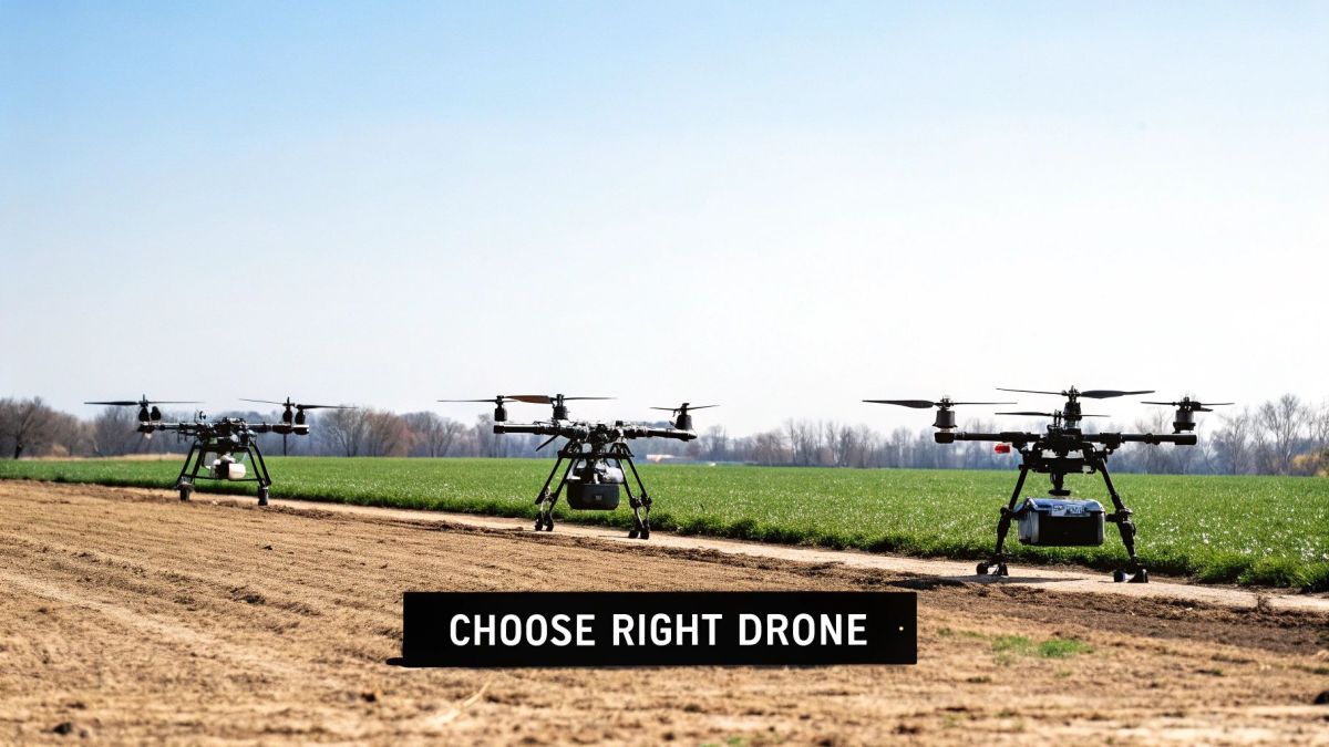
Picking the right drone for your farm isn’t much different from choosing between a ute, a tractor, or a road train. Each is built for a specific job, and using the wrong one is a fast way to waste time and money. The first step is getting to know the main types of agricultural drones out there so you can match the right tech to what you actually need to do.
You'll generally come across three main categories: multi-rotor, fixed-wing, and heavy-lift drones. Each has its own strengths and weaknesses, making them a better fit for different farm sizes, crop types, and tasks—from quick spot-checks to large-scale spraying.
Multi-Rotor Drones: The Agile Scouts
Think of multi-rotor drones—like your typical quadcopters or octocopters—as the nimble farmhands of the sky. They can take off and land vertically, hover perfectly still, and zip around obstacles with ease. This agility makes them incredibly versatile for any job that requires a close, detailed look.
These are the go-to drones for precision work. A vineyard manager in the Margaret River, for instance, could send one up to hover over a specific block of vines to check for early signs of disease or water stress. Because they’re so stable, they're also fantastic platforms for carrying high-resolution cameras to inspect things like fences, water troughs, or irrigation gear.
The trade-off for all that nimbleness? Flight time. Most multi-rotor drones can only stay in the air for 20-40 minutes at a time, which means they aren’t built for mapping thousands of hectares in one go. They’re the specialists, not the long-distance athletes.
Fixed-Wing Drones: The Endurance Mappers
If multi-rotors are the agile scouts, then fixed-wing drones are the marathon runners. They look more like small aeroplanes, and they’re built for one thing: covering a lot of ground, efficiently.
Thanks to their aerodynamic design, they can glide through the air for much longer than a multi-rotor, often for 60 minutes or more on a single battery. This makes them the perfect tool for broadacre farming—think mapping a massive wheat farm in the Mallee or a sprawling cattle station in Queensland. They excel at creating large-scale maps you can use to analyse crop health, plan drainage, or conduct elevation surveys.
They do have their limits, though. Fixed-wing drones need a bit of open space to take off and land, almost like a mini runway. They also can't hover, so they're no good for close-up inspections or jobs that require you to stay put and observe.
Choosing between drone types really comes down to one question: Do you need to cover a lot of ground quickly, or do you need to get a really good look at something specific up close? Your answer will almost always point you toward either a fixed-wing or a multi-rotor drone.
Heavy-Lift Drones: The Flying Tractors
Heavy-lift drones are the true workhorses of the drone world. These aren't just for looking; they're for doing. They are powerful, beastly machines built to carry heavy payloads, effectively acting as flying tractors for precision jobs.
Their main gig is carrying tanks for spraying pesticides and herbicides, or hoppers for spreading seeds and granular fertilisers. With payload capacities that can easily top 40-50 kg, models like the DJI Agras T50 can apply inputs with pinpoint accuracy, hitting only the areas that need it. This targeted approach can dramatically reduce chemical usage, slash costs, and minimise your environmental footprint.
These drones are a serious investment, no doubt about it. But their ability to work in tricky terrain where ground rigs can’t go—like steep hillsides or boggy paddocks—can be a game-changer. They really represent the peak of what drones can do in modern farming, turning aerial data into direct action on the ground.
Matching Drone Types to Common Farming Tasks
To make the choice a bit clearer, here’s a quick comparison of the three main drone types and the jobs they’re best suited for on the farm.
| Drone Type | Best For | Typical Flight Time | Key Advantage | Main Limitation |
|---|---|---|---|---|
| Multi-Rotor | Spot-checking crops, livestock monitoring, fence/asset inspection | 20-40 mins | Agility & hovering for detailed views | Limited range and endurance |
| Fixed-Wing | Large-scale mapping, NDVI analysis, elevation surveys | 60+ mins | Massive coverage area per flight | Cannot hover; needs space to launch/land |
| Heavy-Lift | Precision spraying, seeding, spreading fertiliser | 15-25 mins (loaded) | Carries heavy liquid or granular payloads | Expensive; shorter flight time when loaded |
Ultimately, the best drone is the one that fits the scale and specific challenges of your operation. Whether you need a quick eye in the sky or a powerful tool for application, there’s a drone built for the job.
How Agricultural Drone Sensors See Your Crops
The real magic of drones for agriculture isn’t just their ability to fly; it's in what they can see. A standard camera shows you what a paddock looks like on the surface. But specialised sensors reveal what’s really happening with your crops and soil, often spotting problems weeks before they’re visible to the naked eye.
Think of these sensors as giving your farm a set of superpowers. They’re what turn a drone from a simple flying camera into a powerful agricultural analytics tool. By capturing data across different spectrums of light, temperature, and even elevation, they provide layers of information that lead to smarter, more profitable decisions on the ground.
This advanced capability is a big reason the Australian agriculture drones market is growing so quickly. It hit an estimated USD 54.1 million in 2024 and is tipped to soar to nearly USD 499 million by 2033. This boom is being driven by the push for precision agriculture and government initiatives that back resilient farming tech, helping farmers improve yields and cut down on waste. You can read more about these market trends and their drivers.
Multispectral Sensors: A Plant Health Check-up
The most common and valuable sensor in agriculture is the multispectral camera. While our eyes only see visible light (red, green, and blue), these sensors see that and more. They capture specific, narrow bands of light in the near-infrared (NIR) spectrum, which is completely invisible to us.
So, why does that matter? Healthy, thriving plants are brilliant at reflecting NIR light. But when a plant gets stressed—whether from a lack of water, a nutrient deficiency, or disease—its ability to reflect that light changes dramatically. A multispectral sensor picks up on these subtle shifts long before the leaves even think about yellowing or wilting.
This data is then crunched to create an index map, most often a Normalised Difference Vegetation Index (NDVI) map. It’s basically a colour-coded health report for your paddock.
- Bright Green/Red Areas: Show vigorous, healthy plant growth.
- Yellow/Orange Areas: Signal moderate stress or potential issues brewing.
- Dark Red/Brown Areas: Highlight significant stress or just bare soil.
With an NDVI map, you can instantly see the problem spots. This lets you get out there to ground-truth the issue and apply fertiliser or water exactly where it’s needed, instead of blanket-spraying the entire field.
Thermal Sensors: Your Farm’s Heat Vision
Thermal sensors work like a pair of heat-vision goggles, measuring the surface temperature of everything the drone flies over. In a farming context, this provides incredibly useful insights into water management and even the wellbeing of your livestock.
It’s all based on a simple principle: well-watered crops are cooler. This is thanks to a process called transpiration, which is a bit like how sweating cools us down. If a patch of crop appears warmer than the surrounding area on a thermal map, it's a dead giveaway for water stress.
A thermal sensor lets you spot irrigation system failures—like a clogged dripper or a leaking pipe—that would otherwise go unnoticed, saving both water and potential yield loss.
This technology is also fantastic for livestock management. A thermal drone can help you locate animals in dense scrub, monitor their body temperature to spot early signs of illness, and even check water trough levels from a distance.
LiDAR: The Ultimate 3D Laser Ruler
LiDAR, which stands for Light Detection and Ranging, is a different beast altogether. It doesn’t take a picture. Instead, it fires thousands of laser pulses at the ground every second and measures how long they take to bounce back. The result is an exceptionally precise 3D model of your land and everything on it.
This tech offers a level of detail that other sensors just can't touch.
- Topographical Mapping: Create detailed elevation maps to plan drainage, pinpoint areas prone to waterlogging, or design efficient irrigation layouts.
- Canopy Height and Density: Measure the exact height and volume of your crops, which is incredibly useful for estimating biomass and predicting yield.
- Asset Management: Map out your farm infrastructure like fences, sheds, and roads with millimetre-level accuracy.
When you start combining the data from these different sensors, you can build a complete, multi-layered picture of your farm's health and productivity. It's this deep understanding that empowers you to make proactive, data-driven decisions that save money, boost yields, and keep your operation sustainable for years to come.
Putting Your Drone to Work on the Farm
Knowing about drone types and sensors is a great start, but the real magic happens when you get that tech out in the paddock. This is where the theory meets the dirt. Let's dig into the most common and valuable jobs drones are doing on farms across Australia, changing how we manage land from planting right through to harvest.
These aren't just fancy gadgets; they represent a real shift towards farming smarter, not just harder. The numbers back this up. By 2023, around 10% of Australian agricultural businesses were already using drones in some way. The market itself, worth about USD $33.9 million in 2023, is tipped to explode to roughly USD $691.4 million by 2033. This boom is being fuelled by real-world pressures like labour shortages and a changing climate that demand more intelligent solutions. You can see the full market growth forecast here.
Crop Health Monitoring and Scouting
For many farmers, this is the entry point and often the biggest game-changer. Forget spending hours walking or driving paddocks. A drone with a multispectral sensor can give you a bird's-eye view of hundreds of hectares in a single flight, acting as your ultimate early warning system.
It’s a pretty straightforward process:
- Set the Mission: You draw a virtual fence around a paddock on a tablet, and the drone flies the grid pattern on its own, snapping thousands of images along the way.
- Stitch the Data: Specialised software then gets to work, stitching all those individual photos into one giant, detailed map of your field.
- Analyse the Health Map: This is where the multispectral data shines. It’s used to create a Normalised Difference Vegetation Index (NDVI) map, which is basically a colour-coded health chart for your crops.
Picture this: you're a wheat farmer in WA. Your NDVI map comes back showing a sea of healthy green, but there’s an angry-looking red patch in one corner. That's your cue. You can drive straight to that spot and figure out what’s wrong—is it a nutrient problem, a pest outbreak, or just a patch of compacted soil? No more guesswork, just targeted action.
Precision Spraying and Spot Treatment
Heavy-lift drones are completely changing how we apply herbicides, pesticides, and fertilisers. Traditional methods like a boom spray or a crop duster often mean blanket-spraying an entire field, which costs a fortune in chemicals and can be wasteful. Drone spraying is the complete opposite—it’s all about surgical precision.
This approach is especially powerful for:
- Targeted Weed Control: After spotting weed patches from a mapping flight, you can send a spray drone to treat only those spots. This can slash your chemical bill.
- Tricky Terrain: Drones can get into places a ground rig could only dream of—steep hillsides, waterlogged paddocks, or around obstacles. A viticulturist in the Barossa Valley, for example, could treat a single stressed row on a steep slope without compacting the soil.
- Lighter Environmental Footprint: Using less chemical and minimising spray drift with carefully controlled flight patterns makes precision spraying a far more sustainable practice.
The ability to apply exactly what's needed, precisely where it's needed, is the core principle of precision agriculture. Drones make this principle a practical reality for farms of any size.
Variable-Rate Application (VRA)
Variable-Rate Application is the next step. It’s about taking the insights from your drone maps and feeding them directly to your existing machinery. You’re essentially creating a "prescription map" for your paddock that tells your equipment to apply inputs differently as it moves across the field.
Think of it like this: the drone is the diagnostician, and your seeder or spreader is the surgeon. The drone's data map highlights different zones in your field. Some areas might have richer soil with higher yield potential, while others are a bit weaker.
Using this map, you create a prescription file and load it into the GPS controller on your tractor. As your seeder or spreader travels across the paddock, it automatically adjusts the rate of seed or fertiliser on the fly. You stop wasting expensive inputs on low-potential zones and give your best-performing areas exactly what they need to thrive. It's about maximising the potential of every square metre of your land.
Turning Drone Data into Profitable Decisions
A single drone flight over a paddock can snap thousands of high-resolution photos. But on their own, these images are just a pretty picture. The real magic happens when you turn that raw data into genuine insights that guide profitable decisions on the ground. Think of it like a pile of fresh produce—it only becomes a meal once you prepare and cook it.
This isn't just a one-off job; it's a continuous cycle. The information you gather from today's flight helps you make smarter choices tomorrow, creating a feedback loop that fine-tunes your entire operation. The whole workflow breaks down into four clear stages, taking you from planning the mission to taking action in the field.
The Four-Stage Data Workflow
Getting from aerial photos to real-world results follows a logical path. Each step builds on the last, making sure the data you collect is accurate, meaningful, and ready to be used by your farm machinery.
-
Flight Planning and Automation: It all starts here. Using ground control software on a tablet or laptop, you set up the mission. You'll draw a boundary around the paddock you want to map, choose the flight altitude (this dictates your image resolution), and set the image overlap needed for accurate stitching. Once the plan is locked in, you upload it to the drone, and it’s ready to fly the entire mission by itself.
-
Automated Data Capture: With the flight plan loaded, the drone takes off and flies the pre-set grid pattern, automatically taking photos at just the right moments. A high-precision GPS tags every single photo with its exact location. This automated approach guarantees you get complete and consistent coverage of the area you’re surveying, removing the risk of human error and ensuring no spots are missed.
This simple diagram shows how drones tackle key farm jobs.

The process moves from monitoring and mapping to targeted spraying and variable-rate application, turning what the drone sees into direct action.
From Images to Actionable Maps
Once the drone is back on the ground, the next two steps are all about processing and analysis. This is where the true value is unlocked.
-
Data Processing and Stitching: The thousands of individual, overlapping photos are uploaded to photogrammetry software. This clever software analyses the images, finds common points between them, and stitches them all together into one massive, seamless map of your paddock. The result is a geographically accurate map called an orthomosaic, which becomes the base for all your analysis.
-
Analysis and Prescription File Creation: With your orthomosaic map ready, you can start digging into the data to spot variability. For instance, a multispectral map will clearly highlight zones of healthy, thriving crops and areas that are struggling. From this analysis, you create a "prescription map" (usually a .SHP file) which you can then load into the controller of your tractor, seeder, or sprayer. This file tells the machinery exactly how much input to apply where, putting your resources only where they're needed most.
The impact of drones in Australian agriculture is undeniable. In 2024, the local drone market—driven heavily by ag—was valued at USD 614 million and is expected to hit USD 1.5 billion by 2033. This growth is all about drones with advanced sensors giving farmers the power to monitor crops with pinpoint precision and use variable-rate applications to slash costs and reduce their environmental footprint.
By turning aerial imagery into precise application maps, farmers can ensure that every dollar spent on fertiliser, seed, or chemicals delivers the maximum possible return.
To get the most out of drone data, it's crucial to implement solid data-driven decision-making strategies that connect what you see with what you do. This systematic approach ensures the valuable information your drone gathers doesn't just sit on a screen but actively builds a more efficient and profitable farm.
Flying Drones on Your Farm: Staying on the Right Side of the Rules
Bringing a drone onto the farm is a game-changer, but it’s not quite as simple as just taking it out of the box and sending it up. In Australia, the Civil Aviation Safety Authority (CASA) is the governing body that sets the rules, and for good reason—they’re all about keeping people and property safe.
It's crucial to understand that using a drone for your farm business, even if it never leaves your property boundary, is considered commercial use. This puts you in a different category from a hobbyist flying for fun, and that means a few more boxes to tick. Getting your head around these rules from the start is the key to a smooth and successful drone program.
What Does Commercial Flying Mean on Your Property?
Anytime you fly a drone to benefit your business, you're operating commercially. CASA has a baseline set of 'drone safety rules', which are the non-negotiables for anyone flying for work.
Think of these as the fundamental laws of the sky:
- Keep it in sight. You must be able to see your drone with your own eyes the entire time it’s in the air—not just through a camera feed.
- Fly by day. Flying after sunset requires special, hard-to-get approvals.
- Stick to the height limit. Don’t fly more than 120 metres (400 feet) above the ground directly beneath your drone.
- Keep your distance. You need to stay at least 30 metres away from other people.
- One drone at a time. You can only operate a single drone at once.
Following these rules is the bare minimum for keeping your operations safe, compliant, and out of trouble.
Does Your Drone’s Weight Change the Rules?
Yes, absolutely. CASA’s regulations are tiered based on how heavy your drone is. For most farming applications, you’ll be looking at drones that weigh more than 2 kg.
If your drone is between 2 kg and 25 kg and you're only flying it over your own land for your own business, you'll need to register the drone with CASA and get an operator accreditation. But for anything more complex, or for heavier drones, you'll almost certainly need a Remote Pilot Licence (RePL).
Take those big, heavy-lift spraying drones, for instance. Flying one of those always requires the pilot to hold a proper RePL. This isn't just a tick-and-flick certificate; it involves proper training in everything from aerodynamics and mission planning to handling in-flight emergencies. It’s about ensuring you have the skills to manage a powerful, expensive piece of equipment safely.
Your On-Farm Pre-Flight Ritual
Rules aside, good old-fashioned common sense goes a long way. Developing a consistent pre-flight checklist is one of the smartest things any farm drone pilot can do. It only takes a couple of minutes and can save you a world of headache.
Before you launch, always run through these quick checks:
- Check the Weather: High winds, rain, or even fog can wreck your drone and your data. If it looks dodgy, leave it in the ute.
- Inspect Your Gear: Give the drone a once-over. Are the propellers chipped? Is the frame cracked? Are the sensors clean?
- Check Your Power: Make sure the batteries for both the drone and your controller are fully charged.
- Clear the Area: Ensure your launch and landing zone is clear of people, animals, and obstacles like powerlines or sheds.
- Get a GPS Lock: Don't take off until your drone has a solid GPS signal. This is critical for stable flight and accurate mapping.
By getting a handle on CASA's rules and building safety into your daily routine, you'll ensure your drone program is not just a great investment, but a responsible one too.
Got Questions About Farm Drones?
Thinking about bringing drones onto your farm? It's a big step, and it's smart to have a few questions. This isn't just a new gadget; it's a major investment in how you manage your operation. So, let’s get straight into the common things farmers ask when they're looking at drones for agriculture.
We'll skip the jargon and give you practical, straightforward answers. From the price tag to what it's like to use one day-to-day, here’s what you really need to know.
What's the Real Cost of an Agricultural Drone?
There’s no one-size-fits-all price. Just like a tractor or a header, what you pay for a drone comes down to what you need it to do. The more specialised the job, the bigger the investment.
- Mapping and Scouting Drones: A basic drone for a quick visual check of your crops can be pretty affordable. But for serious mapping with multispectral sensors, you’re looking at a range of $15,000 to $30,000.
- Heavy-Lift Spraying Drones: These are the workhorses and the biggest investment. A high-capacity spraying drone is a serious bit of kit, often starting at $40,000 and going up from there, depending on its tank size and battery setup.
It's crucial to look beyond the initial price and think about the return on investment. When you start adding up the savings on chemicals, targeted fertiliser use, and the hours you get back from not having to walk the paddocks, the numbers really start to make sense.
Are These Things Hard to Fly?
That's probably the biggest worry we hear, but modern farm drones are built to be surprisingly straightforward. You don't need to be a tech genius; they're designed for farmers.
Most of the time, the drone flies itself. You just use an app on a tablet to draw a boundary around the paddock you want to survey. The drone then takes off, flies the pre-planned grid pattern to collect the data, and lands all on its own. It’s as simple as that.
While you can learn to fly them manually, the automated flight plans handle about 95% of all data collection. The real skill is in planning the mission, not wiggling joysticks.
Can Drones Handle Rough Weather?
A proper agricultural drone is built to handle life on the farm. They’re much tougher than the little hobby drones you see around. Most professional models can comfortably fly in winds up to 35-50 kph, so a bit of a breeze won’t stop you from getting the job done.
Rain, however, is the real enemy. It’s not just about the risk to the electronics; raindrops on the camera lens will completely ruin your imagery and make the data useless for analysis. It’s always best practice to wait for a clear day. This protects your gear and makes sure the information you’re collecting is actually accurate.
Ready to see how a tailored drone solution can enhance your operation? The team at Innoflight International designs and manufactures advanced aerial systems for Australian agriculture. Explore our versatile platforms and find the right fit for your farm today by visiting our website.