
Using drones for utilities is quickly shifting from a niche technology to an essential tool for inspecting powerlines and other critical infrastructure. These unmanned aerial systems (UAS) provide a faster, safer, and more economical way to gather high-resolution data, which is key to preventing outages and keeping the grid reliable.
The Old Way vs. The New Way: A Modern Utility Challenge
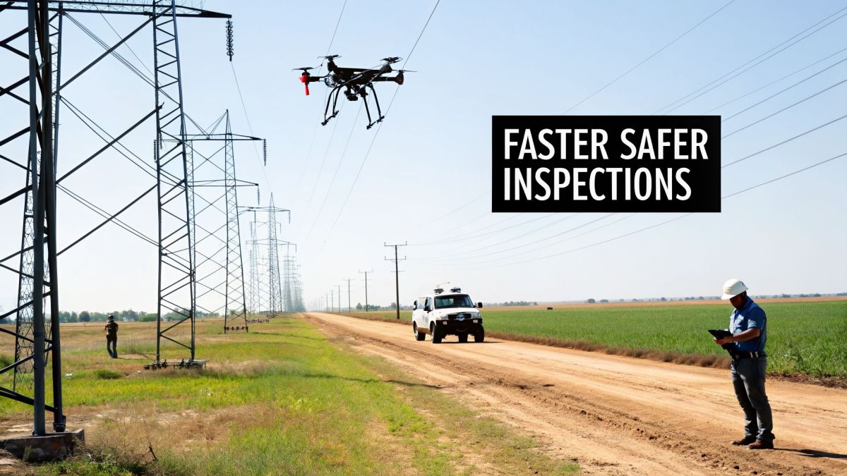
Utility companies are responsible for massive networks that can span thousands of miles, often crossing rugged, hard-to-reach terrain. For decades, keeping an eye on these assets has been a huge operational and financial headache.
The traditional go-to methods have been ground crews and helicopters. While both have been the backbone of inspections for years, they come with some serious downsides. Ground crews move slowly and face significant safety hazards, especially when working near live equipment or in rough country. Helicopters are quicker, but the high costs, noise, and safety risks make them a less-than-perfect solution.
The Real Cost of Inefficiency
The core problem for utilities isn't just the difficulty of inspections; it's the inefficiency and risk baked into these old methods. When ground inspections move at a snail's pace, small issues like a worn-out conductor or a cracked insulator can easily be missed. Left unchecked, these minor faults can escalate into major, costly outages.
This forces utilities into a reactive cycle, where they're constantly putting out fires instead of preventing them. The fallout isn't just the price of repairs. It includes regulatory penalties, unhappy customers, and a tarnished public image. In short, this old-school approach just can’t meet the demands of a modern grid.
A Smarter, Proactive Approach
This is where drones come in, offering more than just a simple replacement for old methods—they represent a complete strategic overhaul. A single drone can fly over a stretch of corridor in a fraction of the time it would take a ground crew, all while the operator stays safely out of harm's way.
This isn’t just about new tech; it’s a fundamental shift from a reactive to a proactive mindset. Instead of waiting for a part to break, drones give you the data to predict and prevent failures before they happen. The industry is catching on fast.
The global market for utility drones was valued at $0.1698 billion in 2024. Experts project it will surge to $2.217 billion by 2035, growing at an incredible compound annual growth rate (CAGR) of 26.31%. This explosive growth is driven by the clear need for better, more efficient infrastructure inspection—a task where drones truly shine. You can read the full research on the growing utility drones market.
To see the difference in black and white, let's compare the old and new approaches side-by-side.
Traditional vs Drone-Based Utility Inspection
The table below breaks down exactly how drone-based inspections stack up against helicopters and ground crews across the most important metrics.
| Metric | Traditional Methods (Helicopter/Ground Crew) | Drone-Based Inspection |
|---|---|---|
| Speed | Slow and cumbersome; covers limited ground per day. | Rapidly covers vast areas, inspecting many miles of corridor in a single day. |
| Cost | Extremely high due to fuel, aircraft maintenance, and large crew requirements. | Dramatically lower operational costs; requires a small, specialized team. |
| Safety | High risk; involves personnel working at heights, in remote areas, or near energized lines. | Minimal risk; operators remain safely on the ground, away from hazards. |
| Data Quality | Inconsistent; relies on manual notes and visual checks, which can be subjective. | Highly detailed and consistent; captures high-res images, thermal data, and LiDAR point clouds. |
As you can see, the advantages of using drones are clear and compelling, impacting everything from the budget to the well-being of your crews.
Connecting Drone Specs to Your Bottom Line
A persistent pain point for utilities inspecting long, linear assets like powerlines is short flight times. This forces crews to constantly stop missions to land and swap batteries, which kills productivity, eats up valuable time in the field, and increases mobilization costs.
A purpose-built system like the Evolution Flight 'Kite 75' single-rotor UAS was designed to solve this exact problem. Its 4-hour flight endurance isn't just an impressive technical spec—it's a direct solution to the need for long-range, uninterrupted inspections. The business outcome is transformative: crews can survey miles of powerlines in a single flight, turning what used to be a week-long project into a single day's work. This capability drastically cuts operational costs and accelerates the entire inspection cycle, allowing for faster data-to-decision workflows.
Choosing the Right Drone and Payload for Your Mission

Choosing the right drone for your utility operations is nothing like buying a consumer model off the shelf. A fantastic photography drone would likely fail completely when tasked with inspecting miles of powerlines. The key is to match the aircraft’s capabilities directly to the demands of your specific job.
The two most critical factors here are flight endurance and payload capacity. Endurance tells you how long the drone can stay in the air, which directly affects how much ground you can cover in one go. Payload capacity determines which sensors you can carry, defining the kind of data you can actually collect.
I've seen it happen too many times: an organization invests in a drone platform only to realize it can't carry the right sensors or fly long enough to be efficient. This is a common and costly mistake. It leads to wasted budgets, project delays, and the need for multiple flights to do what one purpose-built system could have handled easily.
Matching Payload to Mission Requirements
A major pain point for utilities is being forced to make compromises on data quality due to insufficient payload capacity. If a drone can't lift the best sensors, you either settle for lower-quality data or run multiple, separate flights for each sensor type—one for LiDAR, another for thermal, and a third for visual inspection. This approach easily triples your flight time, labor costs, and the complexity of managing disparate datasets.
Think of a drone’s payload capacity like the lifting power of a crane. You wouldn't bring a small crane to a job that requires lifting heavy steel beams. It's the same with drones. If you need a detailed 3D map of your infrastructure, you have to use a high-end LiDAR scanner, and those can weigh several kilograms. High-resolution thermal cameras and top-tier RGB cameras also add significant weight.
The Power of Heavy-Lift Drones for Utilities
A heavy-lift platform is designed to solve this exact problem. Take a system like the Evolution Flight 'X80', a heavy-lift multi-rotor engineered specifically for this kind of work. Its substantial payload capacity of up to 30 kg directly addresses the challenge of single-mission data collection.
This technical capability translates into a powerful business advantage. It means your teams can mount multiple high-end sensors simultaneously and capture different datasets in a single flight:
- A high-density LiDAR point cloud for precise vegetation encroachment analysis.
- A high-resolution thermal scan to spot failing components and hotspots.
- A detailed RGB image survey to identify physical damage like rust or cracks.
The ability to combine missions is a massive efficiency gain. By capturing comprehensive data in a single pass, you can create a complete "digital twin" of your assets far more quickly. This eliminates the need for separate survey flights, saving significant operational time and money while accelerating decision-making.
This multi-sensor approach transforms your drone from a simple inspection tool into a powerful data-gathering platform. Instead of getting fragmented snapshots, you get a complete, layered picture of your infrastructure’s health.
Ultimately, the right drone is one that can carry the tools you need to get the job done right the first time. For serious utility work, this almost always means investing in a heavy-lift system that won't hold you back. It’s about building a program that scales with your needs, not one that limits your potential.
Understanding Advanced Sensors Like LiDAR and Thermal
A drone is only as good as the data it can collect. For utility operators, this means outfitting your aircraft with advanced sensors that can see what the human eye can't. These specialized tools are what turn a drone from a simple flying camera into a powerful diagnostic instrument for your entire network.
The three go-to sensors for drones for utilities are LiDAR, thermal, and high-resolution RGB cameras. Each one captures a different type of data, and when you layer them together, you get a truly comprehensive picture of your infrastructure's health.
This diagram shows how these three key technologies work in tandem to build a complete data picture during an inspection flight.
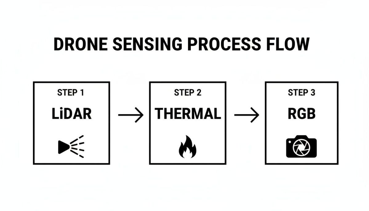
As you can see, a single flight can capture multiple datasets, giving you a multi-layered understanding of asset conditions and environmental risks.
Seeing in 3D with LiDAR
Think of LiDAR (Light Detection and Ranging) as a high-tech tape measure that uses pulses of laser light instead of a physical tape. When mounted on a drone, a LiDAR scanner sends out hundreds of thousands of light pulses every second. These pulses bounce off everything—powerlines, towers, trees, the ground—and the sensor measures how long it takes for each pulse to return.
By calculating these return times, the system builds an incredibly precise 3D model of the entire corridor, known as a point cloud. This isn't just a flat picture; it's a collection of millions of data points, each with exact geographic coordinates. For a utility, this detailed 3D map is a game-changer for tackling one of the most persistent and costly operational headaches: vegetation encroachment.
The real value here is predictive maintenance. Instead of waiting for a tree branch to cause an outage, you can use LiDAR data to measure the exact distance between a powerline and nearby vegetation. This lets you spot high-risk areas and schedule trimming crews with surgical precision, preventing outages before they ever happen.
Spotting Trouble with Thermal Imaging
While LiDAR maps the physical world, thermal cameras see the invisible world of heat. Electrical components naturally generate some heat, but when a part is failing, it gets abnormally hot. A failing insulator, a loose connection, or a struggling transformer will all glow like a lightbulb on a thermal image, creating a "hotspot."
This directly solves the critical problem of unexpected equipment failure. A traditional visual inspection from the ground or a helicopter could easily miss a component that looks perfectly fine but is internally on the verge of failing. A thermal camera, on the other hand, spots these impending issues instantly.
For utility managers, the business result is a dramatic reduction in unplanned downtime. By identifying failing components early, you can schedule maintenance on your own terms, replacing the part during a planned outage instead of scrambling to fix a major failure that has already taken down part of your grid.
This is why Evolution Flight platforms are engineered for seamless integration with these premium sensors. We ensure you can carry the necessary LiDAR and thermal payloads to get high-fidelity data without compromising flight time or stability. This direct compatibility means you spend less time on system setup and more time collecting actionable intelligence.
Finding Flaws with High-Resolution RGB
Finally, high-resolution RGB (or standard visual) cameras are still an essential tool. A drone can get much closer to a tower or conductor than a helicopter ever could, capturing detailed images that allow inspectors to spot small but critical defects.
These can include issues like:
- Rust and corrosion on steel structures
- Cracked or chipped insulators
- Frayed conductor strands
- Missing or damaged hardware like cotter pins
This level of detail helps you address asset degradation before it leads to a structural failure. In the energy sector, this precision is invaluable for tasks like vegetation management, which is responsible for billions in annual damages. In fact, some utilities report that drones can identify 95% of encroachment risks that ground crews might miss, helping to prevent outages that cost the US economy over $150 billion each year. You can find more details in this extensive drones research report.
Turning Raw Drone Data Into Actionable Intelligence

Collecting terabytes of high-resolution imagery and LiDAR point clouds is just the beginning. The real value of using drones for utilities appears when all that raw data gets turned into clear, actionable intelligence that you can actually use to make decisions. Without a smart data workflow, utilities can easily get buried in files, a classic case of being "data rich but information poor."
A successful drone program needs a clear path from the field to the final report. It’s a logical flow: you plan the mission, the drone flies it, and then the real work of processing, analyzing, and reporting begins. The whole point is to get quick, accurate answers to critical business questions, which is why modern data processing software is so essential, especially for complex data like LiDAR.
From Point Clouds to Practical Insights
A raw LiDAR point cloud is really just a huge collection of millions of individual dots. To a manager, it looks like a dense, colorful fog. The major headache has always been the immense manual effort needed to make any sense of it—a slow, tedious job even for a trained geospatial analyst.
This is where artificial intelligence (AI) and machine learning have been a game-changer. Today’s processing software uses AI to automatically classify the points in a LiDAR cloud, figuring out what’s what with incredible speed and accuracy.
- Ground: The software quickly identifies and filters out the ground surface.
- Vegetation: It classifies every tree, shrub, and other plant.
- Structures: It picks out man-made objects like transmission towers and utility poles.
- Conductors: Most importantly, it isolates the powerlines themselves.
This automatic classification isn’t just a neat technical trick; it delivers a powerful business result. It slashes the time it takes to generate vital reports. An analysis that once took a team weeks of painstaking manual work can now be done in just hours or days.
Accelerating Decision-Making with Turnkey Solutions
For many utility companies, building an entire in-house team of geospatial experts to handle all this data just isn’t practical. It demands specialized skills, pricey software, and a lot of training—all of which can slow down or even stop a drone program before it gets off the ground.
This is a common roadblock, but one with a straightforward solution. Companies like Evolution Flight saw this gap and now offer full-suite services that go way beyond just selling the drone. They provide a complete, ready-to-go solution for utilities, managing everything from data collection to final delivery.
By providing expert data processing and analysis, we help utilities bypass the steep learning curve. This allows your team to focus on what it does best—managing the grid—while receiving ready-to-use reports on vegetation encroachment, asset integrity, and potential failure points. This approach significantly accelerates your path to achieving a positive return on investment.
This service-based model breaks the data processing bottleneck, making sure the valuable information your drone collected gets to the people who need it without delay.
The Final Product: Actionable Reports
At the end of the day, the goal is to get clear, concise reports that help your teams take action. Instead of a massive, raw data file, you get intelligence that pinpoints the exact locations needing attention.
These reports can include:
- Vegetation Encroachment Alerts: Maps showing the precise spots where trees are too close to powerlines, complete with exact distance measurements.
- Asset Integrity Audits: Detailed summaries of component health, flagging problems like cracked insulators or corroded tower sections that were spotted in the high-resolution images.
- Thermal Hotspot Maps: Georeferenced locations of overheating components, allowing you to perform maintenance before an outage happens.
Ultimately, turning raw data into intelligence comes down to speed and clarity. It’s about transforming millions of data points into a simple, direct instruction: "A tree at these coordinates is 3 feet from the conductor and needs to be trimmed." That’s the real power of a well-run drone program.
Navigating Safety, Rules, and Digital Security
Bringing any new technology into critical infrastructure always raises big questions about safety, regulations, and data security. With drones for utilities, these topics are front and center. For many, the tangle of aviation rules and cybersecurity threats can feel like a major roadblock, sometimes halting a drone program before it even starts.
The real headache for managers is figuring out how to navigate this maze. People worry about getting the right approvals, the risk of data getting into the wrong hands, and the liability of flying aircraft near high-value assets. These are completely valid concerns, but they're also completely solvable with the right equipment and a clear plan.
Making Sense of Drone Regulations
One of the hottest topics in the drone industry is flying Beyond Visual Line of Sight (BVLOS). Let’s be realistic—for inspecting miles and miles of power lines, keeping the drone in your direct eyesight just isn’t going to work. To fly BVLOS missions legally, you need a rock-solid safety case and special waivers from aviation authorities like the FAA.
Getting that waiver is all about proving your operation is safe. Key requirements usually boil down to three things:
- Reliable Command and Control Links: You absolutely must maintain a constant, stable connection with the drone.
- Detect-and-Avoid Technology: The drone has to be smart enough to spot and avoid other aircraft on its own.
- A Documented Safety Plan: You need a detailed playbook that covers procedures for any emergency you can think of.
Getting BVLOS approval is a game-changer. It unlocks incredible efficiency, letting you inspect huge sections of your network in one go. While it might sound daunting, regulators are working closely with the industry to create clearer, more established paths for these kinds of advanced flights.
Why Cybersecurity Can’t Be an Afterthought
As drones become flying, data-collecting computers, cybersecurity shifts from a "nice-to-have" to a core requirement. A drone scanning your power grid is gathering sensitive information about your most critical assets. That data has to be protected, period.
A significant industrial pain point is the risk of a cyberattack on operational technology. A drone with weak security could be hijacked or have its data feed intercepted, creating a vulnerability in your infrastructure. This is where the security of the drone's hardware and software—its entire supply chain—becomes critical. You need to have complete trust in your equipment.
This is exactly why Evolution Flight is committed to meeting the highest security benchmarks. Our pursuit of Green UAS Certification and compliance with the US National Defense Authorization Act (NDAA) directly addresses this security threat. These standards verify that a drone's components and software come from trusted, vetted sources, free from known security holes. For a utility, choosing an NDAA-compliant platform provides a vital layer of risk mitigation, delivering the business outcome of a secure, trustworthy inspection tool that protects the grid itself.
What's the Real ROI of Your Utility Drone Program?
Let's be honest. When you propose a major investment in a new drone program, the first question from management is always the same: "What's the return?" For anyone championing this change, the biggest hurdle is getting budget holders to see past the upfront cost of the drones themselves. To build a winning business case, you have to show them the full picture of your Return on Investment (ROI).
Figuring out this ROI is about more than just simple cost-cutting. You need to connect the dots between what a drone can do and how it directly benefits the company's bottom line. This means looking at everything from operational savings to the huge financial gains from better safety and preventing outages.
It’s More Than Just Saving Money on Inspections
The most obvious win is replacing expensive helicopter flights or slow-moving ground crews. A well-run drone inspection program can slash direct inspection costs by 25% to 50%. But that’s just the beginning. The real value is found in places that aren't always so obvious.
You'll find the true ROI when you start to put a number on benefits across a few key areas. Each one adds another powerful layer to your business case.
- Reduced Inspection Costs: Think lower fuel bills, no costly helicopter maintenance, and smaller crews. Drones just have a much lower hourly operating cost.
- A Safer Workplace: When you have fewer people climbing towers or working near live lines, you have fewer accidents. This isn't just a moral victory; it can directly lower your insurance premiums and liability costs.
- A More Reliable Grid: Finding problems before they cause an outage is a game-changer. Preventing just one major blackout can save the company hundreds of thousands, or even millions, of dollars in lost revenue, emergency repairs, and regulatory fines.
Get the Right Tool for the Job to Maximize Your Return
One of the quickest ways to kill your ROI is buying the wrong drone. If you spend too much on a system with features you'll never use, you’re wasting money. On the other hand, if you cheap out on a drone that can't handle the mission, you'll create bottlenecks and waste your team's time.
This is where picking the right equipment from the start is so important. A common mistake is choosing a drone that doesn't match your actual day-to-day needs, which can lead to a slow or even negative return. A resource like the Evolution Flight UAV selection guide helps you avoid this trap by walking you through an analysis of your mission requirements—things like corridor length, sensor needs, and weather conditions—to find the right platform.
This isn't just about buying a drone; it's about making a smart investment. When you make sure the drone's payload capacity and flight time perfectly match your inspection goals, you ensure every dollar you spend is working toward a clear business outcome. That’s the fastest way to get a strong ROI you can stand behind.
For instance, the guide might help you realize that a single drone capable of carrying both LiDAR and thermal sensors at the same time is the best fit. This immediately doubles your data collection efficiency and cuts flight time in half compared to a less capable drone that would require two separate flights.
A Practical Checklist for Quantifying Value
To build a business case that gets a "yes," you need to put real numbers to these benefits. This checklist gives you a simple framework for measuring the financial and operational impact your drone program can have.
ROI Checklist for a Utility Drone Program
Use this table as a starting point to quantify the benefits and build a data-driven argument for your drone program. Each category represents a real-world value that contributes directly to the company's success.
| ROI Category | Key Metrics to Measure | Example Financial Impact |
|---|---|---|
| Direct Cost Reduction | Cost per mile of inspection (drone vs. traditional) | Reducing inspection costs from $1,500/mile to $800/mile. |
| Safety and Risk Mitigation | Reduction in recordable safety incidents; lower insurance premiums. | Saving $50,000 annually on insurance due to improved safety record. |
| Outage Prevention | Number of proactively identified faults; estimated cost of averted outages. | Preventing one substation outage, saving an estimated $1.2 million. |
| Operational Efficiency | Time to complete inspection cycles; reduction in crew deployment hours. | Cutting a 4-week inspection cycle down to 5 days. |
By tracking these metrics, you move the conversation from "how much does it cost?" to "look how much it's saving us." This is how you demonstrate the undeniable, long-term value of a modern utility drone program.
Your Top Questions About Utility Drones, Answered
As you start thinking about bringing drones into your utility operations, a few key questions always come up. Getting solid, straight-up answers is the first step toward building a smarter, more modern way to manage your assets. Let's tackle some of the most common ones.
A huge headache for any manager is weather-related downtime, which can derail project schedules and increase costs. A common question is whether drones can fly in rain or high winds. Your standard off-the-shelf drone can't, but industrial-grade systems are a different breed.
Take the Evolution Flight 'Kite 75', for example. Its technical spec of high wind resistance is specifically designed to address this operational pain point. The business outcome is simple: you have more flyable days. This allows your crews to conduct inspections even when the weather isn't perfect, keeping projects on schedule and maximizing the productivity of your team.
How Much Training Does My Team Need?
Another big question is about the pilots. Do you have to go out and hire a bunch of aviation experts? The short answer is no. While you do need certified pilots for commercial work (like holding an FAA Part 107 license in the U.S.), the training itself is very accessible.
The focus is squarely on safety, regulations, and proper operation. Many drone companies, including Evolution Flight, provide complete training programs that get your own people up to speed. This approach empowers your existing team and saves you from relying on pricey outside contractors.
Is My Data Secure?
When you’re talking about critical infrastructure, data security isn't just a feature—it's everything. So how do you protect the data these drones are collecting? It all comes down to choosing the right hardware and software from the very beginning.
A secure drone program is built on a foundation of trust. This means using platforms that are NDAA-compliant and have certifications like Green UAS. It’s your assurance that the entire system, from the drone itself to the software processing the data, is vetted and free from security holes.
This isn't just about ticking a box. It’s a fundamental part of managing risk. It gives you the confidence that the very tools you're using to monitor your grid won't become a backdoor for a security threat. You can then deploy drones for utilities across your entire network, knowing your sensitive data is safe.
Ready to bring your inspection workflows into the 21st century? Evolution Flight offers secure, heavy-lift drone platforms and complete data services built specifically for the challenges utility operators face. Explore our solutions to see how our systems can deliver a clear and measurable return for your organization.