
LiDAR for surveying has fundamentally changed the game. It's a leap from traditional boots-on-the-ground methods, using laser technology—often mounted on a drone—to build incredibly precise 3D maps of the earth's surface.
Think of it like a bat's echolocation, but instead of sound waves, it sends out millions of tiny laser pulses. By measuring how long it takes for those pulses to bounce back, it captures a staggering amount of detail about the environment. The end result is a "point cloud," which is essentially a rich, three-dimensional digital twin of a landscape or structure.
The Modern Surveyor's Shift to LiDAR
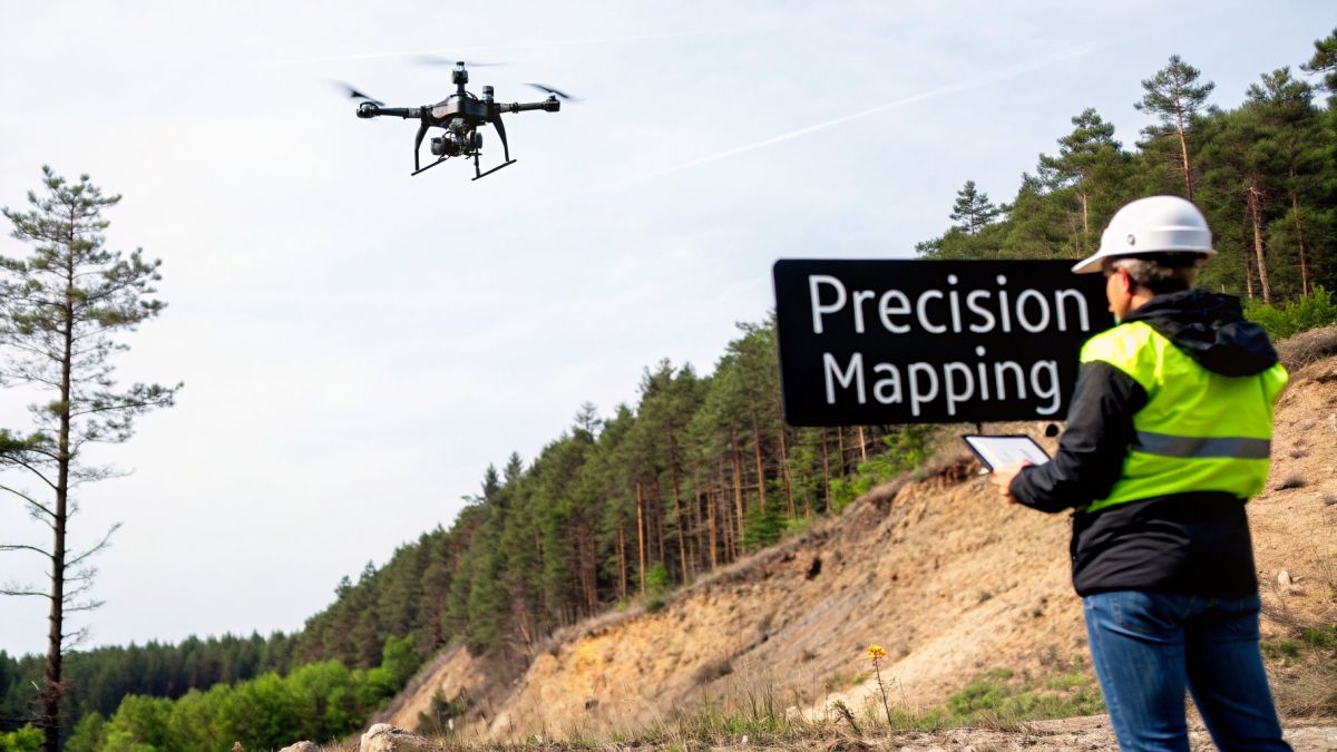
For generations, surveyors faced serious physical and logistical hurdles. Teams would spend weeks on foot, hauling total stations and GPS rovers through rugged terrain. It was slow, back-breaking work. More importantly, it put crews at risk in hard-to-reach or dangerous areas like active mines, dense forests, and steep mountainsides.
This old-school approach was a major industrial pain point. Slow data collection and incomplete maps often led to project delays and blown budgets. An entire infrastructure project could grind to a halt while everyone waited for a survey crew to map a dangerous slope or get through a thick forest.
Overcoming Physical Barriers with Speed and Precision
Drone-based LiDAR cuts right through these old problems. By putting a LiDAR sensor on a UAV, a surveyor can collect millions of data points in a single, short flight. An area that would take a ground crew weeks to cover can now be mapped in just a few hours. That kind of speed completely changes project timelines.
It really shines in places where traditional methods just can't keep up.
- Dense Vegetation: LiDAR's laser pulses are small enough to find gaps in a forest canopy and hit the ground underneath. This gives you a true digital terrain model (DTM), something photogrammetry just can't do since it only sees the treetops.
- Inaccessible Areas: Steep hillsides, swamps, or unstable ground? No problem. A drone can map these areas safely from the air, keeping surveyors out of harm's way.
- Large-Scale Projects: Mapping long corridors for new highways, powerlines, or pipelines used to take months. With LiDAR, it can be done in days.
The core business outcome is simple but powerful: faster, safer, and more complete data collection. This directly leads to quicker project turnarounds, lower labor costs, and better worker safety, smashing the bottlenecks that used to plague big surveying jobs.
To put it in perspective, let's compare the old and new ways of working.
Traditional Surveying vs LiDAR Surveying At a Glance
The table below gives a quick, high-level comparison, showing just how much of an advantage LiDAR-equipped UAVs offer over conventional techniques.
| Metric | Traditional Methods (e.g., Total Station, GNSS) | UAV LiDAR Surveying |
|---|---|---|
| Speed & Coverage | Very slow; a few hundred points per day. Large areas take weeks or months. | Extremely fast; millions of points per flight. Covers vast areas in hours. |
| Data Density | Sparse; data points are collected selectively where accessible. | Ultra-dense; captures a comprehensive 3D model of the entire area. |
| Vegetation Penetration | Poor; impossible to measure ground under dense trees or brush. | Excellent; laser pulses penetrate canopy to map the true ground surface. |
| Safety | High risk; requires personnel to physically traverse hazardous terrain. | Low risk; operator remains in a safe location while the drone flies the site. |
| Accessibility | Limited; cannot survey dangerous or physically impassable areas. | Unrestricted; easily maps steep slopes, wetlands, and other difficult terrain. |
| Labor | Labor-intensive; requires a multi-person crew on-site for extended periods. | Efficient; often a one or two-person job with significantly less time in the field. |
As you can see, the shift to UAV LiDAR isn't just an incremental improvement—it's a complete overhaul of the surveying workflow.
The Growing Demand for High-Quality Data
The industry's rapid move to this technology speaks for itself. The global LiDAR in mapping market, which is crucial for surveying tasks, was valued at USD 5.3 billion in 2025. It's expected to skyrocket to USD 45.8 billion by 2035, growing at a compound annual growth rate (CAGR) of 25.6%. You can discover more about LiDAR market trends and projections on gminsights.com.
This incredible growth shows just how much modern engineering, construction, and environmental projects depend on the precise, detailed data that only LiDAR can provide.
How LiDAR Systems Create Digital Worlds

So, how does LiDAR actually work? At its core, it's a beautifully simple concept. A LiDAR unit fires out a rapid barrage of laser pulses—we're talking hundreds of thousands per second. These invisible light beams shoot out, hit a surface like the ground or a building, and bounce right back to the sensor.
The system's magic lies in measuring the exact time it takes for each pulse to make that round trip. Since we know the speed of light, this "time-of-flight" calculation gives us an incredibly precise distance to that specific point. Repeat that process millions of times over an area, and you get a massive collection of individual measurement points. This is what we call a point cloud—the raw data that forms a stunningly detailed 3D model of the world.
But here’s the tricky part. A laser scanner just sitting on a moving drone is pretty useless on its own. For the data to mean anything, the system has to know its exact position and orientation in space the moment each pulse is sent and received. That’s where a couple of other key players come in.
The Three Pillars of LiDAR Accuracy
Think of a professional LiDAR payload not as one device, but as a team of three highly specialized components working in perfect sync. Each one has a critical job to do.
Laser Scanner: This is the engine of the operation. It's the part that physically sends out the laser pulses and detects the light that bounces back. The most important specs to watch for are the pulse rate (how fast it can fire) and the number of returns it can register from a single pulse.
GPS/GNSS Receiver: This is the system's global positioning expert. A high-end Global Navigation Satellite System (GNSS) receiver tracks the drone’s location down to the centimeter, telling you where in the world every single laser point was measured from.
Inertial Measurement Unit (IMU): If the GNSS tells you where you are, the IMU tells you how you're oriented. It acts like the system's inner ear, constantly measuring the drone's roll, pitch, and yaw. This is absolutely essential for knowing which direction the sensor was pointing for every measurement.
Without the precise location from the GNSS and the orientation data from the IMU, that beautiful point cloud would just be a chaotic mess of points. It’s the seamless fusion of these three technologies that makes high-accuracy LiDAR for surveying a reality.
From Technical Specs to Business Outcomes
It’s easy to get lost in the numbers on a spec sheet, but it's crucial to remember that every technical detail is there to solve a real-world problem.
Take a common headache for mining companies: calculating the volume of their stockpiles. Traditional ground surveys are slow and often miss the complex, irregular shapes of the piles. This can lead to major inventory errors, sometimes costing millions in misstated assets.
This is where a spec like a high pulse rate stops being a number and starts being a financial tool. A LiDAR system with a high pulse repetition rate can blanket that stockpile with points, generating a much denser point cloud.
This density captures the true, complex surface of the pile in a way other methods simply can't. The result is a highly accurate 3D model that produces volume calculations with over 99% accuracy. Suddenly, guesswork is gone, financial reports are solid, and managers can trust their inventory data.
When you mount a powerful LiDAR sensor on a platform like an Evolution Flight drone, you can gather this critical data quickly, safely, and repeatedly. It transforms a major operational challenge into a streamlined, reliable process. That direct line from a technical feature to a powerful business outcome is what defines the value of modern LiDAR systems.
Choosing the Right Drone for Your Surveying Needs
A top-of-the-line LiDAR sensor is useless if the platform carrying it can't do its job. The drone isn't just a taxi for your scanner; it's a critical part of the entire data collection system. If your drone can’t stay in the air long enough, carry the necessary weight, or hold steady in a bit of wind, you'll end up with garbage data. That means expensive re-flights, blown deadlines, and a very unhappy client.
The key is to match the drone to the job you're actually doing. A platform built for a quick five-acre site survey will fall flat on a 50-mile corridor mapping project. Likewise, a lightweight drone will buckle under the strain of a high-end LiDAR sensor needed to punch through dense forest canopies. A one-size-fits-all approach just doesn't work in professional aerial surveying.
Tackling Long Corridors and Dense Vegetation
Think about the massive challenge electric utility companies face. They have to manage vegetation growth along thousands of miles of powerlines, often in rugged, hard-to-reach areas. Sending crews out on foot is slow, dangerous work, and they can easily miss a problem tree hidden by the terrain. This is a huge industrial pain point—failing to spot one dangerously overgrown branch can lead to blackouts, spark wildfires, and create enormous liability.
To solve this, you need a drone with serious legs—one that can fly for a long time without needing a battery swap. It also has to carry a LiDAR sensor powerful enough to see straight through the trees to the ground below.
This is exactly the kind of problem the Evolution Flight EF-700 was built to solve. Its extended flight time and heavy-lift capacity aren't just specs on a sheet; they're direct answers to a real-world business need.
With its endurance, the EF-700 can survey long stretches of a powerline corridor in a single flight. This dramatically cuts down on the time wasted landing, swapping batteries, and re-launching. More importantly, it can carry those premium LiDAR sensors that excel at canopy penetration, capturing a clear picture of the ground and any low-hanging limbs that pose a real threat.
The result for the utility company is a complete, unambiguous dataset showing every potential hazard along the entire right-of-way. This lets them shift from putting out fires (sometimes literally) to using data for proactive vegetation management. They can prevent outages before they happen and make the grid safer for everyone.
Ensuring Data Integrity in Challenging Conditions
Another big headache in LiDAR for surveying is simply staying on schedule, especially when mapping transport corridors like roads and railways. These jobs run on tight timelines and even tighter budgets. The last thing a survey firm needs is for its field team to be grounded because of a little wind—something you're almost guaranteed to encounter in open country or coastal areas.
When a drone gets pushed around by the wind, the flight path becomes unstable. This leads to inconsistent data overlap and a warped point cloud. All that expensive data you just collected? Useless. This forces teams to either wait for a perfect day or burn money on re-flights, throwing the entire project off track.
This is where a platform like the Evolution Flight EF-700 really proves its worth. It’s built for reliability when conditions aren't perfect.
Its exceptional wind tolerance and stable flight mean the LiDAR sensor stays locked on its planned path, even when the wind picks up. That stability is absolutely essential for collecting clean, consistent data, flight line after flight line. By shrugging off common environmental variables, the EF-700 makes sure you get the data right the first time.
The business outcome is simple: you can stick to your schedule and control your costs. Surveying firms can plan and fly missions with confidence, knowing they won't be grounded by a moderate breeze. This eliminates the financial gut-punch of re-flights and helps them deliver survey-grade results on time, every time.
Matching Platforms to Specific Surveying Needs
The market data confirms just how critical these heavy-duty aerial platforms have become. In 2025, aerial LiDAR systems—perfect for the kind of work done in mining, forestry, and infrastructure—claimed a massive 37.45% of the total LiDAR market share. These are the systems powering large-scale scans for everything from flood plain analysis to offshore wind farm siting. With advanced sensors firing up to 14 million points per second, mission times are being slashed. For a closer look at these numbers, you can learn more about the global LiDAR market dynamics on mordorintelligence.com.
To make the connection clearer, we've put together a table that links common industry challenges directly to the solutions offered by Evolution Flight's platforms. It's a quick way to see how the right tech solves a specific business problem.
Matching Evolution Flight Platforms to Surveying Challenges
| Industry Pain Point | Required Technical Spec | Evolution Flight Solution | Business Outcome |
|---|---|---|---|
| Inefficient mapping of long powerline or pipeline corridors | Long flight endurance and ability to carry high-end, penetrating LiDAR sensors | Evolution Flight EF-700 | Complete corridor data in fewer flights, reducing field time and enabling proactive asset management. |
| Project delays due to weather, causing costly re-flights | High wind tolerance and flight stability to ensure data quality | Evolution Flight EF-700 | Consistent data capture in real-world conditions, ensuring projects stay on schedule and on budget. |
| Inaccurate volume calculations for mining stockpiles | Heavy-lift capacity for high-density LiDAR scanners and repeatable flight plans | Evolution Flight EF-700 | 99%+ accurate stockpile volumes, eliminating inventory errors and improving financial reporting. |
| Incomplete data in rugged, inaccessible, or hazardous terrain | Stable, reliable flight over complex topography and remote operation | Evolution Flight EF-700 | Safe and comprehensive data collection in dangerous areas, improving worker safety and data completeness. |
As you can see, choosing the right drone isn't an afterthought. It's about diagnosing the specific pain point of the project and selecting the tool that was purpose-built to solve it, turning a potential operational nightmare into a predictable, profitable outcome.
A Step-by-Step Look at the LiDAR Surveying Workflow
Pulling off a successful LiDAR survey is a lot more than just sending a drone up and hitting "record." Think of it as a four-act play: it starts with careful planning back at the office, moves to precise execution out in the field, and ends with detailed analysis once the data is back on your computer.
Each phase builds directly on the last. Get one part wrong, and you risk compromising the entire project, which can lead to costly mistakes and having to do it all over again.
The whole process can be broken down into four key stages: Mission Planning, Data Acquisition, Data Processing, and creating the Final Deliverables. Let's walk through what actually happens at each step.
Here’s a simple visual of how a drone-based solution can be used to solve a real-world problem, like inspecting powerlines.
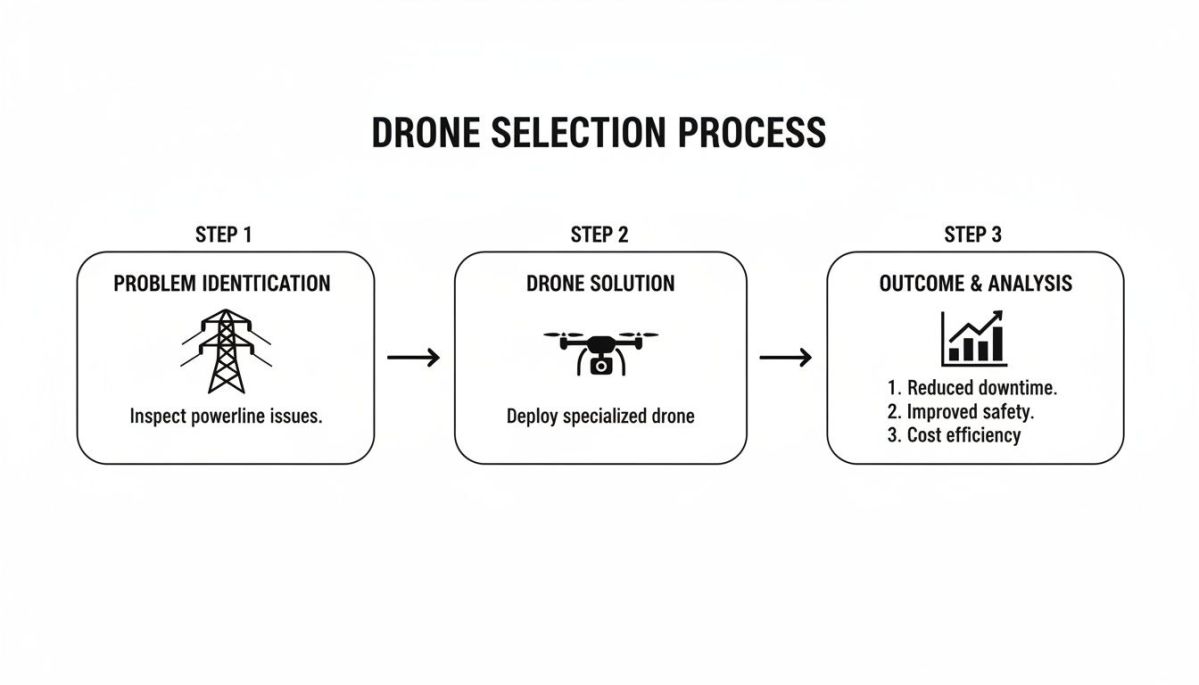
This just shows how a specific challenge is met with a focused drone operation, leading to a clear, measurable result. Now, let’s get into the nitty-gritty of the full workflow.
Step 1: Mission Planning
This is where the foundation for a great survey is laid. Long before the drone's rotors even twitch, you have to figure out exactly what the project needs and translate that into a concrete flight plan. Getting this stage right is crucial for the quality of your final point cloud.
- Dialing in Flight Parameters: This is all about deciding on flight altitude, speed, and how far apart your flight lines will be. If you're modeling detailed infrastructure, you’ll want to fly lower and slower to get a higher point density. For large-scale topographic maps, a higher, faster flight gets the job done more efficiently.
- Setting Your Overlap: Just like with photogrammetry, you need enough overlap between your flight lines. A standard 20-30% overlap is usually a good bet to ensure you don’t have any gaps in your data. It gives you a solid, continuous dataset across the entire site.
- Placing Ground Control: While not always required, using ground control points (GCPs) is a best practice. It’s the best way to double-check the absolute accuracy of your data and make sure your point cloud lines up perfectly with known survey coordinates.
Step 2: Data Acquisition
With a solid plan in your pocket, it's time to head out to the field and capture the data. This isn't just a "press play and walk away" operation. It's all about discipline and sticking to best practices to make sure the raw data you collect is as clean as it can be.
The field crew starts with pre-flight checks on everything—the drone, the LiDAR sensor, and the GNSS base station. Safety is always the top priority, so they'll do a full review of the airspace, check the weather, and identify any potential hazards on the ground. During the flight, the operator keeps a close eye on the drone's performance to ensure everything is going according to plan.
Step 3: Data Processing
Once the drone is safely back on the ground, the raw laser scans and flight data are offloaded. This is where the real magic happens. You take millions of individual laser points and turn them into a clean, organized, and intelligent point cloud.
The first step is usually correcting the drone's flight path using data from the GNSS base station. This is often done using a Post-Processed Kinematic (PPK) workflow.
Next, this super-accurate trajectory is combined with the raw IMU (orientation) and laser data to generate a perfectly georeferenced point cloud. Then comes classification, where a mix of smart algorithms and human review sorts the points into logical categories—like ground, trees, buildings, or powerlines. This automated sorting is what makes the point cloud truly useful.
Step 4: Final Deliverables
A raw point cloud is an incredible dataset, but it's not always what the client needs. The final step is to turn that rich data into practical, easy-to-use products that engineers, project managers, and other stakeholders can actually work with.
Some of the most common deliverables include:
- Digital Elevation Models (DEMs): These are "bare-earth" models, showing just the ground elevation after all the vegetation and buildings have been digitally stripped away. They're perfect for things like flood modeling.
- Digital Surface Models (DSMs): These are similar, but they map the elevation of the very first thing the laser hits. This includes the tops of trees and the roofs of buildings.
- 3D Meshes and Models: For detailed infrastructure work, the point cloud can be turned into a highly accurate 3D model. This gives you a true-to-life "digital twin" of an asset for inspection or as-built verification.
- Contour Lines: Good old-fashioned topographic maps with contour lines are still incredibly useful and can be generated easily from the classified ground points.
This end-to-end process has been a game-changer for large-scale corridor mapping. By 2025, these applications commanded a huge 37.60% of the market's revenue share, largely because government agencies and utilities have invested heavily in LiDAR for things like hazard modeling. Why? Because it delivers accuracy improvements of 40-60% over older methods. You can read the full research about North American LiDAR market trends on marketsandmarkets.com to learn more.
Real-World LiDAR Surveying Applications
The real test of LiDAR for surveying isn't what's on a spec sheet—it's how it solves problems out in the field. This is where the technology truly comes alive, helping companies tackle frustrating challenges that cost them time, money, and put their people in harm's way.
So let's move past the theory and look at a few powerful examples. These stories show what happens when organizations pair the right LiDAR sensor with a capable drone platform, turning massive operational headaches into smooth, data-driven wins.
Keeping the Lights On with Proactive Vegetation Management
Think about an electric utility managing thousands of miles of powerlines that snake through rugged, dense forests. Their single biggest headache is vegetation encroachment. Just one overgrown branch falling on a line during a storm can trigger a huge outage, costing millions and leaving entire communities in the dark.
The old way of dealing with this meant sending crews on slow, dangerous foot patrols or using expensive helicopter flyovers that only gave them a bird's-eye view. When a big storm hits, the utility faces a crisis: how do you find the damage quickly and safely across a massive, often impassable area to get the power back on?
This is where a purpose-built system changes the game entirely.
By sending up a drone from a company like Evolution Flight with a high-performance LiDAR sensor, the utility's entire response is transformed. The drone can fly the powerline corridor in a tiny fraction of the time it would take a ground crew.
LiDAR pulses cut right through the dense tree canopy, creating a precise 3D point cloud of the entire right-of-way. This isn't just a picture; it's a dataset packed with millions of exact measurements.
The data pinpoints every single tree and branch that's too close to the lines—what the pros call "vegetation hazards." The utility gets a clear, prioritized to-do list showing exactly where crews need to go first. The result? Power is restored hours, or even days, faster, which dramatically boosts grid reliability and public safety.
Transforming Mining Operations with Accurate Stockpile Audits
Now, let's head to a large-scale mining operation. One of their constant financial challenges is figuring out the exact volume of their raw material stockpiles. These huge, lumpy piles are always changing, and traditional survey methods are slow, often dangerous, and just not that accurate. This can lead to big inventory write-downs that make investors nervous.
The pain point here is the need for fast, repeatable, and extremely accurate volume calculations for their monthly audits. This is non-negotiable for both operational planning and financial reporting. When millions of dollars in assets are at stake, guesswork just won't cut it.
To solve this, the mine flies a drone-mounted LiDAR system over its stockpiles. The sensor's high point density captures the unique, complex shape of each pile with millimeter-level detail—something a surveyor with a GPS rover could never hope to match.
The new workflow delivers stockpile volumes with over 99% accuracy. A hazardous, week-long job for a survey team is now a routine, automated flight that's over in a few hours. The business outcome is clear: no more costly inventory errors, a streamlined auditing process, and data that every stakeholder can trust without question.
Designing Safer and More Sustainable Infrastructure
Finally, imagine a transport agency planning a new highway through hilly, forested terrain. Their challenge is to design a road that's both affordable to build and easy on the environment. That means minimizing earthworks—the dirt they have to dig up and move—and steering clear of sensitive ecosystems.
To do that right, engineers need a ridiculously detailed and accurate model of the ground as it is today. Without it, they're basically designing blind, which leads to expensive surprises during construction and a bigger environmental footprint.
By running a comprehensive LiDAR for surveying mission over the proposed route, the agency gets a rich, high-resolution Digital Terrain Model (DTM). This "bare-earth" model digitally strips away all the trees and vegetation, giving engineers a perfect view of the true ground surface.
Armed with this precise topographical data, the design team can fine-tune the highway's alignment, grade, and curves. They can calculate cut-and-fill volumes with incredible accuracy, potentially slashing construction costs by millions. The result is a better-designed, more sustainable highway that gets built faster and for less money—all thanks to the superior data only LiDAR can provide.
Calculating the ROI of Your LiDAR Investment
When you're looking at bringing a UAV LiDAR system into your workflow, it's easy to get sticker shock from the initial price tag. But to truly understand the value, you have to look past the hardware cost and think about how it fundamentally changes the way you work. The real return on investment (ROI) isn't just about saving money; it's about gaining massive efficiencies.
The most obvious and immediate payback comes from slashing your time in the field. Think about it: a survey that used to tie up a four-person crew for two weeks can often be knocked out by a two-person team in a single day. Those savings on labor and travel expenses add up incredibly fast, giving you a clear and quantifiable return.
Beyond Direct Cost Savings
While cutting down on field time is a huge win, the real game-changer is the quality of the data and the new capabilities you gain. One of the biggest pain points for any surveyor is the cost of bad data. Having to go back to a site because the initial survey was inaccurate or incomplete is a profit-killer. It means re-mobilizing, re-flying, and re-processing—all of which eats directly into your project margins.
This is where the reliability of your drone platform becomes a crucial financial factor. For instance, the Evolution Flight EF-700 was built from the ground up for exceptional wind tolerance and stable flight. This isn't just a nice feature; it directly tackles the costly problem of re-flights. By capturing clean, consistent data even when the weather isn't perfect, the EF-700 helps you get the job done right the first time, protecting your schedule and your bottom line. It’s about predictable performance you can count on.
Reliable gear doesn't just prevent losses—it also opens up entirely new lines of business.
Suddenly, you can offer high-value services that were impossible before. Think detailed topographic mapping under thick tree canopies, building digital twins of complex industrial sites, or running highly accurate volumetric surveys. These are the kinds of jobs that command higher fees and set you apart from the competition.
Finally, don't forget the long-term value that builds over time:
- Improved Worker Safety: Taking your crew out of dangerous areas—like active mine sites, busy highways, or unstable slopes—is a massive benefit that reduces liability and can even lower insurance costs.
- Better Decision-Making: When you provide engineers and planners with incredibly detailed and accurate data, they can optimize their designs, cutting down on construction costs and minimizing environmental impact.
- Faster Project Turnaround: Finishing surveys in a fraction of the time means your clients can move on to the next phase of their project much sooner. In today's market, that speed is a powerful competitive advantage.
Common Questions We Hear About LiDAR Surveying
Thinking about adding LiDAR to your surveying toolkit? It's a big step, and you probably have a lot of questions. We get it. Here are some straightforward answers to the questions we hear most often from surveyors just like you.
What's the Real-World Accuracy I Can Expect?
For most professional-grade systems, you can consistently hit survey-grade accuracy, which typically means getting down to the 2-5 centimeter range. This isn't just a number on a spec sheet; it's the kind of precision you absolutely need for jobs like infrastructure as-builts or creating detailed topographic maps where every centimeter counts.
Of course, hitting that mark isn't just about the sensor. The stability of your drone is a huge piece of the puzzle. A platform like the Evolution Flight EF-700 is built to provide an incredibly stable flight, which means the GNSS/IMU unit on board can gather clean, reliable data. That's what ultimately lets you nail those tight accuracy targets project after project and confidently bid on high-value work.
How Steep Is the Learning Curve for Processing LiDAR Data?
Let's be honest: raw LiDAR data can look pretty intimidating at first. The good news is that modern processing software has come a long way and is much more intuitive than it used to be. The most time-consuming step—classifying the point cloud—is now largely automated with smart algorithms that can identify ground, buildings, and vegetation for you.
The real secret isn't just knowing how to process the data, but making sure the data you captured in the field was solid to begin with. A reliable drone platform is your best defense against having to do expensive re-flights.
At Evolution Flight, we don't just sell you a drone; we provide the training and support to make sure your team feels completely comfortable turning raw field data into the final products your clients need.
Can LiDAR Really See Through Trees?
Yes, absolutely—and this is where LiDAR truly shines. The laser pulses are tiny and fast, and many of them will find their way through small gaps in the leaves and branches to hit the ground below. This allows you to map the true ground surface with incredible accuracy, even in dense forests.
This ability is a game-changer for so many applications. Think about:
- Utilities: Identifying vegetation encroachment on power lines.
- Engineers: Running flood risk models in heavily wooded river valleys.
- Land Development: Getting an accurate DTM for a site covered in brush.
It gives you essential ground data that's simply impossible to get any other way.
Ready to see how a drone platform built specifically for surveyors can solve your biggest challenges? Evolution Flight builds tough, reliable UAVs designed to carry out high-precision LiDAR missions day in and day out.
Request a quote today and let's talk about your specific needs.