
At its core, a LiDAR UAV drone is an unmanned aerial vehicle fitted with a Light Detection and Ranging sensor. This setup uses rapid-fire laser pulses to measure distances, letting you create incredibly precise, three-dimensional maps of the ground below. It’s completely changing how data is collected across countless industries.
Understanding the Power of LiDAR Drones
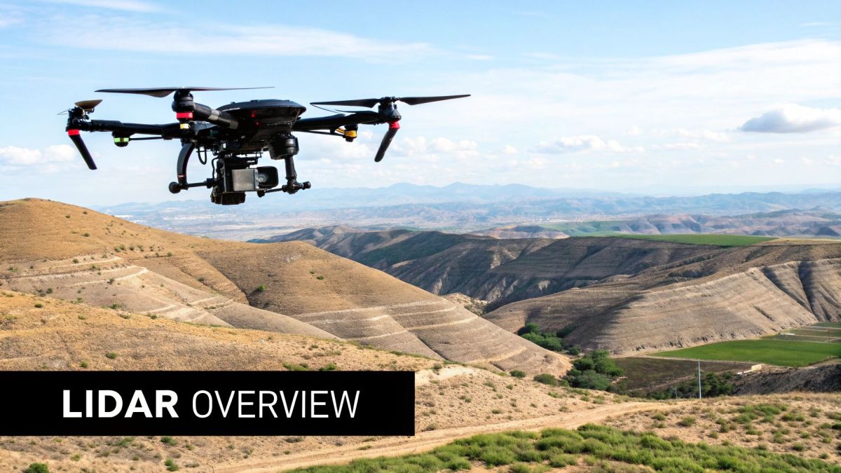
The best way to get your head around how a LiDAR drone works is to think of a bat using echolocation to find its way in the dark. The bat sends out sound waves and uses the echoes that bounce back to build a mental map of its surroundings. LiDAR does pretty much the same thing, but it uses light instead of sound, which creates a far more detailed picture.
A drone with a LiDAR unit fires millions of laser pulses toward the ground every single second. These pulses hit everything in their path—buildings, trees, the earth itself—and bounce back to the sensor. The system then measures the exact time it took for each pulse to make the round trip, allowing it to calculate the precise distance to every point it touched.
When you combine this constant stream of measurements with data from the drone's GPS and an Inertial Measurement Unit (IMU), you get what’s known as a point cloud.
A point cloud is a massive set of individual data points, where each point has its own precise X, Y, and Z coordinates. When you put these millions of points together, they form a stunningly accurate, three-dimensional digital model of the surveyed area.
Core Components Working Together
The real magic of a LiDAR drone is how its main components work in perfect sync to deliver centimetre-level accuracy. If any one of these parts wasn't there, the data would just be a chaotic mess of numbers.
- LiDAR Sensor: This is the heart of the operation. It's responsible for both sending out and receiving the laser pulses.
- GPS (Global Positioning System): This tells you the drone's exact geographic location in the world at any given moment during the flight.
- IMU (Inertial Measurement Unit): This tracks the drone’s precise orientation—its pitch, roll, and yaw—so you know which way it was pointing when each pulse was fired.
By blending the data from all three systems, the software can account for the drone's every movement and tilt. This ensures every single laser point in the cloud is mapped to its correct real-world position. It's this synergy that turns a simple flight into a high-powered mapping mission.
Why This Technology Is a Game Changer
Think about traditional ground-based surveying. It's often slow, demands a lot of manual labour, and can be downright dangerous in rough or inaccessible terrain. LiDAR drones blow past these limitations, capturing huge amounts of data quickly, safely, and with a level of detail that was hard to imagine just a few years ago.
But one of its biggest advantages is its ability to see through vegetation.
The laser pulses are small enough to find gaps between leaves and branches, even in a dense forest. This means they can reach the ground below and create a true "bare-earth" model of the terrain. For industries all over Australia—from forestry and mining to environmental management and urban planning—this capability is invaluable. It’s paving the way for smarter, more informed decisions based on data you can actually trust.
How a LiDAR Drone Creates Detailed 3D Models
A LiDAR drone doesn't just snap a picture of the landscape; it meticulously builds a digital sculpture of it, one laser pulse at a time. This process is a beautifully synchronised dance between advanced hardware and powerful software, all working together to deliver the centimetre-level accuracy that professionals demand. It all starts with three critical components working in perfect harmony.
The heart of the operation is the laser scanner itself. This unit fires out hundreds of thousands, sometimes millions, of laser pulses every second in a sweeping pattern. As these pulses of light hit surfaces—the ground, a tree branch, or the roof of a building—they bounce back to the sensor. The scanner's job is to precisely record the time it takes for each pulse to make that round trip, a measurement we call "time of flight."
This timing data is the foundation, but it's only one piece of the puzzle. To be useful, each of those laser points needs a precise address in three-dimensional space.
The Trio of Precision Hardware
For the system to know exactly where each measurement was taken from, it leans on two other essential instruments: a high-precision Global Positioning System (GPS) receiver and an Inertial Measurement Unit (IMU).
- Global Positioning System (GPS): This is more than your standard car GPS. It tracks the drone's exact latitude, longitude, and altitude at every single moment of its flight, giving every outgoing laser pulse a known starting point in the real world.
- Inertial Measurement Unit (IMU): Think of the IMU as the system's inner ear. It constantly measures the drone’s orientation—its pitch, roll, and yaw. This is absolutely critical because a drone is rarely perfectly level. The IMU’s data corrects for every tiny tilt and turn, ensuring the laser's angle is always accounted for.
By combining the laser's time-of-flight data with the drone's exact position from the GPS and its orientation from the IMU, the system calculates the precise XYZ coordinates for every single point the laser touches.
The following infographic shows just how this simple but powerful three-step data capture process works.
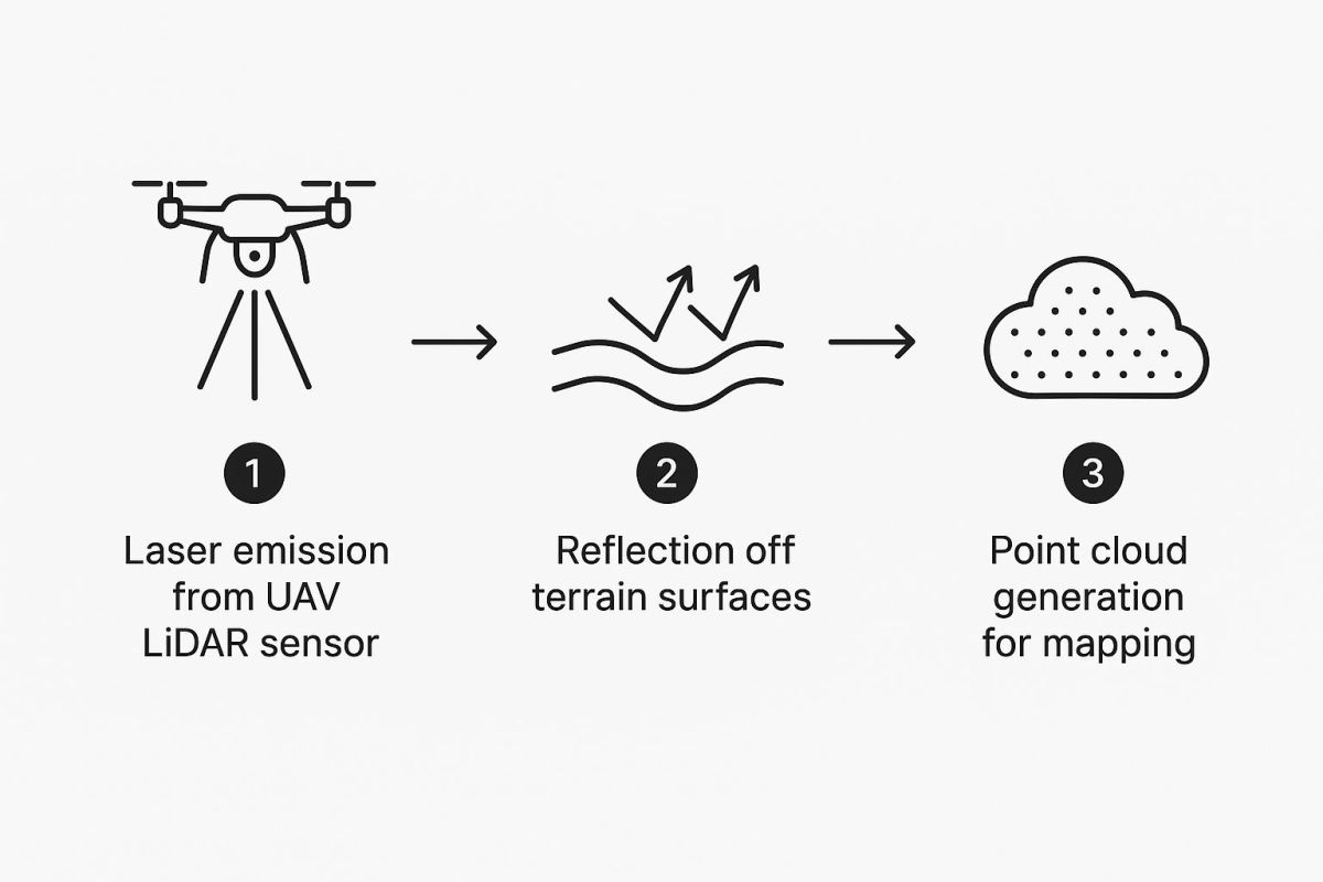
This helps visualise how millions of individual laser measurements are systematically gathered to form one cohesive dataset.
From Raw Data to Actionable Intelligence
The immediate result of a LiDAR survey is a raw point cloud. Picture a digital cloud made of millions, or even billions, of tiny, precisely placed dots. Each dot represents a point where a laser pulse bounced off a surface. This point cloud is an incredibly rich and detailed 3D dataset, but it's not quite a finished model yet.
This is where post-processing software comes into play. It takes this massive collection of points and begins to clean, filter, and classify it.
During classification, the software intelligently sorts the points into categories. For example, it can distinguish points that hit the ground from those that reflected off vegetation, buildings, or powerlines.
This crucial step is what turns raw data into something you can actually use. For instance, by filtering out all the non-ground points, a surveyor can create a Digital Elevation Model (DEM)—a true "bare-earth" model of the terrain. This is invaluable in fields like forestry, as it reveals the topography hidden beneath even the densest tree canopy. While LiDAR drones are masters at capturing the real world, understanding the general principles of 3D model creation for enterprise use can give you a broader appreciation for developing these digital assets.
Ultimately, this entire process transforms a single flight into a powerful mapping exercise. For those curious about the equipment involved, you can explore the various drones with LiDAR that are built specifically for these demanding tasks. The end result isn't just a model; it's a foundation for making smarter, more informed decisions.
Australian Industries Getting a Boost From LiDAR Drones
It’s one thing to talk about the power of a LiDAR UAV drone in theory, but its real value comes to life when you see it tackling real-world challenges across Australia's diverse landscapes. From sprawling farms to rugged mine sites, this technology isn't just a minor upgrade—it's completely changing how key industries get the job done. It delivers a level of detail and speed that older methods just can't touch.
This isn't just a niche trend, either. The Australian drones market, which includes these advanced LiDAR systems, was valued at around USD 614 million in 2024. But that's just the start. It's expected to rocket to over USD 1.5 billion by 2033, which tells you just how vital this tech is becoming.
This growth is all about practical results, turning drones from a novelty into an essential piece of equipment.
A New Era for Australian Agriculture
Australian farmers deal with some of the toughest conditions on the planet. A LiDAR UAV drone gives them a powerful edge in precision agriculture, delivering incredibly accurate topographic data across thousands of hectares.
Think about a farmer trying to plan a new irrigation system across rolling hills. In the past, this was a monumental task. Now, a LiDAR drone can fly over the property and produce a detailed Digital Elevation Model (DEM) in just a few hours. This map shows the exact contours of the land, revealing the perfect spots for channels and pipes to ensure water flows efficiently and isn't wasted—something absolutely critical in a dry country like ours.
It's also a game-changer for monitoring crop health. By measuring the height and density of the plant canopy with pinpoint accuracy, farmers can:
- Spot struggling sections of a field that might need more fertiliser or water.
- Estimate crop yields far more accurately before committing to the harvest.
- Check if new farming techniques are actually working during the season.
This kind of detailed information helps farmers make smarter decisions that increase productivity and support more sustainable use of the land.
By capturing precise elevation and vegetation data, LiDAR drones give agriculturalists the power to optimise resource use, improve yields, and manage their land more effectively than ever before. This is the essence of modern, precision farming.
Making Mining Safer and Smarter
When you look at where LiDAR drones are making a massive difference in Australia, the mining sector is a standout. Mine sites are constantly changing and can be dangerous places, so getting accurate and frequent surveys is crucial for both safety and efficiency.
Take stockpile measurement, for instance. Traditionally, figuring out the volume of those huge piles of extracted material was a slow, hands-on job that put people at risk. Today, a LiDAR UAV drone can fly over them on its own and create a precise 3D model in minutes. This allows site managers to calculate volumes with over 99% accuracy, which is huge for managing inventory and financial reporting.
Safety is where these drones really prove their worth. They're used to:
- Keep an eye on the stability of pit walls and tailings dams, detecting tiny shifts that could warn of a potential collapse.
- Map haul roads to make sure they're safe for heavy machinery to use.
- Survey hard-to-reach or hazardous areas without sending a single person into harm's way.
Getting this vital data quickly and safely helps mines run more smoothly and, most importantly, creates a safer workplace for everyone on site.
Protecting Australia’s Natural Environments
Beyond the farm and the mine, LiDAR drones have become a vital tool for environmental management and conservation across the country. Their unique ability to see through thick tree canopies and map the ground below has transformed how we monitor our precious ecosystems.
For example, conservationists are using LiDAR to track coastal erosion with centimetre-level accuracy. By flying regular surveys, they can measure exactly how much shoreline is disappearing and predict the impact of future storms, helping to build better coastal defence strategies.
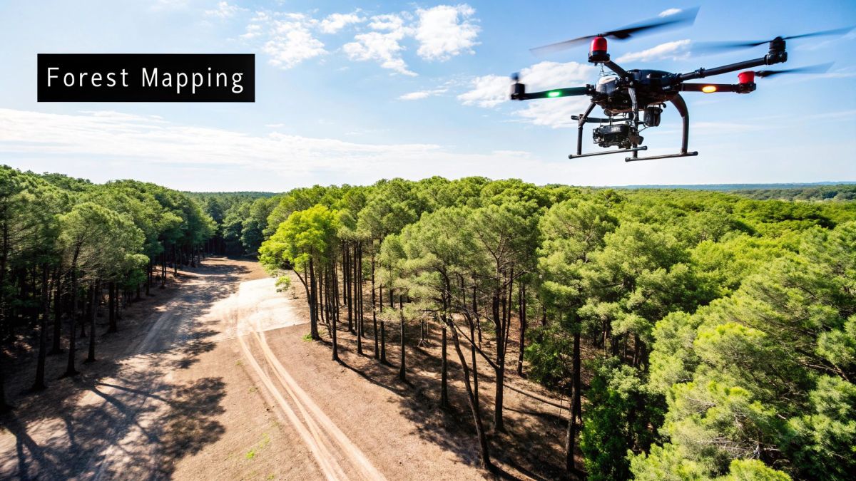
In forestry, a LiDAR UAV drone can create detailed 3D models of the forest canopy to assess its health. This data helps land managers measure biomass, calculate how much carbon is being stored, and pinpoint areas at high risk of bushfires. It gives us a clear, measurable understanding of our forests, which is essential for effective conservation and fire management.
Comparing LiDAR Drones with Other Aerial Survey Methods
When it comes to aerial surveying, the choice often boils down to two main technologies: LiDAR UAV drones and photogrammetry drones. While both can create incredibly detailed maps from above, they go about it in completely different ways, and each one shines in different situations.
Think of photogrammetry as a master artist meticulously stitching together thousands of 2D photos to build a 3D model. It’s all about creating a digital mosaic from images. LiDAR, on the other hand, is more like a surveyor with a high-tech measuring tape. It directly measures the landscape by firing millions of laser pulses and recording the reflections to build its model. This fundamental difference is where their unique strengths and weaknesses come from.
Photogrammetry is brilliant for creating visually rich, full-colour models that look almost real. The hardware is often cheaper to get started with since it uses standard cameras, which makes it a popular choice. But its reliance on what the camera can see is also its biggest weakness.
LiDAR vs Photogrammetry Head-to-Head
When your project demands pinpoint accuracy and the ability to see through surface clutter, a LiDAR UAV drone really comes into its own. Its direct measurement approach tackles challenges where photogrammetry simply can't compete.
Here’s a look at how they stack up on a few key points:
- Vegetation Penetration: This is where LiDAR is in a class of its own. Its laser pulses can slip through tiny gaps in a dense forest canopy to map the true ground below. Photogrammetry just sees the tops of the trees.
- Lighting Conditions: Photogrammetry needs good, even light. Dark shadows, glare, or a gloomy overcast day can throw the whole survey off. LiDAR doesn't care—it brings its own light source, meaning it can work from dawn till dusk, regardless of the weather.
- Accuracy and Detail: While modern photogrammetry can be quite accurate, LiDAR generally offers superior vertical accuracy. It’s unmatched for capturing the fine details of complex assets like powerlines or the subtle contours of the ground.
For any project where the main goal is a bare-earth Digital Elevation Model (DEM) or mapping fine linear features, LiDAR is the clear winner. Its ability to filter out "noise" like vegetation and buildings is something photogrammetry just can't do.
Choosing between LiDAR and photogrammetry isn't about which is "better" overall, but which is the right tool for your specific job. The table below breaks down the key differences to help you decide.
LiDAR Drone vs Photogrammetry Drone: A Quick Comparison
| Feature | LiDAR Drone | Photogrammetry Drone |
|---|---|---|
| Technology | Active sensor (laser-based) | Passive sensor (camera-based) |
| Accuracy | High vertical accuracy (1-5cm) | Good accuracy, but can be variable |
| Vegetation Penetration | Excellent; can see through canopy to the ground | Poor; maps the top of the vegetation |
| Lighting Needs | Works in most light conditions, day or night | Requires good, consistent daylight |
| Data Output | 3D point cloud (x,y,z coordinates) | 2D images, 3D models, orthomosaics |
| Best For | Forestry, archaeology, complex terrain, infrastructure | Visualisations, marketing, open-area mapping |
| Cost | Higher initial investment | Lower initial investment |
Ultimately, the choice comes down to the data you need. If a visually stunning, full-colour model is the priority and the area is clear, photogrammetry is a great, cost-effective option. But if you need to know exactly what the ground looks like under a thick forest or capture the precise location of every powerline, LiDAR is the only way to go.
Making the Right Choice for Your Project
So, how do you decide? It all comes down to your project's goals and the conditions on the ground.
Choose Photogrammetry when:
- A realistic, colourised 3D model is your main deliverable.
- The survey area is open with little to no trees or bushes.
- You're working with a tighter upfront budget for hardware.
- Visuals are more important than centimetre-level vertical accuracy.
Choose a LiDAR UAV drone when:
- You absolutely must map the ground beneath a forest canopy.
- The project demands the highest possible vertical accuracy.
- You need to map fine details like transmission lines or pipe racks.
- You can't rely on perfect weather and need to fly in various light conditions.
The industry is clearly voting with its wallet. The global LiDAR drone market was valued at around USD 197.14 million in 2024 and is expected to rocket to USD 2,376.83 million by 2034. This trend shows a massive shift towards tools that deliver more reliable and detailed data. While both are powerful forms of aerial surveying with a UAV, LiDAR gives you a level of data integrity that opens up brand-new possibilities, especially in challenging environments.
How to Choose the Right LiDAR UAV Drone System
https://www.youtube.com/embed/aaPJNX0Cy4c
Choosing a LiDAR UAV drone system is a big decision and a serious investment. Think of it like buying specialised machinery for a major project—get it right, and you unlock incredible efficiencies. Get it wrong, and you’re looking at costly delays and bad data.
The secret is to match the technology to your specific job. This means looking at three key pieces of the puzzle: the LiDAR sensor itself, the drone carrying it, and the software that makes it all work together.
Most people instinctively look at drones first, but it’s better to start with the LiDAR sensor. After all, the sensor is what actually collects your data; the drone is just the vehicle that gets it into the air. Let your project’s demands guide your sensor choice.
For example, if you’re mapping dense bushland, you’ll need a sensor that can punch through the thick canopy. That means a high pulse rate and the ability to record multiple returns from each laser beam. But if you're surveying a wide-open mine site, a longer range might be more important than multiple returns. Getting this balance right from the start is absolutely crucial.
Evaluating the LiDAR Sensor
The technical specs on a LiDAR sensor can look pretty intimidating at first. But don't get bogged down in the jargon. A few key metrics will tell you almost everything you need to know about how it will perform on your site.
Here’s what you really need to pay attention to:
- Pulse Rate: This is measured in points per second (PPS) and tells you how dense your final point cloud will be. A higher PPS, like 700,000 PPS or more, is essential for capturing fine details on complex structures or terrain.
- Range: This is simply how far the sensor can accurately measure. A longer range lets the drone fly higher, covering more ground in a single go, which is a massive time-saver for large-scale topographical surveys.
- Accuracy: This spec tells you how close the measured points are to their true location in the real world. For any serious survey work, you should be looking for systems that offer an accuracy of 5 centimetres or better.
- Number of Returns: This shows how many separate echoes the sensor can record from a single laser pulse. A sensor with multiple returns (say, 5 or more) is non-negotiable for mapping through vegetation to see the ground underneath.
The perfect sensor is always a trade-off. A long-range sensor might have a lower pulse rate, while a high-density sensor might not reach as far. Figure out what your most common projects will be and pick the sensor that's built for that kind of work.
Selecting the Drone Platform
Once you’ve zeroed in on the right sensor, you need a drone that can carry it safely and effectively. The drone is more than just a flying mount—its performance has a direct impact on your data quality and how efficiently you can work. The two big things to consider here are payload capacity and flight time.
First, the drone needs to handle the total weight of the LiDAR sensor, its power supply, and any other gear like a high-precision GPS. Never push a drone to its maximum payload limit. It’s a terrible idea that will kill your flight time and make the aircraft unstable in windy conditions. Always pick a drone with a payload capacity well above what you actually need.
Flight time is the other deal-breaker. More air time means less time on the ground swapping batteries and more time collecting data. If you’re mapping large areas or long corridors like powerlines and railways, a drone with at least 40 minutes of flight endurance will make your life much easier. It minimises the number of flights needed, which also simplifies the data processing later on. You can learn more about finding the right LiDAR for your drone by thinking through these platform-specific needs.
Don't Overlook the Software
Finally, there's the software. This is the glue that holds your entire workflow together. A well-integrated system with user-friendly flight planning and powerful processing tools will save you countless hours and headaches. Good flight planning software lets you automate your missions, ensuring you get consistent data with the right amount of overlap every single time.
After the flight, you’ll need solid software to make sense of the raw point cloud. This involves calibrating the data, classifying points into categories like ground, vegetation, and buildings, and then creating your final products, like Digital Elevation Models (DEMs). Before you buy anything, make sure the whole process—from mission planning to final report—is a smooth one.
LiDAR-equipped UAV drones represent a critical advancement in Australia's mining industry, a vital sector of the national economy. By 2025, LiDAR drone use in mining and natural resource management in Australia is expected to increase significantly, coinciding with broader drones market growth rates, which are forecasted to reach a CAGR of 27% over 2025–2034. You can explore the full report on Australia's growing drone market on GlobeNewswire.
Your LiDAR Drone Questions, Answered
As LiDAR drones become more common on job sites across Australia, it’s only natural that questions pop up. What does it really cost? What kind of training is involved? How does it handle a bit of bad weather? These are the practical things you need to know before you invest.
We get these questions all the time, so we’ve put together some straight-up answers to help you get a clear picture of what it takes to integrate this technology into your work.
What’s the Real Cost of a LiDAR Drone System?
The price for a complete LiDAR drone setup can swing pretty wildly, and it really comes down to the level of precision your work demands. You're not just buying a drone; you're investing in a full package: the drone, the LiDAR sensor, and the software to make sense of it all.
For someone dipping their toes in or tackling projects where survey-grade accuracy isn't the top priority, you could be looking at an entry-level system starting around AUD $25,000. These are solid for things like initial site assessments or smaller mapping jobs.
But if you're in high-stakes fields like engineering, mining, or large-scale surveying, you’ll need a professional-grade system. For that kind of pinpoint accuracy and longer range, costs often climb past AUD $150,000. At the end of the day, the price tag is a direct reflection of performance—the better the accuracy and the more powerful the sensor, the higher the investment.
What Training Do I Need to Fly a LiDAR Drone in Australia?
Flying a LiDAR drone for work in Australia isn't just about having good flying skills. The Civil Aviation Safety Authority (CASA) mandates that all commercial pilots hold a Remote Pilot Licence (RePL). But for this kind of specialised work, that’s just the first step.
On top of your CASA licence, you'll need specific training that walks you through the entire LiDAR process. This usually covers:
- Mission Planning: Learning how to map out flight paths tailored for LiDAR, getting the right overlap and settings to capture clean data.
- Sensor Operation: Getting hands-on with the LiDAR sensor itself, understanding how to configure it for different environments to get the best results.
- Data Post-Processing: Mastering the software that turns a raw cloud of points into a practical 3D model or a detailed report.
Any good supplier will bundle comprehensive training with the sale of their system. This makes sure your team isn't just licenced to fly, but is genuinely skilled in every part of the job, from planning the flight to delivering the final product.
Can I Fly a LiDAR Drone in Bad Weather?
It’s a common myth that because LiDAR uses its own light, it can see through anything. The reality is that LiDAR drone systems are actually quite sensitive to what’s happening in the atmosphere.
Things like heavy rain, thick fog, or even a lot of dust can scatter the laser pulses. This interference stops the light from hitting its target and bouncing back cleanly, which can result in messy, incomplete, or totally unusable data. If you want the system to deliver on its promise of accuracy, you need clear skies.
For reliable, high-quality results, always plan your LiDAR surveys for clear weather. This ensures the laser signal stays clean and the final point cloud is as accurate as possible.
What Kind of Data Do You Actually Get From a LiDAR Survey?
The data that comes from a LiDAR survey is incredibly detailed and serves as the foundation for a whole range of outputs. The journey starts with a massive raw file and gets refined into something you can actually use to make decisions.
The first thing you get right after a flight is a raw point cloud. Think of it as a huge digital file (typically in a .LAS or .LAZ format) filled with millions, sometimes billions, of individual points, each with its own precise X, Y, and Z coordinate.
This raw data is just the beginning. Through processing, it can be turned into a number of valuable final products, or "deliverables." The most common ones are:
- Classified Point Clouds: The software intelligently sorts every point into a category, like ground, buildings, high vegetation, or powerlines.
- Digital Elevation Models (DEMs): By stripping away everything but the ground points, you get a true "bare-earth" model of the terrain.
- Digital Surface Models (DSMs): This model maps the tops of all surfaces—including trees and rooftops—showing the landscape just as it looks from above.
It’s these polished deliverables that turn a simple drone flight into a powerful analytical tool, giving you the detailed insights needed to move your project forward.
Ready to see how a high-performance LiDAR drone could take your surveying and mapping projects to the next level? The expert team at Innoflight International can help you choose the perfect system for your needs. Contact us today for a customised quote.