
A genuine long-range drone is a world away from a consumer toy that can just fly a bit further. Think of it as a serious industrial tool, built from the ground up for endurance, rock-solid communication, and consistent performance over huge distances. It’s less of a sprinter and more of a marathon runner, designed specifically to operate Beyond Visual Line of Sight (BVLOS) and send back vital data from kilometres away—a capability that’s becoming fundamental for enterprise operations across Australia.
What Does 'Long-Range' Actually Mean for a Drone?
When a professional in the field talks about a 'long-range' drone, they're not just thinking about how far it can fly in a straight line. Sure, a hobbyist drone might manage a few kilometres, but an enterprise system is defined by a powerful trio of endurance, a bulletproof communication link, and the smarts to carry out complex jobs on its own. It's the difference between a simple remote-controlled aircraft and a sophisticated aerial data platform.
This distinction is absolutely critical for industries that manage large-scale assets. Here in Australia, the drone market is booming, largely because of the uptake of these advanced systems. The local market hit around USD 614 million and is on track to reach USD 1.5 billion, which tells you just how much sectors like defence, agriculture, and infrastructure are coming to rely on them. You can dive deeper into the numbers in this Australian drones market analysis.
The Three Pillars of Real Long-Range Flight
To get what really sets these drones apart, you have to look past a simple distance spec on a box. Three core pillars must work together seamlessly to make long-distance operations effective and safe.
- Sustained Endurance: This is all about flight time. How long can the drone actually stay in the air? Your average consumer model might tap out after 30 minutes, but a commercial long-range drone can fly for several hours, often using high-density batteries or even hybrid petrol-electric engines.
- Reliable Comms: A stable command and data link is non-negotiable. If you lose connection, you've lost the mission. These systems use advanced radio frequencies, cellular networks, and even satellite communications to make sure the operator stays in full control and gets a clean data feed, even when the drone is well over the horizon.
- BVLOS Operation: This is the real game-changer. Flying Beyond Visual Line of Sight is what unlocks the enormous potential for mapping vast infrastructure corridors, inspecting hundreds of kilometres of power lines, or monitoring a massive farming property without the pilot ever needing to physically see the aircraft.
Power Systems: The Heart of Endurance
The power source is what gives a drone its legs. When you’re trying to figure out what defines a true long-range drone, you have to get your head around the specs of its power system. For the battery-powered models, this means understanding battery capacity metrics like amp-hour to watt-hour, as this is what directly translates into potential flight time.
A drone's true 'range' is a mix of its endurance (how long it can fly), its communication link (how far it can be controlled), and its mission profile (the job it has to do). Having one without the others just gives you a radio-controlled plane with a very limited purpose.
What Makes Extended Drone Flights Possible?
So, how does a drone manage to stay in the air for hours and travel hundreds of kilometres? It’s not magic. The secret behind a long-range drone’s ability to cover huge distances comes down to smart design choices and a blend of advanced technologies working together. At the end of the day, it's all about making the right trade-offs for the job you need to do.
A good way to think about it is choosing a vehicle. You wouldn't take a diesel truck to run a quick errand in the city; you’d grab the keys to a nimble electric car. That’s your typical multi-rotor drone—brilliant for hovering and close-up inspections. But for a long haul across the country, you need that diesel truck, a machine built purely for endurance and efficiency. This is where fixed-wing and hybrid Vertical Take-Off and Landing (VTOL) aircraft really shine.
These different designs aren't just cosmetic; they represent completely different engineering philosophies. Multi-rotors give you incredible stability and can get into tight spots, but they burn through power like there's no tomorrow. Fixed-wing drones, on the other hand, are the masters of efficiency. They use their wings to create lift, just like a plane, which dramatically stretches out their flight time and range.
This diagram breaks down how these crucial systems—endurance, communications, and BVLOS—all have to work together to make long-range flights happen.
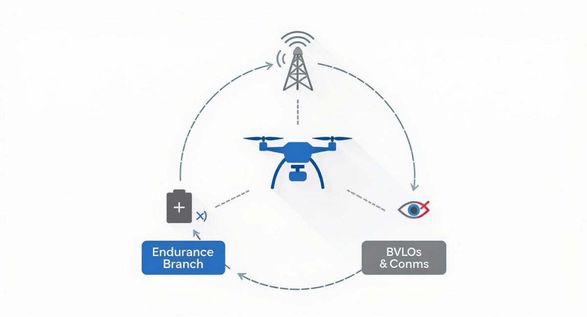
As you can see, none of these pieces work in a vacuum. A powerful engine is completely useless if you don't have a reliable communication link to tell it what to do from miles away.
Propulsion and Power Systems
What's under the hood of a long-range drone is what gives it its stamina. Battery technology is getting better all the time, but for truly long-endurance missions, the energy density of lithium-ion batteries just can’t keep up yet. That’s why many of the serious enterprise-grade drones look to other power sources.
- Battery-Electric: These are great for missions that need up to about 90 minutes of flight time. They use high-density battery packs to power electric motors, which means they're quiet and relatively simple to operate.
- Petrol Engines: When you need to fly for several hours at a time, you can’t beat a small internal combustion engine. They pack an energy punch that allows drones to cover hundreds of kilometres on a single tank.
- Hybrid Systems: This is where things get really clever. These platforms mix a petrol engine (which acts as an onboard generator) with electric motors that actually drive the propellers. You get the best of both worlds: the marathon-like endurance of petrol with the pinpoint control of electric propulsion.
This choice has a massive impact on mission planning. A battery-powered drone might be perfect for surveying a 100-hectare farm. A petrol-powered fixed-wing, however, can inspect a 200-kilometre pipeline in one go. That's the kind of scale we're talking about.
The Unseen Lifeline: Communication Links
A long-range drone is only as capable as its connection back to the pilot on the ground. When that aircraft is flying Beyond Visual Line of Sight (BVLOS), this connection is everything. It's carrying commands out to the drone and sending mission-critical data back. The standard radio links on consumer drones just don't have the muscle for these kinds of distances.
A stable, low-latency data link is non-negotiable for safe and effective BVLOS operations. Losing this link doesn't just mean a failed mission; it means a lost, uncontrolled aircraft, which is an unacceptable risk for any professional operation.
To keep this vital link solid over tens, or even hundreds, of kilometres, professional systems rely on a mix of advanced comms tech.
- Advanced Radio Frequencies: This involves using licensed or more powerful frequency bands (like 1.4 GHz) that are far less crowded and can push a signal further than your standard Wi-Fi frequencies.
- Cellular Networks (4G/5G): By building cellular modems into the drone, it can tap into existing mobile phone towers to stay connected wherever there's network coverage.
- Satellite Communications (SATCOM): For missions in truly remote areas with zero ground infrastructure—think the Australian outback or maritime surveillance—SATCOM is the ultimate solution. It provides a reliable link, even if it has a bit more lag.
Often, these systems are designed with built-in redundancy, so they can automatically switch between comms types to maintain the strongest possible connection. This is the technological backbone that gives a pilot the confidence to send a valuable asset far over the horizon to get the job done.
Navigating Australian BVLOS Flight Regulations
Flying a long-range drone in Australia is as much about navigating regulations as it is about mastering the technology. As soon as your drone flies Beyond Visual Line of Sight (BVLOS), it falls under the strict watch of the Civil Aviation Safety Authority (CASA), Australia's aviation regulator. This isn't a simple tick-box exercise; it's a deep dive into safety and risk management.
For any business looking to run a professional drone program, the first step is getting a Remote Operator’s Certificate (ReOC). Think of this as your foundational licence to fly commercially. It proves your organisation has the right procedures and people to operate drones safely.
But a ReOC is just the starting line. BVLOS missions are a whole different ball game, demanding specific approvals from CASA for each unique operation. This is where the real work begins, moving past standard checklists and into the world of detailed risk assessment.
Understanding the Approval Process
Getting the green light for BVLOS operations can feel like a marathon. CASA needs you to build a rock-solid safety case that proves you can manage every conceivable risk of flying an aircraft you can't see. The core of this process is the Specific Operations Risk Assessment (SORA) methodology.
SORA is essentially a structured way of thinking about what could go wrong. It forces you to identify potential hazards—like losing your comms link or crossing paths with a helicopter—and then design bulletproof procedures to prevent or handle them.
The point of a CASA BVLOS approval isn't to create roadblocks. It's to ensure long-range drone flights achieve a level of safety on par with traditional crewed aircraft. You have to prove you've got the systems to stop a bad day from becoming a worst-case scenario.
This commitment to professionalism is exactly why the Australian drone industry is booming. Government forecasts suggest the local drone market could be worth AUD 14.5 billion and support around 5,500 full-time jobs each year. This potential is unlocked by operators who can navigate these complex rules. You can read more about this exciting industry growth on Archive Market Research.
Key Compliance Components
To even be considered for a BVLOS approval, you need several non-negotiable systems in place. These are the pillars of your safety case.
- Detect-and-Avoid (DAA) Systems: This is the big one. You must have a reliable way to spot other aircraft in the sky—both crewed and uncrewed—and get out of their way. This might involve onboard sensors, ground-based radar, or ADS-B receivers.
- Command and Control (C2) Link Robustness: Your communication link is your lifeline. You have to prove it's stable, secure, and reliable across your entire flight area, with backup plans for what happens if you lose connection.
- Extensive Pilot Training and Currency: BVLOS pilots need skills far beyond a standard drone licence. Their training must cover procedures similar to instrument-rated pilots, focusing on complex mission planning and emergency handling for long-range flights.
Given how much time, money, and expertise is involved, many businesses decide to skip the headache and partner with an experienced drone service provider. These specialists already have the ReOC, the hard-won BVLOS approvals, the right aircraft, and the operational know-how to get the job done safely and legally. It’s a smart way to de-risk your entry into long-range drone operations, letting you focus on the data and insights, not the red tape.
How Industries Use Long Range Drones
The real worth of a long range drone isn’t in its tech specs, but in the problems it solves out in the field. For Australian industries managing assets stretched across vast and often harsh landscapes, this technology delivers real, measurable results. It completely changes the game for safety, cost, and the quality of data you can get your hands on.
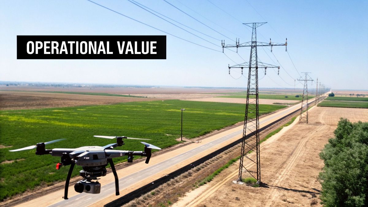
Think about an energy company responsible for inspecting thousands of kilometres of power lines. The old way meant sending out slow, expensive ground crews or putting people at risk in low-flying helicopters. A long range drone turns this into a streamlined, automated mission, capturing incredibly detailed data from a safe distance.
This move from manual, high-risk jobs to automated, data-led oversight is happening across the board. It's not about replacing people; it's about giving them far better tools to make smarter, safer decisions.
Powering the Energy and Utilities Sector
For energy and utility companies, keeping an eye on linear infrastructure like power lines and pipelines is a massive, never-ending job. These assets can run for hundreds, even thousands of kilometres, often through remote country that’s a nightmare to get to. Long range drones are practically built for this kind of work.
Kitted out with high-resolution cameras, thermal sensors, and LiDAR scanners, a single drone can inspect an entire corridor in one flight. This lets operators spot trees getting too close to wires, identify failing insulators, or find tiny pipeline leaks before they turn into major disasters.
Some key applications here include:
- Vegetation Management: Using LiDAR to get pinpoint-accurate measurements between trees and power lines, which is crucial for preventing blackouts and bushfire risks.
- Asset Condition Monitoring: Capturing crystal-clear imagery of towers and components to schedule maintenance proactively, avoiding the huge cost of an unexpected failure.
- Pipeline Integrity Checks: Flying thermal sensors along gas pipelines to quickly spot the subtle temperature changes that signal a potential leak.
Transforming Surveying and Mining Operations
In mining and geospatial fields, everything hinges on accurate, repeatable data. Long range drones have quickly become a go-to tool for large-scale surveying, measuring stockpile volumes, and monitoring site conditions, delivering results in a tiny fraction of the time it takes ground crews.
On an open-cut mine site, drones do everything from calculating how much material is in a stockpile to checking the stability of pit walls. Because they can cover a huge area so quickly, they provide the most current information for operational planning. This makes the mine more efficient and, critically, keeps surveyors out of potentially dangerous areas.
For big projects, the time saved is staggering. A long range drone can map hundreds of hectares in a single flight, producing survey-grade Digital Elevation Models (DEMs) and orthomosaics that plug straight into the mine's planning and management software.
These drones are just as valuable for corridor mapping, like when you’re planning a new road or railway. They can survey the entire proposed route in no time, providing all the detailed topographical data engineers need without having to send teams out on the ground for weeks.
Enhancing Agriculture and Environmental Management
In precision agriculture, good information is everything. Long range drones give farmers and agronomists a bird's-eye view of their land that was impossible to get before, allowing them to make targeted decisions that increase yields and cut down on waste.
By flying over vast fields with multispectral sensors, these drones create detailed health maps of the crop. They can show exactly where plants are stressed from lack of water or nutrients. This means fertiliser or irrigation can be applied only where it's needed, saving money and being better for the environment.
It’s a similar story in environmental management, where long range drones are used for:
- Wildlife Tracking: Covering huge habitats to monitor animal numbers and migration routes with very little disturbance.
- Coastal Erosion Monitoring: Mapping coastlines regularly to track changes over time and help plan defensive strategies.
- Forestry Management: Checking tree health, canopy density, and fire damage across massive forestry plantations.
Supporting Emergency Response and Public Safety
When a disaster hits, getting good information fast is what saves lives. Long range drones give emergency services instant situational awareness, letting them assess the damage and coordinate their response far more effectively.
After a flood or bushfire, a drone can be in the air within minutes, mapping the affected area to find communities that are cut off, spot damaged infrastructure, and identify safe routes for first responders. This "eye in the sky" is a true force multiplier, helping direct resources exactly where they're needed most.
Ultimately, this technology helps teams make clear-headed decisions under immense pressure, improving safety for the public and for the responders themselves. The ability to deploy quickly and cover a massive area makes long range drones a vital part of modern emergency management.
To give you a clearer picture, here’s a quick summary of how different sectors are putting these drones to work.
Industry Use Cases for Long Range Drones
This table breaks down how various industries are using long range drones and the primary benefits they're seeing on the ground.
| Industry Sector | Primary Application | Key Benefit |
|---|---|---|
| Energy & Utilities | Linear infrastructure inspection (power lines, pipelines) | Proactive maintenance, reduced risk, and lower operational costs. |
| Surveying & Mining | Large-scale topographical mapping, volumetric analysis | Drastically reduced survey times, improved site safety, and higher data accuracy. |
| Agriculture | Crop health monitoring, water stress analysis | Increased crop yields, optimised use of resources (water, fertiliser). |
| Environmental | Wildlife monitoring, coastal/forest management | Non-invasive data collection over large, inaccessible areas. |
| Emergency Services | Situational awareness, damage assessment, search & rescue | Faster response times, improved safety for first responders. |
| Infrastructure | Corridor mapping for roads, rail, and other projects | Accelerated planning and design phases with detailed survey data. |
As you can see, the applications are incredibly diverse, but the core advantages—efficiency, safety, and better data—are consistent across every industry.
How to Choose the Right Enterprise Drone

Choosing a long-range enterprise drone is a serious capital investment, and it requires a much deeper look than just comparing spec sheets. To find a platform that actually delivers real-world value, you have to move past basic numbers like flight time. It’s all about a careful analysis of your specific jobs, the environments you’ll be flying in, and how the entire system will slot into your existing operations.
It’s less like buying a tool off the shelf and more like commissioning a key piece of industrial equipment. Your decision needs input from the people who will actually use it—the operational teams, your IT specialists, and the finance department—to make sure it ticks all the right boxes. Taking this holistic approach is the best way to avoid a costly mismatch and set your drone program up for success right from the start.
Building Your Procurement Checklist
The best way to start is by asking the right questions. The goal is to get past the marketing fluff and understand the practical side of deploying, flying, and maintaining the drone. A solid checklist is your best defence against picking an aircraft that looks impressive on paper but can’t handle the pressure in the field.
Think of this as a living document, one you’ll need to tailor to your organisation’s specific challenges. A mining company, for instance, will be laser-focused on dust resistance and how well the drone integrates with high-end LiDAR systems. An energy utility, on the other hand, will prioritise its ability to resist electromagnetic interference and carry a thermal camera for hours on end to inspect power lines.
Here are the critical areas you need to evaluate:
- Mission-Specific Payload Capacity: Can the drone carry the exact sensors and equipment you need for the job? Check its ability to handle specialised payloads like high-resolution LiDAR scanners, multispectral cameras, or gas detectors without affecting flight stability or endurance.
- Software and Data Integration: How do you get the data from the drone into the systems you already use? You need to confirm the drone’s software plays nicely with your existing GIS platforms, asset management tools, and data processing software to avoid creating isolated data graveyards.
- Environmental Resilience: Is this aircraft genuinely built for the tough conditions you work in? Look for IP ratings for dust and water resistance, and don't be afraid to ask for proof of its performance in high winds, extreme temperatures, or the salty air common along Australia’s coastline.
- Total Cost of Ownership (TCO): You need to calculate the full cost over the drone’s entire life. This goes way beyond the initial purchase price to include pilot training, CASA certification support, spare parts, ongoing maintenance, and any software subscription fees.
Your Guide to Choosing a Long Range Drone
Picking the right long-range drone can feel overwhelming, but a structured approach simplifies the process. This checklist breaks down the key factors to consider, helping you ask the right questions to ensure you invest in a platform that truly meets your operational needs.
| Consideration | Key Question to Ask | Why It Matters |
|---|---|---|
| Payload Flexibility | Can it carry our primary sensor (e.g., LiDAR, thermal) and a secondary one simultaneously without a major drop in performance? | A versatile platform that can handle multiple payloads allows you to complete more complex tasks in a single flight, boosting efficiency. |
| BVLOS Capability | Does the drone have the certified comms links (e.g., Satcom, 4G/5G) and safety features (e.g., detect-and-avoid) needed for true Beyond Visual Line of Sight operations? | BVLOS is the key to unlocking the full potential of long-range drones for large-scale corridor mapping and remote inspections. |
| Data Workflow | How easily does the data integrate with our existing software (e.g., Esri, AutoCAD)? Is the data output in an open, standard format? | A seamless workflow prevents data silos and extra processing steps, getting actionable insights to your team faster. |
| Environmental Sealing | What is its official IP rating? Can the supplier provide evidence of its performance in rain, dust, or high-wind conditions? | A drone that can't handle your worksite's weather is a wasted investment. Real-world resilience is non-negotiable for industrial use. |
| Training and Support | What level of training is included? Is local support available in Australia for maintenance, repairs, and regulatory guidance? | A good supplier is a partner. Strong local support minimises downtime and helps your team stay proficient and compliant. |
| Cybersecurity | Where is the data stored and processed? Does the system use encrypted communication links? | Protecting your sensitive operational data is critical. A secure platform prevents data breaches and protects your competitive advantage. |
| Supply Chain & Compliance | Can the supplier provide a full bill of materials to verify the origin of all critical components? | For government and defence contracts, a transparent and secure supply chain is often a mandatory compliance requirement. |
By working through these questions, you move beyond the marketing hype and focus on what will make a real difference to your bottom line and operational success.
Vetting Suppliers and Building a Business Case
The company you buy from is just as crucial as the drone itself. A great partner provides more than just the hardware; they bring the expertise, training, and ongoing support you need to get your program flying and keep it that way.
When you’re looking at suppliers, dig into their track record. Ask them for case studies or, even better, to speak with clients who face similar challenges to yours. A proven history of successful projects in your industry is a massive vote of confidence.
The most successful drone programs are built on a crystal-clear Return on Investment (ROI) analysis. You must be able to show exactly how this technology will cut costs, reduce risks for your people, and deliver better operational intelligence to get the investment over the line.
Building a watertight business case is the final, essential step. You need to put numbers to the benefits by comparing the cost of drone operations to the old way of doing things.
Think about these ROI drivers:
- Cost Reduction: Calculate the savings from doing fewer helicopter flyovers or deploying fewer ground crews. A single long-range drone mission can often gather the same data that would take a ground team weeks to collect.
- Risk Mitigation: Put a value on taking your people out of harm's way—away from working at heights, in remote areas, or near live power lines. A better safety record directly impacts your insurance premiums and prevents costly workplace incidents.
- Enhanced Intelligence: Better data always leads to better decisions. The ability to conduct more frequent, more detailed inspections helps prevent catastrophic equipment failures, lets you optimise maintenance schedules, and can give you a real competitive edge.
Finally, don’t gloss over cybersecurity and supply-chain compliance. Your supplier should be able to provide clear documentation on their data security protocols. You also need to confirm that the drone's components meet any relevant standards for your industry. This due diligence is vital for protecting your data and making sure your operations stay secure and compliant.
Common Questions About Long Range Drones
As you start to think about bringing long-range drones into your operations, it’s natural for some practical questions to pop up. Moving from the idea to the reality means getting to grips with what these aircraft can actually do, the operational hurdles you’ll face, and the strategic choices that make or break a program. This section gives you straight, clear answers to the most common queries we hear, building on what we've already covered to help you make a smart investment.
These aren't just technical questions. They get to the heart of what makes a long-range operation work, from how the aircraft performs in unpredictable Australian weather to the fundamental decision of building your own team versus partnering with experts.
What Is the Realistic Flight Range of These Drones?
The term ‘long range’ really depends on the job at hand and the tech you're using. There’s no single magic number, because the effective range is a balancing act between several factors—it’s not just about the maximum distance listed on a spec sheet. For many targeted inspection jobs, a battery-powered multi-rotor might be considered ‘long range’ if it can reliably check an asset 15 kilometres away and get back safely. Often, that’s more than enough.
But when you're talking about mapping an entire infrastructure corridor or keeping an eye on a massive agricultural property, the definition of long range stretches out considerably. For these large-scale projects, petrol-powered fixed-wing or VTOL drones are the tools of choice. These platforms can operate in a radius of over 100 kilometres and stay in the air for more than 10 hours.
The true operational range of any drone isn’t just about fuel or battery life. It’s a delicate dance between its physical endurance, the rock-solid reliability of its command-and-control link (whether satellite or mobile), and the specific flight path you’ve been approved for by CASA.
Ultimately, the realistic range is whatever you can safely and legally achieve while still getting the job done.
What Are the Biggest Hurdles to Starting a BVLOS Program?
While the technology for Beyond Visual Line of Sight (BVLOS) flight is ready and waiting, the biggest challenges for newcomers are almost always regulatory and operational. Buying a capable drone is the easy part. Getting it in the air legally and effectively is where the real work begins.
The biggest hurdle by far is regulatory compliance. Getting BVLOS approval from CASA is an intensive, time-consuming process that demands a deep understanding of aviation safety. You'll need to develop a watertight safety case, run detailed risk assessments (often using the SORA methodology), and prove your pilots have undergone extensive, specialised training.
Operationally, a few other big challenges often come up:
- Keeping Comms Solid: Maintaining a stable and secure command-and-control link across vast, remote, and sometimes hilly terrain is a major technical and logistical puzzle.
- Handling the Data Flood: Long-range missions produce an incredible amount of data. A single LiDAR survey can spit out terabytes of information. You need powerful systems for processing, storing, and analysing all that raw data to find the insights that matter. Otherwise, you’re just collecting digital noise.
- The Weather Factor: Planning for and reacting to changing weather over a multi-hour flight requires sophisticated forecasting and the ability to adapt your mission on the fly.
Should We Build an In-house Team or Hire a Service Provider?
This is a critical strategic decision, and the right answer depends on your organisation's long-term goals, resources, and how often you'll be flying. For most businesses just starting out with long-range drones, hiring a specialised service provider is the fastest, most cost-effective, and lowest-risk way to get going.
A good provider already has the certified aircraft, the experienced pilots, and—most importantly—the necessary CASA approvals (like a ReOC) for complex BVLOS flights. This approach lets you skip the huge upfront cost and the long, complicated regulatory journey, so you can start benefiting from the data almost immediately.
Building an in-house team is a major long-term commitment. It really only makes sense for organisations that have a consistent, high-volume need for specialised drone work. This path requires a serious investment in:
- Capital Expenditure: Buying enterprise-grade aircraft, sensors, and ground control stations isn’t cheap.
- Human Resources: You'll need to recruit, train, and retain specialised pilots and maintenance technicians.
- Compliance Overhead: This means having dedicated staff to manage CASA certifications, safety systems, and all the ongoing regulatory paperwork.
Starting with a service provider is a fantastic way to prove the business case and learn the operational ropes before you commit to the significant investment of building your own program.
How Does Bad Weather Impact Long Range Missions?
Weather is, without a doubt, the most critical and unpredictable factor in any long-range drone mission. A bit of wind that’s a minor nuisance for a short local flight can become a mission-ending threat when you're flying for hours over hundreds of kilometres. High winds are a huge concern; they can wreck the drone’s stability and drain its battery or fuel at an alarming rate, slashing its endurance.
While fixed-wing drones handle wind better than multi-rotors, they still have their limits. Rain, fog, or even thick cloud can damage sensitive electronics and, just as crucially, block or degrade the data being collected by cameras or LiDAR sensors. If the data is bad, the mission was pointless.
Because a long-range mission can last all day, operators have to do thorough weather forecasting not just for the launch site, but for the entire flight path. Conditions can change dramatically over large distances and at different altitudes, sometimes forcing a crew to abort a mission mid-flight to get the aircraft back safely. This isn’t just good practice; it's a non-negotiable part of professional flight planning.
Ready to see how a professionally managed long-range drone program can enhance your operations? At Innoflight International, we provide end-to-end aerial intelligence solutions, from advanced UAS platforms to expert operational support. Discover our enterprise drone systems and start your journey today by visiting us at https://evolutionflight.com.