
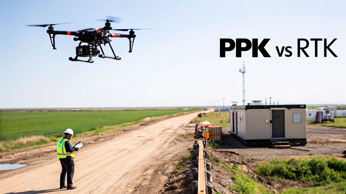
When you get down to it, the difference between PPK vs. RTK all comes down to when you correct your GPS data. With RTK (Real-Time Kinematic), corrections happen as the drone flies. PPK (Post-Processed Kinematic) waits to apply corrections until after the mission is complete. For drone pilots, that single difference can be the deciding factor between a successful survey and a total waste of time.
Understanding the Real Difference
At a practical level, the PPK vs. RTK choice is about prioritizing either immediate results or data reliability.
RTK offers the undeniable appeal of speed. It processes positional corrections in the air, feeding you centimeter-accurate data right away. This all depends on the drone maintaining a rock-solid radio or internet link to a ground base station or a CORS network. If that connection holds, it's fantastic for jobs where you need answers on the spot, like quick construction site checks.
But that absolute need for a live data link is also RTK's Achilles' heel. The biggest headache for surveyors and mappers in the field is mission failure due to signal loss. Fly into a dense forest, a deep quarry, or between tall city buildings, and that crucial connection can drop in an instant. When the link breaks, the correctional data stops, and the accuracy of your map can be ruined. More often than not, this means you’re heading back to the office to schedule an expensive re-flight.
Why PPK Offers More Reliability
This is exactly where PPK comes in as a more dependable alternative. Instead of trying to maintain a fragile real-time link, a PPK drone just records raw satellite data from the aircraft and a base station on the ground. Once the flight is over, you bring those two data logs into your office software, which then "corrects" the position of every single photo.
This simple change in workflow completely sidesteps the signal loss problem. Since there's no live link to worry about, you can confidently fly in remote areas, challenging terrain, or over long corridors. The business impact is huge: you eliminate costly re-flights and guarantee data delivery. For example, the Evolution Flight 'Phoenix' heavy-lift drone, with its robust PPK integration, directly solves this by ensuring complete data capture in challenging environments. This technical capability delivers the business outcome of mission certainty, allowing operators to confidently serve demanding clients in sectors like utilities and mining, no matter what the site throws at you.
| Feature | RTK (Real-Time Kinematic) | PPK (Post-Processed Kinematic) |
|---|---|---|
| Correction Timing | During the flight (real-time) | After the flight (post-processing) |
| Data Link | Required: Constant radio/internet link | Not Required: Operates offline |
| Workflow Speed | Faster, with immediate in-field results | Slower, requires office processing time |
| Reliability | Vulnerable to signal loss/interruption | Highly reliable, immune to in-flight signal issues |
| Best Use Case | Open areas with good connectivity | Remote, obstructed, or large-scale areas |
How PPK and RTK Technology Works
To really get a feel for the PPK vs. RTK debate, you have to look at how each one actually works in the field. The equipment you use and how the data moves from point A to point B will shape your entire workflow, your budget, and the final quality of your survey data.
The Real-Time Setup of RTK
RTK is all about correcting data on the fly. For this to work, you need a few key pieces of equipment to communicate seamlessly while the drone is in the air.
Here’s what a typical RTK mission requires:
- An RTK-Enabled Drone: The drone itself needs a specialized GNSS receiver that can process correction data as it comes in.
- A Ground Base Station: This is a stationary receiver you set up over a known point. Its job is to calculate errors from the satellite signals it's picking up.
- A Stable Data Link: This is the make-or-break component. You absolutely must have a constant radio or cellular link between the base station and the drone to send those corrections in real time.
If that live connection drops, even for a second, the drone stops getting corrections. The positional accuracy for that part of your flight is instantly compromised. This dependence on a live link is a major headache for many teams. The field setup is more complex, driving up labor costs and introducing a real risk of mission failure if the signal is lost.
For many crews, just setting up and maintaining that live link can be a huge time sink. You often need a clear line of sight between the drone and the base station, which just isn't realistic on a lot of job sites, like active construction zones or sprawling infrastructure projects.
The Simpler Field Deployment of PPK
PPK, on the other hand, makes things much simpler in the field because it gets rid of the real-time data link altogether. The focus shifts from live transmission to solid, reliable data logging.
The setup for a PPK flight is incredibly straightforward:
- A GNSS-enabled drone flies its mission, logging raw satellite data (ephemeris data) and precise photo timestamps directly to its onboard memory.
- At the same time, a ground base station sits in a fixed, known location and logs its own raw satellite data.
That’s all you have to do in the field. The drone and base station work completely independently, so you never have to worry about a connection dropping. The magic happens back at the office. Specialized software takes the RINEX files (Receiver Independent Exchange Format) from both the drone and the base station and syncs them up. This post-flight process corrects the position for every single image, giving you consistent accuracy across the whole project.
This streamlined approach directly solves the industrial pain point of operational complexity and high labor costs. The Evolution Flight 'Phoenix' heavy-lift drone, for example, is built with an integrated PPK workflow to minimize ground setup. This technical feature generates the business outcome of getting crews in the air faster, allowing them to cover large-scale infrastructure surveys more efficiently and with less risk of data gaps. This ultimately brings down labor costs and helps you hit project deadlines.
Recent industry data highlights just how important this difference is. RTK works great in wide-open areas about 85-90% of the time, but its failure rate can skyrocket to 20-30% in environments with obstructions like buildings or trees. For firms flying heavy LiDAR scanners, PPK's ability to handle baselines up to 100 km is a game-changer for oil and gas pipeline surveys in remote regions. It can reduce the need for Ground Control Points (GCPs) by 70-80%, turning hours of setup time into just a few minutes. You can find more practical insights on these operational differences from DSLRPros.
A Side-by-Side Comparison of Workflows
Understanding the high-level difference between PPK and RTK is one thing, but seeing how they play out in the field is another entirely. Your choice directly impacts everything from pre-flight planning to final data delivery, shaping your team's efficiency and the integrity of your results. For industries where data certainty is non-negotiable, a stage-by-stage comparison is essential.
This diagram gives a great visual breakdown of the two workflows. You can see how RTK depends on a live connection, while PPK separates the fieldwork from the data processing.

The key takeaway from the image is RTK's reliance on that constant data link, versus PPK's two-part approach of logging in the field and processing back at the office.
Pre-Flight Preparation
An RTK workflow is all about connectivity. Before the drone even gets in the air, you have to establish and verify a stable data link between the drone, your ground controller, and the base station or a virtual reference station (VRS) network. This means checking radio signal strength or cellular coverage across the entire survey area, which can add a surprising amount of time to your pre-flight checklist, especially on large or unfamiliar sites.
On the other hand, a PPK mission has a much simpler setup. Your main job is to place the base station over a known point and make sure it starts logging satellite data. That's it. This dramatically reduces setup complexity and is a lifesaver in remote locations where a reliable data link is just not going to happen.
In-Flight Operations
During the flight, the operational differences become even clearer. With RTK, the pilot is constantly watching the data link status. A "fixed" solution means you’re getting centimeter-accurate data. But if that signal drops for even a moment, the status switches to "float," and your positional accuracy degrades instantly. This is a major source of frustration for many operators, creating data uncertainty and the risk of an incomplete survey.
PPK completely removes this in-flight stress. The pilot can focus on what matters: flying the mission safely and making sure the entire area is covered. The drone and base station independently log their raw GNSS observations, so signal blockages from trees, buildings, or terrain have zero effect on the data you collect. This operational freedom is where PPK truly shines.
For clients in defense, security, and public safety, the pain point of incomplete or indefensible data due to signal loss is a non-starter. They need a complete dataset every time. Evolution Flight platforms, with their robust PPK workflow support, are built to address this. The technical feature of independent onboard data logging generates the business outcome of guaranteed mission-critical data integrity.
Post-Flight Data Processing
Once the drone is back on the ground, the workflows split again. An RTK mission, in theory, gives you ready-to-use, geotagged images, which is great for quick in-field validation. You can confirm you got what you needed before packing up. The catch is that any data captured during a signal loss is often useless without time-consuming and less accurate manual corrections.
A PPK workflow, however, requires a dedicated processing step back in the office. You take the raw GNSS logs from the drone and the base station and load them into specialized software. This software then calculates the precise position for every single image. While it's an extra step that delays immediate results, the tradeoff is a more robust and complete dataset.
This table breaks down the practical differences between PPK and RTK workflows, from field setup to final data quality, highlighting key considerations for drone operators.
PPK vs RTK Operational Comparison
| Operational Aspect | RTK (Real-Time Kinematic) | PPK (Post-Processed Kinematic) |
|---|---|---|
| Field Setup | Requires stable radio or cellular link between drone, base, and controller. Setup can be complex and time-consuming. | Simple setup. Place base station, start logging, and fly. No live data link needed. |
| In-Flight Reliability | Prone to signal loss ("float" solution) from obstructions, leading to gaps in high-accuracy data. | Unaffected by signal loss. Drone and base log data independently, ensuring complete data collection. |
| Pilot Workload | Pilot must constantly monitor the data link and "fix" status. High-stress in challenging environments. | Pilot focuses solely on safe flight execution and area coverage. Lower stress and cognitive load. |
| Data Availability | Geotags are available immediately after flight, allowing for quick in-field checks. | Requires a post-processing step in the office. Data is not immediately available on-site. |
| Final Data Quality | Data quality can be inconsistent, with gaps or degraded accuracy where the signal was lost. | Delivers a consistently accurate and complete dataset by processing the entire flight's observations. |
| Best For | Open terrain with excellent signal coverage; jobs requiring immediate on-site results. | Complex or remote environments; missions where data integrity and completeness are paramount. |
Ultimately, PPK's ability to create a complete and reliable dataset, even when conditions are tough, makes it a superior choice for professional operations where there's no room for error.
Take a real-world case: in dense urban canyons or forested rail corridors, RTK signal drops can happen with 25-35% frequency, degrading positions to 5-15 cm errors. PPK, by contrast, recovers to <2 cm accuracy by processing satellite data from the entire flight. Some reports have clocked PPK's operational uptime at 99% compared to RTK's 75% in tough terrain. For transport agencies modeling floods, this reliability allows wind-tolerant drones to fly BVLOS missions up to 50 km away, cutting the need for repeat flights by 60%. You can dive deeper into these performance metrics by checking out Identified Tech's analysis.
Picking the Right Tool for the Job
The textbook differences between PPK and RTK don't mean much until you're out in the field. Picking the wrong one for your project can sink your budget with bad data and force you to re-fly the entire mission—a mistake no commercial operator can afford. The right choice always comes down to the unique demands of your work, from the ground you're flying over to how fast you need to deliver the final results.
For some projects, the instant feedback from RTK is the only way to go. For others, the rock-solid reliability of PPK is a must-have.
Utilities and Corridor Mapping
If you're managing electric utilities or pipelines, your assets can stretch for hundreds of kilometers, often through some of the toughest terrain imaginable. The biggest pain point here is maintaining data integrity over long, linear missions, where signal drops aren't just a possibility—they're a certainty.
For these kinds of long, linear missions, PPK is the clear winner.
- Tough Terrain: Powerlines and pipelines don't stick to flat, open ground. They cut through dense forests, deep valleys, and rugged mountains where holding a constant RTK data link is simply impossible. PPK’s workflow sidesteps this problem entirely, as it processes the data after the flight, so you never lose a thing to a dropped signal.
- Flight Endurance: Covering long corridors means long flight times. With PPK, the pilot can concentrate on the mission itself—managing the aircraft and flying the plan—without the constant stress of babysitting a fragile data link.
This is exactly where a flexible system proves its worth. The Evolution Flight 'Recon' single-rotor UAS was built for these challenges. Its technical specification of long flight endurance combined with its ability to carry a PPK sensor directly solves the problem of covering vast distances without data loss. This generates the business outcome of complete, reliable data for critical tasks like monitoring vegetation encroachment and inspecting the right-of-way, reducing the need for multiple flights and lowering operational costs.
Mining and Earthworks
A mine site is a constantly changing environment with a wide range of survey needs. One day you might need a quick volume calculation for a stockpile, and the next you could be doing a massive baseline survey of the entire operation. The industrial pain point is having a workflow that's both fast enough for daily tasks and dependable enough for large-scale planning without having to own multiple, separate systems.
When it comes to daily stockpile measurements in an open-pit mine, RTK is king. Its real-time data gives mine managers immediate volume calculations, which helps them make quick decisions about moving material and keeping production on track. The wide-open space of a pit usually gives you the clean line-of-sight needed for a stable RTK connection.
But when it's time for a large-scale baseline survey or an exploration mapping project, PPK becomes the go-to. These missions often cover huge, undeveloped areas where setting up a reliable RTK connection just isn't practical. The Evolution Flight 'Recon' features a modular payload system allowing it to be easily swapped between RTK and PPK setups. This technical capability solves the pain point by generating the business outcome of maximum asset utilization; you can use the same drone for both rapid daily checks and critical long-term surveys, increasing your return on investment.
Emergency Response and Public Safety
When disaster strikes, getting information quickly can save lives and kickstart recovery efforts. In these high-stakes situations, a hybrid approach using both RTK and PPK often delivers the best results. Real-world events have shown just how powerful combining the two can be.
For example, after Hurricane Ian hit in 2022, first responders used RTK to get a fast, real-time map of about 80% of the damage zones, which helped guide immediate rescue and relief teams. Later, they used PPK to process the data to survey-grade accuracy for insurance claims, which reportedly cut claim disputes by 40%. This kind of blended workflow is the future of drone operations. As detailed in drone industry analysis, workflows that mix both methods can hit 99.5% accuracy and are on track to become standard for enterprise drone work. You can get more insights on how these blended workflows deliver top-tier results on Drone Nerds.
This really underscores the value of having a system that can do both. The pain point for public safety is the need for both immediate situational awareness and post-event analytical data. The Evolution Flight 'Recon', with its hybrid RTK/PPK capability and long endurance, addresses this directly. This feature allows it to use RTK for quick initial damage assessment, then switch to PPK for persistent, large-area missions. The business outcome is a 25% reduction in operational costs by cutting the number of flights needed to get the complete picture.
Combining RTK and PPK for Maximum Reliability
Thinking about PPK vs RTK as a choice between one or the other is a common misconception. In reality, the best approach for professional operators is a hybrid workflow that uses both. This gives you the on-the-spot benefits of RTK with the complete data backup of PPK, creating the perfect safety net for any mission.
Here’s how it works: You fly your mission with RTK turned on, which allows for real-time position checks and gives you a good sense of data quality right there in the field. At the same time, the drone is logging all the raw GNSS data needed for a full PPK run. This dual approach is the best way to tackle one of the biggest risks in our industry: total mission failure due to data gaps.

Creating a Mission-Proof Workflow
Let's put this into a real-world context. Say you're mapping a critical infrastructure corridor. Re-flights are off the table because the schedule is tight and the costs are high. Using a hybrid workflow, you get the confidence of seeing that live "RTK fix" status as the drone flies. But what happens when the signal inevitably drops because of trees, buildings, or hilly terrain?
With a hybrid system, a dropped link is no big deal. The mission continues without a hitch. Because the drone was also logging raw satellite data, you simply switch to a PPK workflow back at the office. You can then process the entire flight's data, fill in any gaps where the RTK signal was lost, and still deliver a perfectly accurate final dataset.
This hybrid capability provides a business outcome of 100% data assurance. It gives you complete peace of mind on high-stakes jobs, ensuring a temporary signal loss doesn't turn into a catastrophic loss of time, money, and your client's trust.
The Evolution Flight Advantage in Hybrid Operations
This kind of operational resilience isn't just a software trick; it has to be built into the drone system from the ground up. The industrial pain point here is the risk of mission failure on high-stakes jobs. At Evolution Flight, our advanced systems like the Evolution Flight 'Nova' heavy-lift multi-rotor are designed specifically to solve this with a powerful hybrid capability.
The 'Nova's technical specification is its seamless integration of hardware and software to run both RTK and PPK processes simultaneously. For operators, this directly generates critical business outcomes:
- Eliminates Re-flights: By ensuring all data is captured and can be corrected, this feature generates the business outcome of avoiding expensive and time-consuming re-flights due to signal loss.
- Maximizes Field Efficiency: You get the speed and on-site feedback of RTK without giving up the bulletproof data integrity of PPK. Every minute in the field counts, and this makes it more productive.
- Ensures Operational Resilience: For emergency response or critical infrastructure inspections, this feature means you can fly in challenging environments with the confidence that you'll get the data you need, no matter what.
By combining the strengths of both RTK and PPK, you no longer have to choose between speed and reliability. This modern approach gives you both, making sure every flight is a success. If you'd like to dive deeper into how different correction methods work, DroneDeploy offers an excellent guide on GPS correction technologies.
Making the Right Investment for Your Business
Picking between PPK and RTK goes way beyond the technical specs. It's a business decision that will directly affect your efficiency, the reliability of your data, and your bottom line. The conversation isn't about which one is "better" in a vacuum, but which one is the right tool for your specific job.
Making the wrong choice can lead to blown budgets, missed deadlines, and data you can't trust. It's a common headache in our industry we call investment uncertainty.
The best method really comes down to the conditions you face on a project. Do you need answers right away in a wide-open field? Or is your top priority getting bulletproof data in a tricky environment? How you answer questions about the project's scale, terrain, connectivity, and deadlines will point you to the right solution.
From Technology to Business Outcomes
A drone is just one piece of the puzzle. The real value comes from a complete, integrated system where the aircraft, the sensor, and the workflow all fit together to meet your business needs. This is where specialized experience really counts. You're not just buying a drone; you're investing in a capability that delivers a specific result.
Choosing the right system isn't just about the tech specs. It's about solving an operational problem. For a utility company, that problem is keeping the grid reliable. For a surveyor, it's delivering legally defensible data on time and on budget. The right investment is the one that achieves that business outcome.
At Evolution Flight, our expertise is in putting these complete solutions together. We get in the trenches with businesses to understand their unique operational hurdles and then build a system to overcome them. For instance, a firm that needs to map a high-resolution corridor through a remote, forested area is facing the industrial pain point of data gaps caused by signal loss during long-range missions.
For that kind of job, we would build a system around the Evolution Flight 'Helios-L' LiDAR survey drone. The technical specification of this platform is its long-endurance airframe combined with a high-performance PPK workflow. This directly solves the client's problem and generates a clear business outcome: guaranteed 100% data capture on every flight, which eliminates costly re-work and ensures a profitable project.
This hands-on approach makes sure your investment pays off right away. By matching the right drone with the best workflow, we help you get past the "PPK vs RTK" debate and start focusing on hitting your core business goals.
A Few Common Questions About PPK and RTK
As you get deeper into high-precision drone surveying, a few questions always seem to pop up about PPK and RTK. Let's tackle some of the most common ones I hear from professionals in the field.
Is PPK Always More Accurate Than RTK?
Not always, but it's almost always more reliable. Think of it this way: under perfect conditions, both methods can get you that sought-after centimeter-level accuracy. The real world, however, is rarely perfect.
PPK's main advantage is its resilience. Since all the correction calculations happen after the flight is done, it doesn't care about the temporary signal dropouts that plague RTK in the real world. An RTK system, on the other hand, starts producing lower-quality data the second its radio or cellular link to the base station flickers.
Can I Do PPK Without a Base Station?
That's a hard no. You absolutely need a base station for any serious PPK or RTK work. The base station sits on a known point on the ground, logging the same satellite signals as the drone at the exact same time. This ground data is the "truth" you need to correct the drone's position.
While you might hear about using data from a CORS network (a grid of continuously operating reference stations), setting up your own base station on-site is the gold standard for controlling your accuracy.
What Happens If My RTK Signal Drops During a Mission?
This is the classic RTK headache and a major industrial pain point: the risk of data gaps rendering a survey useless. When the signal drops, your receiver goes from a "fixed" solution (your good, centimeter-level data) to a "float" or "autonomous" one. Accuracy immediately plummets, sometimes to several meters. This leaves you with big holes in your high-precision dataset.
This is exactly why smart operators use a hybrid approach. A top-tier system like the Evolution Flight 'Nova' heavy-lift multi-rotor has a technical specification of simultaneous RTK and PPK data logging. This means if the RTK link drops, it doesn’t matter—you have a complete PPK dataset ready as a fallback. The business outcome is 100% data integrity, which saves you from the massive expense and schedule delays of a re-flight. You get RTK's real-time confidence with PPK's bulletproof reliability.
How Much Time Does Post-Processing Add to a PPK Workflow?
You should budget an extra 15 to 60 minutes for post-processing, depending on the length of your flight and the software you're using. The process is pretty straightforward: you download the RINEX files from your drone and base station and feed them into your processing software. The software then crunches the numbers and outputs corrected geotags for all your images.
So, no, you don't get the instant results in the field that RTK provides. But for that small time investment, you get a dataset that's almost guaranteed to be solid and consistently accurate. For most survey-grade work, that trade-off is well worth it.
Ready to find the right high-precision drone solution for your business? The team at Evolution Flight specializes in configuring complete systems that match the right drone, sensor, and workflow to your unique operational challenges. Visit us at https://evolutionflight.com to discuss your project needs.