
If you're an Australian business looking for a UAV for sale, you'll quickly realise the market is filled with industrial-grade tools that are worlds apart from the drones you see in a hobby shop. The real key isn't just buying a drone; it's about investing in a complete aerial data solution that genuinely improves how you work and delivers a measurable return.
Finding the Right Enterprise UAV in Australia
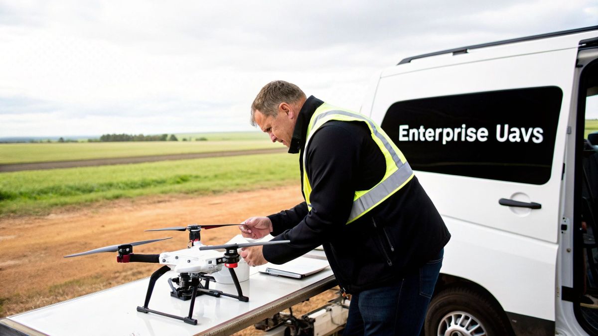
Trying to make sense of the commercial drone market can feel like a huge task. Let's cut through the confusion. This guide is your roadmap to understanding industrial UAVs, where choosing the right system is a serious investment in your operational muscle. Think of it less like buying a product off the shelf and more like acquiring a powerful, specialised tool built for tough Aussie conditions.
The numbers back this up. Australia's commercial drone market is already valued at around USD 1,051.3 million in 2024. It's expected to more than double to a staggering USD 2,708.5 million by 2030, showing just how fast local industries are adopting this technology. You can dig deeper into this market growth with industry analysis from Grand View Research.
A Mission-First Approach to Procurement
Before you even look at a single drone model, stop and ask the most important question: what do we actually need this thing to do? A smart procurement plan always starts with the mission, not the machine. Get this right, and every other decision you make will line up perfectly with your business objectives.
We'll break down everything you need to know, from getting your head around the Civil Aviation Safety Authority’s (CASA) rules to picking the right drone and sensor package for the job. Thinking "mission-first" brings immediate clarity to your requirements. For example, are you focused on:
- Precision Agriculture: Needing to check on crop health, manage irrigation, or even keep an eye on livestock from the air?
- Asset Inspection: Tasked with safely inspecting power lines, wind turbines, bridges, or other vital infrastructure without putting people at risk?
- Large-Scale Surveying: Required to generate highly detailed topographical maps for mining, construction, or land development?
When you focus on the problem you're solving, you can ignore the marketing hype and pinpoint the platforms that will actually deliver value. The goal is to acquire a new capability, not just a new piece of hardware.
Your Strategic Framework for Success
By the time you finish this guide, you’ll have a clear framework to confidently choose a UAV that provides a solid return on investment and ticks every box for Australian compliance. We'll walk through the essentials of enterprise drone operations, giving you the knowledge to make a smart, informed decision. This guide is designed to empower your team to invest in an aerial solution that becomes a core part of your day-to-day workflow.
Getting to Grips with Australian Drone Laws and CASA Rules
Before you even start looking at drones for sale in Australia, you need to understand the rules of the sky. Getting your head around the regulations set by the Civil Aviation Safety Authority (CASA) isn't just about ticking boxes; it's the bedrock of a safe, legal, and successful drone program.
Think of it like getting your driver's licence before buying a car. You wouldn't hit the road without knowing the rules, and the same goes for putting a high-value asset into the air.
The first thing to realise is that flying a drone for your business is a completely different ball game to flying one for fun. CASA has a clear framework for commercial operations to keep our shared airspace safe. Trying to sidestep these rules is a fast track to hefty fines and can ground your entire operation before it even gets going.
Your Pathway to Flying Commercially
For most businesses, there are two main ways to get airborne legally. The path you choose really comes down to how complex your missions are and the size of the drone you need.
-
The Excluded Category: This is the simplest starting point, designed for very low-risk jobs. It lets you fly a drone under 2kg for commercial work without needing a full operator's certificate, but you have to stick to a strict set of standard operating conditions.
-
Remotely Piloted Aircraft Operator's Certificate (ReOC): This is the professional standard for any serious enterprise drone program. A ReOC is your organisation's licence to fly, opening up far more complex and valuable missions.
A ReOC is more than just a piece of paper. It’s a signal to clients and regulators that you're committed to professional safety and operational standards. It gives your business the green light to fly heavier drones, operate closer to people, and apply for special approvals like flying at night or beyond the pilot’s line of sight.
Holding a ReOC shows you've got a proper safety management system in place. It's the key that unlocks the true potential of your investment in drone technology.
Pilot Licences and Drone Registration
It's not just about the business certification; your pilots and the drones themselves have their own requirements. Think of it as three layers of compliance that all work together.
Remote Pilot Licence (RePL)
Anyone flying for a ReOC holder needs their own Remote Pilot Licence. This is the individual pilot’s qualification, proving they have the theory and the practical skills to fly safely. It's a CASA-issued licence that covers everything from flight planning and aeronautical knowledge to handling emergencies.
Drone Registration
This one's simple but non-negotiable: every drone flown for commercial purposes in Australia, no matter its weight, must be registered with CASA. It’s a quick online process that links the drone to your business. Registration is free and ensures every commercial drone in the sky is accounted for—a critical part of keeping our airspace safe.
VLOS vs BVLOS: Seeing is Believing
Finally, you'll need to know the difference between Visual Line of Sight (VLOS) and Beyond Visual Line of Sight (BVLOS) operations.
-
VLOS (Visual Line of Sight): This is the standard for most drone flights. The pilot has to be able to see the drone with their own eyes the entire time, without binoculars, to keep track of it and steer clear of hazards.
-
BVLOS (Beyond Visual Line of Sight): This is the advanced stuff. It's where the drone flies beyond the pilot’s visual range, enabling massive jobs like inspecting hundreds of kilometres of pipeline or surveying vast farming properties. Getting approval for BVLOS work requires a rock-solid safety case, advanced technology, and specific CASA approvals.
Starting out with a clear understanding of these CASA rules means you're building your drone program on a solid, professional, and fully compliant foundation from day one.
Matching the Drone Platform to Your Mission
When you're looking to buy a UAV in Australia, the goal isn't to find the 'best' drone on the market. It's about finding the right drone for the job you need to get done.
Think of it like buying a work vehicle. You wouldn't show up to a construction site with a sports car to haul timber, and you wouldn't use a massive ute for a quick trip to the city. Both are great at what they do, but they're built for entirely different purposes. The same logic is crucial when selecting an enterprise drone.
Your choice between the three main platform types—multi-rotor, fixed-wing, and hybrid VTOL—will directly shape your operational efficiency, the quality of your data, and your overall return on investment. Let's break down which one fits your needs.
The Agile Multi-Rotor: For Hovering and Close Inspection
When most people picture a commercial drone, they're thinking of a multi-rotor like a quadcopter or an octocopter. These are the workhorses for any task that needs pinpoint precision, hovering, and close-up data capture. Their ability to take off and land vertically, often in tight spots, makes them incredibly versatile.
Need to inspect the blades of a wind turbine or get a detailed look under a bridge? A multi-rotor can get right up close, hold its position steady against the wind, and capture high-resolution imagery. This makes them the go-to choice for:
- Asset Inspection: Getting clear visuals of power lines, mobile phone towers, and building facades.
- Small-Scale Mapping: Creating detailed 3D models of construction sites or small land parcels.
- Public Safety: Providing crucial overwatch and situational awareness in emergency situations.
The trade-off? Flight time. All that power needed to hover means most enterprise multi-rotors have a flight endurance of around 30 to 45 minutes. That's perfect for targeted jobs, but not so efficient for covering huge areas.
The Efficient Fixed-Wing: For Mapping Large Areas
For missions that demand endurance and covering massive distances, the fixed-wing drone is the undisputed champion. Designed like a traditional aeroplane, these drones are built for efficient forward flight, letting them stay airborne for hours at a time.
Imagine you need to survey a 500-hectare farm to create a crop health map. A fixed-wing drone can cover that entire area in a single flight—a task that would require a multi-rotor to land for numerous battery swaps, costing you significant time and effort.
A fixed-wing drone trades the ability to hover for exceptional endurance and speed. This design makes it the ideal platform for large-scale aerial surveying, agricultural analysis, and mapping linear infrastructure like pipelines or rail corridors.
The one major catch is take-off and landing. They typically need a runway or a catapult to get airborne and a clear, open space for a belly landing, which can be a real challenge in rough or confined terrain.
The Hybrid VTOL: The Best of Both Worlds
A new class of drone is quickly becoming a favourite in the Australian market: the hybrid VTOL (Vertical Take-Off and Landing). These clever platforms combine the best features of both multi-rotor and fixed-wing designs. They use propellers to take off and land vertically like a helicopter, then transition into efficient forward flight like an aeroplane.
This powerful combination is a leading reason why the hybrid market is booming. With projected growth at 26.4% CAGR from 2024 to 2032, these systems solve the biggest pain points by offering longer flight times without sacrificing operational flexibility. You can dive deeper into this trend in the latest Australia drones market research.
This simple flowchart shows how a drone's weight is a key starting point for understanding Australian compliance.
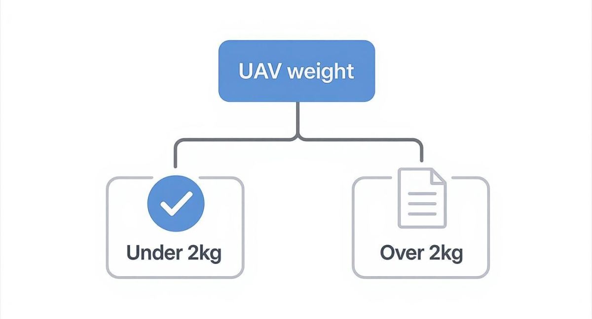
As you can see, drones over 2kg immediately fall under more stringent regulations, which is another critical factor that will influence your platform choice from the very beginning.
To help you decide, here's a quick comparison of how these platforms stack up against each other for different business needs.
Comparison of Enterprise UAV Platforms
| Platform Type | Key Advantage | Typical Flight Time | Payload Capacity | Best For |
|---|---|---|---|---|
| Multi-Rotor | Precision hovering & VTOL in tight spaces | 25-45 minutes | Low to Medium | Close-up inspections, small-site 3D modelling, public safety overwatch. |
| Fixed-Wing | Extreme endurance & large area coverage | 1-3+ hours | Low to Medium | Large-scale mapping, agriculture, linear infrastructure monitoring (pipelines, railways). |
| Hybrid VTOL | Combines VTOL flexibility with fixed-wing endurance | 1-2+ hours | Medium to High | Surveying in complex terrain, long-range inspection, large-area mapping without runways. |
Ultimately, taking the time to match the right platform to your specific mission is the first and most important step towards ensuring your drone program is a success.
Choosing The Right Tools for The Job: Payloads and Sensors
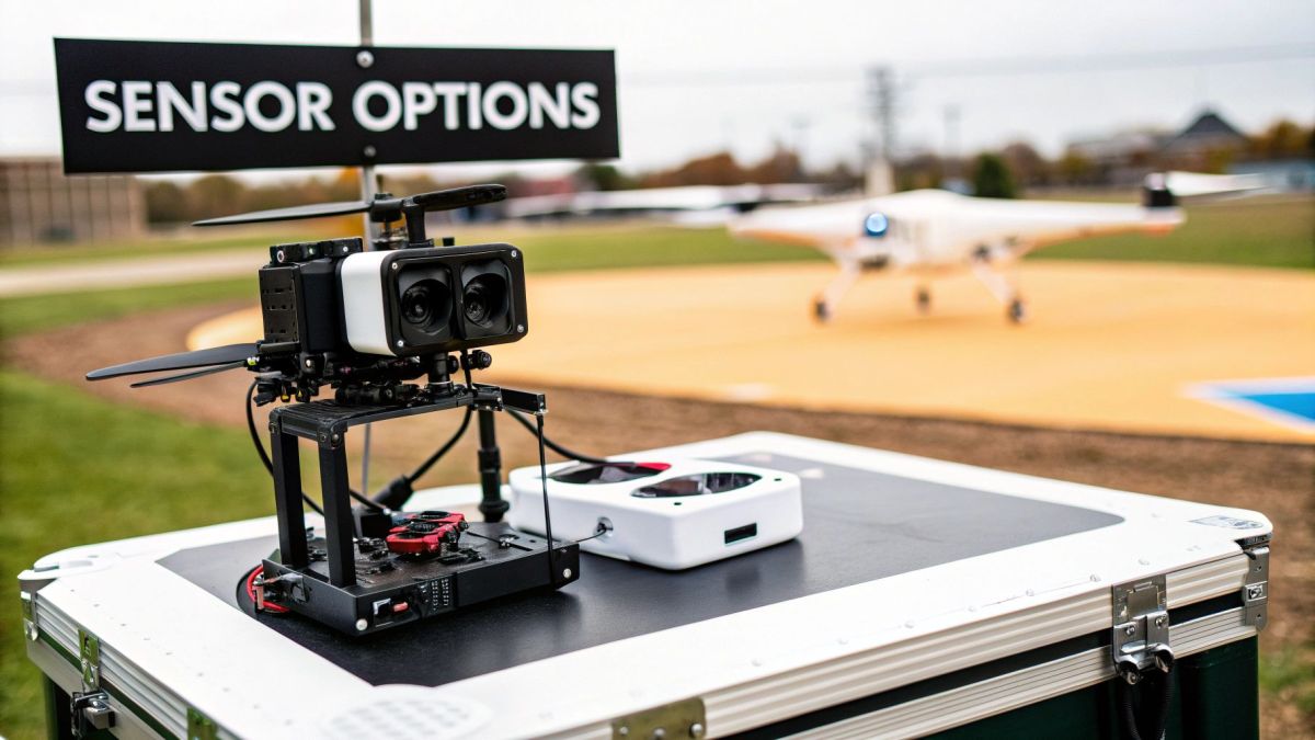
A drone is really just a sophisticated flying platform. The real magic, and the reason you're investing in one, lies in the payload it carries. Think of the drone as a high-tech work ute. The ute gets you to the job site, but it's the specialised tools in the back that actually get the work done.
For any enterprise looking at a UAV for sale in Australia, choosing the right sensor is just as vital as picking the aircraft itself. This payload is what captures the data your business needs to make smarter decisions, improve safety, and become more efficient. Let’s look at the most common options and what they actually do on the ground.
RGB Cameras for Photogrammetry
This is your workhorse sensor and the foundation for countless aerial data jobs. An RGB (Red, Green, Blue) camera is essentially a very powerful digital camera, but its job is far more than just taking pretty pictures.
When used for photogrammetry, the drone flies a precise, automated grid pattern over a site, snapping hundreds or even thousands of overlapping images. Specialised software then gets to work, stitching all these photos together to create incredibly detailed and measurable digital assets.
This technology is the backbone for:
- Creating 3D Models: Think digital twins of construction sites, infrastructure, or buildings that you can measure and inspect from your desk.
- Orthomosaic Maps: A single, massive, high-resolution image of a large area that’s been corrected to be perfectly map-accurate.
- Volumetric Calculations: Need to know exactly how much material is in that stockpile? Photogrammetry provides accurate volume measurements for mining and civil works.
Thermal Imaging Cameras
Thermal sensors don't see visible light; they see heat. This allows you to spot things completely invisible to the naked eye, making them a game-changer for inspections and public safety.
Imagine trying to find one faulty panel in a massive solar farm. A thermal camera can fly over the entire array and instantly flag an overheating cell that points to a malfunction. The same idea applies to finding heat leaks in buildings, identifying failing components on electrical infrastructure, or even finding a missing person in a search and rescue operation.
Multispectral Sensors for Agriculture
While a standard RGB camera sees the world like we do, a multispectral sensor sees much more. It captures data from specific bands of light right across the electromagnetic spectrum, including parts we can't see, like near-infrared.
Why is this so useful? Healthy plants reflect light differently from stressed or diseased ones. A multispectral sensor can pick up on these tiny changes in reflection long before any problem becomes visible to the human eye. For an Aussie farmer, this means they can:
- Catch pest infestations before they spread.
- Pinpoint exactly which parts of a field need more water.
- Apply fertiliser with precision, saving money and reducing environmental runoff.
Essentially, this sensor gives you a detailed crop health map, swapping guesswork for data-driven farming.
A drone's sensor is its superpower. Whether it’s seeing heat, analysing light beyond our vision, or mapping the world in 3D, the payload is what transforms the aircraft from a flying machine into a powerful business intelligence tool.
LiDAR for Unmatched Precision
When you need the absolute highest level of accuracy, you need LiDAR. Standing for Light Detection and Ranging, it’s the gold standard for creating ultra-precise 3D maps. It works by firing out thousands of laser pulses every second and measuring the time it takes for them to bounce back.
The real ace up LiDAR’s sleeve is its ability to punch through vegetation. Where a camera only sees the top of a tree canopy, LiDAR pulses find the gaps between the leaves to map the true ground level underneath. This is absolutely critical for creating accurate terrain models in vegetated areas, like planning a new road through dense bushland or conducting flood modelling.
For a Pilbara mine, LiDAR is perfect for creating repeatable, highly accurate stockpile measurements, regardless of dust or tricky lighting. When you’re working with advanced sensors like LiDAR, processing the data correctly is key. You can learn more about how LiDAR annotation for autonomous systems is used to turn that raw data into intelligence. It’s this level of precision that makes LiDAR the go-to for high-stakes surveying and engineering projects.
Evaluating What Really Matters: Performance and Safety in the Field
When you start browsing for commercial drones in Australia, the spec sheets can throw a lot of impressive numbers at you. But a drone's true worth isn't found in a lab; it's proven out in the field, under the tough conditions Australia is known for. It’s crucial to look past the marketing hype and dig into the core performance and safety systems that will protect your investment and make sure your missions actually get done.
Think of it like buying a 4×4 for remote work. The brochure might boast about its engine size, but you’re really interested in its fuel range on a long haul, its ground clearance on rough outback tracks, and whether it’ll start every time. That same practical mindset is exactly what you need here.
Real-World Endurance and Environmental Toughness
The first thing to get real about is flight endurance. A manufacturer might claim a 50-minute flight time, but that number is almost always recorded in perfect, windless conditions with nothing attached. The second you clip on a heavy LiDAR scanner and fly into a coastal headwind, that impressive figure can plummet. You need to ask vendors for the numbers that matter: endurance data under the payload weights you'll actually be using.
Just as critical is the drone's ability to handle the elements, which is spelled out in its Ingress Protection (IP) rating. This simple two-digit code tells you exactly how sealed the drone is against solids (like dust) and liquids (like rain).
- First Digit (Solids): A rating of 5 means it’s dust-protected, which is essential for dusty mine sites or agricultural work. A 6 means it’s completely dust-tight.
- Second Digit (Liquids): A rating of 4 can handle water splashes from any direction. A 5 can withstand low-pressure water jets, meaning it won’t quit on you in light to moderate rain.
For a drone that’s going to work reliably anywhere from the dusty Pilbara to the drizzly Tasmanian highlands, look for an IP rating of IP54 or higher. It’s a solid benchmark for a genuine workhorse.
The Non-Negotiables: Safety and Security Systems
Performance is one thing, but an enterprise drone absolutely must have multiple layers of safety baked in. These aren't just nice-to-have features; they are the fundamental systems that prevent catastrophic failures and give you the confidence to operate around valuable assets and critical infrastructure.
At the top of this list is redundancy. A single point of failure on any aircraft is a recipe for disaster, and drones are no exception. This is where professional-grade platforms really separate themselves from the pack.
Redundancy is simply your drone’s built-in backup plan. It means critical components are duplicated, so if one fails, another instantly takes over. This allows the pilot to bring the aircraft home safely instead of watching it drop out of the sky.
Key redundancies you should insist on include:
- Dual Batteries: If one battery suddenly fails, the other has enough power to get the drone on the ground in one piece.
- Dual IMUs and Compasses: The Inertial Measurement Unit (IMU) is the drone's inner ear, managing balance and orientation. A backup prevents a total system failure if the main one glitches.
On top of that, a solid geofencing system is non-negotiable for staying compliant. This feature uses GPS to create virtual fences, stopping the drone from accidentally drifting into restricted airspace near airports or over populated areas. Think of it as an automated safety net that helps you stick to CASA regulations.
Finally, you need to be sure you're the only one in control. Insist on a secure, encrypted command-and-control link to prevent signal hijacking or interference. It’s the only way to guarantee you always have total control over your asset.
Your Australian UAV Procurement Checklist
Buying a high-value enterprise drone isn't like buying a new ute. It's a serious business investment, and getting it right means thinking about the entire solution, not just the hardware in a box. This checklist is designed to pull everything we've talked about into a practical plan, making sure the drone you choose is ready to work for you from day one.
Think of it as your pre-flight check before you spend a single dollar. Run through these steps, and you’ll be confident you've covered all your bases, from what you need it to do, to who’s going to fix it when things go wrong.
Step 1: Define Your Core Mission and Data Needs
Before you even glance at a drone catalogue, you need to be crystal clear on what you're trying to achieve. The job dictates the tool, not the other way around. Be brutally specific.
- What's the main goal? Are you mapping vast stretches of land for topographic surveys, getting up close and personal with infrastructure for inspections, or checking crop health from above?
- What's the final product? Do you need to deliver centimetre-perfect 3D models to a client, generate detailed thermal reports, or create multispectral maps to guide precision agriculture?
- Where will it be flying? The dusty heat of the Pilbara presents very different challenges to the gusty coastlines of Victoria or the humid, dense bush of Far North Queensland.
Step 2: Calculate Total Cost of Ownership and ROI
A smart procurement decision goes way beyond the initial purchase price. The real cost of a drone program includes everything you need to keep it running safely and effectively for years to come.
The sticker price is just the beginning. A realistic budget has to include pilot training, insurance, software subscriptions, routine maintenance, and inevitable repairs. This is your total cost of ownership (TCO), and it's the only number that matters when calculating your return on investment.
To figure out the ROI, you need to put a dollar value on the benefits. Will a drone slash inspection downtime by 50%? Can it cut survey costs by keeping your team out of hazardous, hard-to-reach areas? Quantify these efficiency gains and safety improvements to build your business case.
Step 3: Vet Vendors and Verify Local Support
The company you buy from is just as critical as the drone itself. You absolutely need an Australian-based partner who gets our unique conditions and knows CASA regulations inside and out. Don't be shy—ask them the hard questions.
- Do you provide local, in-person training that’s certified by CASA?
- What’s your process for maintenance and repairs? Crucially, what are your average turnaround times?
- Can I get a real person on the phone for technical support during Australian business hours?
To dig even deeper into vetting any major business investment, it's wise to use a comprehensive due diligence checklist to make sure you cover all your bases.
Step 4: Arrange a Meaningful Field Demonstration
This is the final, non-negotiable step. Never, ever buy an enterprise UAV without seeing it fly in a real-world scenario that looks just like yours. A simple flight in a flat, open field tells you nothing. You need to push the platform and see if it can handle what you’ll throw at it.
If you can, get the vendor to run a demo on one of your actual project sites. This is the ultimate test. You'll see how the drone copes with local wind conditions and how its sensors perform on your real-world assets. It’s the final confirmation that the system can actually deliver the data your business depends on.
The growth here is undeniable. Australian agriculture is expected to see around 500,000 drone flights a year for crop management alone, while environmental monitoring is set to top 3.5 million flights. You can learn more about the expanding Australian UAV market and see just how widespread this technology is becoming.
A Few Common Questions
Diving into the world of enterprise drones can feel a bit overwhelming, and it's natural to have questions before making a big investment. Here are some of the most common things we get asked by Australian businesses, with straight-to-the-point answers to help you on your way.
How Much Should We Budget for an Enterprise UAV in Australia?
This is a classic "how long is a piece of string" question, as the cost depends entirely on what you need the drone to do. You might see entry-level commercial drones for around $5,000, but for serious surveying or heavy-duty inspection work, you're realistically looking at a range between $20,000 and well over $100,000.
It's crucial to remember that you're not just buying a drone. A complete enterprise package will also include specialised payloads (like LiDAR or thermal sensors), the software needed to process all that data, and CASA-certified pilot training. When you're working out your budget, think about the total cost of getting operational, not just the sticker price of the aircraft.
Do We Really Need a Licence to Fly a Commercial Drone in Australia?
For almost any professional application in Australia, the answer is a firm yes. Your pilots will need a Remote Pilot Licence (RePL), and your business must have a Remotely Piloted Aircraft Operator's Certificate (ReOC) issued by CASA. Think of these as the absolute bedrock of a legal, safe, and professional drone program.
There's a narrow 'Excluded Category' for tiny drones doing very simple tasks, but a ReOC is the true professional standard. It shows you’re serious about safety and compliance, and it opens the door to much more valuable and complex work.
A ReOC is your company's official licence to operate. It's what allows you to fly heavier drones, work closer to people, and apply for advanced permissions like Beyond Visual Line of Sight (BVLOS) flights. For any serious enterprise, it's non-negotiable.
What Kind of Training and Support Should a Good Vendor Offer?
A good Australian supplier won't just sell you a drone in a box and walk away. They should be a partner, providing a complete solution to get you up and running successfully. You should be looking for a vendor that provides:
- CASA-certified pilot training to get your team their RePL.
- Hands-on operational training on the specific drone you’ve bought, so your pilots are confident and competent with it from day one.
- Ongoing help with data processing software and fitting the drone into your existing workflows.
The most important thing? Make sure they offer local technical support, repairs, and maintenance. When something goes wrong—and eventually, it will—having fast, onshore support is the key to minimising downtime. An expert you can call locally is worth their weight in gold.
Can We Just Fly the Drone Wherever We Need to for a Job?
No, you can't. Australian airspace is carefully regulated to keep everyone safe. Commercial drone operators face strict rules, especially when flying near major airports, over towns and cities, or in any controlled airspace. Getting the right approvals from CASA is essential.
A huge part of holding a ReOC is learning how to plan your missions properly. This involves using official tools like CASA's 'OpenSky' app to check airspace restrictions and completing a detailed risk assessment before every single flight. It’s this discipline that ensures your operations are both safe and 100% compliant.
Ready to integrate a high-performance, Australian-supported UAV into your operations? At Innoflight International, we provide enterprise-grade drone solutions with the local training and support you need to succeed. Request a quote today to find the perfect platform for your mission.