
Ever wondered how those incredibly detailed, top-down views of construction sites or sprawling farmlands are created? You’re likely looking at the work of a UAV mapping drone.
Think of it as a surveyor in the sky. Instead of a team on the ground with tripods and measuring tools, these Unmanned Aerial Vehicles fly planned routes, capturing massive amounts of geographic data with pinpoint accuracy. This process creates a detailed digital twin of the landscape below.
What Is a UAV Mapping Drone

It’s easy to mistake a mapping drone for just a fancy flying camera, but it’s much more than that. It’s a complete data-gathering system. The drone flies autonomously along a pre-set flight path, or “mission,” methodically snapping hundreds—sometimes thousands—of overlapping photos or collecting sensor data from above.
The real magic, however, happens after the drone lands. Powerful software takes all that raw information and stitches it together. This isn’t like making a simple photo collage; it’s a complex process that transforms countless individual data points into unified, measurable, and highly accurate digital models. It’s like putting together a giant, geographically perfect 3D puzzle from the air.
Key Outputs from Mapping Drones
All that data collected by a UAV mapping drone gets processed into a few key outputs. Each one offers a different perspective, turning raw aerial information into practical insights for industries like construction, agriculture, and mining.
- Orthomosaic Maps: These are high-resolution, geographically accurate aerial maps. Unlike a regular photo taken from the sky, an orthomosaic has been corrected for distortion, meaning the scale is uniform across the entire image. You can take real measurements directly from it.
- Digital Elevation Models (DEMs): A DEM gives you a “bare-earth” view of the terrain. It digitally removes all the trees, buildings, and other surface features to show you the true shape of the ground underneath. It’s essential for understanding things like land contours and how water will flow.
- 3D Point Clouds: This is a huge collection of tiny data points, each with its own set of 3D coordinates. Together, they form an incredibly detailed digital replica of a site, capturing everything from buildings and vegetation to stockpiles and ground features with stunning precision.
By pairing automated flight with sophisticated data processing, a UAV mapping drone can pack what used to be weeks of manual survey work into just a few hours of flight time, all while delivering more comprehensive and accurate data.
Ultimately, this technology gives professionals a way to see their projects and environments with a level of detail and clarity that was once unimaginable.
The Tech That Gives Drones Their Mapping Superpowers
A UAV mapping drone isn’t just a fancy remote-controlled aircraft; it’s a high-tech data-gathering machine. At its heart are one of two “seeing” technologies that allow it to map the world from above: Photogrammetry and LiDAR. Each one builds incredibly accurate digital replicas of the physical world, but they get there in completely different ways.
Figuring out which one is right for you is the key to a successful project. Think of it like this: one is a master artist painting a lifelike portrait, while the other is a sculptor meticulously measuring every single curve and edge.
Photogrammetry Explained
At its core, photogrammetry is the science of making measurements from pictures. A drone will fly a precise pattern over an area, taking thousands of overlapping photos from slightly different angles. Back at the office, specialised software sifts through these images, finds common points between them, and uses some clever maths to work out their exact position in 3D space.
It’s a bit like assembling a massive, complex digital jigsaw puzzle. By piecing all those overlapping perspectives together, the software can reconstruct the entire scene into a photorealistic 3D model, complete with all the original colours and textures. This makes it a fantastic option when visual detail is king, like tracking progress on a construction site or creating stunning visuals for a real estate listing.
The Power of LiDAR
LiDAR, which is short for Light Detection and Ranging, takes a totally different approach. Instead of a camera, a LiDAR-equipped drone carries a sensor that fires out thousands of laser pulses every single second. It then measures the precise time it takes for each of those pulses to hit an object and bounce back.
You can think of it like a bat using echolocation to find its way around in the dark. But instead of sound, the drone uses rapid pulses of light to “see” and map its environment with pinpoint accuracy. The great thing about this method is that it doesn’t care about shadows or bad lighting.
LiDAR’s real trump card is its ability to see through vegetation. While some laser pulses hit the top of the tree canopy, others will find tiny gaps and make it all the way to the ground. This allows it to map the true ground level, even in a thick forest—a game-changer for jobs like forestry management or flood plain analysis.
Photogrammetry vs LiDAR Key Differences
So, which one should you choose? It all comes down to the specifics of your job. One gives you a beautiful, true-to-life picture, while the other delivers unmatched measurement accuracy, especially in tricky environments.
This table breaks down the main differences.
| Feature | Photogrammetry | LiDAR |
|---|---|---|
| Data Type | Creates visually rich, textured 3D models and orthomosaic maps from images. | Produces a dense “point cloud” of precise 3D coordinate measurements. |
| Best For | Visual inspections, construction site monitoring, and creating realistic models. | Mapping vegetated areas, powerline corridors, and when high accuracy is essential. |
| Limitations | Struggles with uniform surfaces (like snow) and can be affected by shadows. | Data is less visually intuitive and sensors are typically more expensive. |
| Output | High-resolution aerial maps and colourful, textured 3D models. | Extremely accurate digital elevation models and bare-earth terrain maps. |
Ultimately, both technologies are what turn a drone into a serious mapping tool. The simplest way to remember it is that photogrammetry shows you what the world looks like, while LiDAR tells you precisely what it is.
How Industries Are Using UAV Mapping Drones
Technical specs are one thing, but the real value of a UAV mapping drone comes to life out in the field. Across Australia, all sorts of industries are ditching old-school methods for aerial mapping to get projects done faster, safer, and with a whole new level of insight. This tech isn’t just for specialists anymore; it’s becoming a core tool for managing modern projects.
Whether it’s a massive farm or a bustling construction site, these drones are completely changing how work gets done. They deliver an incredible amount of detail quickly and without breaking the bank, helping professionals make smarter decisions on the fly.
Agriculture and Land Management
In farming, a UAV mapping drone is like the ultimate crop scout. With multispectral sensors on board, farmers can keep a close eye on plant health, spotting stress from pests or dry patches long before you could ever see it with your own eyes.
This kind of data means you can act precisely where needed—saving water, cutting back on fertiliser, and ultimately getting a better yield. It’s the same story for environmental scientists, who use drones to watch coastal erosion, see how vegetation is recovering after bushfires, and manage conservation work with a clarity that just wasn’t possible before.
Construction and Mining Operations
The impact on construction and mining is massive. Out in Australia’s vast landscapes, UAV mapping drones have been a game-changer, delivering precise geospatial data that traditional surveying just can’t compete with. This efficiency boost can lead to cost savings of up to 50-70% compared to manned surveys, as drones quickly create high-resolution orthomosaics and digital surface models (DSMs) over huge areas. You can dig into more data on the Australian drone market growth on GlobeNewswire.
Jobs that used to take days are now done in minutes.
- Stockpile Volume Calculations: Instead of sending a surveyor out to manually measure, a drone can fly over a stockpile and calculate its volume with impressive accuracy in less than an hour.
- Site Progress Tracking: Regular flights create a visual timeline. This allows project managers to easily compare what’s happening on-site against the original plans and spot problems early.
- Enhanced Safety: Surveyors can map dangerous or hard-to-reach spots—think steep embankments or active mine pits—from a safe distance, dramatically cutting down the risk.
By providing a repeatable, accurate, and rapid data collection method, a UAV mapping drone keeps projects on schedule and on budget while ensuring personnel remain out of harm’s way.
The diagram below shows the two main ways these drones capture data: photogrammetry and LiDAR, which are the engines behind these applications.
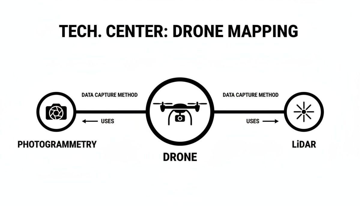
This gives you a clear picture of how both cameras and lasers are used from a drone to build incredibly detailed models of the ground below. These two technologies are the foundation for pretty much every industrial mapping job out there.
How to Choose the Right UAV Mapping Drone
Choosing the right mapping drone feels like a massive decision, and honestly, it is. The aircraft you pick is the heart of your entire operation, and it will directly shape your efficiency, the quality of your data, and your bottom line. Getting it wrong can mean wasted flights, unusable data, and expensive do-overs.
The very first fork in the road is deciding between a fixed-wing and a multirotor drone. Each type is built for a different job, and figuring out which one you need is the most important first step you’ll take.
Think of a fixed-wing drone like a mini aeroplane. It’s designed for one thing: endurance. If you’re mapping huge areas—a massive farm, a long pipeline corridor, or a sprawling mine site—a fixed-wing model is almost always the way to go. They simply cover more ground, faster, and stay in the air for much longer on a single battery.
A multirotor, on the other hand, is your helicopter. It’s all about agility. It can take off and land straight up and down (VTOL), hover perfectly still, and manoeuvre around tight, complex spaces. This makes it the perfect tool for detailed inspections of bridges, mobile phone towers, or busy construction sites where you need to get up close from every possible angle.
Fixed-Wing vs. Multirotor Drones
| Drone Type | Best For | Key Strengths | Limitations |
|---|---|---|---|
| Fixed-Wing | Large area surveys, agriculture, corridor mapping | Long flight times, high speed, superior area coverage | Requires open space for takeoff and landing, cannot hover |
| Multirotor | Structural inspections, small site mapping, complex terrain | VTOL capability, hovering, high manoeuvrability | Shorter flight times, slower speed, less area coverage |
Beyond the Airframe: What Really Matters
Once you’ve settled on the fixed-wing vs. multirotor debate, a few other crucial factors come into play. A great mapping drone isn’t just about its shape; it’s a complete system that has to match what you’re trying to achieve.
- Sensor Compatibility: Remember, the drone is just the taxi—the sensor (your camera or LiDAR unit) is the passenger doing all the important work. You have to make sure the drone you choose can actually carry the payload you need and provide the right power and connections for it to function correctly.
- Flight Time and Endurance: How long can it actually stay up there? More air time means fewer battery swaps and a much smoother workflow on big jobs. Always look for the real-world flight time with a payload attached, not the best-case-scenario number advertised by the manufacturer.
- Accuracy and Positioning Tech (RTK/PPK): If you need survey-grade results, this is non-negotiable. Your drone must have Real-Time Kinematic (RTK) or Post-Processed Kinematic (PPK) capabilities. These systems are what separate the toys from the tools, correcting GPS data on the fly to deliver the centimetre-level accuracy required for professional surveying and engineering work.
- Budget and Total Cost of Ownership: It’s easy to get fixated on the initial price tag, but you need to think bigger. Factor in the cost of extra batteries, ongoing maintenance, software licences, and potential repairs. Sometimes, a cheaper drone can end up costing you a lot more in the long run through downtime and hidden expenses.
In Australia, our wide-open spaces mean fixed-wing UAVs are often the go-to for large-scale projects, efficiently mapping vast areas like the Outback. This is backed by government support, with significant funding going to companies like V-TOL Aerospace to develop solar-powered drones for remote mapping. You can read more about Australian UAV market trends on Expert Market Research.
And finally, never forget the rules. Your drone and how you fly it must always comply with the regulations set by the Civil Aviation Safety Authority (CASA). Flying legally and safely should always be your top priority.
A Proven Workflow for Successful Mapping Missions

A flawless drone mapping mission doesn’t just happen. It’s the result of a solid, repeatable workflow that starts long before the propellers even begin to spin. Think of it as a recipe for success—a structured approach that minimises mistakes, protects your data, and turns those raw aerial shots into genuine insights you can act on.
The whole process really boils down to three core phases: planning everything out before you leave, executing the flight with discipline, and then processing the data back at the office. Each step builds on the last, and skipping one can easily throw off the accuracy of your final map, wasting a lot of time and money.
Phase 1: Pre-Flight Planning
This is where you win or lose the mission. Before you even think about heading to the site, you need to map out the project area and plan your automated flight path. This is all done in mission planning software, like DJI Pilot 2, where you’ll set the flight altitude, speed, and—most importantly—the image overlap. You want a high overlap, usually around 70-80%, to make sure the processing software has plenty of common points to stitch all the images together perfectly.
Another massive part of planning is your ground control. If you need survey-grade accuracy, you absolutely must use Ground Control Points (GCPs). These are just physical markers you place on the ground with precisely known coordinates. They act like anchors, locking your digital map to its exact real-world location and correcting any small GPS drift from the drone itself.
Setting GCPs is what turns a pretty aerial picture into a reliable, measurable survey tool. It’s the difference between a nice-to-have map and a professional asset that engineers and surveyors can bet their decisions on.
Phase 2: On-Site Execution
Once you’re on-site, a strict routine is your best friend. Always, and I mean always, run through a pre-flight checklist. Look over the drone for any damage, check your battery levels, and make sure the props are secure. Weather is a huge player here, too. High winds, rain, or even just a weak satellite signal can wreck a mission. If conditions aren’t right, don’t risk it. It’s always better to wait.
When you’re good to go, place your GCPs in the spots you planned earlier, making sure they’re clearly visible from the air. Launch the drone and keep an eye on its progress through your control software. You need to stay alert for anything unexpected—birds getting too close, a sudden change in the weather—and be ready to take manual control in a heartbeat.
Phase 3: Post-Flight Processing
Flight’s done, and you’ve safely transferred the data. Now for the final leg. This is where you feed all that raw data—hundreds of images and GPS logs—into photogrammetry software like DJI Terra. The software then kicks off a complex process called aerotriangulation, where it finds matching points across all the different images.
Using that information along with your GCP data, it builds the final products you’re after.
- Data Alignment: First, the software lines up all the images with their GPS timestamps.
- Point Cloud Generation: Next, it creates a dense 3D point cloud from those aligned photos.
- Model and Map Creation: Finally, it uses the point cloud to generate the detailed orthomosaic map and digital elevation models you need.
Following this workflow, from start to finish, is the key to making sure every drone mapping mission is efficient, safe, and produces the highest quality data possible.
Here’s the rewritten section, crafted to sound like an experienced human expert.
What’s Next for UAV Mapping?
The world of aerial mapping is moving incredibly fast. If you think today’s drones are impressive, wait until you see what’s coming. We’re on the cusp of a major shift, moving away from just collecting data to an era where drones don’t just see a landscape—they understand it. This is all being driven by some powerful new tech that will make mapping missions faster, smarter, and easier to scale.
Leading the charge is Artificial Intelligence (AI). Think about a drone flying over a wheat field. Instead of just taking photos, it instantly flags and maps every section that’s low on nitrogen. Picture another UAV inspecting a bridge on its own, spotting potential stress fractures and classifying how serious they are, all in real time. That’s what AI brings to the table—turning raw data into genuinely useful insights right on the spot and slashing the time spent on post-processing.
Smarter Sensors and Flying Further
It’s not just the software getting smarter; the hardware is too. Sensor technology is getting smaller and more powerful at an astonishing rate. We’re seeing lighter, more capable LiDAR and multispectral sensors, which means even compact drones can carry survey-grade equipment. This is a big deal because it makes high-end mapping more affordable and lets us use drones on a wider range of jobs.
But the real game-changer on the horizon is the widespread adoption of Beyond Visual Line of Sight (BVLOS) flights. For years, regulations have forced pilots to keep their drones within their direct line of sight. Once BVLOS becomes standard practice, we’ll be able to map huge infrastructure corridors, sprawling farms, and remote environmental sites in a single, efficient flight.
This isn’t just a simple tech upgrade. Moving towards greater autonomy and longer flight ranges will completely redefine what a mapping drone can do. Large-scale data capture will become a routine task, not the complex logistical headache it can be today.
This kind of progress is getting a solid push from government bodies, too. For instance, Airservices Australia recently linked up the first UAS Service Suppliers with its Flight Information Management System (FIMS). This is a crucial step for creating safer skies, especially with commercial drone flights projected to hit a staggering 60.4 million by 2043. If you’re interested, you can read more about how government investment is shaping the Australian UAV industry. It’s this combination of forward-thinking regulation and smarter tech that makes the future of UAV mapping not just powerful, but safe and sustainable too.
Got Questions? We’ve Got Answers
As you get ready to dive into the world of drone mapping, a few questions always seem to pop up. Let’s tackle some of the most common ones to help you get started on the right foot.
Just How Accurate Are These Maps?
This is the big one, and the answer is: it depends on your setup.
If you’re aiming for survey-grade results, you absolutely can get them. By using a drone equipped with RTK or PPK technology and setting up Ground Control Points (GCPs) on your site, you can achieve accuracy down to just a few centimetres. It’s incredibly precise.
On the other hand, if you fly without those ground references, your accuracy will be closer to a few metres. That’s still more than enough for things like tracking construction progress or conducting visual inspections where a general overview is all you need.
Do I Need a Special Licence to Fly a Mapping Drone?
In Australia, the short answer is yes. As soon as you’re flying for any commercial purpose, you fall under the rules of the Civil Aviation Safety Authority (CASA).
You’ll need to get the right certification to operate a UAV mapping drone legally, especially once you start using heavier models. The rules do change, so it’s always smart to check the latest regulations on the CASA website before launching any project.
How Long Does It Take to Process All That Data?
The processing time can vary massively. A small job, say with a couple of hundred photos, might be ready in just a few hours if you have a powerful computer.
But for a large-scale project, like mapping an entire farm or creating a detailed 3D model from thousands of high-resolution images, you could be looking at a full day or even longer. It really comes down to the size of the area and the complexity of the final map or model you’re building.
Ready to achieve survey-grade accuracy with a reliable, Australian-designed system? Evolution Flight offers advanced drone solutions for heavy-lift, LiDAR, and agricultural mapping.
Discover the right UAV for your mission at https://evolutionflight.com.