
Let's cut through the jargon. At its core, a UAV (Unmanned Aerial Vehicle)—what most people just call a drone—is an aircraft without a pilot inside. It's best to think of it not as a toy, but as a versatile 'flying toolkit' that can be flown remotely by a human or programmed to fly on its own.
From Hobby Gadget to Industrial Powerhouse
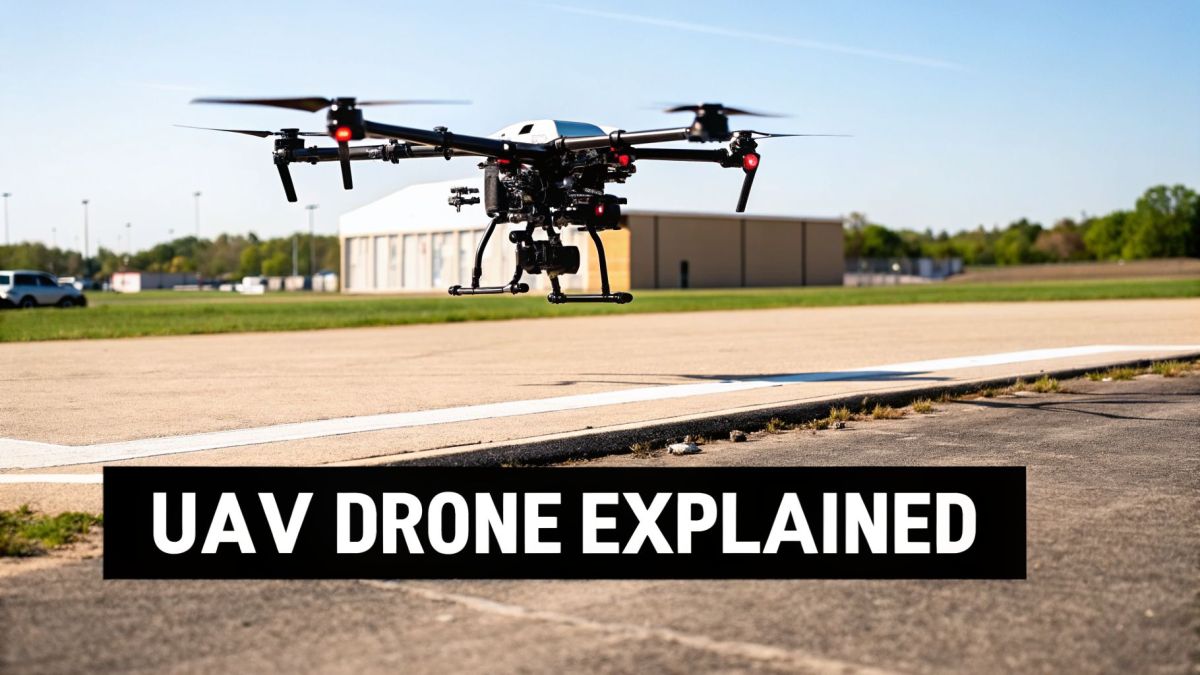
When you hear "drone," you probably picture a small quadcopter buzzing around a park. But in the industrial world, UAVs are a completely different beast. These aren't just gadgets for taking photos; they are tough, purpose-built machines designed for serious work in fields like energy, construction, and large-scale mapping.
Their whole purpose is to get demanding jobs done safer, faster, and more efficiently than sticking to old-school, on-the-ground methods.
This difference is something many businesses learn the hard way. A common industrial pain point for surveyors and inspectors is the inefficiency and frustration of using consumer drones for professional jobs. These drones often can't handle moderate wind, lack the power to carry high-end sensors, and their short flight times mean you’re constantly landing to swap batteries. This turns a single project into a fragmented, stop-and-start affair, killing productivity and profitability.
The Professional-Grade Difference
This is exactly where professional platforms prove their worth. For instance, the Evolution Flight heavy-lift multi-rotor was engineered to solve that specific pain point. Its high payload capacity isn't just a number on a spec sheet—it directly generates a crucial business outcome.
This capacity means the drone can carry advanced, heavy sensors like LiDAR scanners for long flights, allowing a survey team to capture incredibly accurate 3D models of infrastructure or terrain in a single, uninterrupted mission.
This completely transforms data collection. What was once a slow, fragmented process becomes a smooth, efficient, and profitable operation.
The table below breaks down the key differences between the drones you see in a park and the UAVs working on a job site.
Consumer Drones vs. Enterprise UAVs at a Glance
| Feature | Consumer Drone | Enterprise UAV (e.g., Evolution Flight) |
|---|---|---|
| Primary Use | Hobby, photography, recreation | Industrial inspection, mapping, surveying |
| Payload Capacity | Very low (often just a built-in camera) | High (supports heavy, interchangeable sensors) |
| Flight Time | Short (15-30 minutes) | Extended (45+ minutes, depending on payload) |
| Durability | Fragile plastic construction | Robust, weather-resistant materials |
| Data Security | Basic, often vulnerable | Advanced encryption and secure data links |
| Cost | Low (a few hundred to a couple thousand dollars) | Significant investment (tens of thousands of dollars) |
As you can see, enterprise UAVs are built from the ground up for reliability and performance in challenging environments, justifying their role as critical industrial tools.
This massive shift toward commercial use is what’s fueling the market’s incredible growth. The global UAV market was valued at USD 52.65 billion in 2026 and is on track to hit an astounding USD 209.91 billion by 2035. You can dive deeper into these figures by checking out this in-depth report on the UAV market.
How Industrial Drones Actually Work
So, what really makes these powerful flying tools tick? They're a far cry from the drones you might see in a park. Industrial UAVs are sophisticated systems where rugged hardware and intelligent software have to work in perfect harmony to pull off some seriously demanding jobs.
To get what a UAV really is, you have to look under the hood at the parts that let it fly and do its work.
Think of the drone's body, its airframe, as the skeleton. It has to be light enough to fly efficiently but also incredibly tough to handle rough weather while carrying expensive equipment. The muscle is the propulsion system—the motors and propellers that give it the power to lift off and navigate with precision.
But the real heart of any industrial drone is its brain: the flight controller. This is a small but mighty onboard computer, and it's a true piece of engineering magic.
The Brains Behind the Flight
The flight controller is the drone's central nervous system. It takes in thousands of data points every single second from a whole suite of sensors. It’s constantly crunching numbers on speed, altitude, and orientation to make tiny adjustments to the motors. This is what keeps the drone perfectly stable, even when the wind starts gusting.
This is where you can see the difference between a toy and a tool. A significant industrial pain point for inspectors is getting blurry, unusable data when trying to hold a drone steady near a cell tower or wind turbine, especially in gusty conditions. A hobby drone gets tossed around, but a professional system solves this. For example, the advanced flight controller in the Evolution Flight heavy-lift multi-rotor is specifically designed for stability. This technical feature ensures the drone remains locked in place, which generates the business outcome of sharp, clear inspection photos without motion blur—translating directly to more reliable, actionable data and fewer costly re-flights.
Navigation and Control
Drones get their sense of direction from high-tech navigation systems, mainly GPS and other satellite networks. This allows them to know exactly where they are, which is crucial for flying pre-planned routes with centimeter-level accuracy.
The link between the pilot on the ground and the machine in the air is the Ground Control Station (GCS). This isn't just a basic remote control. It’s a full-blown command center that shows real-time flight data, video feeds, and system health. The pilot uses the GCS to send commands, change the mission plan mid-flight, or take manual control if necessary, making even the most complex jobs manageable and safe.
It’s the combination of a tough airframe, powerful motors, a smart flight controller, and a comprehensive GCS that turns a flying machine into a reliable industrial tool for gathering critical data.
The Main Types of Industrial Drones
When people ask, "what is a UAV drone," they soon find out there's no single answer. Commercial drones are specialized tools, and the design you need depends entirely on the job you have to do. You wouldn't use a hammer to turn a screw, and you wouldn't use a long-range fixed-wing drone for a close-up building inspection.
The most common types you'll see in the field are multi-rotor, fixed-wing, and hybrid VTOL models. Getting a handle on what makes each one different is the first step in choosing the right tool for your work.
Multi-Rotor Drones
Multi-rotor drones are what most people picture when they hear the word "drone." These machines, from quadcopters (four rotors) to Quadcopters (six rotors), are the kings of stability and precision. By changing the speed of each propeller, they can hover perfectly still, move straight up or down, and fly in any direction with surprising agility.
This ability to just hang in the air makes them the go-to choice for any job that needs a steady, close-up look.
- Detailed Asset Inspection: Think of looking for tiny stress fractures on a single wind turbine blade.
- Close-Quarters Work: They're great for navigating a cramped industrial site or a dense city block.
- Infrastructure Surveys: They can capture super-sharp images of a specific part of a bridge or dam.
Fixed-Wing Drones
Unlike their hovering cousins, fixed-wing drones look and fly a lot more like a classic airplane. They use their wings to create lift and glide through the air, which makes them incredibly efficient over long distances.
Think of them as the marathon runners of the drone world. They can’t stop and hover, but they can stay in the air for hours, mapping massive areas of land or monitoring long pipelines and railways. Their biggest advantages are endurance and range.
Hybrid VTOL and Heavy-Lift Platforms
Hybrid VTOL (Vertical Take-Off and Landing) drones try to give you the best of both worlds. They take off and land straight up like a multi-rotor but then switch to flying on their wings like a fixed-wing. This means you get the long flight times without needing a runway, making them incredibly flexible.
No matter the type, all these drones share a common set of core components that work together to make flight possible.
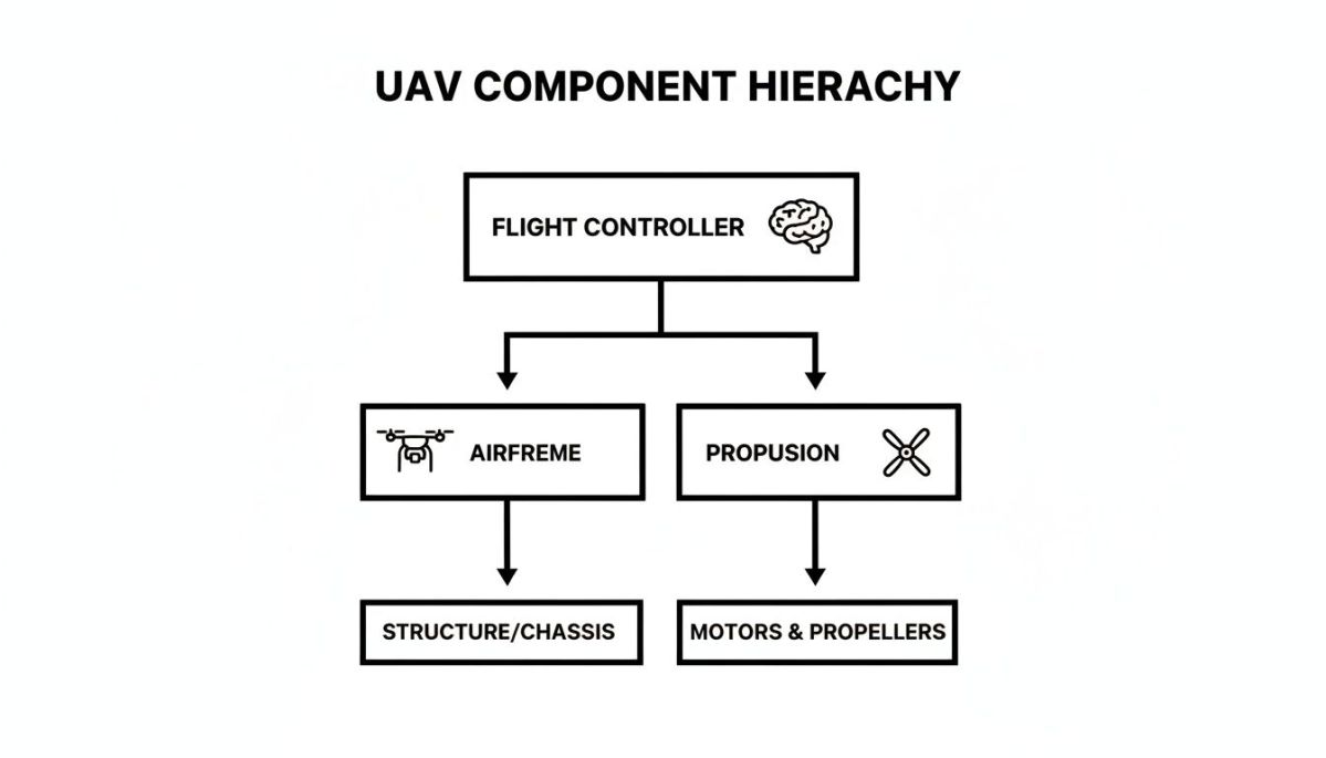
As you can see, the flight controller is the brain, telling the propulsion system what to do, all while being housed in the airframe.
But here’s a major industrial pain point for many geospatial and survey teams: the constant trade-off between flight time and sensor weight. To use a top-of-the-line LiDAR scanner, operators often have to accept short flight times, forcing them to land and swap batteries repeatedly. This operational inefficiency destroys project timelines and profit margins.
This is exactly the problem specialized platforms were built to solve. The Evolution Flight single-rotor UAV, for example, was engineered with superior lift capacity and endurance to directly overcome this challenge.
This design delivers a clear business advantage: it enables a survey company to carry the best sensors for much longer missions. This directly translates to the business outcome of mapping an entire utility corridor or a large mine in a single flight, dramatically cutting down on time in the field and boosting the ROI on every project.
Key Payloads and Sensors for Enterprise Data
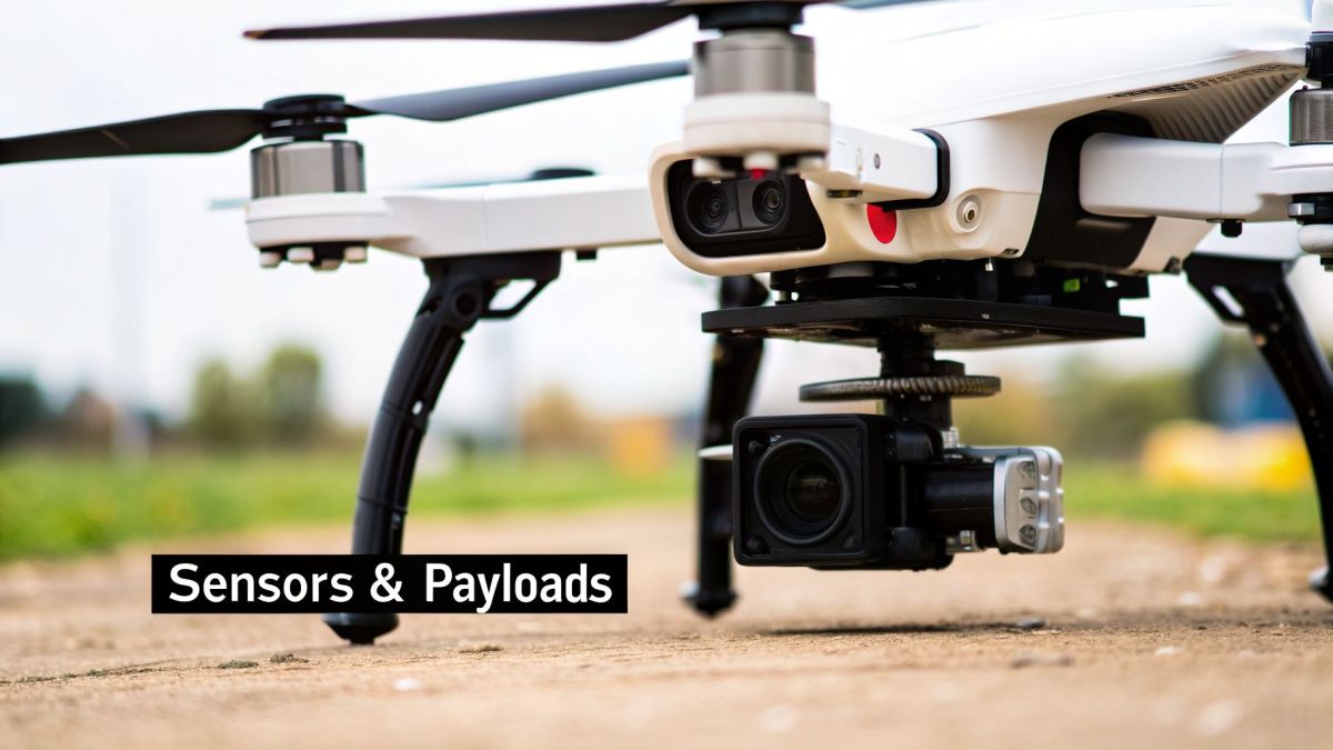
A drone is really just a flying platform. What makes it a powerful business tool is what it carries. These tools, called payloads or sensors, are what collect the valuable data you need.
Think of them as the drone's specialized senses. They can see things the human eye can't, sniff out invisible gases, and measure the world with incredible precision. Instead of putting a person in a risky or hard-to-reach place, a drone can carry a sensor to get the job done faster, safer, and often, better. The payload you choose depends entirely on the problem you're trying to solve.
Common Types of UAV Drone Sensors
While there’s a wide variety of payloads out there, a few workhorses handle the bulk of industrial jobs. Each one is a specialist, designed to capture a specific type of information.
- LiDAR (Light Detection and Ranging): A LiDAR unit shoots out thousands of laser pulses per second and measures how long they take to bounce back. This process builds a stunningly accurate 3D map of an area, often called a "point cloud" or "digital twin."
- High-Resolution Cameras (Photogrammetry): Think of these as super-powered cameras that snap hundreds or thousands of overlapping photos from the air. Special software then stitches these images together to create detailed 2D maps and 3D models of a site.
- Thermal Imagers: These sensors don't see light; they see heat. By visualizing temperature differences, they can spot failing equipment on a solar farm, find heat loss in a building's roof, or even locate a missing person in the dark.
- Gas Detectors: These are highly specialized "sniffers" that can detect specific chemicals in the air. They are vital for tasks like finding methane leaks along a gas pipeline or checking air quality near an industrial facility.
Solving Real-World Problems with the Right Payload
Let's look at a classic challenge for an electric utility: managing vegetation along thousands of kilometers of powerlines. Trees growing too close to the lines are a huge source of power outages and a major fire hazard. This is a massive industrial pain point. Sending out crews to walk or fly these lines in helicopters is slow, costly, and can miss critical spots.
This is where the right drone and sensor combination changes everything. The Evolution Flight heavy-lift multi-rotor was designed specifically for this kind of work. Its high payload capacity, a key technical spec, is the key that unlocks the solution.
That lifting power allows the drone to carry a heavy, high-end LiDAR sensor. Flying the powerline corridor with this setup creates a precise 3D digital model of every wire, pole, and tree. The business outcome is that utilities can analyze this data to see exactly where a branch is getting too close, turning reactive, emergency tree-trimming into a proactive, planned maintenance program. This approach drastically cuts fire risk and boosts the reliability of the entire grid.
This kind of advanced sensor use in business has exploded, thanks in large part to technology that first matured in the military. The military drone market, valued at USD 18.2 billion in 2025, is expected to grow to USD 66.5 billion by 2035. That investment has created incredible technology that has spilled over into the commercial world, allowing geospatial companies to fly top-tier scanners for mapping projects that demand millimeter-level accuracy. You can dive deeper into this trend in this detailed drone market research report.
Real-World Industrial Applications for UAVs
Knowing the theory behind a drone is one thing. Seeing how these flying toolkits solve tough, real-world problems is where their true value really shines. Across all sorts of industries, companies are using drones to tackle jobs that used to be dangerous, incredibly slow, and expensive.
Drones are more than just flying cameras. They are mobile data platforms that deliver insights critical for business decisions, from mapping huge farms to inspecting towering wind turbines. The list of applications is growing every single day.
From Manual Labor to Aerial Intelligence
Think about the oil and gas industry. One of its biggest industrial pain points has always been the manual inspection of pipelines that snake across hundreds, sometimes thousands, of kilometers of remote and rugged land. This process is a drain on time, money, and puts people in harm's way. Sending crews to walk these lines or fly them in helicopters is a logistical nightmare, and a leak might go unnoticed for weeks, creating major environmental risks and financial losses.
This is where a purpose-built drone completely changes the game. An Evolution Flight fixed-wing or VTOL platform is engineered specifically for this kind of challenge, turning a reactive, hazardous task into a proactive, automated one. Its single most important technical specification for this job is its long-endurance capability.
This one feature delivers a massive business outcome. With a gas detector and camera on board, a single drone can autonomously patrol hundreds of kilometers of pipeline in one flight. This means inspection times are slashed from weeks to hours, leak detection alerts are sent almost instantly for rapid response, and personnel safety is dramatically improved by keeping workers out of dangerous situations. The entire right-of-way can be monitored continuously for security and maintenance needs, fundamentally shifting the approach to asset integrity.
A Growing Market Fueled by Results
This widespread adoption is driving huge market growth. In fact, North America held a 34.12% global market share in 2025, a figure powered by concrete results. Pipeline operators, for instance, are hitting 90% accuracy in vegetation and asset monitoring and cutting leak detection times from weeks down to hours. You can dive deeper into these trends in this comprehensive UAV industry report.
This move from manual work to aerial intelligence isn't just happening in oil and gas. Transportation agencies use wind-tolerant drones to survey roads and railways, while environmental groups monitor coastal erosion and track biodiversity.
In every single case, the core benefit is the same: gathering better data, more often, and far more safely than ever before. This is the real answer to the question, "What is a UAV drone?" It's a tool that gives us a safer, smarter way to work.
Alright, you've got the basics down. You know what a UAV is and what it can do. But now comes the real question: how do you actually pick the right one for your specific needs? This is where we move from theory to practice, and it’s all about balancing a few key trade-offs.
Think of it like choosing any other critical piece of equipment. You have to start with the job itself. What are you trying to accomplish? If you need to map a hundred miles of pipeline, a long-endurance fixed-wing drone is probably your best bet. But if your goal is to get up close and personal with a single cell tower for a detailed inspection, a nimble multi-rotor that can hover with precision is the tool for the job.
Once you’ve defined the mission, you can zero in on the specifics. Does the drone have enough flight time, or endurance, to cover the area you need? Can it carry the weight of your specialized sensor, whether that's a high-resolution camera or a sophisticated LiDAR unit? The drone is just the vehicle; its ability to carry the right payload is what makes it useful.
Don't Overlook Data Security
For many organizations, especially in defense, public safety, or managing critical infrastructure, there's one factor that trumps almost everything else: data security. In these fields, using a drone with weak security isn't just a liability—it's a direct threat to your operations. The risk of sensitive data about a power grid or a secure facility ending up in the wrong hands is a major industrial pain point you cannot ignore.
This is where you need to look beyond flight specs and dig into a platform's security credentials. For example, a manufacturer like Evolution Flight builds its platforms with these concerns front and center, pursuing technical standards like Green UAS Certification and full NDAA compliance.
These certifications aren’t just letters on a datasheet. They represent a secure supply chain and a cyber-hardened platform, delivering the crucial business outcome of confidence that the data you collect over sensitive sites is protected from foreign access or exploitation.
Ultimately, having this level of verifiable security isn't just good practice; it’s often a requirement to even be considered for government and defense contracts. It demonstrates that you take data integrity seriously, which can be the deciding factor that helps you win high-stakes projects.
Your Questions Answered: Getting Started with UAVs
When businesses first start looking into drones, the same few questions always seem to pop up. Let's tackle them head-on with some straightforward answers.
What’s the Difference Between a Drone, a UAV, and a UAS?
You’ll hear these terms thrown around a lot, sometimes all in the same sentence, but they each have a specific meaning.
- Drone: This is the common, catch-all term everyone knows. It can refer to anything from a toy in a park to a high-end industrial machine.
- UAV (Unmanned Aerial Vehicle): This is a more technical term that refers specifically to the aircraft itself—the flying part of the equation.
- UAS (Unmanned Aerial System): This is the most accurate and comprehensive term. A UAS includes the whole setup: the UAV (the aircraft), the ground control station the pilot uses, and the communication link that ties it all together.
Think of it this way: the UAV is the car, but the UAS is the car, the driver, and the remote control they're using.
How Hard Is It to Fly a Professional Drone?
Flying a small consumer drone around your backyard is one thing. Operating a professional-grade system for a critical job is a whole different ballgame. It absolutely requires proper training and certification.
A key industrial pain point for new commercial drone programs is the steep learning curve for pilots. Juggling complex flight controls while simultaneously trying to ensure an expensive sensor is capturing perfect data can lead to mission failure and operator burnout.
This is where a drone's automated mission planning software makes a world of difference. Advanced systems, like those on Evolution Flight platforms, have this technical feature built-in. It allows you to plan the entire flight path on a screen beforehand. Once in the field, the drone flies the route autonomously. This delivers the business outcome of freeing up the pilot to focus on what truly matters: monitoring the live data feed and ensuring the job gets done right, which dramatically increases mission success rates and reduces pilot stress.
What Are the Main Regulations I Need to Know?
Drone laws change from country to country, so checking with your local aviation authority is always the first step. However, a few core concepts are nearly universal.
You'll constantly hear about VLOS (Visual Line of Sight), which means the pilot must be able to physically see the drone with their own eyes at all times. The other side of that coin is BVLOS (Beyond Visual Line of Sight), which allows for much longer flights but requires special waivers and advanced technology. Getting familiar with these rules is non-negotiable before you ever take off.
Ready to move beyond questions and see how a professional UAV can solve your specific operational challenges? Evolution Flight provides secure, high-performance platforms engineered for industrial success.