
Imagine having a set of eyes in the sky, capable of not just seeing but truly understanding the ground below. That’s the magic that happens when we combine drones with Geographic Information Systems (GIS). Drones become our high-flying data collectors, and GIS is the brain that turns all that information into real, actionable intelligence.
How Drones and GIS Work Together
At its heart, the partnership between drones and GIS is straightforward but powerful. Think of a drone as a flying, high-precision data gathering platform. It soars over a site, capturing enormous amounts of detailed imagery and spatial data, doing it far faster and more safely than anyone could on foot.
But on their own, these thousands of images are just raw puzzle pieces. They lack context.
This is where GIS comes into the picture. GIS acts like a digital workshop, taking all that raw data from the drone and stitching it together. It processes the information to build incredibly accurate, layered digital maps and 3D models. Suddenly, a jumble of photos becomes a coherent, measurable tool that lets us see patterns we’d otherwise miss.
This fusion of technologies is a game-changer for industries all across Australia. The local drone market hit a value of around USD 0.28 billion in 2024 and is expected to grow by 27% each year for the next ten years. This boom is being driven by sectors like mining, agriculture, construction, and environmental management, all of which are leaning heavily on drones and GIS. You can read more about the growth of Australia's drone market and what's fuelling it.
The advantages of bringing these two technologies together are massive:
- Pinpoint Accuracy: Drones capture data with centimetre-level detail, which means the GIS maps and models created from it are far more precise than what you’d get from satellites.
- Massively Improved Safety: Workers no longer need to enter dangerous or hard-to-reach places. They can inspect everything from mine walls and power lines to disaster zones from a safe distance.
- Saves Time and Money: A single drone flight can survey hundreds of hectares in a morning. A ground crew would take days, if not weeks, to do the same job, which translates to huge cost savings.
- Smarter Decisions: When managers have access to current, detailed visual data layered within a GIS, they can make better strategic calls—whether that's figuring out how to boost crop yields or tracking the progress of a major construction project.
2. Capturing Geospatial Data from the Sky

To really get a grip on what makes the combination of drones and GIS so powerful, we need to start with how a drone actually ‘sees’ the world. We're not just talking about snapping a few pretty pictures from above. It’s all about capturing incredibly detailed, geographically referenced data that forms the very foundation of every map and model we build.
Think of a drone as a flying platform, and the sensor it carries as its specialised set of eyes. Each type of sensor is built to see the world in a unique way, gathering information that goes far beyond what our own eyes can pick up. The sensor you choose ultimately dictates the kind of story your data will tell.
The Drone’s Toolkit of Sensors
Not all drone sensors are created equal. The type you fly with completely changes the kind of data you can collect. Let's break down the most common ones you'll encounter.
Common Drone Sensors and Their GIS Applications
| Sensor Type | What It Measures | Primary GIS Output | Best For |
|---|---|---|---|
| RGB Camera | Visible light in Red, Green, and Blue spectrums. | Orthomosaic Maps, 3D Models | Visual site inspections, construction progress monitoring, creating realistic 3D renderings. |
| Multispectral | Specific, narrow bands of light (including near-infrared). | Vegetation Health Indices (e.g., NDVI) | Precision agriculture for spotting crop stress, environmental monitoring, forestry management. |
| LiDAR | Distance, using pulsed laser light. | 3D Point Clouds, Digital Elevation Models (DEM) | Creating highly accurate terrain models under dense vegetation, corridor mapping for utilities. |
These sensors are the workhorses of aerial data capture, each offering a different lens through which to view and analyse a project site.
More Than Just Photos: RGB, Multispectral, and LiDAR
The most familiar sensor is the standard RGB (Red, Green, Blue) camera, which works a lot like a high-end digital camera. It captures high-resolution, full-colour images that are intuitive and easy to understand, making it the go-to for creating detailed visual maps and 3D models.
For deeper analysis, we need more specialised tools. A multispectral sensor is like giving the drone a form of superpower vision. It captures data from specific, narrow bands of light—some visible, some not—that can reveal hidden truths about the environment. For an agronomist, this might mean spotting crop stress weeks before it’s visible to the naked eye.
Then you have LiDAR (Light Detection and Ranging). If you can picture a bat using sound to navigate in the dark, LiDAR works on a similar principle, but with laser light. It fires out pulses of light and measures how long they take to bounce back, creating an incredibly precise 3D ‘point cloud’ of the landscape. For a deep dive into advanced elevation data, check out this guide on drone LiDAR mapping.
LiDAR is a genuine game-changer for mapping through thick vegetation. A normal camera only sees the top of a forest canopy. LiDAR pulses, on the other hand, can actually punch through the leaves to map the true ground surface below. You can explore more about the advantages of LiDAR systems in our detailed guide right here: https://evolutionflight.com/lidar-uav-drone/
From Thousands of Images to a Single, Usable Map
So, the drone has captured the data. Now what? The real magic happens in a process called photogrammetry—the science of taking measurements from photographs.
During a typical flight, the drone flies a pre-planned grid pattern over the site, snapping hundreds or even thousands of overlapping photos. Each one is geotagged with precise GPS coordinates.
Back in the office, photogrammetry software gets to work. It analyses all those individual images, finds common points between them, and stitches them together into one seamless, geographically accurate dataset. This is how a massive collection of photos is transformed into a valuable GIS-ready product.
The Key Outputs You’ll Use in GIS
After all that processing, the drone data yields several core products that can be dropped straight into any GIS platform. These are the building blocks for almost any kind of spatial analysis.
- Orthomosaic Map: This isn't just one big aerial photo. It’s a highly accurate, geometrically corrected image where all distortions have been removed. Every single pixel is in its correct geographic spot, meaning you can take reliable measurements of distance, area, and volume directly from it.
- Digital Elevation Model (DEM): A DEM is a 3D model of the bare earth. It shows you the topography of the terrain without any buildings, trees, or other surface features. It's absolutely essential for jobs like flood modelling, drainage analysis, and planning earthworks.
- Digital Surface Model (DSM): The DSM is similar, but it captures the elevation of everything on the surface—buildings, trees, powerlines, you name it. It gives you a complete 3D picture of the landscape exactly as it is right now.
- 3D Point Cloud: This is the rawest, most detailed output. It's a massive collection of millions of individual points, each with its own X, Y, and Z coordinate in space. It's the foundation for creating hyper-realistic 3D models and performing complex measurements.
Once you understand how these sensors and processes fit together, it's easy to see why drones and GIS offer such a detailed and accurate view of our world. This sets the stage for the powerful analytical workflows we'll dive into next.
Turning Drone Data into Actionable Intelligence
Raw data, no matter how precisely you capture it, is just that—raw. The real magic happens when you pair drones with GIS, turning that raw potential into clear, actionable intelligence that helps you make smarter decisions. It's a journey from the sky to your screen, following a structured workflow where each step builds on the last.
Think of it like a three-stage relay race. The drone captures the data, specialised software refines it, and finally, GIS gives it context and meaning.
This is the fundamental path for converting a collection of aerial photos into strategic insights that can drive your business forward.

Let's break down each stage of this workflow, from mission planning all the way to analysis.
Stage One: The Mission Plan
A successful drone mapping project starts long before the propellers ever start spinning. A solid mission plan is your foundation, and it's about much more than just drawing a box on a map. You have to think carefully about your end goal to make sure the data you collect is actually fit for purpose.
Here are the key things to nail down in your plan:
- Defining the Flight Path: Modern flight planning software makes this easy, allowing you to create precise grid patterns that guarantee you cover your entire area of interest without missing any spots.
- Setting Image Overlap: This is non-negotiable. For the software to stitch your images together accurately, they need to overlap significantly. A good rule of thumb is 70-80% front and side overlap.
- Establishing Altitude: Your flight altitude directly controls the resolution of your data, what we call the ground sample distance (GSD). Flying lower gives you incredibly detailed images, but it chews through time and battery life.
Skimping on planning leads to data gaps, wonky models, and a whole lot of wasted time. A meticulous plan ensures the raw data you bring back is clean, complete, and ready for the next step.
Stage Two: Processing the Raw Data
Once the drone is back on the ground, its memory card is full of thousands of geotagged images. Now it's time to feed this data into specialised photogrammetry software. Tools like Pix4D or Agisoft Metashape do the digital heavy lifting, transforming those individual photos into cohesive, map-accurate geospatial products.
The software is incredibly clever. It meticulously analyses every single image, finds common points across hundreds of photos, and uses them to calculate the precise position and orientation of each one in 3D space. This process is what generates your key outputs—orthomosaics, Digital Surface Models (DSMs), and 3D point clouds—which are the building blocks for your GIS analysis.
This is where the drones and GIS partnership really comes to life. It’s the bridge that takes you from a simple collection of aerial photos to a scientifically valid, measurable digital twin of your site.
Stage Three: Integration and Analysis in GIS
This is the final and most important step. We bring the processed datasets into a GIS platform like ArcGIS or the open-source QGIS. Here, data finally becomes intelligence. Your drone-derived layers aren't just viewed on their own; they're combined with other existing spatial data to paint a much richer, more complete picture.
Let's imagine a farm manager in rural New South Wales. Their workflow might look something like this:
- Import Drone Data: They start by importing a brand new multispectral orthomosaic of their paddocks into their GIS project.
- Layer Additional Data: Next, they overlay this with other data they already have, like soil type maps, historical yield information, and property boundaries.
- Perform Analysis: Using the GIS tools, they can run an analysis to pinpoint specific zones where crop stress (which is visible in the multispectral data) lines up with a particular soil type.
- Create Actionable Outputs: The manager then generates a precise "prescription map." This map is sent directly to their smart tractor, which applies fertiliser only to the struggling zones. This saves a heap of money and is much better for the environment.
This is the whole point of the drones and GIS process. It's not about making a pretty map. It's about using layered spatial information to ask complex questions and get clear, data-driven answers. For a bit of background, understanding the basics of weather map definitions can help you grasp how different types of spatial data tell a story.
By following this workflow, any organisation can reliably turn high-quality aerial data into a powerful tool for strategic planning and getting things done more efficiently.
Choosing the Right Drone and GIS Software
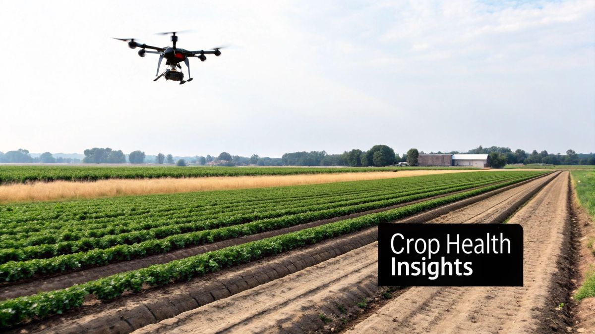
Getting your drone and GIS projects off the ground starts with the right gear. The hardware you fly and the software you run will have the biggest impact on the quality, accuracy, and efficiency of your work. It's all about matching your tools to your specific project goals and, of course, your budget.
Think of it like picking a vehicle for a job. You wouldn't take a sports car to a construction site, and you wouldn't use a massive truck for a quick trip to the shops. The same logic holds true here—choosing the right drone can make or break your mission.
Matching the Drone to the Mission
The first big decision is the type of drone itself. Your choice usually comes down to a trade-off between endurance and agility, with two main types leading the market.
-
Fixed-Wing Drones: These are the marathon runners of the drone world. Built like small aeroplanes, they are designed for efficiency and can cover huge areas—often hundreds of hectares—in a single flight. This makes them perfect for large-scale agricultural mapping, environmental monitoring, or long corridor surveys for infrastructure.
-
Multi-Rotor Drones: Think of quadcopters as the gymnasts. They offer incredible stability and manoeuvrability, able to take off and land vertically, hover in one spot, and inspect things from tricky angles. They’re the go-to for detailed site inspections, 3D modelling of buildings, and any job that needs close-up, high-resolution images.
Beyond the frame, keep a close eye on specs like flight time, which tells you how much ground you can cover on one battery, and payload capacity, which dictates what kind of sensors you can carry. For a deeper dive into mission planning, exploring a guide to the best UAV flight planning software can give you a much better sense of how to get the most out of your hardware.
Selecting Your Data Processing Engine
Once the drone has landed, you need the right software to turn all those raw images into something you can actually use in a GIS. This usually means using two different kinds of software in sequence: a photogrammetry engine followed by a GIS platform.
Photogrammetry software stitches your drone photos together to create 3D models and maps. Then, you bring those outputs into a GIS platform for deeper spatial analysis and to create your final products.
Comparing Popular GIS and Photogrammetry Software
Choosing the right software can feel overwhelming, as there are many great options out there. This table breaks down some of the most popular tools to help you figure out which one might be the best fit for your workflow.
| Software | Type | Key Features | Best For |
|---|---|---|---|
| Agisoft Metashape | Photogrammetry | Powerful processing, great for dense point clouds, supports various sensor types. | Users needing high levels of control and customisation for complex 3D modelling and survey-grade outputs. |
| Pix4Dmapper | Photogrammetry | User-friendly interface, automated workflows, strong quality reporting and validation tools. | Professionals looking for a reliable, streamlined process to create orthomosaics and surface models quickly. |
| ArcGIS Pro | GIS Platform | A full suite of advanced spatial analysis tools, deep data management, and powerful visualisation. | Organisations needing an enterprise-level solution for complex analysis, data sharing, and map production. |
| QGIS | GIS Platform | Free and open-source with a massive library of plugins, a strong community, and endless customisation. | Individuals, small businesses, and academics who need a powerful, flexible, and no-cost GIS solution. |
While this gives you a starting point, the most important factor is making sure your chosen programs play well together. A seamless connection between your tools is essential for a smooth workflow.
The most crucial thing to check is integration. Your photogrammetry software must be able to export data in formats that your GIS platform can easily read, like GeoTIFFs for orthomosaics or LAS files for point clouds. Getting this right from the start will save you a world of pain later on.
Ultimately, building your toolkit is a strategic process. By carefully weighing your project needs against what different drones and software can do, you can put together a powerful system that turns aerial data into genuinely useful insights.
Drones and GIS Applications in Australia

The real magic of combining drones and GIS happens when you see them at work in the real world. Across Australia, this partnership isn't just some tech novelty; it's become a fundamental tool for tackling complex problems in some of our most vital industries. From the red earth of the Pilbara to the fertile plains of the Murray-Darling Basin, incredible stories of innovation are playing out every day.
When you take aerial data and analyse it within a GIS, you get real, tangible results. We're talking about boosting efficiency, making workplaces safer, and gathering critical information to help us look after our environment. Every use case shows a direct line from the technology to a positive outcome on the ground.
A Game-Changer for Mining in Western Australia
Picture the vast mining operations in WA, where managing enormous stockpiles of raw materials is a constant logistical puzzle. In the past, figuring out the volume of these piles was slow, hard work and, frankly, often dangerous. Now, mining companies are using LiDAR-equipped drones to completely overhaul this process.
A drone can fly over a stockpile in just minutes, capturing millions of precise data points. This information is then used to create an incredibly accurate 3D model, letting inventory managers calculate volumes with a speed and precision that was once unthinkable. This near-real-time data makes a huge difference to stock management and financial forecasting.
Even more importantly, it keeps surveyors out of harm's way by removing the need to physically walk on or near unstable piles of material. It’s a clear win-win for both productivity and safety. If you're just getting started with this tech, you can get a fantastic overview by exploring our guide on aerial surveying UAVs and what they can do.
Fuelling Precision Agriculture in the Murray-Darling Basin
For farmers in the Murray-Darling Basin, every drop of water and every bit of fertiliser counts. Precision agriculture, powered by drone-captured multispectral imagery, is helping them make every input matter. When a drone flies over a crop, it can spot things the human eye would miss, like subtle changes in plant health from one part of a field to another.
This data is fed into a GIS to generate detailed vegetation health maps, such as the Normalised Difference Vegetation Index (NDVI). These maps clearly highlight which areas of a paddock are thriving and which are under stress.
Instead of blanketing an entire field with the same amount of water or fertiliser, farmers can now use these maps to target their resources with surgical precision. This approach not only boosts crop yields and profitability but also dramatically cuts down on chemical runoff, helping to protect the delicate local ecosystem.
Protecting Australia’s Unique Environments
Australia's drone market hit around USD 614 million in 2024 and is expected to soar to USD 1.5 billion by 2033. A huge part of this growth is coming from environmental monitoring and conservation, where drones provide invaluable data for protecting our unique ecosystems. You can dig deeper into what's driving this expansion in the latest market research on Australian drones.
This growth is being fuelled by real-world conservation successes.
-
Coastal Erosion Monitoring: In Queensland, conservation groups regularly use drones to map coastlines that are vulnerable to erosion. By comparing orthomosaic maps captured over time, they can measure exactly how the shoreline is changing, which helps inform better coastal management strategies and protect fragile habitats.
-
Wildlife Tracking and Bushfire Recovery: Following devastating bushfires, drones with thermal cameras have become a vital tool for finding and counting surviving koala populations. This data helps wildlife rescue teams focus their efforts and gives conservationists a clearer picture of the long-term impact on biodiversity.
-
Threatened Species Monitoring: Specialised gear like drone-borne radio telemetry lets conservationists track threatened species in remote or rugged terrain without disturbing the animals. It's a safe and efficient way to gather the data needed to protect them.
From mining and farming to conservation, the combination of drones and GIS is delivering powerful solutions to some of Australia's biggest challenges. These examples prove the technology is far beyond the testing phase—it's now a proven tool helping us build a more efficient, safe, and sustainable future.
What's Next for Geospatial Intelligence?
Looking ahead, the partnership between drones and GIS is poised to get even stronger. We're on the cusp of some exciting developments that are less about just collecting data and more about getting smart, instant answers from it.
At the heart of this change is Artificial Intelligence (AI) and machine learning. Right now, a GIS analyst might spend hours painstakingly scanning drone imagery to spot a tiny fault in a powerline or find diseased trees in a massive plantation. In the very near future, AI algorithms will do the heavy lifting, sifting through thousands of images in minutes and flagging issues with an accuracy that humans simply can't match. This will free up experts to focus on the big-picture decisions, not the repetitive legwork.
Real-Time Data and Autonomous Operations
Live data streaming is also set to become the norm. Picture this: during a bushfire or flood, a drone sends a live video feed and sensor data straight into a central GIS platform. This gives incident commanders a complete, up-to-the-minute view of what's happening on the ground, allowing them to track the event's spread and move resources exactly where they're needed most.
We're moving away from post-flight processing and towards live intelligence. This transforms the drone from a simple mapping tool into a dynamic, real-time sensor in an emergency response network.
Taking this even further, we'll see the rise of autonomous drone swarms. Imagine sending out a coordinated fleet of drones to map a huge area, like a sprawling farm or a disaster zone. They would automatically divide the task, collect data all at once, and feed it back into a single GIS, building a complete operational picture in a fraction of the time it would take a single drone.
All these advancements point in one direction: the integration of drones and GIS is becoming more automated, more immediate, and a whole lot smarter. Getting a handle on these tools today is the best way to prepare for the next generation of geospatial problem-solving.
Common Questions About Drones and GIS
As drones become a common tool in the GIS world, it's natural for a few key questions to pop up time and again. Getting your head around these is the first step to planning a successful project, staying on the right side of the law, and ultimately, trusting the data you collect.
Let's dive into some of the most common queries we hear from professionals right here in Australia.
What Are the Legal Requirements for Flying Drones Commercially?
This is the big one, and rightly so. Flying a drone for work in Australia isn't a free-for-all; the Civil Aviation Safety Authority (CASA) has a clear set of rules to keep our skies safe.
For most serious commercial jobs, especially those near cities or in controlled airspace, you’ll need to be properly certified. This usually means getting a Remote Pilot Licence (RePL) for the pilot and an operator's certificate (ReOC) for the business.
But there is a bit of a shortcut. CASA has what's called an "excluded category" for smaller-scale operations. This lets you fly commercially without the full licences, as long as you play by these strict rules:
- Your drone must weigh less than 2 kilograms.
- Fly only during the day and always keep the drone within your visual line of sight.
- Don't fly higher than 120 metres (400 feet) above the ground.
- Stay at least 30 metres away from other people.
Rules can and do change, so it’s always a good idea to check the latest CASA guidelines before you send a drone up. It’s the only way to be sure your work is both safe and legal.
How Accurate Is Drone Mapping Data?
This is a classic "it depends" question. The accuracy you can get from a drone is incredible, but it's not a given. It can range from a few metres of error right down to just a few centimetres.
Straight out of the box, a drone's standard GPS is usually good enough for a rough visual overview, but it won't be accurate enough for any kind of survey or engineering work. You might be looking at an accuracy of a few metres.
To get that highly prized, survey-grade precision, you need to bring in Ground Control Points (GCPs). Think of GCPs as anchors. They are clearly marked targets you place on the ground, and their exact coordinates are measured using professional survey equipment. When you process your drone photos, you tell the software, "This pixel is exactly at this known coordinate." The software then stretches, shifts, and warps the entire map to fit these known points, resulting in centimetre-level accuracy.
Can I Use Drone Data with My Existing GIS Datasets?
Yes, absolutely! In fact, this is where the magic really happens. Drone data isn't created in some weird, proprietary format. The main outputs—orthomosaics, Digital Elevation Models (DEMs), and 3D point clouds—are all produced in standard file types like GeoTIFF and LAS.
This means you can drop them straight into any professional GIS software you already use, like QGIS or ArcGIS.
Once your drone imagery is in your GIS, it's just another data layer. You can stack it on top of your existing council boundaries, utility lines, historical aerial photos, or soil maps. Suddenly, you're not just looking at isolated datasets; you're seeing the full picture and uncovering connections that were invisible before.
At Innoflight International, we provide advanced drone platforms and integrated sensor solutions designed to deliver the high-quality data your GIS workflows demand. Explore our UAV solutions to find the right system for your next geospatial project.