
Imagine being able to check every single hectare of your property for pests, water stress, or nutrient deficiencies—and doing it in a fraction of the time it takes on the ground. This isn’t a glimpse into the future; it's what’s happening right now on Australian farms that have adopted drone technology. These aren’t just flying cameras. Think of them as highly specialised farmhands, giving you a bird's-eye view with almost microscopic detail.
The Drone Revolution on Australian Farms
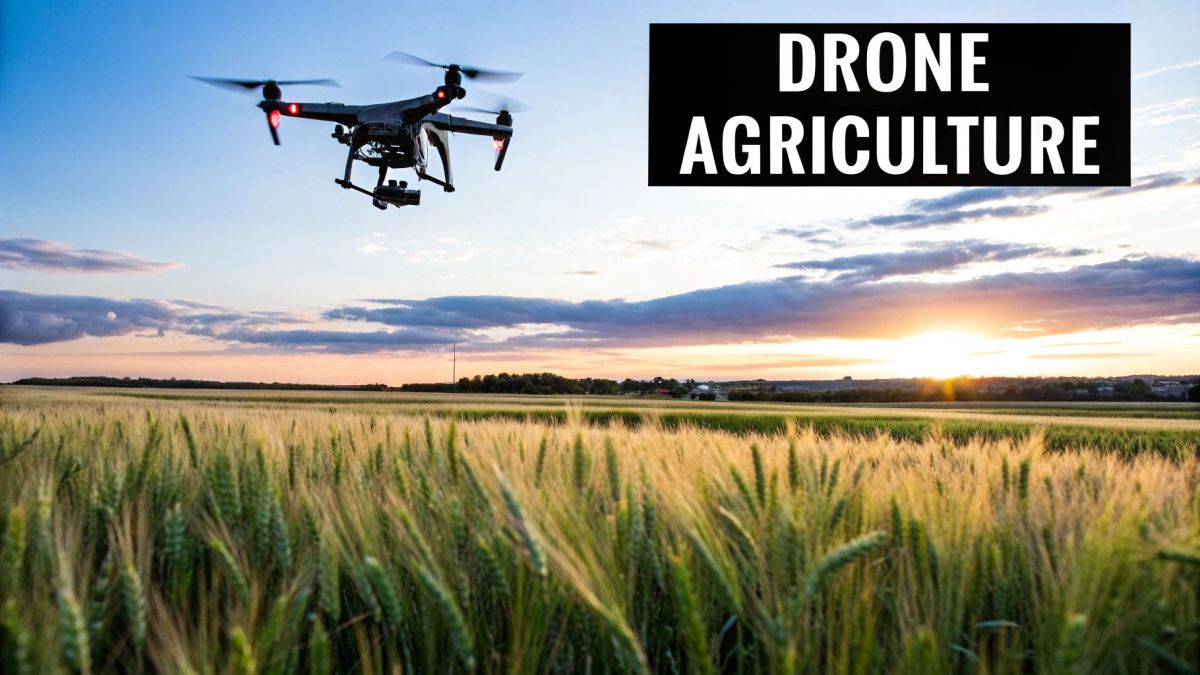
Across Australia's massive and varied landscapes, the agricultural sector is going through a quiet but significant change. Traditional methods, as reliable as they've been, often mean high costs, long hours, and a lot of manual labour. Throw in unpredictable weather, irrigation headaches, and pest control, and a farm's productivity and bottom line can take a serious hit. This is where drones in agriculture Australia are stepping in, offering a powerful answer to these age-old problems.
This guide cuts through the noise to get straight to what this technology really means for your farm. We’ll look at how unmanned aerial vehicles (UAVs) are turning conventional farming practices into efficient, data-backed operations. It’s all about giving farmers the power to make smarter, more informed decisions that have a direct impact on their success.
From Manual Labour to Automated Insight
The best way to think of an agricultural drone isn't just as another piece of machinery, but as a tireless partner in the paddock. It gives you a perspective that was once impossible or just too expensive to get. From this vantage point, you can take precise actions that help boost yields, cut running costs, and support more sustainable farming.
The results are already showing up on properties all over the country. Farmers are using drones for:
- Early Problem Detection: Spotting crop diseases or pest infestations before they have a chance to wipe out an entire paddock.
- Resource Optimisation: Applying water, fertiliser, and pesticides with pinpoint accuracy, which means less waste and a smaller environmental footprint.
- Improved Time Management: Getting jobs like livestock monitoring or field scouting done in a matter of hours, not days.
By turning raw data into real-world intelligence, drones help farmers shift from constantly reacting to problems to proactively managing their property. This change is key to improving profitability and building a sustainable future.
A New Era of Farming
This technology is making precision agriculture a real possibility for farms of all sizes, not just the massive corporate ones. From the broadacre crops in the Wheatbelt to the vineyards of the Barossa Valley, the ways you can use drones are as diverse as the Australian landscape itself. This guide will get you ready for a deep dive into the specific applications that are changing what modern farming looks like.
We'll cover everything from how these drones actually work to the specific rules and regulations you need to be aware of. By the time you're done, you'll have a clear picture of how to bring this powerful tool into your own operation and get your farm ready for what's next. The drone revolution isn't on its way—for many Aussie farmers, it's already here.
How Agricultural Drones Actually Work
When you picture a drone, you might think of a small quadcopter for taking photos. An agricultural drone is a completely different beast. Forget the hobbyist gadget; think of a specialised piece of farm equipment. It’s built with the toughness of a tractor but operates with the precision of a surgeon. These aren't toys; they're powerful tools designed for hard work.
The real difference is in their build and their mission. Unlike the drones you see at the park, the models used on Australian farms can be up to 20 times the size. They're engineered to handle everything from mapping hundreds of hectares to delivering precise amounts of water, fertiliser, or pesticides. To do this, they’re kitted out with advanced imaging gear like RGB, multispectral, and thermal cameras that capture a complete picture of crop health and soil conditions.
These machines are built to carry heavy payloads and operate in the tough, often dusty and windy, conditions of the Australian bush.
Seeing What the Human Eye Can't
The true advantage of an agricultural drone lies in the specialised sensors it carries. These are its ‘eyes’, and they collect information far beyond what we can see. Each type of sensor offers a unique perspective, giving farmers a layered, in-depth view of their land.
Here’s a quick rundown of the key technologies:
- High-Resolution RGB Cameras: Think of these as super-powered digital cameras. They capture incredibly detailed visual images, which are perfect for straightforward jobs like counting plants, spotting obvious weed patches, or checking for storm damage.
- Multispectral Sensors: This is where things get really clever. These sensors measure light from specific parts of the spectrum that are invisible to us, especially near-infrared light. Healthy plants reflect this light very differently to plants that are stressed, thirsty, or diseased.
- Thermal Cameras: As the name suggests, these detect heat. They’re brilliant for finding irrigation problems. A blocked sprinkler or an underwatered patch of a paddock will show up as a hotspot, making it easy to identify and fix.
Think of a multispectral sensor as an X-ray for your crops. It lets you see problems ‘under the skin’ long before they become visible to the naked eye. This gives you a crucial head start to fix the issue before it costs you yield.
The Brains Behind the Operation
A drone doesn’t just wander aimlessly across a paddock. Its ability to fly incredibly precise, repeatable patterns is all down to a smart system of hardware and software working together. This is what makes them such an efficient tool for farming at scale.
The core of the system is GPS-guided autonomous flight. Before taking off, the farmer or operator uses special software to draw a flight path on a digital map of the property. This plan is then sent to the drone.
Once in the air, the drone follows that pre-set route with centimetre-level accuracy, automatically correcting its course for wind and changes in terrain. This guarantees total, even coverage, whether you're scanning a 100-hectare wheat field or a block of grapevines. Every piece of data it collects is geotagged—meaning each image is tied to a specific GPS coordinate. This is vital for turning all that raw data into a map you can actually use.
Real-World Drone Applications on Australian Farms
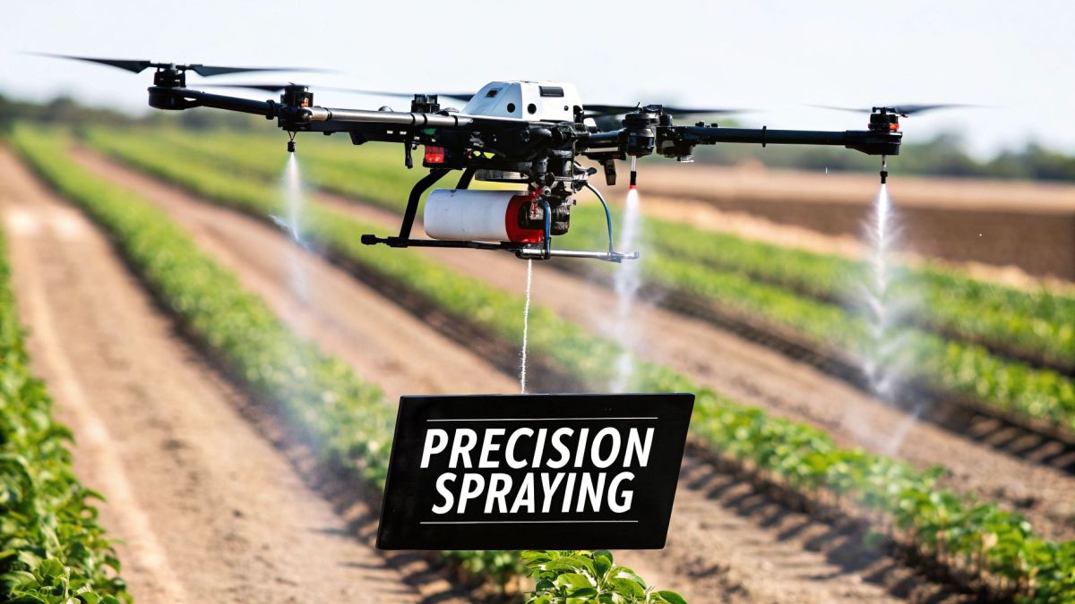
Theory is one thing, but seeing drones in agriculture across Australia in action is where their value really hits home. This isn't some futuristic pipe dream; farmers are already using this tech to solve everyday problems, slash costs, and get more out of their land.
Take a wheat farmer in Western Australia, for example. In the past, they might have spread nitrogen uniformly across hundreds of hectares. Now, a drone with a multispectral sensor can fly the property and create a detailed crop health map in just a few hours.
This map instantly shows which areas are doing well and which are falling behind, enabling a targeted fertilisation plan. Instead of guessing, the farmer applies fertiliser only where it's truly needed. This simple change can cut input costs by thousands of dollars and stops excess chemicals from running off into the environment. It's precision agriculture in its purest form: using smart data to make better decisions for the farm and the land.
Monitoring Crop and Pasture Health
One of the biggest wins with drones is the ability to keep a constant, bird's-eye watch over your crops. It’s a perspective you simply can’t get from the ground, and it lets you spot trouble long before it spirals out of control.
Think of it as a regular health check-up for your paddocks. A drone can systematically fly over a field, gathering data that picks up on the subtle signs of stress from pests, diseases, or nutrient issues—often weeks before you could see them with the naked eye. This gives you the jump on problems, allowing for small, targeted fixes instead of large-scale, expensive ones.
For those who need to manage aerial data collection professionally, a standardised form for requesting drone footage can help ensure all the right parameters are captured.
This same idea works brilliantly for livestock pastures. Drones can quickly measure biomass, giving graziers a clear picture of feed availability. With that info, they can plan rotational grazing schedules that prevent overgrazing and keep their stock healthy and well-fed.
Precision Spraying and Weed Mapping
Spraying is easily one of the most expensive and labour-intensive jobs on a farm. Old-school methods like boom sprayers or crop dusters rely on blanketing entire areas, which is not only wasteful but can also be harmful to the surrounding environment.
Drones flip this approach on its head. First, a mapping drone flies over to pinpoint the exact location of weed outbreaks. Then, a second spraying drone is sent out to apply herbicide with centimetre-level accuracy, hitting only the weeds.
The benefits are immediate and substantial:
- Massive Cost Savings: Herbicide use can plummet by up to 80%. You're only spraying the weeds, not the whole paddock.
- Environmental Protection: With almost no chemical drift, you protect nearby native plants, waterways, and beneficial insects.
- Improved Safety: Operators stay well away from potentially dangerous chemicals, dramatically reducing their risk of exposure.
Drones transform spraying from a brute-force activity into a surgical strike. This not only cuts costs dramatically but also supports the farm's long-term sustainability by preserving soil and ecosystem health.
Optimising Irrigation and Water Management
In a country as dry as ours, water is gold. Every drop counts, and inefficient irrigation is a direct blow to your bottom line. This is where drones equipped with thermal cameras are changing the game.
By flying over an irrigated crop, a thermal drone can instantly spot differences in soil moisture. A patch that looks hotter than the areas around it is a dead giveaway for underwatering, most likely from a clogged irrigator or a leaky pipe.
This allows farmers to find and fix issues in minutes—a task that used to mean days of walking the fields. The result is better water distribution, a more consistent yield, and a huge reduction in wasted water. To learn more, you can dive into the fundamentals of https://evolutionflight.com/precision-agriculture-with-drones/ in our detailed guide.
Livestock Management from the Air
For anyone running a large station, just finding and counting stock can be a massive job, often taking days with utes, bikes, and expensive helicopters. Drones offer a much faster, safer, and cheaper way to keep track of livestock.
A single drone can cover enormous areas in a short time, sending live, high-resolution video back to the operator. This makes it perfect for:
- Mustering: Finding and tracking the movement of mobs and herds.
- Stock Counting: Using software to get an accurate headcount without the hassle.
- Checking Water Points: Making sure troughs and dams are full without a long drive.
- Monitoring Animal Health: Spotting an injured or isolated animal from the air so you can intervene quickly.
By cutting down on the use of ground vehicles and choppers, drones don't just save a fortune in time and fuel; they also reduce stress on the animals, which is a big plus for herd welfare.
The Economic and Environmental Benefits of Drones
So, what’s the real reason a farmer should think about investing in drone technology? It all boils down to one simple thing: a solid return on your investment. The perks of using drones in Aussie agriculture aren't just pie-in-the-sky ideas; they deliver real, measurable improvements to your bank account and your farm’s environmental impact.
Bringing this tech onto your property is all about making smarter, more precise decisions that lead directly to serious cost savings and better profits. It’s about getting the most out of your resources. When you know exactly what your crops need and where, you can stop wasteful, blanket applications of expensive inputs like fertiliser and chemicals.
This precision means using less water, less spray, and less fertiliser. Those savings add up fast. At the same time, this data-first approach helps you get more out of every paddock. Spotting problems like pests, disease, or a dodgy irrigator early on means you can jump in and fix them quickly, leading to healthier crops and, ultimately, bigger and better yields come harvest time.
Boosting Your Bottom Line
The financial argument for drones is pretty clear—it’s all about efficiency and accuracy. Instead of relying on guesswork or spending days on the quad bike doing manual checks, you get a bird's-eye view of your entire property, giving you the hard data you need to act with confidence. This proactive style of management stops little problems from turning into expensive disasters.
For example, imagine a drone spots a nitrogen deficiency in a specific patch of your wheat crop. Instead of fertilising the whole paddock, you can create a prescription map for your tractor's variable-rate controller to apply nutrients only where they're needed. It’s targeted, it’s efficient, and it saves a fortune.
This data shows just how quickly Aussie farmers are catching on and the results they're getting.
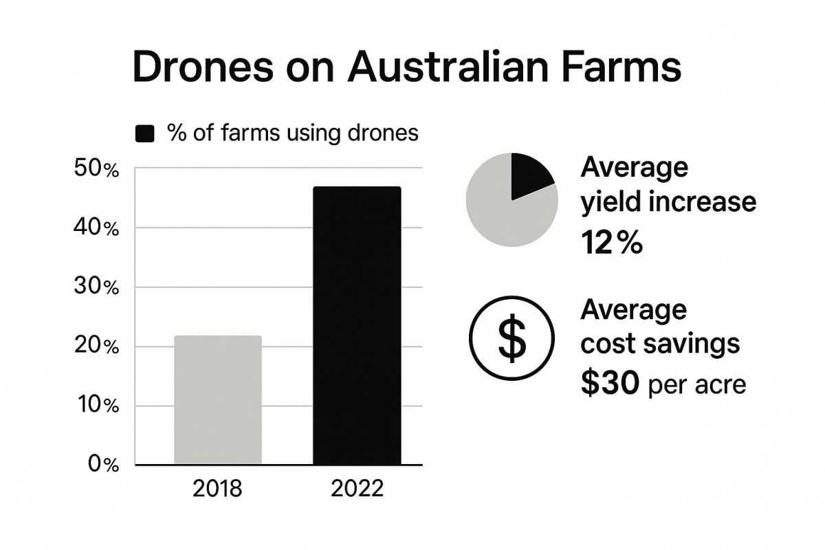
You can see that drone usage has tripled in just four years, and farmers are seeing significant average increases in yield while cutting costs.
Here’s a quick look at how those savings really stack up:
- Slash Your Input Costs: Studies have shown that precision spraying with drones can cut herbicide use by up to 80%. That’s a massive saving on chemicals alone.
- Increase Your Yields: By getting on top of crop stress factors early, farms using drone data often report yield increases of between 5-15%.
- Cut Down on Labour and Fuel: A single drone can survey hundreds of hectares in one flight. That’s a job that could take a person days on a bike, burning fuel and time.
To really see the difference, let’s compare a few common jobs side-by-side.
Drone Farming vs Traditional Methods: A Cost-Benefit Snapshot
This table breaks down how drones change the game for everyday farming tasks, moving from broad-acre guesswork to data-driven precision.
| Farming Task | Traditional Method | Drone-Assisted Method | Key Benefit |
|---|---|---|---|
| Pest & Weed Spotting | Manual scouting on foot or quad bike; time-consuming and often misses early signs. | Automated flights with multispectral cameras detect stress spots before they're visible to the naked eye. | Early intervention, preventing widespread outbreaks and reducing chemical use. |
| Fertiliser Application | Blanket application across the entire paddock based on soil tests or historical data. | Variable Rate Application (VRA) maps are created from drone data to apply fertiliser only where needed. | Massive cost savings on inputs and reduced environmental runoff. |
| Crop Health Monitoring | Visual inspection, which is subjective and can be slow to identify issues like water stress or disease. | Regular flights create NDVI or other health maps, tracking plant vigour across the entire farm in near real-time. | Proactive management, leading to higher, more consistent yields. |
| Irrigation Checks | Manually checking sprinklers, pipes, and soil moisture levels, which can take hours or days. | Thermal imaging drones quickly identify leaks, blocked nozzles, or dry patches from the air. | Improved water efficiency and reduced labour costs. |
As you can see, the shift isn't just about a new piece of kit; it's a fundamental change in how you manage your land and resources.
Cultivating a Greener Future
Beyond the dollars and cents, drones bring some pretty significant environmental wins. Sustainable farming isn't just a trendy term anymore; it’s a vital part of modern agriculture that consumers and supply chain partners are demanding. Drones are a key tool for making sustainability both practical and profitable.
Precision application is where the biggest environmental benefits lie. When you can apply chemicals with surgical accuracy, you drastically lower the risk of spray drift and chemical runoff into waterways or onto neighbouring properties. This protects local ecosystems, improves your soil health for the long haul, and helps preserve biodiversity.
By minimising chemical usage and optimising water distribution, drones in agriculture in Australia help farmers become better stewards of their land. This enhances environmental credentials and builds a more resilient and sustainable farming operation for future generations.
This targeted approach also creates a safer working environment for you and your team by reducing direct exposure to potentially harmful chemicals. On top of that, the detailed data you collect from regular drone flights provides an invaluable record for compliance and certification schemes, proving your commitment to responsible land management. This level of insight is a core benefit of modern aerial surveying UAV technology, which turns a simple flyover into a powerful management tool.
Navigating Australian Drone Rules and Regulations
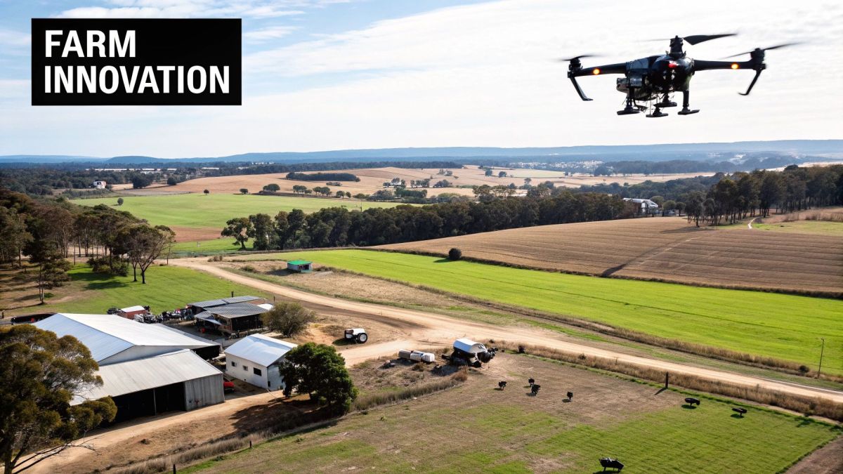
Before you send a drone up over the back paddock, you need to get your head around the rules of the sky. In Australia, the Civil Aviation Safety Authority (CASA) is the governing body for all drone operations. Flying a drone on your farm isn't as simple as pulling it out of the box and taking off; understanding the rules keeps you, your team, and your neighbours safe while helping you steer clear of some pretty hefty fines.
The regulations for drones in agriculture Australia really boil down to two things: how much your drone weighs and what you're using it for. CASA has set up specific categories to make it clear what’s required for different kinds of work, which is must-know information for any farmer looking to bring this tech onto their property.
It's best to think of these rules not as a roadblock, but as a flight plan for safe and legal operations. Following them means you can get the most out of your drone without landing yourself in hot water.
Understanding Drone Weight Categories
The biggest factor that determines which rules apply to you is your drone's weight. For farm work, your operations will likely fall into one of a few key weight classes, and each has its own set of requirements.
-
Sub-2kg Drones (Excluded Category): For the smaller, lighter drones, the rules are a bit more relaxed. If you're flying a drone under 2kg for commercial purposes over your own land, you generally don't need a formal licence. You do, however, still have to stick to CASA's standard operating conditions.
-
2kg to 25kg Drones: This category is where you'll find many of the more serious agricultural drones—the ones built for spraying and detailed mapping. To operate a drone of this size for your business, you'll almost certainly need proper qualifications to prove you can handle the larger, more complex equipment safely.
It’s absolutely crucial to know your drone's take-off weight, including any payload like sensors or spray tanks, so you can figure out which category you’re in. For a deeper dive into the kind of accuracy these machines need, you might find it useful to read our guide that explains what is RTK GPS and how it achieves centimetre-level precision in the air.
Licensing and Certification Requirements
For most serious agricultural drone work, especially if you're using drones over 2kg, you or your operator will need to be properly certified. This isn't just red tape; it ensures a high standard of safety and operational know-how.
The main ticket you'll need is the Remote Pilot Licence (RePL). Getting a RePL involves completing theory and practical training with a certified provider. It’s your proof that you have the skills to fly your drone safely and that you understand Australian aviation law.
If you plan on flying a drone over 25kg or need to operate outside the standard rules (like flying closer to people or at night), you'll also need a Remotely Piloted Aircraft Operator's Certificate (ReOC). This is more of an organisational certificate that lays out your procedures for safely conducting more complex jobs.
Key Rules You Must Always Follow
No matter how big your drone is or what licences you hold, there are some universal rules that apply to every single flight. CASA calls these the "standard operating conditions," and they are non-negotiable.
- Fly in Visual Line-of-Sight: You must be able to see the drone with your own eyes at all times—not just through a camera feed on a screen.
- Maintain Safe Distances: Never fly your drone closer than 30 metres to people, vehicles, or buildings that aren't on your own property.
- Respect Airspace: Keep well away from restricted airspace. This means staying clear of airports and areas around emergency situations like bushfires.
- Fly Below 120 Metres: Your drone must stay at or below 120 metres (400 feet) above ground level.
- Fly During the Day: Unless you have specific approval from CASA, all your flights must happen during daylight hours.
Sticking to these core principles is the foundation of being a responsible drone user in Australian agriculture.
Choosing the Right Drone for Your Farm
Picking the right drone for your farm isn't about finding the "best" one on the market. It's about finding the right tool for the job you need done. A drone that's perfect for mapping a 500-hectare wheat paddock would be overkill for checking on a few head of cattle in a holding yard. Think of it like buying a vehicle – you wouldn't use a road train to pop down to the shops, and a ute isn't much good for hauling grain at scale.
Before you invest, it helps to understand the main types of ag drones out there. The market for drones in agriculture in Australia is absolutely exploding right now. It hit USD 54.1 million in 2024 and is projected to skyrocket to USD 499.0 million by 2033. If you want to dig into the numbers, the full report from the IMARC Group breaks down what’s driving this massive growth.
Fixed-Wing vs Multi-Rotor Drones
The first big choice you'll face is the drone's basic design, which really dictates what it can and can't do. You're generally looking at either a fixed-wing model or a multi-rotor, and the right one for you depends on whether you need to cover big country or get in close for detailed work.
- Fixed-Wing Drones: These look like small aeroplanes and are built for one thing: endurance. They can fly for a long time and cover huge areas, often hundreds of hectares on a single battery. This makes them the go-to for mapping broadacre crops or doing large-scale surveys.
- Multi-Rotor Drones: These are what most people picture when they think of a drone – a quadcopter or Quadcopter. Their big advantage is agility. They can take off and land vertically and hover in one spot, which is essential for detailed inspections, checking on livestock, or precision spraying.
Selecting the Right Sensors and Cameras
A drone itself is just a platform; its real power comes from the sensors and cameras it carries. These are the "eyes" of the operation, and fitting the right ones is how you turn a simple flight into useful information that can save you time and money.
Here are the most common sensor types you'll come across:
- High-Resolution RGB: This is basically a very good standard camera. It’s perfect for visual jobs like spotting weeds from above, doing a quick stock count, or assessing fence line damage after a storm.
- Multispectral Sensors: This is where things get really clever. These sensors capture light that we can't see, giving you a direct window into crop health. You can spot stress from pests, diseases, or a lack of nutrients well before you'd ever notice it with your own eyes.
Think of it this way: an RGB camera tells you what your crop looks like today. A multispectral sensor tells you how it feels and what it will likely look like next week, giving you a crucial head start on any problems.
Lastly, don't forget the software. A drone flight produces a massive amount of raw data. It’s specialised software that stitches all those images together, interprets the sensor readings, and turns it into something genuinely useful, like a weed map you can act on or a prescription file to send straight to your spreader. This is the final piece of the puzzle that makes the whole system work.
Frequently Asked Questions About Farm Drones
Bringing any new piece of technology onto the farm is a big decision, and it always comes with questions. When it comes to drones in agriculture in Australia, most farmers want to cut through the hype and understand the practical details before they part with their hard-earned cash.
Let's walk through some of the most common queries we hear, covering everything from the upfront costs and necessary skills to how these machines actually fit into your day-to-day work.
How Much Does an Agricultural Drone Cost?
The price tag on a farm drone can swing pretty wildly depending on what you need it to do. If you're just after a simple eye in the sky for visual scouting, you could get started for a few thousand dollars.
For the more serious gear—drones with advanced multispectral sensors or spraying setups—you’re looking at anywhere from $20,000 to over $50,000. It's also smart to budget for ongoing costs like software, training, and any licences you might need.
A lot of farmers find it makes sense to hire a drone service provider for a season first. It's a great way to test the waters, see the real-world benefits on your own property, and get a feel for the return on investment before making a big capital purchase.
Do I Need a Special Licence to Fly a Farm Drone?
This all comes down to the drone's weight and what you're doing with it. The Civil Aviation Safety Authority (CASA) has set out some clear rules.
For a small drone (under 2kg) flying over your own land, the rules are fairly straightforward. But for most proper commercial farm work, especially if the drone is over 2kg, you’ll almost certainly need to get a Remote Pilot Licence (RePL).
The RePL involves a bit of theory and hands-on training. Honestly, the most valuable part isn't just learning to fly; it's learning how to turn the raw data the drone gathers into smart, profitable decisions for your farm.
How Does Drone Data Work with My Existing Farm Equipment?
This is where it all clicks together and you really see the power of precision ag. The data you get from a drone—say, a detailed weed map or a chart showing nitrogen levels—is meant to talk to your other machinery.
This information gets processed into a "prescription map." You can then load this map straight into modern tractors and sprayers equipped with variable rate technology (VRT).
This integration means your gear can automatically change how much fertiliser, herbicide, or water it's applying as it travels across the paddock. It's all about putting inputs exactly where they're needed and not wasting a drop where they aren't.
What Is the Future of Drone Technology in Australian Farming?
The next big steps are all about smarter integration and more automation. We’re heading towards a farm where all the technology works together seamlessly, and drones are a central part of that.
Here’s what’s on the horizon:
- Drone 'Swarms': Imagine a team of drones working in coordination to map or spray massive areas in a fraction of the time it takes today.
- Full Autonomy: We're talking drones that can launch themselves, fly a mission, process the data, and return to their charging station, all without a person touching a controller.
- Advanced AI: The artificial intelligence behind the scenes will get even sharper, giving you predictive insights that help you get ahead of problems before they even start.
Ready to see how advanced drone technology can transform your agricultural operations? Innoflight International designs and manufactures high-performance UAVs tailored for Australian conditions. Discover our solutions at https://evolutionflight.com.