
A drone's software isn't just one program; it's a whole suite of tools working together. This digital ecosystem is the brain behind the machine, managing everything from flight planning to data analysis. It's what turns the physical drone into a powerful tool for complex jobs like 3D modelling, land surveying, and inspecting assets.
Your Guide to Understanding UAV Software
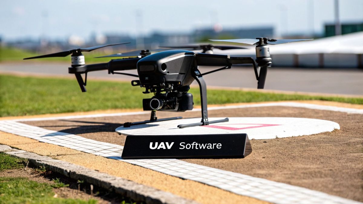
Think of your drone, or Unmanned Aerial Vehicle (UAV), like a high-performance car. The hardware—its motors, propellers, and frame—is the powerful engine and chassis. But without a skilled driver, a reliable navigation system, and advanced diagnostics, it's just a machine going nowhere fast. UAV software is all of those things wrapped into one digital toolkit.
This isn't just a simple remote control app on your phone. It’s a collection of specialised programs that collaborate to unlock what your drone can really do. A top-of-the-line drone is just a flying camera without the right software. But with it, that same drone becomes a critical tool for gathering precise, actionable intelligence for your business. This guide will walk you through how it all works.
The Core Functions of UAV Software
At its core, drone software handles three key stages of any aerial mission. Breaking it down this way makes it clear why a single, do-it-all program is so rare in professional circles.
- Flight and Mission Control: This is the 'pilot and navigator'. This software does everything from keeping the drone stable in a crosswind to flying complex, pre-planned routes for automated surveys.
- Data Capture Management: This part makes sure the drone's sensors—be it a high-res camera or a LiDAR scanner—are grabbing the right data at the right time. It manages camera angles, triggers, and image overlap to ensure the data you collect is actually usable.
- Analysis and Processing: This is the 'analyst' software. It takes all the raw data you've captured and turns it into something meaningful. It might stitch thousands of photos together to create a 3D model or process sensor readings to generate detailed maps. You can learn more about how this works in our guide on the relationship between drones and GIS.
This software ecosystem is the engine driving the industry's incredible growth. The Australian UAV market hit around USD 0.28 billion in 2024 and is on a steep upward trajectory. With a projected compound annual growth rate (CAGR) of 27%, it's expected to climb to about USD 2.76 billion by 2034, a boom largely powered by software innovation.
Choosing the right software isn't just a technical decision; it's a strategic one. The quality of your software directly determines the quality, accuracy, and ultimately the value of the insights you can extract from your UAV operations.
The Three Pillars of a UAV Software Ecosystem
Think of any successful drone operation, and you'll find it rarely relies on a single, do-it-all program. Instead, it’s powered by a dynamic ecosystem of specialised tools all working together. It’s a lot like a three-person flight crew: a pilot, a navigator, and an analyst. Each has a critical role, but they must communicate perfectly to get the job done right. The same is true for UAV software.
This ecosystem is built on three core pillars, each one handling a vital stage of the workflow, from the moment the drone takes off to the final report landing on a client's desk. Getting your head around how these parts work and interact is the first step to building a truly effective aerial data solution.
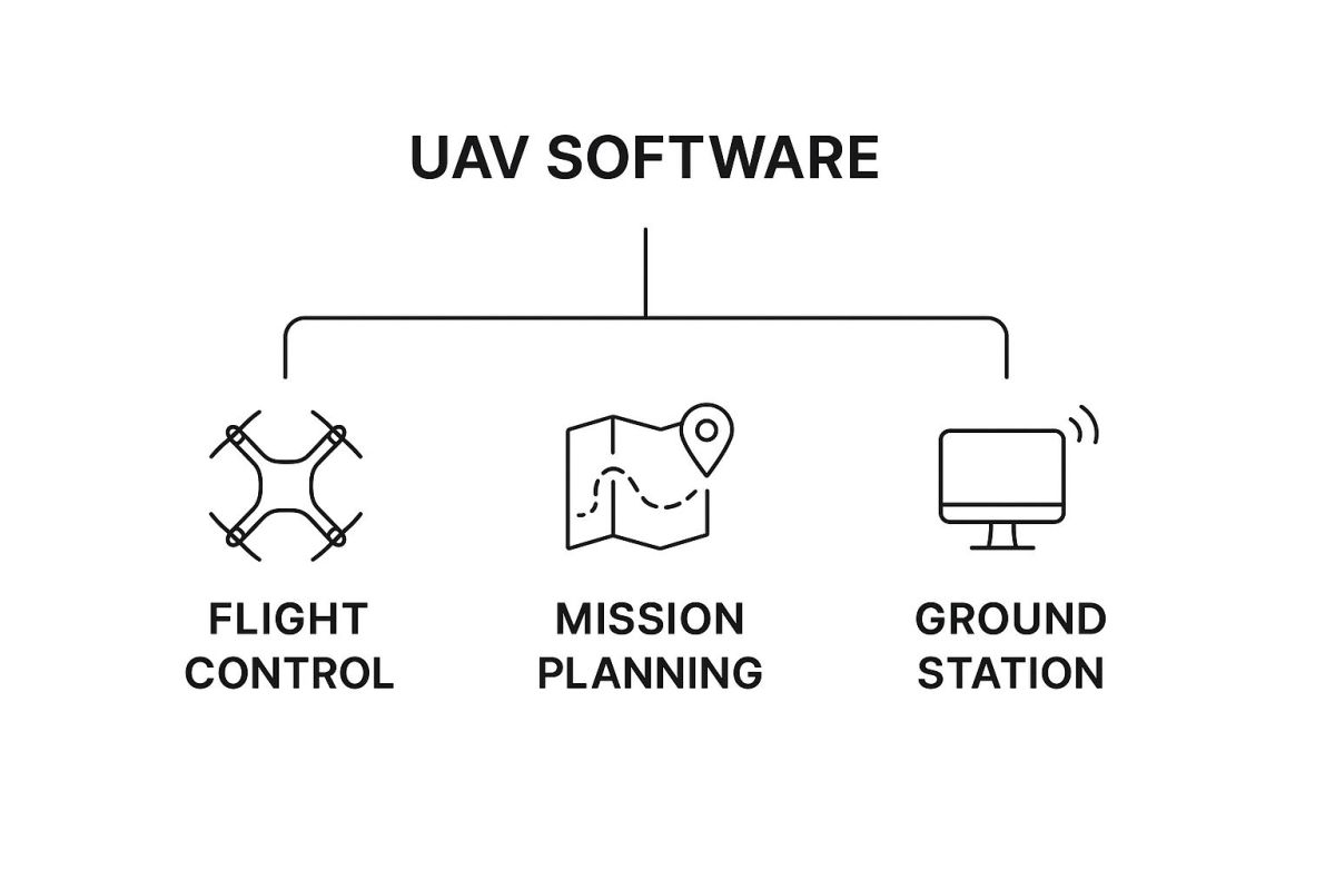
As you can see, each software category has a distinct job, branching out from the central idea to create a complete, end-to-end workflow.
Flight Control and Ground Station Software
First up is the 'pilot' of your operation. Flight control software is the direct link between you and your drone. It’s what translates your commands into action, managing the motors, stability, and all the real-time flight data needed to keep the UAV safely in the air. This software is usually built into the drone’s firmware and is managed through a Ground Control Station (GCS) app.
The GCS app, often running on a tablet or a tough-as-nails controller, is your cockpit. It gives you a live video feed, crucial telemetry (like altitude, speed, and battery life), and of course, the manual flight controls. It’s all about giving you complete situational awareness and the power to take over instantly if you need to. For any professional setup, solid system integration strategies are essential to make sure all these moving parts talk to each other without a hitch.
Mission Planning Software
Next, you have the 'navigator'. While the GCS handles the here-and-now of flying, mission planning software lets you automate complex flights before the drone even leaves the ground. This is where you turn a simple drone into a precision instrument for collecting data.
Mission planning is the bridge between your project goals and the drone's actual flight path. It ensures you capture consistent, high-quality data every single time, taking the guesswork and human error out of complex survey patterns.
Using this software, you can draw a survey area on a map and let the program generate the most efficient flight path automatically. You get to set all the key parameters to make sure you don’t miss a thing:
- Altitude: This directly impacts the ground resolution of your photos.
- Speed: A balancing act between image clarity and how long the mission takes.
- Image Overlap: Critical for ensuring there are enough common points between photos for the processing software to do its magic later.
- Camera Triggers: This lets you tell the drone exactly where and when to take a picture.
This kind of automation is absolutely vital for jobs like mapping huge agricultural fields across regional Australia or carrying out detailed inspections of powerline corridors. To dive deeper, check out our complete guide to UAV flight planning software.
Data Processing and Analysis Software
Finally, we meet the 'analyst' in our crew. This is arguably where the real value gets created. All that raw data your drone collects—whether it's thousands of high-res images, a dense LiDAR point cloud, or thermal readings—is pretty much useless until you have software that can make sense of it all.
Data processing software takes this raw information and turns it into something you can actually use. For example, photogrammetry software stitches together the thousands of overlapping images from your mission to build dimensionally accurate 2D orthomosaics and 3D models. Other specialised programs can analyse multispectral data to create crop health maps or process thermal data to find faulty solar panels.
These three pillars—flight control, mission planning, and data processing—are the backbone of any professional drone operation. They're what turn a flying sensor into a genuine business solution.
Turning Raw Drone Data Into Actionable Insights
Once your drone has landed, the real work begins. The flight itself is just the collection phase; the raw data you've gathered—thousands of images, millions of LiDAR points, or complex thermal readings—is full of potential. But on its own, it’s just noise.
This is where data processing and analysis software comes in. It's the crucial step that translates all those pixels and points into genuine business intelligence. It’s no surprise the Australian drones market, valued between USD 614 million and USD 1.05 billion in 2024, is booming. The powerful analytical tools turning data into dollars are a huge part of that growth.
Think of it like a carpenter needing different saws for different cuts. Each type of drone data requires a specialised tool to process it correctly. Let's break down the main categories.
Photogrammetry Software
Imagine taking thousands of overlapping photos of a building site and then having a program stitch them together into a single, flawless mosaic. That’s photogrammetry software in a nutshell. It finds common points across countless images to build incredibly accurate and measurable 2D maps and 3D models.
This is the workhorse of the UAV software world. It’s used for everything from tracking progress on a high-rise in Perth to calculating stockpile volumes at a mine in the Pilbara. The results aren't just visually impressive; they're packed with valuable data.
- 2D Orthomosaics: These are high-resolution, map-accurate images without the distortion you see in a normal photo. They’re perfect for surveyors who need a reliable visual base for planning.
- 3D Point Clouds: A massive collection of points floating in 3D space, each with its own precise geographic coordinates. This forms the skeleton for creating detailed 3D models.
- Digital Elevation Models (DEMs): These models strip away buildings and trees to show the bare-earth surface. They're vital for understanding terrain for land development or flood modelling.
LiDAR Processing Software
While photogrammetry works with photos, LiDAR (Light Detection and Ranging) uses lasers. A drone with a LiDAR sensor fires out thousands of laser pulses every second and measures how long they take to bounce back. The result is an exceptionally dense and precise point cloud.
LiDAR processing software is built to clean, classify, and make sense of this data. Its biggest advantage is the ability to punch through vegetation to map the ground underneath—something photogrammetry simply can't do. You can find out more about how these systems work in our guide to https://evolutionflight.com/drones-with-lidar/.
LiDAR processing is the go-to choice when extreme precision is a must. Think mapping powerline corridors to check for overgrown trees or conducting detailed topographical surveys for major engineering projects.
Specialised Sensor Analysis Software
Drones often carry more than just standard cameras or LiDAR. These specialised sensors collect unique data, and each needs its own kind of analysis software.
- Thermal Analysis Tools: These programs interpret data from thermal cameras, which see heat instead of light. They’re used to spot faulty panels on solar farms, find heat leaks in buildings, or even check on the health of livestock.
- Multispectral Software: This software is all about seeing the unseen. It processes data from sensors that capture specific bands of light invisible to the human eye. In agriculture, this is a game-changer. A farmer in the Barossa Valley can use it to create vegetation health maps (like NDVI) to pinpoint crop stress and apply water or nutrients exactly where they're needed.
To get the most out of this data, many modern UAV software platforms are now incorporating artificial intelligence. This level of AI-powered data analysis is what really turns a simple drone flight into a strategic business advantage.
Comparison of UAV Data Processing Software Types
To help clarify the differences, here’s a quick comparison of the main software types and how they’re typically used in Australia.
| Software Type | Primary Function | Input Data Type | Common Australian Application |
|---|---|---|---|
| Photogrammetry | Creates 2D maps and 3D models from images | Standard RGB photos | Construction site monitoring, agricultural mapping, stockpile volume calculation |
| LiDAR Processing | Cleans and classifies laser point clouds | LiDAR point cloud data (.las, .laz) | Forestry management, infrastructure inspection (powerlines), high-precision surveying |
| Thermal Analysis | Interprets and visualises heat data | Radiometric thermal images | Solar farm inspections, building insulation audits, search and rescue operations |
| Multispectral | Analyses vegetation health and stress | Multispectral image bands | Precision agriculture (crop health), environmental monitoring, water quality analysis |
As you can see, the right software depends entirely on the job at hand. Choosing the correct tool is what unlocks the true potential of your drone data, turning a simple aerial picture into a detailed, data-rich report.
How to Choose the Right Software for Your UAV
Picking the right software for your UAV can feel a bit overwhelming. You’re faced with a sea of options, all claiming to be the best. But here’s the secret: there is no single "best" program. The real goal is to build the right toolkit for what you need to do.
Getting this right from the beginning saves a massive amount of time, prevents frustrating and expensive do-overs, and ultimately ensures you get the valuable data you’re actually after. The whole process starts not by looking at shiny software features, but by getting crystal clear on your own goals.
Are you a surveyor in Western Australia chasing centimetre-level accuracy for a cadastral job? Or are you an agronomist in the Riverina keeping an eye on crop health over huge paddocks? Your mission dictates every single choice you'll make from here.
Define Your Primary Goal and Required Outputs
Before you even glance at a software’s website, you need a solid answer to one question: What problem am I trying to solve?
The moment you can answer that, your search gets a whole lot easier. A construction manager who just needs to track weekly site progress has completely different software needs than an environmental scientist mapping coastal erosion.
Start by working backwards. Figure out what you need the software to produce at the very end. This final product, your "deliverable," is your North Star.
- For Surveying and Mapping: Are you aiming for a 2D orthomosaic map for site planning, or do you need a super-detailed 3D point cloud for a topographical survey?
- For Asset Inspection: Is a folder of high-res, geotagged photos of a bridge or powerline enough? Or do you need a full 3D model so you can actually measure defects?
- For Agriculture: Are you just after a simple vegetation health map (like an NDVI) to spot problem areas, or something more complex, like a prescription map for variable-rate fertilising?
Nailing down your outputs first stops you from accidentally paying for a powerful, expensive photogrammetry suite when all you really needed was a simple tool for video analysis.
Assess Hardware and Sensor Compatibility
Your drone and its payload—the camera, LiDAR, or multispectral sensor—are the bedrock of your whole operation. Your software has to play nicely with them. This sounds obvious, I know, but it’s a surprisingly common trap people fall into.
Not all software can chew through data from every type of sensor out there.
Run through this quick checklist:
- Drone Model Compatibility: Does the mission planning app you're looking at actually support your drone? The manufacturer’s own app (like DJI Pilot 2) is always a safe bet, but third-party options often pack in more advanced features.
- Sensor Data Requirements: If you’re flying a specialised bit of kit, like a Zenmuse L2 LiDAR or a multispectral camera, double-check that your processing software can handle its unique data formats and calibration workflow.
- Geotagging Method: How does your drone log location data for each image? The software needs to be able to read this, whether it's baked into standard EXIF data or comes from separate, high-precision logs for PPK/RTK work.
A classic mistake is buying a top-tier sensor without first checking if your current processing software can actually unlock its full potential. Always check compatibility before you spend big on new hardware. Otherwise, you’ve just created a very expensive bottleneck for yourself.
Evaluate Accuracy and Processing Requirements
Accuracy isn't a simple, one-size-fits-all thing in the drone world. The level of precision you need is tied directly to your end goal. For a real estate fly-through video, pinpoint positional accuracy is pretty much irrelevant. For a boundary survey, a few centimetres can be the difference between a happy client and a legal dispute.
- Relative Accuracy: This is all about how precise measurements are within the model itself. It's crucial for things like calculating stockpile volumes, where the exact global position matters less than getting the volume spot-on.
- Absolute Accuracy: This refers to how accurately your model is placed on its true position on Earth. To nail this, you need Ground Control Points (GCPs) or clever GPS techniques like RTK/PPK. This is absolutely non-negotiable for any professional surveying or engineering work.
Your accuracy demands also shape your processing workflow. High-accuracy jobs often rely on a Post-Processed Kinematic (PPK) workflow. This requires software that can crunch raw satellite observation data after the flight. While RTK gives you corrections in real-time, PPK offers more flexibility and can often deliver even higher accuracy, which is a lifesaver in areas with patchy communication signals. As a rule of thumb, a minimum flight duration of 10-15 minutes is a good idea to collect enough GNSS data for a solid PPK solution.
Compare Pricing Models and Support
Finally, you have to think about the money. UAV software usually comes in a few different flavours when it comes to pricing.
- Perpetual Licence: You buy it once and own it forever. Just be aware that major version upgrades might cost you extra down the line.
- Subscription (Monthly/Annual): You pay a recurring fee for continuous access to the latest updates and support. This has become the standard for most platforms.
- Pay-per-Project: You only pay for the data you process. This can be a great, cost-effective option if you only fly occasionally.
When you're weighing up the cost, look past the initial price tag. What kind of technical support is included? Is there a good community forum or a deep knowledge base you can tap into? For any professional operation, fast and reliable support can be just as valuable as the software itself—especially when you’re out on a job site with a deadline breathing down your neck. Choosing the right software for a UAV is all about building an operational stack that is capable, reliable, and makes financial sense for your business.
Putting UAV Software to Work Across Australian Industries
It’s one thing to talk about what drone software can do, but it’s another thing entirely to see it in action. All across Australia, industries are waking up to the fact that a drone is just a tool; it's the software that unlocks its true potential. We're seeing businesses move beyond just flying a drone to actually integrating it into their workflows to solve real problems, work smarter, and keep their people safer.
Let's look at a few real-world examples from key Australian sectors. I'll walk you through the problem they faced, the kind of software they used to fix it, and the results they actually saw. This is where the drone's digital brain turns a simple flight into real profit and progress.
Precision Agriculture in the Riverina
Imagine you're a grain farmer in the Riverina, managing thousands of hectares. For years, the standard practice was to apply a blanket rate of nitrogen fertiliser across every paddock. This was a huge expense, and frankly, a bit of a guessing game. Some spots got too much, which is just money down the drain, while other areas didn't get enough, which hurts your yield come harvest time.
The goal was to get smarter with their fertiliser application. The answer came from a drone equipped with a multispectral sensor, which captures light frequencies our eyes can't see.
- The Problem: Applying a single, expensive rate of fertiliser across vast, varied paddocks.
- The Software Solution: The team used multispectral data processing software to make sense of the sensor's readings. This software crunches the data and generates a Normalised Difference Vegetation Index (NDVI) map – essentially, a detailed health chart for the entire crop. Healthy plants look very different to struggling ones on an NDVI map.
- The Outcome: The map clearly pinpointed the specific zones within the paddocks that needed more attention. This data was then fed into a variable-rate spreader, creating a "prescription map" for the fertiliser. The result? A 20% drop in fertiliser costs and a much more consistent, higher-quality crop. The software literally turned aerial pictures into an actionable plan.
Mining Operations in the Pilbara
On a massive iron ore mine in the Pilbara, knowing exactly how much material is in your stockpiles is a critical monthly chore. The old way involved surveyors walking the site with GPS equipment – a slow process that put them in close proximity to enormous machinery. On top of the safety risks, the results weren't always consistent.
The mine needed a way to get this job done faster, safer, and with more reliable numbers.
Photogrammetry software is no longer a "nice-to-have" in modern mining; it's an essential tool. It delivers a powerful mix of speed, safety, and accuracy for measuring volumes, giving site managers solid data to base their inventory decisions on.
They switched to a drone-based survey program. A UAV flew a pre-planned grid pattern over the stockpiles, snapping thousands of high-resolution, geotagged photos.
- The Problem: Stockpile measurements were slow, dangerous, and often inaccurate.
- The Software Solution: Those thousands of images were loaded into advanced photogrammetry software. The program's job is to find common points in the photos and stitch them all together, creating an incredibly detailed 3D model of the stockpiles. From that model, it can calculate the volume with an accuracy often within 1-2% of the old ground-based methods.
- The Outcome: A job that used to take two full days now takes about three hours. Crucially, it completely removes people from a high-risk area. The mine now gets highly accurate, repeatable data for managing its inventory and forecasting production, all thanks to some clever software.
Construction Project Tracking in Sydney
A large development firm in Sydney was in the middle of a complex, multi-stage construction project. Trying to keep investors and stakeholders in the loop, while also verifying that contractors had hit their milestones, was a constant battle. They were relying on ground-level photos and manual reports that just didn't show the full scope of the project.
What they really needed was a bird's-eye view of the entire site, backed by solid data, on a regular basis.
- The Problem: It was difficult to track overall site progress and confirm that work was completed on time.
- The Software Solution: A drone performed weekly flights, and the imagery was processed using photogrammetry software. This created not only a detailed 3D model but also a super high-resolution 2D map (called an orthomosaic) of the entire site.
- The Outcome: Project managers could now take a virtual tour of the site right from their office. They could compare the latest 3D model directly against the architect's original plans (BIM models) to spot any issues. They could measure distances, check elevations, and see exactly what had been built that week. This visual, data-first approach smoothed out communication and led to a 15% reduction in the time they spent on physical site inspections and verifying milestones.
The Future of UAV Software and Automation

The world of UAV software is moving at a breakneck speed. The next wave of innovation is set to make drones smarter, faster, and more deeply woven into how we run our businesses. We're on the cusp of a major shift—from telling drones what to do, to a future where they can start to think for themselves.
The next generation of software for UAV operations is all about two things: greater intelligence and seamless collaboration.
Driving this change are big leaps in artificial intelligence (AI) and the sheer grunt of cloud computing. These technologies are turning drones from simple data-gathering tools into genuine partners that can analyse information on the fly, make decisions, and share what they've learned instantly. For Australian businesses, this opens up a whole new level of efficiency and capability.
Smarter Drones Through AI and Machine Learning
Artificial intelligence is finally giving UAV software the ability to see and understand the world in a way we could only imagine a few years ago. Instead of just taking pictures, drones are starting to figure out what’s in them, right there and then.
This is all thanks to machine learning, where we train software on huge sets of data to spot specific patterns. Think of an agricultural drone. You can teach it to not only see that a crop is stressed but to identify the specific disease or pest causing the problem—all while it's still in the air.
The next leap forward isn't just about automation, but true autonomy. UAV software will enable drones to react to their environment, identify new points of interest, and even adjust their own mission plan without human intervention.
This growing intelligence will pop up in a few key ways:
- Real-time Object Detection: A drone inspecting a powerline could automatically flag a cracked insulator, sending an alert with its exact coordinates back to the maintenance crew.
- Predictive Analysis: By looking at data over time, software could start to predict potential equipment failures on a worksite or forecast crop yields with much better accuracy.
- Autonomous Navigation: Drones will get much better at flying in tricky, GPS-denied spots like dense forests or inside warehouses, using their own sensors to find their way around.
The Shift to Cloud-Based Platforms
Working hand-in-hand with AI is the move to cloud-based platforms, which is completely changing how we manage drone operations. In the past, processing massive datasets—like a detailed photogrammetry model—meant you needed a seriously powerful and expensive desktop computer chained to your desk.
Cloud processing takes all that heavy lifting and moves it to powerful remote servers.
This means you can upload your data straight from the field and get it processed far more quickly, often by multiple machines working together. The results are then available to your whole team through a simple web browser, no matter where they are in the country. It makes working together on large-scale projects across Australia a whole lot easier and creates one central hub for every mission.
Answering Your Top Questions About UAV Software
Let's tackle some of the most common questions that pop up when people start digging into drone software. Getting these answers straight can clear up a lot of confusion and point you in the right direction.
Can I Just Use One Piece of Software for Everything?
It's a nice idea, but in practice, you'll almost always need a few different programs working together. Think of it as a 'software stack'.
You'll have one app for the hands-on flying and mission planning—often the one that comes from your drone's manufacturer. Then, you'll need a separate, more specialised program to turn all that raw data into something useful, like a 3D model or a detailed map. This is where dedicated photogrammetry or GIS software comes into play.
Is Free Drone Software Good Enough to Get Started?
Absolutely. Free software is a fantastic way to get your feet wet. You can learn the ropes of planning a flight path and even do some basic data processing without spending a cent.
But when you step up to commercial jobs, the game changes. For projects that demand centimetre-level accuracy, complex analysis, and the peace of mind that comes with tech support, investing in professional software is essential. It's what ensures you can deliver reliable, high-quality results to your clients.
For professional work, think of paid software as a critical investment, not just an expense. The reliability, support, and advanced features are what make your data accurate and dependable enough for paying customers.
Do I Need a Supercomputer to Run This Stuff?
It depends on what you're doing. The app you use for flight planning will run just fine on a standard tablet or smartphone.
However, processing the data you collect is a different story—it's incredibly demanding on your hardware. For this part, you'll want a powerful computer. We're talking about a machine with a high-end graphics card (GPU), plenty of RAM (32GB or more), and fast storage to handle the large files from your software for UAV missions.
For robust, enterprise-grade UAV platforms designed for high-precision data capture, Innoflight Technology offers integrated solutions that streamline your entire workflow. Discover our advanced systems at https://innoflighttechnology.com.