
A UAV GPS tracker is what gives your drone its bearings. Think of it as your drone's internal compass and map, all rolled into one. It’s the technology that constantly answers the question, "Where am I?", ensuring your drone never gets lost and can always find its way back to you.
Understanding Your Drone's Digital Compass
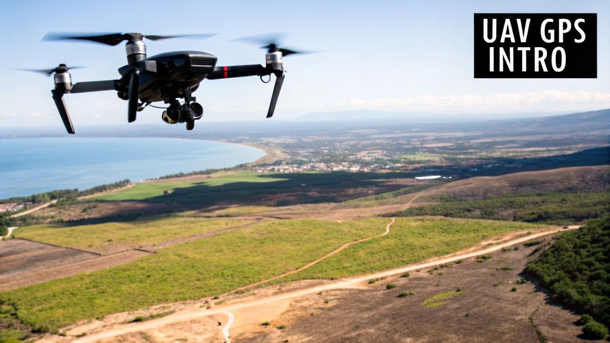
At its core, a UAV GPS tracker is a highly sensitive receiver that tunes into signals from a network of satellites circling the Earth. It's more than just a single component; it's a complete system that feeds location data to nearly every smart feature your drone has. Without it, things like autonomous flight, pinpoint navigation, and even basic safety functions just wouldn't be possible.
Imagine you’re trekking through the vast Australian outback with only a compass. You know which way is north, but you have no clue where you actually are. Flying a drone without GPS is a lot like that. The UAV GPS tracker is the device that pinpoints your drone's precise latitude, longitude, and even altitude, giving you a real-time dot on a map. This constant stream of location data is the lifeblood of the whole operation.
Why This Technology Is So Important
This continuous location awareness unlocks a drone's most impressive features. It's the technology that makes so many functions possible, whether you're flying for fun or for a professional job in some of Australia's most challenging environments.
With a solid GPS signal, a drone can:
- Hold a Stable Position: The tracker feeds the flight controller the data it needs to hover perfectly still, fighting against wind. This is absolutely essential for getting crisp, clear photos and smooth video footage.
- Follow Pre-Programmed Flight Paths: For complex missions like surveying a farm or inspecting a pipeline, GPS allows the drone to follow a precise, repeatable route all on its own.
- Return to Home Safely: This is a huge one. The "Return to Home" safety feature relies entirely on GPS to remember where it took off from, so it can navigate back automatically if the battery gets low or it loses connection with the controller.
In essence, the GPS tracker transforms a simple flying machine into an intelligent, spatially aware tool. It provides the certainty and reliability needed to deploy these valuable assets with confidence across Australia’s demanding terrain.
This system is the foundation that all the more advanced features are built on. It's the starting point for achieving the centimetre-level accuracy needed for professional surveying and mapping. Grasping this fundamental role is the first step in seeing how a simple uav gps tracker makes everything from a casual weekend flight to a high-stakes industrial mission possible.
How GPS Technology Powers Your Drone
Ever wondered how a drone can hover so perfectly still or fly a precise path without any visible effort? It might seem like magic, but the secret lies in a constant, high-speed conversation with satellites orbiting thousands of kilometres above us. A UAV GPS tracker is essentially a highly sensitive listener, tuned into signals beamed down from this network.
Each satellite broadcasts a unique, time-stamped signal. The drone’s onboard receiver picks up these signals from multiple satellites at once. To get a reliable lock on its position, it needs to hear from at least four of them. The more satellites it can connect with, the stronger and more accurate its location data becomes, which is the bedrock for nearly all of its smart flight features.
This is a great breakdown of how those raw signals from space become useful positioning data for your drone.
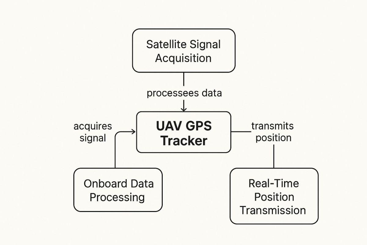
As you can see, it's a straightforward three-step process: the drone acquires the signal, processes the data, and then transmits its real-time position.
Pinpointing a Location with Trilateration
So, how does the drone turn those satellite signals into an exact spot on the map? It uses a clever bit of geometry called trilateration.
Think of it this way: imagine you're lost, and you call three friends. Each one tells you how far away you are from them—say, 10 km from one, 15 km from another, and 12 km from the third. If you draw a circle around each friend's location with the right radius, you'll find there's only one point where all three circles overlap. That's you.
A drone’s GPS does the exact same thing, just in three dimensions to account for latitude, longitude, and altitude. By calculating the time it takes for a signal to travel from a satellite, it knows its distance. With distance data from at least four satellites, it can nail down its precise 3D position with incredible accuracy.
This isn't a one-off calculation. It happens many times every second. This constant stream of data allows the drone's flight controller to make tiny, non-stop adjustments, which is what lets it hover perfectly in a breeze or follow a complex flight plan to the letter.
Achieving Centimetre-Level Precision
For most of us, standard GPS is more than accurate enough. But some jobs demand something much, much better. Think of professional applications like land surveying, precision agriculture, or inspecting critical infrastructure. In these fields, you need positioning that’s accurate down to the centimetre. This is where advanced systems come in, taking raw GPS data and refining it to a whole new level.
These systems work by correcting for tiny errors in standard GPS signals—errors caused by things like atmospheric interference or tiny wobbles in satellite orbits. There are two main ways to do this:
- Real-Time Kinematic (RTK): This method uses a fixed ground station whose exact position is already known. This station receives the same satellite signals as the drone, spots the errors in real-time, and sends a correction signal straight to the UAV. The drone instantly applies these corrections, achieving centimetre-level accuracy on the fly.
- Post-Processed Kinematic (PPK): PPK is similar, also using a ground station to record satellite data. The key difference is that the corrections aren't sent live. Instead, the data from both the drone and the ground station are downloaded and processed after the flight. This approach is often more reliable in places where the communication link might be patchy.
By going beyond standard GPS, these advanced kinematic systems turn a simple navigation tool into a high-precision instrument for serious professional work. To dive deeper, you can learn more about how RTK GPS technology functions in our detailed guide. It really shows how a UAV GPS tracker can be adapted for the most demanding industrial jobs.
What Are the Real-World Benefits of a GPS Tracker on Your Drone?
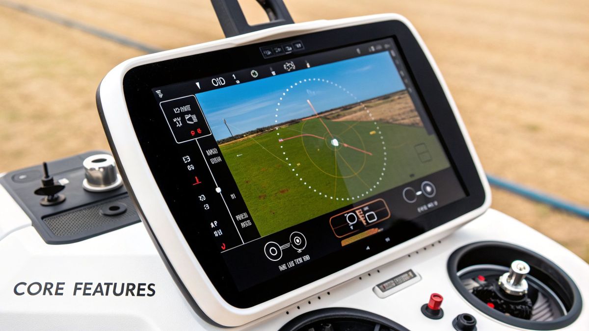
It’s one thing to understand the tech behind a UAV GPS tracker, but what really counts is seeing the difference it makes in the field. Adding a tracker to your drone isn’t just a minor upgrade; it’s a crucial move to protect your equipment, make your team more efficient, and stay on the right side of aviation laws. The benefits are direct, clear, and can have a real impact on your bottom line.
Let's break down the three main advantages a reliable UAV GPS tracker offers: better asset security, big wins in operational efficiency, and easier regulatory compliance. Each of these turns a technical feature into genuine, practical value.
Keep Your Expensive Assets Safe
A commercial drone is a serious investment, often running into thousands of dollars. Losing one to a flyaway, a technical glitch, or even theft is a massive headache for any operator. A GPS tracker is your best insurance policy, giving you a constant, real-time link to your valuable asset.
Picture this: your drone suddenly loses signal while flying over dense bushland or a remote mine site. Without a GPS tracker, finding it would be like searching for a needle in a haystack. With one, you have its last known coordinates, which shrinks the search area from impossibly large to manageable. It turns a potential write-off into a simple recovery mission.
In Australia, this isn't just a nice-to-have; it's fundamental to modern drone work, especially across our vast and remote landscapes. It's no surprise that over 85% of commercial drones operating in Australia are kitted out with high-precision GPS trackers. Local operators report that this tech slashes UAV loss rates by around 70%. Across industries like mining and agriculture, that adds up to millions of dollars saved every year. You can get more industry perspective from top Australian drone service providers like AUAV.
Think of a GPS tracker as your drone's digital leash. If it ever breaks free, you have a direct line to find it, protecting your investment and keeping your operations running.
Get More Done, More Efficiently
A UAV GPS tracker does more than just keep your drone safe; it's a powerhouse for operational efficiency. The precise location data it provides is the key to the automated, repeatable flight paths that are essential for modern commercial drone applications.
Consider a large-scale survey, like mapping a construction site or checking crop health across a massive farm. Flying these routes manually is slow, inefficient, and prone to human error, which results in patchy, inconsistent data.
A GPS-guided drone, on the other hand, can follow pre-programmed flight plans with centimetre-level accuracy. This guarantees you capture consistent, high-quality data every single time. This level of automation means one operator can oversee multiple drones or missions at once, boosting productivity significantly.
This precision directly improves several key areas:
- Fleet Management: Keep an eye on the location and status of every drone you own from a single dashboard.
- Automated Data Collection: Ensure perfect overlaps and flight lines for top-tier photogrammetry and LiDAR surveys.
- Less Time in the Field: Missions get done faster and with fewer mistakes, which cuts down on labour costs and shortens project timelines.
The following table breaks down just how significant these impacts can be for commercial drone fleets. It highlights the tangible improvements in security, efficiency, and compliance that GPS tracking brings to the table.
Impact of GPS Tracking on Commercial Drone Operations
| Benefit Area | Description | Quantifiable Impact (Based on Australian Data) |
|---|---|---|
| Asset Security | Provides real-time location data, enabling quick recovery of lost or stolen drones. | Reduces drone loss rates by an estimated 70%, preventing significant financial loss. |
| Operational Efficiency | Enables precise, automated flight paths for consistent data collection and survey missions. | Increases mission productivity by up to 50% by allowing one pilot to manage multiple UAVs. |
| Regulatory Compliance | Creates auditable flight logs to prove adherence to CASA regulations, especially for BVLOS operations. | Reduces compliance-related admin time by 30% and enables access to advanced operational approvals. |
| Maintenance & Safety | Tracks flight hours and operational stress, helping to schedule proactive maintenance. | Improves fleet safety records and can lower insurance premiums by up to 15%. |
As you can see, the data speaks for itself. Integrating GPS trackers isn't just about finding a lost drone—it's about creating a smarter, safer, and more profitable operation from the ground up.
Make Regulatory Compliance Simple
Finally, dealing with regulations is a non-negotiable part of running a commercial drone business in Australia. The Civil Aviation Safety Authority (CASA) has strict rules, and reliable location tracking is often at the heart of meeting them.
For instance, flying Beyond Visual Line of Sight (BVLOS) is pretty much impossible without a dependable GPS system to monitor the drone's location at all times. The tracker provides the data logs you need to prove a flight was conducted safely and within approved airspace. This makes the compliance process much smoother, cuts down on paperwork, and opens the door to more complex and valuable types of missions.
Real-World Applications in Australian Industries
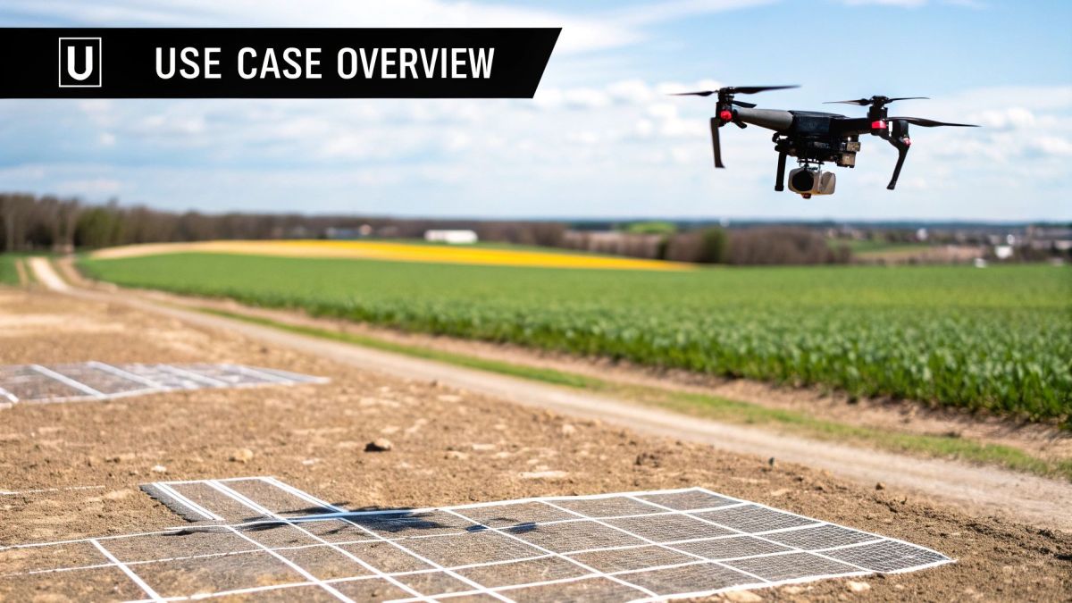
The real magic of a UAV GPS tracker happens when you see it at work across Australia's tough and varied industries. We're not just talking about dots on a screen; this technology is the backbone of operations that are boosting productivity, making workplaces safer, and helping protect our unique natural landscapes.
From the sprawling farmlands of the Murray-Darling Basin to the remote mine sites of Western Australia, GPS-guided drones have become an essential piece of kit.
Picture a farmer using a drone to check on crop health. The GPS tracker lets the drone fly a perfect, pre-planned path, collecting data that pinpoints exactly which areas need a bit more water or nutrients. This targeted approach, known as precision agriculture, saves a massive amount of water and fertiliser while also boosting crop yields. In the same way, mining companies use drones to autonomously survey huge stockpiles, getting dead-accurate volume calculations without sending surveyors into potentially dangerous zones.
Boosting Agricultural Efficiency
In Aussie agriculture, where every dollar and drop of water counts, the UAV GPS tracker is a game-changer. Drones fitted with high-precision GPS and special sensors can create detailed health maps of an entire property. This information lets farmers shift from broad, farm-wide treatments to looking after individual plants, a practice that seriously improves results.
This move to data-driven farming is well underway. A recent analysis found that over 60% of commercial drone flights in Australia use GPS tracking that connects to cloud platforms for smarter flight analysis and safety checks. Our ag sector, in particular, leans heavily on GPS for precision farming. Drones are used to check crop and soil health with an accuracy of under one metre, which can improve yield predictions by up to 25%. You can dig deeper into these trends over at Airdata UAV.
This level of accuracy unlocks smarter farming in a few key ways:
- Variable Rate Application: Drones can tell automated farm machinery to apply seeds, fertilisers, or pesticides only where needed, cutting down on waste and environmental runoff.
- Early Pest Detection: GPS-tagged images help spot pest problems early on, allowing for a quick, targeted response before an outbreak spreads across the whole paddock.
- Livestock Monitoring: On massive pastoral stations, drones with GPS trackers can find and check on livestock across vast, hard-to-reach country, saving countless hours in the saddle or on a bike.
Enhancing Safety in Mining and Infrastructure
It's not just on the farm where the UAV GPS tracker is proving its worth. It's a vital safety tool in industries like mining, construction, and infrastructure management. These jobs often involve massive, complex sites where the risks for workers on the ground are very real. Drones offer a way to get crucial data from a safe distance, and the GPS tracker makes sure that data is both reliable and geographically spot-on.
Think about the massive job of inspecting thousands of kilometres of remote rail lines or power corridors. A GPS-guided drone can fly these routes on its own, snapping high-resolution photos to spot faults or vegetation getting too close. This not only keeps inspection crews out of harm's way but also creates a repeatable, verifiable record of the asset's condition over time.
A drone can survey a hazardous mine pit wall in minutes. That same job would take a human crew hours, exposing them to significant risk. The GPS data ensures every survey is perfectly aligned with the last, allowing for precise tracking of any ground movement.
Protecting Australia's Natural Wonders
The benefits don't stop there. This technology is also being used in environmental conservation and emergency services. Scientists use GPS-tracked drones to monitor the health of fragile ecosystems like the Great Barrier Reef, assessing coral bleaching with a scale and detail that was impossible just a few years ago. The tracker ensures each survey flight covers the exact same path, providing priceless data for long-term studies.
During emergencies like bushfires or search and rescue missions in rugged country, a UAV GPS tracker gives teams a real-time view of what's happening. Rescue crews can send up a drone to map a fire front or search for a missing hiker, with the GPS data providing precise coordinates to guide teams on the ground. This technology isn't just making industries more efficient—it's changing the very way we protect our environment and save lives.
Navigating GPS Spoofing and Signal Interference
A UAV GPS tracker is a fantastic tool for navigation and safety, but it's not foolproof. Like any system that relies on radio signals, it has its weak spots, and every professional drone operator in Australia needs to know what they are. The two biggest risks are signal interference and a more sinister threat called GPS spoofing.
Understanding these challenges isn't about scaremongering; it's about being prepared. When you know how these threats work, you can put solid strategies in place to protect your expensive UAVs and make sure your missions go off without a hitch, even if the GPS signal gets a bit shaky or someone is actively trying to mess with it.
What Is GPS Spoofing?
GPS spoofing is a deliberate, malicious attack. It’s where someone uses a powerful transmitter to blast out fake GPS signals that are stronger than the real ones coming down from satellites.
Imagine someone shouting the wrong directions at your drone, drowning out the correct voice. The drone's UAV GPS tracker picks up this louder, fake signal and gets tricked into thinking it's somewhere it isn't. This can end badly – the drone might fly way off course, smash into something, or even get hijacked and landed somewhere the attacker wants.
GPS spoofing isn't just theory. It's a very real security risk, especially for drones flying near sensitive areas like airports, critical infrastructure, or in contested airspace. A successful attack can mean losing your drone, leaking data, and creating serious safety hazards.
Building a Defence Against Signal Threats
Luckily, modern drones don't have to rely solely on GPS. The best way to defend against spoofing and interference is to build a navigation system with multiple layers, so it’s not putting all its eggs in one basket. This is where sensor fusion comes in – blending data from different onboard systems to get a much more reliable picture of where the drone is and what it's doing.
This approach creates a system of checks and balances inside the drone's flight controller. If the GPS data suddenly says something that doesn't line up with what the other sensors are reporting, the system can flag the GPS as untrustworthy and lean on the other inputs instead. This sensor diversity is your best defence.
Key defensive sensors include:
- Inertial Measurement Units (IMU): This is basically the drone's inner ear, sensing acceleration and rotation. If the GPS signal claims the drone has instantly jumped 100 metres sideways, but the IMU reports zero acceleration, the system knows something fishy is going on.
- Vision-Based Systems: Onboard cameras can be used to visually track movement over the ground, a technique known as optical flow. This gives you a secondary source of positioning data that has nothing to do with GPS signals.
- LiDAR and Other Sensors: For more complex jobs, bringing in data from payloads like LiDAR can seriously boost navigational accuracy. By comparing real-time scans of the terrain against existing maps, a drone can confirm its location without any external signals at all. You can explore our deep dive into how LiDAR technology works for drones to see how these systems create their own maps.
The vulnerability of UAVs in Australia to GPS spoofing is a known security issue. International research and local trials have demonstrated just how easily fake signals can manipulate a drone's flight path. In fact, Australian cybersecurity agencies estimate that nearly 20% of reported UAV safety incidents might involve some form of GPS interference or spoofing. This really drives home how vital these multi-sensor navigation solutions are. To see more on this topic, you can read the full research on GPS spoofing vulnerabilities.
How to Choose the Right UAV GPS Tracker
Picking the right GPS tracker for your drone isn't about grabbing the most expensive one off the shelf. It’s all about finding the right fit for what you actually do. Get it wrong, and you could be stuck with dodgy data or a lighter wallet for no good reason.
Think of it like buying a car. You wouldn't take a Ferrari on a rugged off-road track, and you wouldn't use a massive ute for a quick trip into the city. In the same way, the tracker you need for simple aerial photos is a world away from the high-precision unit required for a professional survey.
Define Your Accuracy Requirements
First things first, you need to ask yourself the big question: how accurate do I really need to be? Your answer here will immediately slash the number of options you need to consider.
-
Standard GPS Accuracy: For a lot of jobs like real estate photography, basic infrastructure inspections, or just flying for fun, a standard GPS is absolutely fine. You’ll get accuracy within a few metres, which is plenty for general navigation and making sure your drone comes home safely.
-
High-Precision (RTK/PPK): If you're in the business of professional surveying, construction mapping, or precision agriculture, then you're playing in a different league. You need centimetre-level accuracy. This is where specialised systems like RTK (Real-Time Kinematic) or PPK (Post-Processed Kinematic) come in. These advanced trackers iron out tiny signal errors to give you the pinpoint precision needed to build reliable, high-detail maps and models.
Assess Physical and Technical Constraints
Once you've nailed down your accuracy needs, it's time to think about the practical side of things. How will this tracker actually fit with your drone? A top-of-the-line tracker is no use if it’s too heavy for your UAV to lift or if it kills the battery in minutes.
Here are the key factors to weigh up:
- Size and Weight: Every gram matters on a drone. Make sure the tracker's weight is well within your drone's payload capacity, otherwise, you'll sacrifice flight time and stability.
- Power Consumption: Have a look at how much power the tracker needs. A power-hungry module can seriously cut into your flight time, meaning more battery changes and more interruptions to your work.
- Integration and Compatibility: The tracker has to talk to your drone's flight controller and ground station software without any fuss. Double-check that it’s compatible with your current setup to avoid a major headache. This is especially true for your UAV flight planning software, as the tracker needs to feed data into it smoothly.
The real aim is to find a UAV GPS tracker that gives you the precision you need without dragging down your drone’s overall performance. It’s a balancing act, but getting it right means you’ve invested in a tool that genuinely improves your work, rather than getting in the way.
Frequently Asked Questions
It's natural to have a few last-minute questions when you're thinking about adding a GPS tracker to your UAV. Getting the right answers can make all the difference, so let's clear up some of the most common things drone operators ask.
This should help you sort out any final details before you commit.
What Is the Typical Accuracy of a UAV GPS Tracker?
For most off-the-shelf commercial drones, you're looking at a horizontal accuracy somewhere between +/- 1 metre and +/- 5 metres. That’s perfectly fine for general aerial photography, basic asset inspections, and making sure your drone knows how to get back home.
But for high-precision work like land surveying or precision agriculture, that won't cut it. Those jobs need accuracy down to the centimetre, which is where specialised systems like RTK (Real-Time Kinematic) or PPK (Post-Processed Kinematic) come in. They work by correcting tiny signal errors to deliver pinpoint accuracy.
Can I Add a GPS Tracker to Any Drone?
Pretty much, yes—but there are a few things to keep in mind. Most modern drones already have a GPS module built right into the flight controller. For older drones, or if you simply want a separate, independent tracker for extra security, there are plenty of standalone units you can buy.
When picking an external UAV GPS tracker, the main thing is to make sure it plays nice with your drone's setup. You’ll need to check a few things:
- Physical Fit: Is it small and light enough? You don't want it throwing off your drone’s balance or draining the battery.
- Power Source: It needs power. Will it connect to the drone's main battery, or does it have its own?
- Software Integration: The tracker has to be able to send its location data back to your ground control software.
Is a Subscription Required for a GPS Tracker?
It really depends on the tracker. A basic GPS receiver that just talks to your drone's flight controller won't cost you a thing in ongoing fees. It just uses the free, public satellite network to figure out where it is.
On the other hand, many standalone trackers built for theft prevention or real-time fleet management use the mobile network (like 4G or 5G) to send location data over the internet. These almost always come with a monthly or yearly subscription to cover the mobile data costs.
For operators in Australia who need high-performance drone solutions with seamlessly integrated navigation systems, Innoflight International offers a full range of UAS platforms and custom payloads. Find the right system for your mission at Evolution Flight Systems.