
For as long as anyone can remember, firefighting has been a battle against the unknown. It’s a job built on gut instinct and educated guesses made in the thick of the action.
Imagine your crew stepping into a smoke-choked warehouse, where you can't see your own hands in front of your face. Or picture a rural brigade trying to out-think a raging bushfire, basing their strategy on patchy information from the ground. This kind of dangerous guesswork has always been part of the job, forcing commanders to make life-or-death calls with only a fraction of the full picture.
This lack of a bird's-eye view creates enormous risks. Firefighters on the ground might have no idea that a roof is about to collapse just metres away, or that they're getting too close to volatile chemicals inside an industrial complex. In a bushfire, crews can't possibly see how a sudden wind change is steering the fire front over the next ridge. These are the information gaps where things go wrong.
Why Drones Are a Game Changer for Firefighting
The biggest challenge in any emergency is getting a solid grasp of situational awareness—a clear, real-time understanding of everything that's happening. It’s about knowing the current state of play, what's likely to happen next, and how to best use your people and equipment for the greatest impact and safety. Traditionally, incident controllers built this picture from radio chatter, personal observations, and years of experience, but it was always a fragmented and incomplete view.
Drones have completely changed the game. They act as an extension of a firefighter’s senses, delivering an immediate, high-level perspective that cuts straight through the chaos and confusion of an incident. It’s like handing the incident controller a live, interactive map of the entire scene.
"The building is your enemy, KNOW YOUR ENEMY." – Francis Brannigan, Fire Service Construction Educator
Brannigan's famous quote perfectly captures the importance of intelligence in firefighting. Drones deliver that intelligence instantly, helping crews understand a building's structure, see heat signatures, and spot hidden dangers before they even think about going inside.
From Blurry Snapshots to Live Intelligence
Before drones in the fire service became common, commanders were working with delayed information that was often outdated by the time they got it. Today, drones feed back a constant stream of live data, turning a blurry, static picture into high-definition, real-time video. This isn't just a small improvement; it's a fundamental shift in how fires are fought.
This live intelligence gives fire services the power to:
- Make Smarter Decisions: You can send a crew directly to a hidden hotspot picked up by a thermal camera, rather than having them search for it.
- Increase Crew Safety: Spotting structural weaknesses, hazardous materials, or potential flashover zones from a safe distance keeps firefighters out of harm's way.
- Improve Operational Speed: You can map a large incident area, assess property damage, or find a missing person in a fraction of the time it would take on foot.
By providing this crucial intelligence, drones are quickly becoming one of the most valuable tools in a modern firefighter's kit, making sure our crews are better informed, better protected, and better equipped to save lives and property.
How Drones Transform Fire Ground Operations
On the fire ground, drones are much more than just flying cameras. They've become indispensable tools that deliver critical intelligence and support right when it's needed most. Think of them as the eyes and ears for the incident commander, offering a perspective from above that's simply impossible to get from the ground. This shift from ground-level guesswork to real-time aerial intelligence is fundamentally changing how firefighting operations are managed.
The infographic below really puts it into perspective, showing the leap from traditional methods to modern, drone-assisted operations.
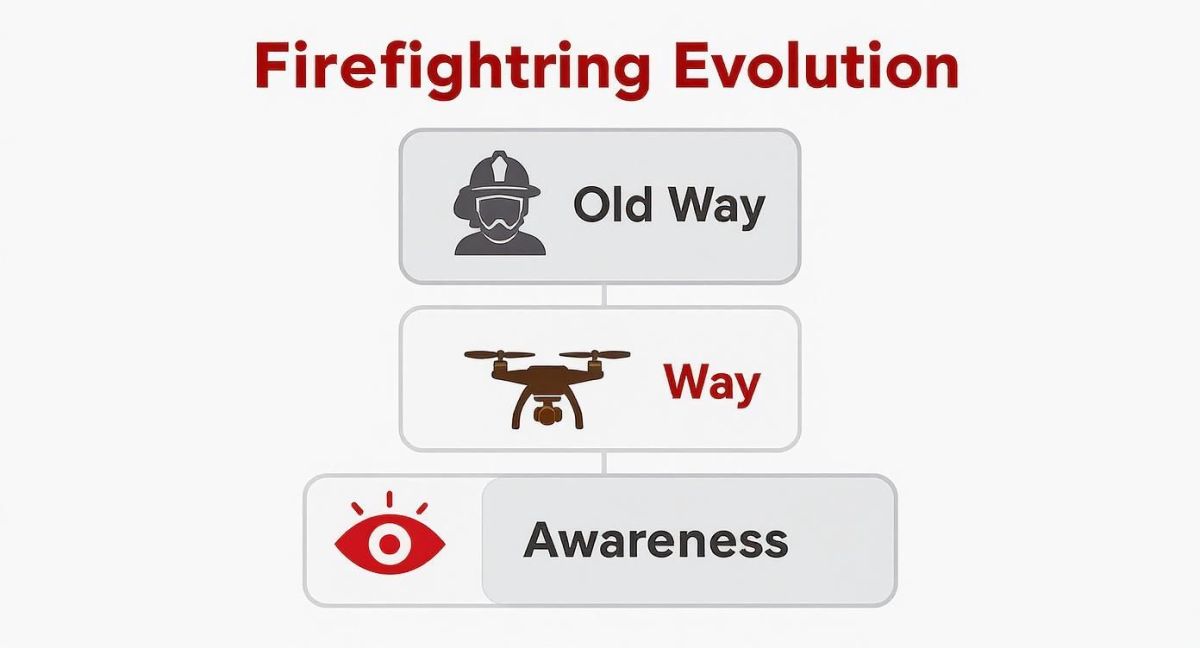
It’s clear the "new way" isn't just a minor upgrade. Drones give us a massive jump in awareness, which has a direct and immediate impact on strategy and, most importantly, firefighter safety.
Enhancing Situational Awareness with Live Feeds
The most immediate benefit of using drones is the live, bird's-eye view they provide of the entire incident. Picture an incident commander at their command post, watching a crystal-clear video feed from 100 metres above a burning commercial building. This isn't science fiction anymore; it’s a daily reality for many modern fire services.
This live feed is like having a dynamic, digital map that updates itself in real time. It gives commanders the power to:
- Track how a fire is spreading across a large building or landscape.
- Keep an eye on the location and safety of all firefighting crews.
- Pinpoint the safest entry and exit points for personnel.
- Spot new dangers, like a collapsing roof or a spreading chemical spill, long before they put crews on the ground at risk.
This constant stream of information allows for proactive, smart decisions instead of just reacting to fragmented radio reports.
Seeing Through Smoke with Thermal Vision
One of the most powerful tools a firefighting drone can carry is a thermal imaging camera. Essentially, it gives us a set of superhuman eyes that see heat instead of light. When smoke and darkness make normal vision impossible, this capability is a complete game-changer.
With a thermal drone, pilots can instantly find the hottest parts of a fire, even through a thick, smoke-filled roof. This means crews can direct water exactly where it will have the most impact, saving precious time and water. Even more critically, it can detect the heat signature of a trapped person inside a building or a hidden ember that could reignite a bushfire hours after everyone thinks the danger has passed.
Drones provide real-time situational awareness, helping command staff make informed decisions on fire suppression strategy and resource allocation as incidents evolve. Whether it’s a HazMat response or a structure fire, drones are dramatically improving firefighter safety.
The following table breaks down some of the most common ways drones are making a difference on the fire ground.
Key Drone Applications in Fire Service Operations
| Application | Technology Used | Primary Benefit |
|---|---|---|
| Situational Awareness | High-Definition (HD) Live Video | Provides a real-time, bird's-eye view for incident commanders. |
| Hotspot Identification | Thermal Imaging (Infrared) Camera | Pinpoints the hottest parts of a fire through smoke and darkness. |
| Search and Rescue | Thermal Imaging & High-Zoom Camera | Quickly scans vast or dangerous areas to locate missing persons. |
| Damage Assessment | 3D Mapping & Orthomosaic Imagery | Creates detailed maps for post-fire investigation and analysis. |
| Hazardous Materials (HazMat) | Gas Sensors & Chemical Detectors | Safely identifies and monitors airborne threats from a distance. |
Each of these applications provides crews with information they simply couldn't get before, making their job safer and more effective.
Aiding Search and Rescue Missions
During large-scale incidents like bushfires, floods, or building collapses, finding missing people is the number one priority. A drone can cover huge, dangerous areas in a fraction of the time it would take a ground crew. When every minute counts, that’s an enormous advantage.
Fitted with high-zoom cameras and thermal sensors, a drone can systematically scan a search area, sending its feed back to the command centre. This allows rescue teams to focus their efforts where they’re needed most, guided by confirmed sightings. The role of drones for rescue operations is growing fast and becoming a standard part of the emergency services toolkit.
Improving Post-Fire Analysis and Investigation
After the fire is out, the work is far from over. Investigators need to figure out the cause and origin, and communities need to assess the damage. Drones are incredibly valuable here, creating detailed 3D maps and high-resolution aerial photos of the scene. This data gives investigators a permanent, accurate record without disturbing crucial evidence on the ground.
Platforms like Resgrid's operational features integrate this data, offering tools for real-time mapping and resource tracking that build on the drone's capabilities.
This technology is being adopted rapidly across Australia's emergency services. As of May 2025, Australia had around 38,874 licensed drone operators, a significant jump from the previous year. Fire and rescue agencies are among the biggest users, with studies predicting a 10% productivity increase in the sector from drone use alone. That translates to an estimated $460 million boost to the economy and could save billions through earlier fire detection.
The Tech Behind Firefighting Drones
To really get why drones are changing the game for fire services, you have to look under the bonnet. We're not talking about the kind of drone you'd buy at a department store; these are highly specialised, rugged pieces of kit built to withstand the chaos of an emergency scene. The success of any drone mission really boils down to having the right aircraft with the right sensors for that specific job.

Whether it's a nimble quadcopter weaving through a factory complex or a large, fixed-wing model soaring over a vast bushfire, the drone's body is only half the story. The real magic is in the advanced payloads they carry, which essentially become a firefighter's eyes and ears in the sky.
Drone Airframes: The Right Tool for the Job
Not all drones are built the same. The type of airframe a crew uses depends entirely on what they need to do—whether that’s zipping around in tight spaces or staying airborne for hours to survey a massive area.
- Multi-Rotor Drones (Quadcopters): These are the workhorses you’ll see most often. They can take off and land vertically, hover perfectly still, and manoeuvre in confined areas. This makes them perfect for structural fires, general incident overwatch, and even reconnaissance inside a building.
- Fixed-Wing Drones: Looking more like a small aeroplane, these are built for endurance. They can patrol a massive bushfire front for hours on end, making them ideal for large-scale mapping and long-duration surveillance.
- VTOL (Vertical Take-Off and Landing) Hybrids: These are the best of both worlds. A VTOL drone can take off like a helicopter but then fly efficiently like a plane, giving it both flexibility and staying power for complex incidents.
This mission-specific approach means fire crews get the best possible tool for whatever they're facing.
The Eyes in the Sky: Critical Sensor Payloads
The real power of drones in fire service operations comes from the high-tech sensors they carry. These payloads transform a simple flying machine into a sophisticated data-gathering tool, giving crews information they could never get from the ground.
One of the most vital tools is the thermal imaging camera. Think of it as giving firefighters heat-vision goggles. This incredible tech lets them see through dense smoke to find people, pinpoint the hottest parts of a fire, or spot hidden embers that could easily flare up again. For instance, during a major ship fire at the Port of Newark in the US, crews used a thermal drone to safely track how the fire was spreading and gauge temperatures from a distance—something that would have been impossible on foot.
But it’s not just about seeing heat. Other specialised sensors deliver even deeper insights:
- High-Resolution Zoom Cameras: These allow an operator to inspect a building for structural damage or read a safety placard on a chemical tanker from a safe distance.
- LiDAR (Light Detection and Ranging): This sensor fires laser pulses to create stunningly accurate 3D maps of a burn scar or a collapsed building, which is invaluable for post-fire analysis.
- Gas and Chemical Sensors: In a hazmat situation, these sensors can fly directly into a chemical plume to identify the substance and measure its concentration, all without putting a single person at risk.
All this tech works together to paint a complete, real-time picture for the incident controller on the ground.
Drones provide real-time situational awareness, helping command staff make informed decisions on fire suppression strategy and resource allocation as incidents evolve. Whether it’s a HazMat response or a structure fire, drones are dramatically improving firefighter safety.
As Australia faces more frequent and severe bushfires, the adoption of drones by fire services has ramped up. The local market for autonomous firefighting drones is forecast to grow at a compound annual growth rate of 16.2% between 2025 and 2035. Technologies like thermal imaging and GPS-guided flight are completely changing how fires are managed, and most importantly, reducing the risks to human crews. You can find more insights on the autonomous drone market at FactMr.com.
The Brains of the Operation: AI and Automation
The next big step for firefighting drones is the growing role of Artificial Intelligence (AI) and automation. New AI algorithms can analyse a live video feed to automatically map a fire's perimeter, track how fast it’s spreading, and even predict where it’s likely to go based on weather and terrain.
This kind of automated analysis frees up the drone pilot to focus on flying safely and relaying critical information to command. On top of that, huge leaps in drone collision avoidance systems are making it safer than ever to operate in cluttered environments like city centres or dense forests, ensuring the drone can get where it needs to go without a hitch.
Drones in Action: Real-World Australian Case Studies
Talk is cheap. You can discuss the theoretical benefits of new technology all day, but the real test is how it performs when things get messy. Across Australia, fire and rescue agencies are putting drones to that test every single day, and the results speak for themselves. These aren't just gadgets; they're becoming essential tools that turn chaotic, dangerous incidents into controlled, manageable operations.
Let's look at a few real-world examples that show how drones are providing the critical intelligence needed to save lives and protect property.
From sprawling bushfire fronts in New South Wales to complex industrial blazes in our cities, drones are quickly becoming the go-to for getting a rapid, clear picture of what's happening. These stories from the field show the tangible difference an eye in the sky makes when crews on the ground are up against it.
Navigating a Smoke-Filled Warehouse Rescue
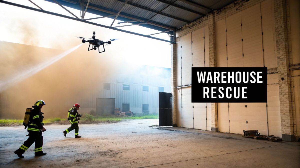
Picture this: a huge commercial warehouse is on fire. The building is filled with a thick, toxic black smoke, cutting visibility to absolute zero. A report comes in—a worker is trapped inside. But where? Sending firefighters in blind is a commander's worst nightmare. They're walking into a potential structural collapse, unknown hazardous materials, and an unpredictable fire.
This is exactly the kind of high-stakes scenario where drones are changing the game. In a recent incident just like this, the fire service didn’t send a search team in straight away. Instead, they launched a drone equipped with a thermal imaging camera.
The pilot skilfully flew the drone over the roof, its infrared camera cutting right through the dense smoke. Within minutes, a clear heat signature popped up on the screen—a person, huddled in a corner far from the main blaze. The pilot relayed the exact coordinates to the incident commander, who then guided a rescue crew on a direct path to the trapped worker. It was a fast, precise, and life-saving move.
- The Problem: A person was trapped in a zero-visibility, highly dangerous environment, making a traditional search incredibly risky for fire crews.
- The Drone Solution: A thermal drone located the victim by seeing their heat signature through the smoke.
- The Outcome: The rescue was quicker, more accurate, and significantly safer for everyone involved.
Mapping a Fast-Moving NSW Bushfire
During a major bushfire in rural New South Wales, ground crews were in a constant battle against a fire front that kept changing direction with every wind shift. By the time traditional mapping information made its way back to the command post, it was already obsolete. This information lag is deadly, putting both firefighters and entire communities in the line of fire.
An aerial perspective gives incident controllers the ability to see the bigger picture, track the fire's edge, identify spot fires, and make proactive decisions about resource deployment and community warnings.
To get ahead of the blaze, the aviation unit deployed a fixed-wing drone to fly long, systematic patterns over the fire ground. It streamed live video and thermal imagery directly to the control centre, painting a real-time map of the fire's perimeter. Suddenly, commanders could see exactly where the fire was, where it was heading, and how fast it was moving.
Armed with this live intelligence, authorities issued incredibly specific and timely evacuation warnings to residents directly in the fire's path. The drone's constant watch also picked up spot fires erupting ahead of the main front, allowing crews to be redirected to stamp them out before they could grow. This proactive approach, driven by real-time data from the sky, undoubtedly saved homes and lives.
Accelerating Post-Fire Community Recovery
After a fire has torn through a community, the recovery process is often painfully slow. The first step is assessing the damage, which traditionally means teams walking street by street, a task that can take days or even weeks. This painstaking process delays vital support for affected residents and holds up the work of insurance assessors and recovery agencies.
Following a recent major fire, one Australian service used its drone fleet to change that. They flew systematic grid patterns over the entire impacted area, capturing thousands of high-resolution photos. Within hours, these images were stitched together to create a detailed orthomosaic map of the burn scar.
This single, comprehensive map gave every stakeholder—from the local council to emergency relief organisations—an immediate and accurate picture of the devastation. They could instantly identify the hardest-hit properties, prioritise help for those most in need, and fast-track insurance claims. This rapid damage assessment helped a shattered community start the long road to rebuilding far sooner than ever before.
Getting to Grips with the Rules and Safety
Putting a drone in the air during an emergency isn’t as simple as just hitting the launch button. Every single flight is backed by a serious set of rules and safety protocols, making sure these high-tech tools are a help, not a hazard. Here in Australia, the Civil Aviation Safety Authority (CASA) sets the standards for everything that flies.
For fire services, this means every drone pilot needs to be properly trained and certified. This goes way beyond knowing which stick does what. It’s about understanding airspace rules, managing risks on the fly, and knowing exactly what to do when things go wrong. You wouldn't hand the keys of a fire truck to someone without a licence, and the same logic applies to piloting a drone over a live fire ground.
Getting these regulations right is the foundation of a professional and safe drone program. Understanding the rules for drone commercial use is a great starting point for any agency looking to get its program off the ground.
Key Rules of Engagement
Once the basics are covered, pilots need to master a few key concepts that are absolutely critical in a major incident. One of the big ones is flying Beyond Visual Line of Sight (BVLOS). Normally, pilots have to keep their drone in sight at all times, but that’s just not practical when you're trying to map a massive bushfire or get a view over a sprawling industrial complex.
Thankfully, CASA grants special approvals for emergency services to fly BVLOS. This allows drones to cover vast distances and collect intelligence that would otherwise be impossible to get. It’s how we can map a fire's edge, look for stranded people in dense bushland, or keep an eye on things during a long-running incident. It’s an advanced skill that relies heavily on remote piloting expertise and trusting your telemetry data.
Safety and Teamwork on the Ground
A successful drone operation is as much about what happens on the ground as it is about skill in the air. The sky above a major fire can get incredibly crowded. With helicopters and water bombers in the mix, clear coordination is non-negotiable to prevent a mid-air disaster.
Before any drone even thinks about taking off at an incident with other aircraft, the first and most vital step is setting up clear communication channels and an airspace management plan.
To keep everything running smoothly and safely, fire services follow strict on-site protocols:
- Airspace Deconfliction: Drone pilots stay in constant radio contact with air attack supervisors. They work together to coordinate flight paths and altitudes, ensuring everyone stays in their designated lane.
- Secure Launch and Landing Zones: A specific area is cordoned off for drone operations. It needs to be well clear of people, vehicles, and potential dangers like powerlines.
- Data Security: The information a drone gathers can be incredibly sensitive—think thermal footage from a potential crime scene or maps of critical infrastructure. This data has to be handled securely to protect both privacy and the integrity of the operation.
By sticking to these procedures, drones in the fire service become a powerful and safe tool in the broader emergency response, adding a whole new layer of capability without creating new risks.
The Future of Drones in Australian Fire Services
As impressive as today's drone applications are, we're really just scratching the surface of what this technology can do for our fire services. The future isn't about slightly better drones; it’s about smarter, more autonomous aerial tools that will become genuine partners for Australian firefighters. We're moving away from single-drone missions and heading towards coordinated systems that will completely reshape how we manage incidents.
This isn't just wishful thinking. The numbers show a massive shift is already underway. Projections estimate that the total number of drone flights in Australia will skyrocket from 1.5 million in 2023 to over 60 million by 2043. As this Airservices Australia forecast explains, a huge driver for this growth is the demand for drones in emergency and disaster response.
The Rise of Autonomous Drone Swarms
One of the most exciting developments coming down the pipeline is the 'drone swarm'. Picture this: instead of sending up one drone over a massive bushfire, a crew deploys a coordinated team of ten or twenty autonomous drones. Working in perfect sync, they could map the entire fire front at once, pinpoint multiple spot fires, and even drop water or retardant on critical hotspots—all without a pilot for each individual unit.
This kind of swarm technology is a true force multiplier. It lets a small team manage an enormous incident area with incredible speed and precision. The drones talk to each other, divvying up tasks to ensure nothing is missed. For incident commanders, this means getting a level of real-time intelligence that was once unimaginable.
Smarter Drones with Advanced AI
Artificial intelligence (AI) is poised to become the brain behind the next generation of firefighting drones. Tomorrow’s drones won't just stream video; they'll actively analyse what they're seeing. An AI-powered drone could, for example, identify the most threatening part of a fire front by assessing fuel loads and wind direction, then automatically alert the command post.
The next generation of drones won't just be tools; they will be teammates. They will process information, identify threats, and suggest strategies, freeing up human commanders to focus on the big-picture decisions.
This means drones will start making smart, tactical decisions on their own. They could predict a fire's path with far greater accuracy or flag a structural weak point in a burning building before it collapses and endangers crews on the ground.
Specialised Drones for Every Mission
The 'one-size-fits-all' model is also on its way out. We're going to see a much wider range of specialised drones, each built for a specific job.
- Micro-Drones: Think small, nimble drones designed for complex indoor searches. They'll be able to navigate tight corridors and weave through collapsed structures to find people who are trapped.
- Heavy-Lift Drones: On the other end of the scale, larger, more powerful drones will carry much bigger payloads. This could be anything from delivering vital medical supplies to isolated crews to deploying larger fire-suppressant capsules.
This evolution makes it clear that the role of drones in Australian fire services is shifting from simple observation to active, intelligent participation. It's a change that promises a much safer and more effective future for firefighters and the communities they protect.
Your Questions Answered: Drones on the Fire Ground
As drones become a more common sight at emergency scenes, it's natural to have questions about how they actually work when the pressure is on. Let's tackle some of the most frequent queries we hear from both the public and fellow emergency responders.
Can Drones Actually Fly in Heavy Smoke or Bad Weather?
This is probably the most common question, and for good reason—fires rarely happen on calm, clear days. The short answer is yes, but with some serious caveats.
Heavy smoke, surprisingly, isn't a huge problem for the drone itself. Thermal imaging cameras are the real stars here; they see heat signatures, not visible light, so they can cut straight through a smoke column to find hotspots or locate trapped people. Extreme weather, however, is a different beast entirely.
While professional-grade drones have a decent level of weather resistance, they aren't magic. High winds can make a drone almost impossible to control, and heavy rain or icy conditions are a definite no-go. A trained pilot's first job is risk assessment. They're constantly watching the weather, and if it's too dangerous to fly, the drone stays in its case.
A drone is a powerful tool, but it's just one tool in the kit. The key is knowing when to deploy it and, just as importantly, when to keep it on the ground. Safe operation always comes first.
How Are Drone Pilots Trained for Fire Emergencies?
Getting a drone in the air during a major incident is a world away from hobby flying. In Australia, any commercial pilot needs to be certified by the Civil Aviation Safety Authority (CASA), but for emergency services, that’s just the starting line.
The real training is highly specialised and focuses on the unique demands of the fire ground.
- Incident Command Integration: Pilots have to understand how to slot into the existing command structure. Their job is to provide useful intelligence that helps the Incident Controller make better decisions, not to be a distraction.
- Tactical Flying: This is about more than just keeping the drone in the air. It involves flying in complex, often dangerous environments, making sense of thermal data in real-time, and keeping a cool head when things are chaotic.
- Airspace Management: This is non-negotiable. Fire grounds are busy places, and learning to safely deconflict with helicopters and water-bombing aircraft is one of the most critical skills a pilot can have.
This intense preparation means that when a pilot from the drones in fire service team shows up, they’re ready to be an immediate asset, not a liability.
What’s the Biggest Limitation of Drones in Firefighting?
For all their advantages, the single biggest hurdle we currently face is flight time. Your typical multi-rotor drone—the kind that can hover in one spot—runs on batteries that last for about 30-40 minutes.
At a protracted incident like a large bushfire or a factory fire that burns for hours, this creates a logistical challenge. It means landing the drone, swapping out the battery, and getting it back in the air, all while trying to maintain continuous eyes in the sky. It’s manageable, but it requires a good system and enough spare batteries.
While some fixed-wing drones can fly for much longer, they can't hover, which is a crucial ability for close-up inspections. As battery technology gets better, we’ll see these flight times stretch out, making these incredible machines even more valuable on the fire ground.
At Innoflight International, we provide the advanced, reliable unmanned aerial systems that emergency services trust for critical operations. Our heavy-lift, long-endurance platforms are designed to perform in the toughest conditions. To find the right drone solution for your agency, explore our platforms.