
Deciding to rent a LiDAR drone isn't just about getting your hands on some cool new tech; it's a sharp business move that can give you a real competitive advantage. More and more Australian companies are figuring out that renting provides a level of flexibility and financial sense that buying just can't offer, especially for one-off jobs or highly specialised surveys. It’s all about accessing high-end equipment without the hefty price tag and long-term commitment.
Why Smart Businesses Rent LiDAR Drones
The growing trend of LiDAR drone rentals comes down to one thing: practicality. For many Aussie industries, it’s not about owning the latest and greatest gadget. It's about getting the right tool for the job, right when you need it. This on-demand approach lets you sidestep massive upfront costs and all the headaches that come with owning, maintaining, and storing sensitive equipment.
Imagine a civil engineering firm that's just won a contract to map a new highway corridor. Buying a complete LiDAR drone setup could easily set them back $150,000 or more. That's a huge investment for a piece of gear that might just gather dust between major projects. Renting, on the other hand, gives them access to a top-of-the-line system and a certified pilot for a fraction of that price, keeping the project's budget healthy and profitable.
The Financial and Technical Edge of Renting
The upsides of renting go far beyond just saving money at the start. The technology in the drone and sensor world moves at lightning speed. What's considered a premium sensor today could be old news in just a couple of years. When you rent, you ensure you’re always using current, high-performance equipment without worrying about your expensive asset losing value.
You can see this playing out in the market data. The Australian drone market was valued at around AUD 620 million and is expected to skyrocket to approximately AUD 5.64 billion by 2034. That's a compound annual growth rate of about 24.7%! LiDAR applications are a massive part of what's fuelling this growth, which tells you just how much demand there is for these specialist services.
Renting turns a huge capital outlay into a manageable, predictable operational expense. It empowers you to confidently bid on projects that need advanced data, all without the financial risk of owning an asset that's constantly depreciating.
Before we dive deeper, let's quickly compare the two options side-by-side. This table breaks down the key differences between renting and buying a LiDAR drone setup.
Rental vs Purchase At a Glance
| Factor | LiDAR Drone Rental | LiDAR Drone Purchase |
|---|---|---|
| Initial Cost | Low, pay-per-project | High capital expenditure |
| Technology | Access to the latest models | Tech becomes outdated quickly |
| Maintenance | Included in rental fee | Your responsibility and cost |
| Pilot/Expertise | Often includes a licensed pilot | Requires in-house training/hiring |
| Flexibility | High; choose the right tool for each job | Low; limited to the equipment you own |
| Storage & Insurance | Handled by the rental company | Your responsibility and cost |
| Depreciation | Not your problem | Significant financial loss over time |
As you can see, the choice isn't always straightforward. It really depends on your business model, project frequency, and long-term goals.
Key Industries Benefiting from Rentals
Several sectors have already woven LiDAR drone rentals into their day-to-day operations:
- Mining Operations: They're using rentals for fast, accurate stockpile measurements, pit surveys, and checking slope stability without having to shut down work.
- Forestry Management: Professionals can map canopy height, calculate timber volume, and assess bushfire risk across huge, hard-to-reach areas way more efficiently than ground crews ever could.
- Environmental Monitoring: Teams rely on LiDAR to map coastal erosion, analyse floodplains, and track vegetation health with stunning accuracy.
When you're weighing up whether to buy your own drone or just rent one when you need it, it’s worth getting your head around the details of equipment financing vs leasing. The right path for your business will depend on things like how often you’ll need the gear, your budget, and your overall strategy. For many, renting simply hits that perfect sweet spot between power and practicality.
Matching the Right Drone to Your Project
Picking the right gear for a LiDAR drone rental isn't just a small technical detail—it's what your whole project is built on. Get it wrong, and you could be looking at inaccurate data, wasted time in the air, and a budget that's completely blown out. It all comes down to matching the tech to what your site demands and the quality of data you absolutely need to get.
The first move is always to get crystal clear on your project's goals. Are you trying to map a dense forest where seeing through the tree canopy is the whole point? Or maybe you're scanning a busy urban area that requires incredibly high-resolution detail to capture every last building facade and powerline. Your answers here will steer every decision you make from this point on.
Multirotor vs Fixed-Wing Drones
The drone platform itself is a major fork in the road. Each type has its own strengths, and the right choice really depends on the job you're tackling.
- Multirotor Drones: Think of these as the specialists for smaller, more detailed sites. Because they can take off and land vertically (VTOL) and just hover in one spot, they’re brilliant for close-up inspections or mapping tricky areas with limited access.
- Fixed-Wing Drones: When you've got a massive area to cover, like a long pipeline route or a huge farm, fixed-wing drones are the way to go. They’re far more efficient, covering a lot more ground in a single flight, but they do need a bit of open space to get airborne and land.
This decision tree gives you a great visual of that initial thought process, helping you figure out if renting is the smart move for your project's specific timeline and needs.
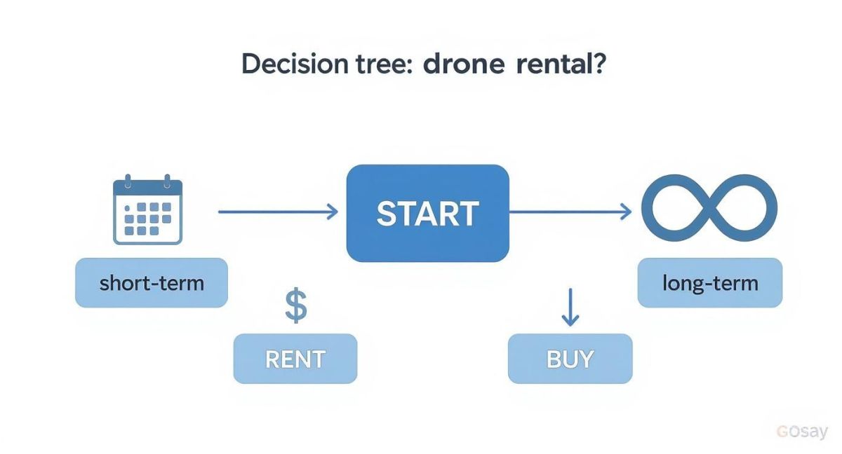
The infographic gets to a simple but vital point: for one-off jobs or short-term projects, renting is a no-brainer financially. But if you find yourself needing LiDAR constantly, it might be time to think about buying.
Decoding Key Sensor Specifications
Once you’ve got a drone type in mind, it’s time to look at the LiDAR sensor itself. It’s easy to get lost in all the technical jargon, so just focus on what the numbers actually mean for your results.
Keep a close eye on Points Per Second (PPS)—the higher this number, the denser and more detailed your final point cloud will be. You also need to check the sensor's accuracy rating to make sure it meets your project's tolerance for error, which is often measured down to the millimetre.
The rise of LiDAR technology is a huge reason why Australia’s drone market is booming. It brought in over USD 1 billion and is expected to fly past USD 1.5 billion by 2033, growing at about 10.44%. This just shows how essential LiDAR drones have become for everything from city planning to environmental checks across the country.
The ultimate goal is to match the sensor's capability to your deliverable. There's no point paying for a top-tier sensor if your project only requires standard accuracy, just as a lower-spec sensor won't work for a high-precision engineering survey.
Finally, just have a chat with your potential rental provider. A good one will be more like a consultant, asking you plenty of questions about your site, what you're trying to achieve, and what data you need at the end of the day. Be ready to talk about the terrain, how much vegetation there is, and the file formats you need. Their expertise is a massive part of the lidar drone rental service and is key to making sure you walk away with the right equipment for a successful scan.
Getting to Grips with the Real Rental Cost
When you're planning a project, a solid budget is everything. And if you're looking at hiring a LiDAR drone, the daily rate you see advertised is just the tip of the iceberg. To really understand what you'll be spending, you need to dig a little deeper than that initial quote.

I’ve seen plenty of people get caught out by costs that weren't obvious at first glance. Think about things like mobilisation fees – the cost of getting the crew and gear out to your site. This is especially true for remote projects anywhere in Australia. Almost every hire is a "wet hire", which means the price includes a licensed, experienced pilot. Honestly, you wouldn't want it any other way; their expertise is crucial for safety and getting quality data.
Breaking Down a Typical Quote
Let’s imagine you need a topographical survey for a 50-hectare rural development. The final bill will have several layers, and it’s vital you understand each one. A professional provider will be transparent about this, but it pays to know what to look for.
A proper quote for a job like this should detail:
- Equipment Hire: The base rate for the drone and the LiDAR sensor itself, usually priced per day or for the entire project.
- Personnel Costs: This covers the certified pilot and sometimes a dedicated surveyor or data technician on-site.
- Mobilisation & Travel: All the expenses to get the team to you, including their travel time, vehicle running costs, and accommodation for multi-day jobs.
- Data Processing: This is a big one. It’s the expert work of turning the raw point cloud data into the classified, clean formats you can actually use.
- Insurance: Non-negotiable. Public liability and equipment insurance will always be factored into the final price.
The single biggest mistake I see people make with their budget is underestimating data processing. It's not just a file download. It's a highly skilled task that turns millions of raw data points into a precise, usable 3D model.
If you want to see how all these pieces fit together, taking a look at a detailed guide on LiDAR survey costs can give you a much clearer picture and help you budget more accurately.
How to Avoid Nasty Financial Surprises
To keep your budget intact, your first step should always be to ask for a fully itemised quote. Get them to separate every cost so you can see exactly where your money is going.
Ask pointed questions. What’s included in the standard rate, and what counts as an extra? Are basic data deliverables part of the package, or is there an additional charge for every report and file format you need?
You also need to talk about weather. What happens if the drone can’t fly because of high winds or rain? Will you be hit with a standby rate? Getting these details sorted out and put in writing from the start is the best way to protect yourself from surprise invoices down the line. Any rental partner worth their salt will be happy to give you this clarity upfront.
What to Look for in a Rental Agreement
Think of your rental agreement as the project's safety net. It’s much more than just a piece of paper outlining the costs; it’s the document that spells out exactly what you’re getting, what the provider is promising, and what happens if things don't go to plan. Signing a vague contract is probably the fastest way to end up with budget blowouts and a final product that doesn't meet your needs.
A solid agreement should be a detailed blueprint for the entire job, leaving no room for guesswork. It's where you and the provider get on the same page about everything, from on-site logistics to how the final data will be handed over.
Defining Your Project Deliverables
This is, without a doubt, the most crucial part of the agreement. You need to be incredibly clear about what you expect to have in your hands once the drone has landed and the data has been processed. Just asking for a "point cloud" is far too vague—the specifics can vary dramatically from one provider to another.
Make sure your contract spells out:
- Final Data Formats: Get specific about the file types you need. Will it be .LAS or .LAZ? This ensures the data slots straight into your existing software and workflows without any headaches.
- Point Cloud Classification Level: How detailed does the classification need to be? Are you happy with a basic, unclassified cloud, or do you need a dataset that precisely separates the ground, vegetation, and buildings?
- Required Accuracy Reports: Always insist on a formal accuracy report. This is your proof that the data meets the precision standards you were quoted, giving you complete confidence in the results.
You'll find many providers now offer Drone-as-a-Service (DaaS) packages. These bundles typically include the pilot, flight planning, and all the data processing. It's a common model in Australia's mining sector, where LiDAR is used for things like volumetric analysis, cutting survey times from days down to a few hours. You can find more info on how DaaS packages are shaping the industry to see if it suits you.
Before you put pen to paper, double-check that every single deliverable you're expecting is listed in the contract. If it’s not written down, there's no guarantee you'll get it. Taking a few minutes to confirm this can save you from major disputes later on.
Key Clauses You Cannot Overlook
Beyond the data itself, the agreement needs to cover the operational and legal side of things. These clauses protect both you and the provider by setting clear boundaries and responsibilities for the job.
First, look for clear language on liability and insurance. The provider absolutely must have adequate public liability insurance. The agreement should also clarify who's responsible for what if there's an accident or equipment damage on your site.
Data ownership is another big one. The contract should explicitly state that you are the sole owner of all data collected. This is vital, as it stops the provider from reselling or using your project's valuable data without your permission.
Don't forget to check the bad weather clause. What happens if the flight gets postponed due to high winds or rain? A fair agreement will have a clear process for rescheduling the job without hitting you with unfair penalty fees.
Finally, the agreement must confirm that the provider complies with all Civil Aviation Safety Authority (CASA) regulations. This means they need a valid Remotely Piloted Aircraft Operator's Certificate (ReOC) and must use CASA-certified pilots. This isn't just a bit of red tape; it's a non-negotiable for any legal and safe lidar drone rental in Australia.
From On-Site Scan to Final Data Delivery
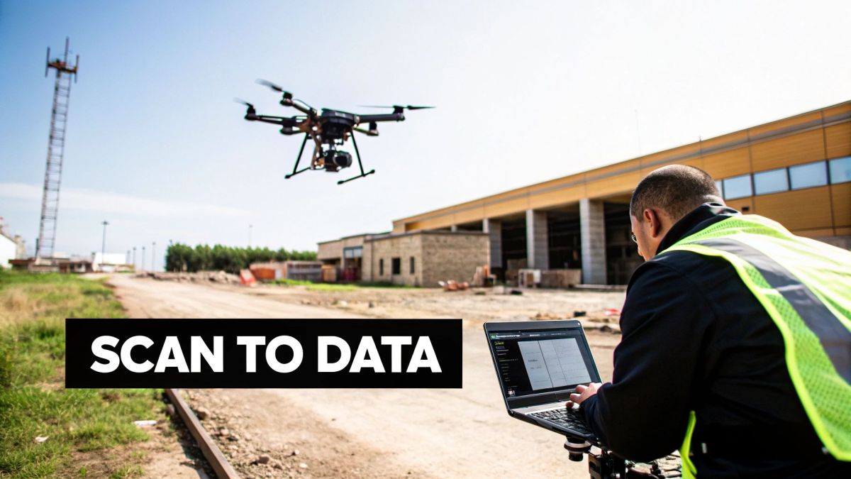
Knowing what happens from the moment the drone team arrives on your site to the day you get your hands on the final data is crucial. It helps everything run smoothly and demystifies the whole process. A professional LiDAR service doesn’t just show up and fly; they follow a well-oiled plan focused on safety and top-notch data quality.
The day of the scan actually starts on the ground, not in the air. The crew will kick things off with a thorough site assessment and a safety briefing, often called a "toolbox talk". This is where everyone gets on the same page about the flight plan, points out any potential hazards, and sets up clear communication for the day.
While the drone is flying, the certified pilot and surveyor will be managing the mission, often keeping an eye on the data as it's being collected. Your main job at this point is simply to make sure they have safe and uninterrupted access to the site.
From Raw Data to Usable Point Cloud
Once the drone is back on the ground, the data team’s work is just getting started. The raw information from the sensor is basically a massive jumble of individual points—it's not a usable 3D model just yet. This is where post-processing comes in, turning that raw data into something you can actually work with.
This vital stage breaks down into a few key steps:
- Georeferencing: This is where the raw data gets locked into its real-world position. Technicians use GNSS data from the drone, along with ground control points, to get the coordinates spot-on.
- Data Cleaning: Next, they filter out the noise. This means removing any rogue points caused by things like birds flying through the scan or atmospheric interference, leaving you with a clean dataset.
- Classification: The point cloud is then sorted. Using a mix of smart algorithms and manual checks, the team categorises points into groups like ground, vegetation, buildings, and powerlines.
Turnaround time can really vary. For a small, simple project, you might see some preliminary data within a couple of business days. But for a large-scale survey that needs detailed classification, you should realistically plan for one to two weeks.
Your Final Deliverables and Ongoing Support
Your provider will send over the data in the formats you agreed on, usually through a secure cloud link. The most common file you'll receive is a classified point cloud in .LAS or .LAZ format, which plays nicely with most CAD and GIS software. You can get a better idea of how LiDAR for drone surveys are customised for different industries and their specific outputs.
The real magic, though, often happens when that point cloud data is turned into something more tangible. It can be used for all sorts of things, from creating detailed digital twins for managing infrastructure to generating super-accurate topographical maps for a new construction project.
A good partner won't just email you a file and call it a day. They should be there to make sure you can open, view, and actually use the data. Open communication during the processing stage is the sign of a solid lidar drone rental partnership, guaranteeing the final result is exactly what your project needs.
Answering Your LiDAR Drone Rental Questions
When you're looking into LiDAR drone rentals, a few key questions always come up, especially when you're trying to line up budgets and project deadlines. Whether this is your first time or you're a seasoned pro, let's break down the common queries we hear all the time.
So, How Much Does It Actually Cost to Hire a LiDAR Drone?
This is the big one, and the honest answer is: it depends. The scale and complexity of your project are the main drivers.
For a straightforward, single-day job, you should probably budget somewhere between $3,000 and $5,000. But for larger, more complex surveys that cover a lot of ground or require intricate detail, that figure can easily climb north of $10,000 per day.
So what does that price actually include? Typically, it covers the drone, the LiDAR sensor itself, and a certified pilot to operate it. It's really important to get a detailed quote that spells out any extra costs, such as:
- Travel and mobilisation fees to get the team and gear to your site.
- Complex or specialised data processing after the flight.
- Generating specific reports or models from the raw data.
Most quality providers in Australia work on a "wet hire" model, sometimes called Drone-as-a-Service (DaaS). This is a good thing for you, as it bundles all the essentials into one figure, giving you a much clearer idea of the total cost from the get-go.
Do I Need to Sort Out Special Permits for the Flight?
Thankfully, this is one thing you don't have to worry about. Your rental provider takes care of all the red tape.
Any professional Australian drone company must hold a Remotely Piloted Aircraft Operator's Certificate (ReOC) from the Civil Aviation Safety Authority (CASA). They'll also only use fully licensed and experienced pilots.
Your provider is completely responsible for managing the airspace, getting the necessary flight approvals, and making sure the whole operation is safe and legal. All you need to do is provide them with safe and clear access to the site.
Before you sign anything, always ask to see their ReOC and certifications. It’s a simple step that protects you from any liability headaches and confirms you're working with a legitimate, professional outfit.
What Kind of Data Format Will I Get Back?
The core deliverable from any LiDAR scan is a high-density 3D point cloud. This usually comes as a .LAS or .LAZ file, which are industry-standard formats that play nicely with pretty much all engineering and GIS software.
From that foundational point cloud, a whole range of other useful products can be created. Depending on what you need, this could be a Digital Elevation Model (DEM), a detailed 3D mesh for visualisations, or a classified point cloud that separates the ground from vegetation and buildings. Make sure you define the exact deliverables you need in your initial agreement—it'll save a lot of back-and-forth later.
How Long Will I Be Waiting for the Final Data?
The turnaround time really hinges on the size of your project and how much number-crunching is needed on the back end.
For a smaller site scan, you might see preliminary data in just two to three business days. It's surprisingly quick.
However, for bigger projects needing detailed classification or the creation of complex models, it’s more realistic to plan for one to two weeks for the final, polished data. If you’re on a tight schedule, bring this up early. Talk to your provider about expedited processing options and get that delivery timeline locked into your service agreement.
Ready to get precise, actionable data for your next project without the massive capital outlay? Innoflight International specialises in providing high-end drone and sensor solutions tailored to your exact needs. Request a quote today and let our experts equip you with the right technology for the job.