
The cost of a LiDAR survey in Australia isn't a simple, off-the-shelf price. Think of it less like buying a standard product and more like commissioning a custom-built home.
For smaller projects using drones, you might see prices starting from AUD $1,500 and going up to AUD $10,000, but that's just a ballpark figure to get you started.
Demystifying LiDAR Survey Pricing
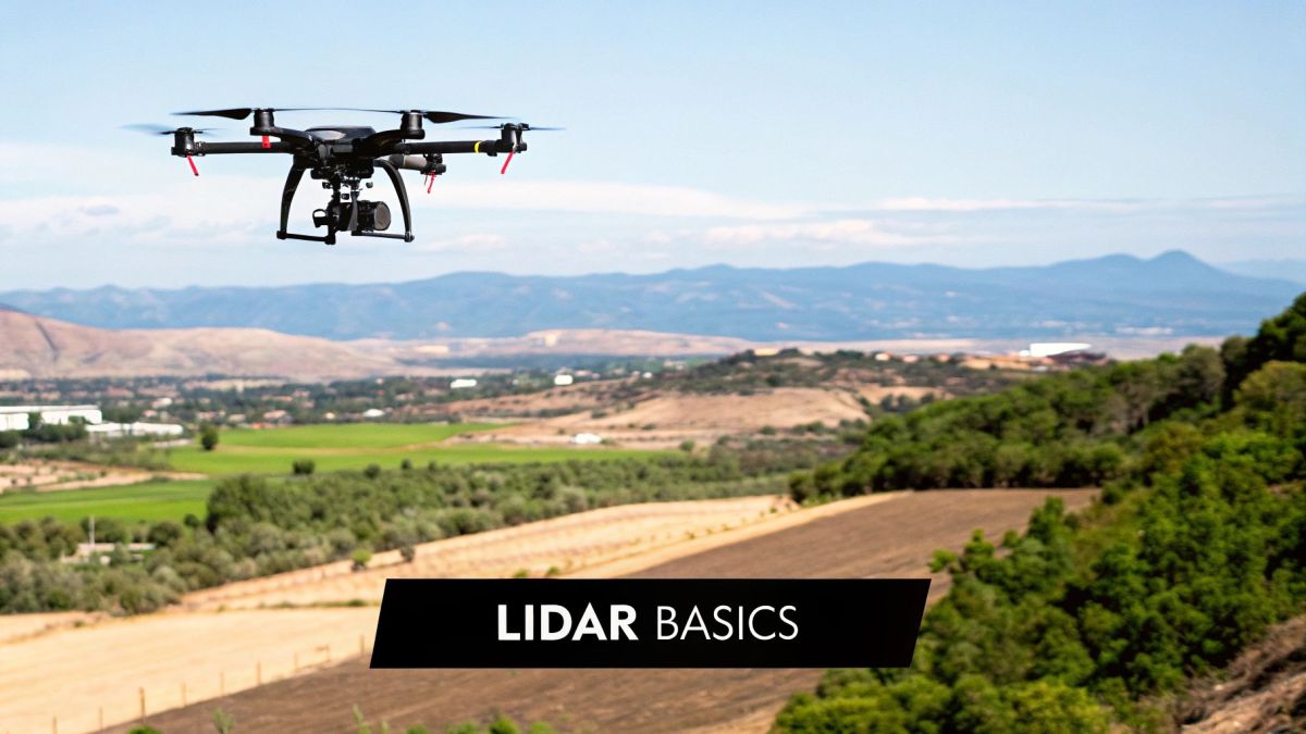
To really get a handle on your final quote, you need to look past a single number. The final investment is shaped entirely by what your project needs, which is why a one-size-fits-all price just doesn't exist. Any reputable provider will need the key details before they can give you an accurate estimate.
The price swings wildly based on a few core things. In Australia, the cost of a LiDAR survey depends on the size of the area, how tricky the terrain is, and the quality of the sensor doing the work.
For drone-based surveys covering up to 4 square kilometres, you’re generally looking at a range of AUD $1,500 to AUD $10,000. That price climbs if you're dealing with complex landscapes or need the survey done on a tight deadline. You can dive deeper into these figures by reading this detailed report on survey cost breakdowns.
Think of it this way: a quick scan of a small, flat paddock is pretty straightforward. But mapping a remote, densely forested mountain range? That's a whole different ball game. It demands better gear, longer flight times, and a whole lot more number-crunching back at the office.
What Shapes Your Final Quote
So, what are the big-ticket items that drive the price up or down? Knowing these helps you understand exactly what you’re paying for and why one quote might be so different from another.
Let's break down the key cost drivers that will have the biggest impact on your budget.
To make this easier to digest, here’s a quick summary of the main things that influence the final cost of your LiDAR survey.
Quick Guide to Lidar Survey Cost Factors
| Cost Factor | Impact on Price | Example |
|---|---|---|
| Project Size and Scale | High | A 500-hectare forestry block will cost significantly more than a 5-hectare construction site due to longer flight times and more data. |
| Terrain Complexity | High | Mapping a steep, tree-covered mountain is more expensive than scanning a flat, open field because it requires more complex flight planning. |
| Required Detail | Medium-High | A detailed engineering survey needing high point density costs more than a broad-scale topographical map with lower detail. |
Understanding these factors is the first step in budgeting effectively for your project and ensuring you get the data quality you actually need.
-
Project Size and Scale: This one's pretty simple. Bigger areas mean more flight time, more data to store, and more power to process it all. A survey for a single construction site will naturally be a lot cheaper than mapping a major infrastructure corridor.
-
Terrain Complexity: Flying over flat, open land is a breeze. Navigating steep, rugged, or heavily vegetated areas is much tougher. Difficult terrain requires more careful flight planning and a lot more work to filter out the 'noise' from the data.
-
Required Detail (Point Density): How much detail do you need? This is a critical question. Higher point density gives you incredibly granular data, but it also means collecting and processing a massive amount of information, which definitely pushes up the LiDAR survey cost.
So, What Exactly Is LiDAR and Why Should You Care About the Cost?

Before we get into the dollars and cents, it helps to have a gut-feel for what LiDAR actually is and why it often comes with a higher price tag. The simplest way to think of it is like a bat's echolocation, but instead of sound waves, it uses millions of laser pulses to "see" the world in stunning 3D detail.
The name itself, LiDAR, stands for Light Detection and Ranging. It's a remote sensing method where a specialised sensor, usually mounted on a drone or aeroplane, fires out rapid laser beams. These beams hit the ground, buildings, trees—everything in their path—and bounce back. The system measures how long each pulse takes to return, and from that, it calculates precise distances. The result is a massive, incredibly accurate 3D map called a "point cloud".
This isn't just a slightly better version of old-school surveying methods; it's a completely different ball game. The data is so dense and rich that it’s become the foundation for a huge range of modern projects.
The Three Big Reasons LiDAR Is Worth It
What makes this technology a smart investment? When you look past the initial LiDAR survey cost, its value really shines through in three key areas where other methods just can't keep up.
-
Blistering Speed: A LiDAR system captures millions of data points every second. This means it can map huge, complicated areas in a tiny fraction of the time it would take a traditional ground crew. A job that could tie up a team for weeks on foot can often be wrapped up in a single day of flying.
-
Incredible Accuracy: When it’s set up and calibrated correctly, LiDAR delivers survey-grade accuracy, often down to just a few centimetres. That level of precision is non-negotiable for serious engineering design, construction checks, or monitoring infrastructure where a small mistake can lead to massive costs down the line.
-
Seeing Through Trees: This is LiDAR's superpower. The laser sends out so many pulses that some will inevitably find their way through gaps in even the thickest forest canopy to hit the ground below. This allows us to digitally strip away the vegetation and create a true "bare earth" model of the terrain—something that's next to impossible with normal photography.
This ability to 'see' through vegetation is a game-changer for industries like forestry, environmental management, and any project in heavily vegetated terrain. It reveals the true topography hidden beneath the trees.
Once you understand these benefits, you start to see a LiDAR survey as less of an expense and more of a strategic move. The high-quality data it provides leads to better decisions, lowers project risks, and creates efficiencies that easily justify the upfront cost.
To learn more about how this technology is deployed, explore this detailed guide on LiDAR UAV drones. And if you're interested in companies working with advanced 3D data solutions, check out vibe3d's homepage.
When you get a quote for a LiDAR survey, you'll notice the final number is a sum of several parts, not just a single fee. Figuring out what goes into the lidar survey cost helps you understand exactly where your investment is going. Think of it like building a house – the price isn't just for the finished structure, but for the materials, the skilled tradespeople, and the architectural plans that bring it all together.
In the same way, every LiDAR project has three core cost pillars that make up the final quote. These are the fundamental drivers that determine just how big and complex your project will be.
This diagram shows the three main ingredients that make up the total cost of a LiDAR survey.
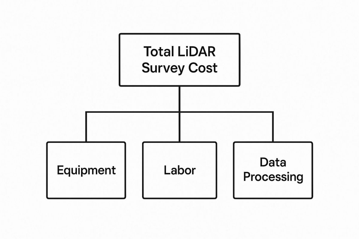
As you can see, the final price is a blend of the gear, the on-the-ground fieldwork, and the hefty data processing needed to turn raw scans into something you can actually use.
Equipment and Mobilisation Costs
First up, you have the hardware itself. High-quality LiDAR scanners are incredibly sophisticated and expensive pieces of technology. These systems can easily cost tens, or even hundreds, of thousands of dollars, and they're the engine of the whole operation. This cost covers not just the scanner but also whatever is carrying it, whether that's a specialised drone, a helicopter, or a small plane.
Then there's mobilisation. This is simply the logistics of getting the equipment and a qualified crew out to your project site. A survey in a remote, hard-to-reach location will naturally have higher mobilisation costs than one in a major metro area because of the extra travel time, accommodation, and access challenges.
Labour and Fieldwork Expenses
The second pillar is the people. Pulling off a LiDAR survey takes a team of highly skilled professionals. This isn't a simple "push a button and go" job; it involves certified pilots, survey technicians, and ground support staff who know exactly what they're doing.
Their time and expertise are vital during the fieldwork phase for several key tasks:
- Mission Planning: This involves carefully plotting flight paths to make sure every inch of the site is covered without wasting time or battery life.
- Ground Control: The team sets up and measures ground control points (GCPs). These are fixed points on the ground that ensure the final data is perfectly anchored to real-world coordinates, making it incredibly accurate.
- Data Acquisition: This is the actual flying part – safely operating the aircraft and LiDAR system to capture millions of data points with pinpoint precision.
The complexity of your site has a big impact here. A flat, open paddock is a straightforward job. A dense forest on a steep slope or a busy urban street? That requires much more intricate flight planning and ground support.
Data Processing and Final Deliverables
This is the part people often underestimate, but it's usually the most time-consuming and crucial stage of the whole project. The raw data that comes off the LiDAR sensor is just a massive "point cloud"—a seemingly chaotic jumble of millions of individual laser measurements. Turning that raw data into a structured, usable 3D model is where the real magic happens.
This digital craftsmanship involves cleaning the data, classifying points (like ground vs. trees vs. buildings), and creating the final products you actually need. It’s where raw information becomes powerful insight.
This stage requires serious computing power and specialised software, all run by experienced geospatial analysts. Their job is to filter out noise, check the accuracy against the ground control points, and produce the final deliverables you asked for. This could be anything from Digital Elevation Models (DEMs) and contour maps to detailed 3D models ready to be dropped into CAD software.
The more detail and accuracy you need, the more time-intensive—and therefore costly—this processing phase will be.
To give you a clearer picture, let's break down where the money typically goes.
Cost Breakdown of a Typical Lidar Survey Project
| Project Stage | Percentage of Total Cost (Approx.) | Key Activities |
|---|---|---|
| Equipment & Mobilisation | 20-30% | Transporting gear and crew, scanner rental/depreciation, vehicle/aircraft costs. |
| Fieldwork & Data Capture | 30-40% | Mission planning, setting ground control, flight operations, on-site personnel. |
| Data Processing & Analysis | 35-50% | Point cloud cleaning, classification, feature extraction, quality assurance. |
| Final Deliverables | 5-10% | Generating maps (DEMs, contours), 3D models, and final reports. |
As the table shows, the bulk of the cost is often split between the on-site fieldwork and the intensive data processing that follows. It highlights that the most significant investment is in the expert labour required to both capture and make sense of the data.
Drone vs Manned Aircraft: A Cost Comparison
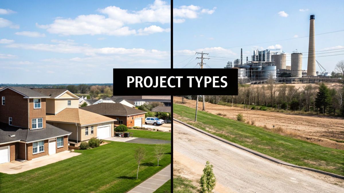
One of the biggest decisions you'll make, and one that heavily influences the final price tag, is the choice between using a drone or a traditional manned aircraft. This isn't a simple case of one being better than the other; it’s about picking the right tool for the job. And the deciding factor, almost every time, is the scale of your project.
For smaller, more targeted areas, drones (or UAVs) are nearly always the smarter financial move. We're talking about projects like a single construction site, a small quarry, or a detailed scan of a historic building. Drones are incredibly agile, can be deployed quickly, and fly at lower altitudes, which allows them to capture exceptionally high-density data over a compact space.
This precision makes them ideal for jobs where every millimetre counts, without the hefty operational overheads of a full-sized aeroplane. Getting started is faster and cheaper, and the whole process is just more flexible.
When Drones Make Financial Sense
If your survey area is relatively small and you need incredibly detailed data, a drone is your go-to. Their strength is in focused, specific jobs where pinpoint accuracy is the main goal.
Here are a few scenarios where a drone-based survey will almost certainly lower your LiDAR survey cost:
- Small to Medium Construction Sites: Perfect for tracking progress, checking earthwork volumes, or creating as-built models for sites up to a few square kilometres.
- Mining and Quarries: Great for regular stockpile volume calculations or mapping pit walls safely and accurately.
- Detailed Asset Inspection: Capturing complex 3D data of structures like bridges, dams, or powerline pylons.
- Environmental Monitoring: Assessing erosion, vegetation health, or changes in a specific, contained ecosystem.
For these kinds of projects, hiring a manned aircraft is like using a semi-trailer to deliver a single pizza. It’s overkill, inefficient, and will cost you a fortune for no good reason.
When Manned Aircraft Are More Economical
On the other hand, as soon as your project area starts to grow, the cost-benefit analysis flips. For large-scale mapping, manned aircraft—planes or helicopters—become the only sensible choice. Think about surveying an entire water catchment, a major transport corridor stretching for hundreds of kilometres, or a massive forestry plantation.
Yes, the upfront hourly rate is significantly higher. But a manned aircraft can cover a staggering amount of ground in a single flight, a task that would take a drone countless flights and battery changes to complete. This sheer efficiency over vast areas drastically brings down the cost-per-hectare, making it the practical option for any regional or state-level mapping.
Because they fly higher and faster, the data collection is wrapped up in a fraction of the time, leading to major savings on huge surveys. Matching the right platform to your project's scale is the key to a smart, effective budget.
Calculating the True Return on Your LiDAR Investment
Focusing only on the initial LiDAR survey cost is a classic case of missing the forest for the trees. You’re not just buying a dataset; you're investing in a powerful tool for making smarter decisions and avoiding costly mistakes down the track. The real value isn't in the invoice, but in the long-term savings and efficiencies it creates.
Think of it this way: a single, expensive stuff-up on a major construction project can easily dwarf the cost of a high-quality LiDAR scan. In that context, the survey becomes a very cheap insurance policy against budget blowouts. With centimetre-level accuracy, project managers can spot design clashes, verify earthwork volumes, and make sure everything fits the real world before breaking ground. That alone can save a fortune in rework.
Beyond the Initial Outlay
And the benefits don't stop at the construction site. In agriculture, for instance, precise topographical data can completely change how you manage irrigation and drainage, leading to better crop yields and significant water savings. For infrastructure planning, detailed flood modelling from a LiDAR scan can literally save millions by protecting critical assets and entire communities.
These long-term financial wins are precisely why the technology is becoming so widespread. It’s also where practices like value engineering in construction really shine, because having that rock-solid initial data is the foundation for optimising project costs from day one.
The upfront survey cost is often a small price to pay for the enormous savings and efficiencies gained. It shifts the focus from a one-time expense to a long-term strategic asset that pays for itself many times over.
Large-Scale Investment and Proven Value
This idea of long-term value isn't just a theory; we're seeing it proven on a massive scale. Investment in LiDAR surveys across Australia has ballooned, largely driven by huge government projects that need reliable data.
A perfect example is the Digital Twin Victoria (DTV) Program. Back in 2022, they pumped over AUD $4 million into state-wide LiDAR surveys to build Victoria’s first high-resolution digital elevation model. If you want to see the full scope of this, you can learn more about Victoria's record LiDAR initiative.
Projects like that show a clear shift in thinking. Governments and big companies now see high-quality spatial data as fundamental to modern planning and management. By making this initial investment, they unlock efficiencies in everything from urban planning and emergency response to environmental monitoring. It’s no longer about a one-off cost, but an investment in future resilience and prosperity. For a deeper dive into managing these costs, have a look at our insights on reducing the total cost of ownership for survey gear and data.
Getting an Accurate Quote for Your LiDAR Survey
When you’re ready to bring a LiDAR provider on board, the best way to get a clear, reliable quote is to come prepared. Think of it like briefing an architect: the more detail you give them upfront, the more accurate their plans and cost estimates will be.
Getting your details in order doesn't just speed things up. It also means you can compare different proposals properly. When every provider is quoting on the exact same information, you get a true apples-to-apples comparison.
Your Pre-Quote Checklist
Before you make the call or send that email, pull together the essential details of your project. Having this information ready shows you’re serious and helps survey providers give you a sharp, competitive quote without all the back-and-forth.
Here’s what you should have on hand:
- Project Location and Boundaries: This is the big one. A digital file like a KML (from Google Earth) or an SHP (shapefile) is perfect because it locks in the exact survey area with no room for error.
- Required Level of Detail: Be specific about the point density you need. Are you after a broad-scale topographical map, or do you need super-detailed data for engineering design work?
- Final Deliverables: Make it clear what you expect to receive. Do you just need a Digital Elevation Model (DEM), or are you after contour lines, a classified point cloud, or a full 3D model ready for your CAD software?
- Site-Specific Challenges: Give them a heads-up on any known issues. Think dense tree canopies, steep and tricky terrain, restricted airspace, or even just getting access to the site.
Providing a clear, comprehensive brief is the single most effective way to manage your LiDAR survey cost. It eliminates guesswork for the provider and ensures the quote you receive accurately reflects the scope of work.
It's also crucial to talk about accuracy. If your project demands centimetre-level precision, you'll need to understand the role of ground control. You can get a better handle on the technology involved by reading our guide explaining what RTK GPS is and how it works. Arming yourself with this knowledge will help you confidently pick the right partner for the job.
Answering Your Questions About LiDAR Costs
When you’re looking into the cost of a LiDAR survey, a few common questions always pop up. Let's break them down with some straightforward answers to give you a clearer picture of the investment.
How Much Does a LiDAR Survey Cost for a Small Property?
For a smaller job, like a single residential block or a tight construction site, a drone LiDAR survey is almost always the most budget-friendly way to go. Here in Australia, you can expect prices to start from around $1,500 to $3,000, though this can vary based on how much detail you need and how complex the site is.
Why Is Data Processing So Expensive?
This is a great question. The data processing is often where the real heavy lifting happens. What comes out of the scanner is a massive, jumbled collection of millions of dots called a "point cloud". It's just raw data.
Turning that cloud into something useful—like a 3D model, a detailed map, or a Digital Elevation Model (DEM)—takes highly skilled technicians and some seriously powerful software. Their expertise is what transforms raw data points into actionable insights you can actually build from.
How Can I Reduce My Overall Survey Cost?
The best way to keep your LiDAR survey cost in check is to be prepared and communicate clearly. If you can give your survey partner a precise project boundary (a KML file is perfect for this), be crystal clear about what final products you need, and flag any potential site access problems from the get-go, you'll help eliminate a lot of guesswork. This clarity almost always leads to a more accurate quote and fewer surprise costs down the line.
LiDAR vs Photogrammetry: What Is the Cost Difference?
On the surface, photogrammetry often looks cheaper for the initial data capture, especially if you just need visual data. But LiDAR is in a different league when it comes to accuracy, particularly in areas with trees or dense vegetation where photogrammetry struggles.
So, while the upfront cost for LiDAR might be higher, the incredible precision it delivers can save you from expensive rework and errors later on. For any engineering or survey-grade work, the total value you get from LiDAR often far outweighs the initial savings from photogrammetry.
Ready to see what high-precision aerial data can do for your next project? Innoflight International delivers advanced drone and LiDAR solutions built for exceptional accuracy and efficiency. Chat with our expert team about what you need and get a detailed quote by visiting us at https://evolutionflight.com.