
Professional UAVs are more than just a step up from the hobby drones you see in the park; they're purpose-built tools designed for serious work in commercial, industrial, and government settings. These aren't toys. They're equipped with high-end features like precision sensors, long-lasting batteries, and rugged frames to handle tough jobs and deliver reliable, actionable data.
What’s Driving the Professional Drone Boom in Australia?
When most people think of a "drone," a small, zippy quadcopter often comes to mind. But professional UAVs are a different beast altogether. A good analogy is to think of a consumer drone as your family car—great for weekend trips and getting around town. A professional UAV, on the other hand, is like a specialised piece of machinery—think a tractor-trailer or an excavator, engineered for a specific, demanding task.
These powerful systems are fast becoming indispensable across Australia’s biggest industries. From the sprawling farms of the Riverina to the remote mining operations in the Pilbara, professional UAVs are tackling complex challenges in ways that are safer and more efficient than ever before. This guide will take you through the essentials, from the core tech to what it takes to launch a drone program that actually makes a difference to your bottom line.
A Market That’s Taking Off
The shift towards professional drones isn't just a trend; it's a massive, growing market. The Australian drone sector was valued at around USD 614 million and is on track to grow at a compound annual rate of roughly 10.44% between 2025 and 2033.
This isn't just wishful thinking. The growth is fuelled by strong government backing, clear regulations, and a real need for this technology in our key industries. Projections show the market could hit about USD 1.5 billion by 2033, cementing UAVs as a cornerstone of Australia's industrial future.
A professional drone isn't just a flying camera; it's a sophisticated data collection platform. Its value lies not in its ability to fly, but in the quality and accuracy of the information it gathers.
Where UAVs Are Making a Real Impact
The influence of professional UAVs is spreading far and wide, with different sectors finding unique ways to solve old problems:
- Agriculture: Farmers are sending up drones with multispectral sensors to get a bird's-eye view of crop health, fine-tune their irrigation, and ultimately boost their yields.
- Mining and Resources: Surveyors can now map massive stockpiles, check the stability of pit walls, and inspect heavy machinery, all from a safe distance.
- Construction and Infrastructure: Project managers use drones to keep a close eye on site progress, carry out detailed inspections of tall structures, and generate precise 3D models.
- Emergency Services: First responders deploy thermal drones to find missing people in search and rescue missions and get a clear picture of what’s happening during a bushfire.
Looking at what's happening globally, major developments like Amazon's plans for drone delivery give us a glimpse into the future potential of UAVs. These aren't just minor improvements; professional drones are fundamentally changing how work gets done.
Understanding the Core Types of Drone Platforms
When you're first diving into the world of professional drones, the tech specs can feel a bit overwhelming. Let's cut through the jargon and focus on what each type of drone actually does.
Think of it like choosing a work vehicle. You wouldn't send a small ute to do a job that needs a road train. In the same way, professional drones are purpose-built for specific jobs, and understanding their core design is the first step to choosing the right tool.
The main categories of professional UAVs are all about matching the physical design to the mission, whether that means hovering for a detailed inspection or flying for hours to map a huge area.

As you can see, form really does follow function in the drone world.
Multi-Rotor Drones: The Versatile Workhorse
When you picture a professional drone, you’re probably thinking of a multi-rotor. These models, especially quadcopters (with four rotors) and Quadcopters (with six), are the backbone of many industries. Their superpower is their ability to take off and land straight up and down, then hover in one spot with incredible stability.
This makes them the perfect choice for any job that requires a steady hand and a close-up view. Imagine needing to inspect a wind turbine blade or check the steel on a bridge. A multi-rotor can get right up close, hold its position perfectly, and let a high-resolution camera capture every last detail.
- Vertical Takeoff and Landing (VTOL): They don’t need a runway. This means they can launch from a small clearing, a city rooftop, or even the deck of a boat.
- Precision Hovering: Their unmatched stability is a must-have for detailed inspections, high-end aerial photography, and cinematic filming.
- High Manoeuvrability: They can move up, down, sideways, and backwards with ease, making them perfect for navigating around complex structures.
The main trade-off? Flight time. Keeping all those rotors spinning takes a lot of energy, so most professional multi-rotors have a flight endurance of 20 to 45 minutes. This makes them less ideal for jobs that involve covering huge distances.
Fixed-Wing Drones: The Long-Distance Marathon Runner
Fixed-wing drones look and fly just like a traditional aeroplane. They generate lift with their wings, which is a far more efficient way to stay in the air than constantly spinning rotors. This design gives them a huge advantage in speed and endurance, allowing them to cover massive areas in a single flight.
Think of a fixed-wing drone as a tiny, autonomous surveying plane. If your mission is to map a 1,000-hectare farm or survey a 50-kilometre pipeline corridor, this is the tool for you. They can stay airborne for hours at a time, gathering data efficiently over vast stretches of land.
The catch is that they can't hover. Just like a plane, a fixed-wing drone has to keep moving forward to stay aloft. It also needs a bit of room to take off—often with a catapult launcher—and a clear area to come in for a belly landing.
Hybrid VTOL Drones: The Best of Both Worlds
So, what happens when you need the pinpoint hovering of a multi-rotor and the long-range efficiency of a fixed-wing? You get a Hybrid VTOL (Vertical Takeoff and Landing) drone. These clever machines truly offer the best of both worlds.
A hybrid VTOL takes off and lands vertically using rotors, just like a helicopter. But once it's up in the air, it transitions to forward flight, using its wings for lift like an aeroplane. This dual-mode capability makes them incredibly versatile.
A hybrid drone gives operators the tactical flexibility to launch from anywhere, while still having the endurance to perform large-scale missions. It effectively solves the biggest limitations of the other two platform types.
The rising popularity of all these drone types in Australia points to a booming market. In fact, our local professional drone sector is set to grow at an incredible CAGR of 27%, with experts estimating it will reach a value of USD 3.06 billion by 2034. This growth is being fuelled by their use in everything from infrastructure inspection and agriculture to real estate, with multi-rotor, fixed-wing, and hybrid models all carving out their niche. You can discover more about the Australian drone market outlook from expertmarketresearch.com.
Comparison of Professional UAV Drone Types
To help you see the differences at a glance, this table breaks down the three main drone platforms. It’s a quick way to compare their core strengths and see where each type shines.
| Drone Type | Key Strengths | Primary Limitations | Ideal Australian Use Cases |
|---|---|---|---|
| Multi-Rotor | VTOL capability, precision hovering, high manoeuvrability, easy to operate. | Short flight times (20-45 mins), lower speed, less efficient for large areas. | Building/asset inspections, real estate photography, emergency services (search & rescue), cinematography. |
| Fixed-Wing | Long endurance (hours), high speed, covers vast areas efficiently, excellent for mapping. | Needs space for launch/recovery, cannot hover, less manoeuvrable in tight spaces. | Large-scale agriculture surveys, pipeline/powerline monitoring, environmental mapping, broad-acre surveillance. |
| Hybrid VTOL | Combines VTOL with fixed-wing endurance, highly versatile, can operate from confined spaces. | More complex mechanically, higher initial cost, slightly less efficient than pure fixed-wing. | Long-range inspections, large-scale mapping from remote sites, emergency response, remote deliveries. |
Choosing the right drone is all about matching its core design to your mission's demands. Whether you need the surgical precision of a multi-rotor, the marathon endurance of a fixed-wing, or the all-round capability of a hybrid, there's a platform built for the job.
Understanding a Drone's Toolkit: Payloads and Essential Features
Think of a professional UAV drone as your ute, and the payload as the specialised tools you load in the back for a specific job. The drone itself is just the transport; its real power comes from the data it gathers. This is where mission-critical features and advanced sensor payloads turn a simple flying machine into a serious data-collection powerhouse.
A professional drone isn’t just about the frame and propellers—it’s defined by the technology it can carry. These systems are built to support sophisticated gear that can see the world in ways our eyes can't. To get the most out of any commercial drone operation, you first need to understand these payloads.
The Eyes in the Sky: Payloads That See Everything
Different jobs need different kinds of data, which makes picking the right sensor absolutely critical. Each payload is engineered to solve a specific problem, whether that's building a detailed 3D map or spotting a hidden heat leak.
-
High-Resolution RGB Cameras: Imagine the camera on your phone, but on steroids. These capture incredibly sharp visual data, perfect for creating photorealistic 3D models of construction sites, carrying out visual inspections of bridges, or just producing stunning high-definition aerial photos.
-
Thermal Cameras: These sensors don't see light—they see heat. This lets operators spot tiny temperature differences with amazing precision. A thermal camera can pinpoint faulty panels on a solar farm, find where a building is losing heat, or even help find a lost person in dense bushland during a search and rescue mission.
-
Multispectral Sensors: Aussie farmers rely on these to see what’s invisible. Multispectral sensors capture light in specific bands we can't see, revealing crucial details about crop health, water stress, and soil quality. This information allows for a targeted approach to watering and fertilising, which saves money and boosts crop yields.
LiDAR: The Gold Standard for 3D Mapping
Going beyond standard cameras, LiDAR (Light Detection and Ranging) is a massive leap forward in data accuracy. A LiDAR sensor works by shooting out thousands of laser pulses every second and timing how long they take to bounce back. This process builds an incredibly precise three-dimensional "point cloud" of the area below.
This technology is a game-changer for any job where millimetre-level accuracy is a must. For instance, surveyors can create highly detailed topographic maps of land hidden under thick trees, as the laser pulses can punch through the canopy to map the true ground level. Our complete guide explains more about the power of a LiDAR UAV drone.
A professional drone with LiDAR isn’t just taking a picture; it’s meticulously measuring the world. It creates a digital twin of reality, giving you the precise data needed for earthworks calculations, stockpile volume measurements, and infrastructure planning.
Platform Features That Make or Break a Mission
The best payload in the world is useless if the drone can't support it properly. A few core features are non-negotiable for ensuring a professional UAV can get the job done safely and effectively, especially in the tough Australian environment.
RTK and PPK for Pinpoint Accuracy
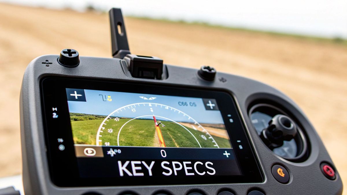
Standard GPS is good enough for your car's navigation, but for professional surveying, it just doesn't cut it. That's where Real-Time Kinematic (RTK) and Post-Processed Kinematic (PPK) systems come in.
These technologies use a ground station to correct GPS signal errors in real time, letting the drone know its exact position down to the centimetre. This survey-grade accuracy is what truly separates a professional mapping drone from a hobbyist model, guaranteeing the data is reliable enough for serious engineering and construction work.
Extended Flight Time and Rock-Solid Data Links
Surveying a large farm or a long stretch of pipeline takes time. Professional UAVs are built with high-capacity batteries and efficient motors to stay in the air longer, often for 45 minutes or more on a single charge. This endurance means you can cover more ground in one go, making the whole operation far more efficient.
Just as vital is a reliable connection between the drone and the pilot. Professional systems use powerful, encrypted data links that maintain a stable signal over several kilometres. This ensures you always have full control and a clear video feed, even when the drone is flying well beyond your visual line of sight (with the right CASA approvals, of course).
Real-World Applications In Australian Industries
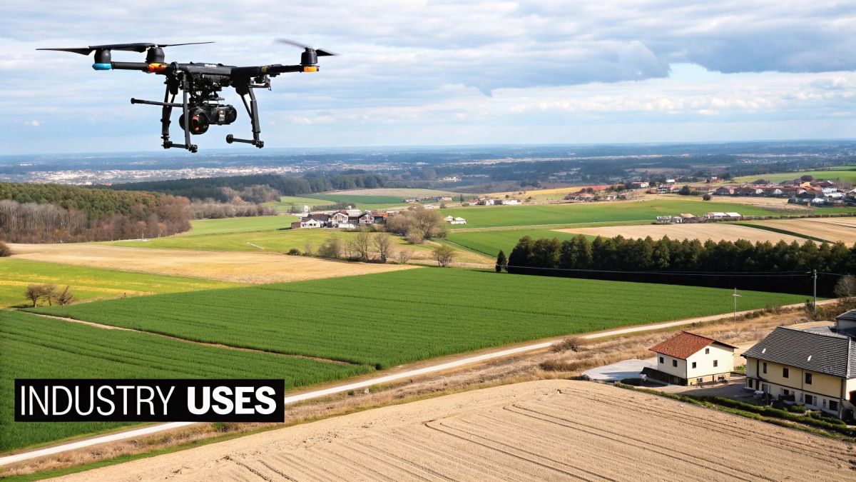
Drones aren’t just a collection of specs on paper—they’re tools that deliver real impact where it matters most. In regions from the red dust of the outback to concrete jungles in our cities, these flying platforms are rewriting the rulebook on efficiency, safety and precision.
Rather than small tweaks, this is a wholesale change in how Australian industries tackle their toughest challenges. Below, you’ll find four snapshots of drones at work, each one a window into their potential on the ground.
Boosting Yields In The Murray-Darling Basin
Out here, water is more precious than gold. Picture a grower launching a fixed-wing craft fitted with a multispectral sensor. In under an hour, it scans thousands of hectares, spotting stressed plants, leaks in irrigation lines and patches lacking nutrients.
Let’s break down the benefits:
- Targets irrigation and fertiliser only where it’s needed
- Cuts waste and trims costs
- Promotes healthier crops and bigger harvests
To see how farms across the country are using this approach, check out our detailed guide on the role of drones in agriculture in Australia.
Enhancing Safety In The Pilbara Mines
In the Pilbara, measuring ore piles used to mean sending people up slippery slopes beside heavy machinery. It was slow, risky work that left surveyors exposed to slips and falls.
Now, a LiDAR-equipped UAV flies those same stockpiles in minutes, firing thousands of laser pulses per second to build a centimetre-accurate 3D model. From the office, surveyors crunch the numbers, generate volume reports and never set foot in harm’s way.
Tracking Progress On Sydney Infrastructure
A Sydney motorway site sprawls over kilometres of earthworks, lanes and tunnels. Weekly walks around the site give a fragmented snapshot and eat up valuable time.
Swap boots on the ground for a multi-rotor drone and you get:
- High-resolution aerial images
- Detailed 3D models and orthomosaics
- Early warning on potential delays
This consistent stream of aerial data becomes the project’s single source of truth. It improves communication between teams, enhances site planning, and provides an invaluable visual record for reporting and dispute resolution.
Aiding Search And Rescue In The Bush
When an SES crew hunts for a missing hiker as dusk closes in, dense bushland can turn every metre into a maze. Ground teams crawl branches and scrub, hoping for a faint trace.
Introduce a drone with a thermal camera, and suddenly body heat glows brightly against the cool terrain. Crews narrow their search zones, converge on the target faster and guide ground teams directly to the person in need. In these moments, speed and perspective can mean the difference between life and death.
The rising tide of drone applications like these is fueling economic growth. The Australian government estimates the sector will reach AUD 14.5 billion by 2040, creating an estimated 5,500 full-time jobs per year between 2020 and 2040. You can discover more insights about commercial drone industry growth at tolluncrewedsystems.com.
How to Select the Right UAV for Your Business
Choosing the right professional UAV drone isn’t about chasing the latest shiny model. It’s about solving a specific business problem. It’s all too easy to get lost in a sea of technical specs, but the best approach always starts with one simple question: what job do I need this tool to do?
Forget starting with the drone—start with your objective. Are you trying to create centimetre-accurate topographic maps for a construction site, or do you need to inspect powerlines stretched across rugged terrain? The answer to that question will immediately narrow down your options and point you in the right direction.
This needs-first approach stops you from overspending on features you'll never use. Even worse, it prevents you from underspending and ending up with a tool that simply can't do the job your business needs it to do.
Define Your Operational Environment
Where you plan to fly is just as critical as what you plan to do. The Australian landscape throws a unique set of challenges at any piece of equipment, and a drone that performs perfectly in a calm urban park might be completely out of its depth in the gusty winds of a coastal wind farm or the searing heat of the outback.
Think carefully about these environmental factors:
- Weather Conditions: Will you be flying in high winds, rain, or extreme temperatures? If so, you’ll need a drone with a high Ingress Protection (IP) rating and proven wind resistance.
- Terrain: Are you working over vast, flat farmland or complex, mountainous regions? This will influence your requirements for flight range and sophisticated obstacle avoidance systems.
- Launch and Recovery Areas: Do you have plenty of space for a fixed-wing takeoff, or are you operating from tight, confined spaces where the VTOL capability of a multi-rotor is essential?
Determine Your Data Requirements
Let’s be honest, the data you need to collect is the whole reason for the mission. The quality and type of data you’re after will directly dictate your choice of payload and, by extension, the drone itself.
Ask yourself what level of accuracy is non-negotiable. If you’re shooting a real estate video, a standard high-resolution camera will do the trick. But if you’re conducting a survey that will inform a major engineering project, you need survey-grade accuracy. That means you absolutely must have a platform that supports RTK or PPK positioning systems. Getting this right is crucial to making a sound investment.
The real value of a professional UAV is measured by the quality of its data. A beautiful flight is pointless if the data it collects isn’t accurate, reliable, and actionable enough to drive business decisions.
Calculate the Total Cost of Ownership
The sticker price of a drone is just the beginning. To get a realistic picture of your long-term investment, you need to think about the total cost of ownership (TCO). Many first-time buyers get caught out by the ongoing operational expenses needed to run a professional drone program.
Your budget needs to account for several key areas beyond the initial purchase. These often-overlooked costs can make or break the financial viability of your drone operations.
Key TCO Components to Consider:
- Software: This includes flight planning apps and, more importantly, the specialised software needed to process and analyse your data (like photogrammetry or LiDAR processing suites).
- Training and Certification: You have to factor in the cost for pilots to get their Remote Pilot Licence (RePL) and for the business to potentially secure an Operator’s Certificate (ReOC) to stay on the right side of the law.
- Maintenance and Spares: Drones are high-performance machines that need regular upkeep. Budget for spare batteries, propellers, and potential repairs to minimise costly downtime.
- Insurance: Public liability insurance isn’t optional—it’s a must-have for any commercial operation to protect your business if something goes wrong.
By taking this structured approach, you can move forward with confidence and select a professional UAV that truly fits your business goals. For those looking to source locally, exploring a directory of Australian drone manufacturers is an excellent place to start finding platforms built specifically for our tough local conditions.
Navigating Australian Drone Rules and Regulations
Flying a professional UAV drone in Australia isn't a free-for-all. It's a carefully managed space, with the Civil Aviation Safety Authority (CASA) setting the rules to keep everyone safe. Think of these regulations less as red tape and more as the essential guardrails for running a professional and compliant drone program.
At the heart of it all are two critical certifications you absolutely need to understand: the Remote Pilot Licence (RePL) and the Remote Operator’s Certificate (ReOC). They might sound similar, but they serve very different purposes.
Key Licensing and Certification
First up is the Remote Pilot Licence (RePL). This is the pilot's ticket to fly. Just like a driver's licence, it’s a personal qualification that proves you have the skills and knowledge to operate a drone safely.
Then there’s the Remote Operator’s Certificate (ReOC). This isn't for the individual; it's for the business itself. It certifies that your company has the necessary safety systems and operational procedures in place to manage commercial drone flights legally.
Here’s the simple breakdown:
- Remote Pilot Licence (RePL): This is for the person flying the drone. It’s a must-have for anyone operating outside the very basic rules and allows you to fly for a business that holds a ReOC.
- Remote Operator’s Certificate (ReOC): This is for your organisation. It’s what allows your business to take on complex commercial jobs, like flying closer to people or beyond the pilot’s visual line of sight.
For almost any serious commercial work, you'll need both. This setup ensures that both the pilot in the field and the company back at the office are working together to maintain the highest safety standards.
The RePL qualifies the pilot, while the ReOC authorises the business. For most professional applications, you will need both to operate legally and effectively under CASA guidelines.
Building a Culture of Safety and Compliance
Getting the right licences is just the starting point. The best drone programs are built on a rock-solid culture of safety that goes far beyond just ticking the regulatory boxes. It's about embedding safety into every single thing you do.
The most effective way to do this is by creating clear, repeatable processes for every mission. Having structured guidelines is non-negotiable for safe and efficient operations. See how a good Standard Operating Procedure template can become the backbone of your flight operations.
When you combine well-defined SOPs with detailed pre-flight checklists and a solid plan for managing your data, you turn your drone work from a casual activity into a professional, scalable, and safe part of your business.
Got Questions About Professional Drones? We've Got Answers.
Stepping into the world of professional drones is about more than just the tech. You've got to think about the real-world costs, the rules of the sky, and how to get the most out of your investment. Let's tackle some of the most common questions we hear from new pilots and businesses.
What's the Real Cost to Get a Drone Program Off the Ground?
The price tag on the drone is just the beginning. To build a realistic budget, you need to look at the whole picture. The drone and its essential payloads—like high-res cameras or LiDAR sensors—can run anywhere from $5,000 to over $50,000, all depending on what you need it to do.
But the hardware is only one piece of the puzzle. You'll also need specialised software for planning your flights and processing all the data you collect. And don't forget the big one: training. Getting your CASA-required pilot licence (RePL) and potentially an operator's certificate (ReOC) is a significant cost. Add in ongoing expenses like insurance, spare batteries, and routine maintenance, and you'll find a comprehensive starting budget often sits in the $15,000 to $25,000 range.
How Much Training Do I Actually Need to Fly a Professional Drone?
Here in Australia, you can't just fly a drone for work without the right ticket. The law says you must hold a Remote Pilot Licence (RePL). This means getting through both theory and hands-on flight training with a CASA-certified provider, which ensures you know the regulations and can fly safely.
But getting your licence is just the starting line. Real mastery comes from training specific to the drone you're flying, so you can handle all its features and control its payloads like a pro. You'll also need to get skilled with data analysis software—think photogrammetry or thermal imaging tools—to actually turn all that raw data into something your business can use.
Can I Just Buy One Drone and Use It for Everything?
Absolutely, and that's one of the best things about modern professional drones. Many high-end systems are built to be modular, with payloads you can swap out in minutes. This means you can adapt a single drone for completely different jobs. You might use a high-resolution camera for a mapping job in the morning, then switch to a thermal sensor for an asset inspection in the afternoon.
The trick is to invest in a drone platform that can actually support all the different payloads your work demands. While this jack-of-all-trades approach is great for many tasks, some highly specific missions, like long-range pipeline monitoring, might still be better suited to a purpose-built aircraft like a fixed-wing drone. Always start by figuring out your main business needs to make sure you're choosing the right tool for the job.
At Innoflight International, we focus on providing tough, mission-ready drone solutions built for Australian industries. Whether you're after a heavy-lift platform for LiDAR surveying or a versatile system for agricultural analysis, our expert team is here to help you build a professional drone program that delivers genuine results.
Take a look at our advanced drone platforms at https://evolutionflight.com.